Tibet, a land of mystery lying in the canopy of Himalaya, offers great opportunities for trekkers. Tibet Vista offers you the ultimate guide to your trekking in the top 8 Tibetan trekking routes. They are the most popular trekking routes favored by our guests. What follows are the typical trekking routes in Tibet. They are just a part of the whole tours, not limited to trekking itself, so these 8 tour programs are a combination of SUV tours and trekking. You shall not miss them if you plan a trekking tour in Tibet in 2023.
1.10 Days Shalu to Nartang Trek
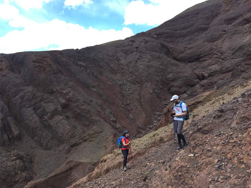
10 Days Shalu to Nartang Trek
Best time for trekking: From April to October
Trekking difficulty index: basic
Joy index: high
Overview
Shalu to Nartang is the shortest Tibet trekking route. It follows an ancient trade route between these two great Buddhist monasteries. The whole trek lasts about 15-16 hours; we divide it into 2-3 days according to your personal physical condition.
Most Recommended Tour Itinerary: 10 Days Shalu to Nartang Trek
General Itinerary
The trekking begins at Shalu Monastery (3980m) to Upper Lungsang (5 hours/19km/420m ascent /240m decent).
Then you traverses west over a couple of small ranges to Ngor Monastery (3 hours/8km/550m ascent/240m descent).
From Ngor it is a downhill slog to Nartang Monastery (5-6 hours, 410m descent).
Scenic Spots along the Route
The route passes through several villages and uninhabited dry canyons. This trip you will see Shalu Monastery, Ngor Monastery, Nartang Monastery and Tashilunpo Monastery. You will enjoy sightseeing the wild natural sceneries along the way. At Shalu you could gaze the delicate murals and Buddhist sculptures built more than 1000 years ago while Nartang is one of the three biggest scripture-printing temples in Tibet. Here you could see rich scriptures printed in Tibetan language nowhere else could be found.
While you trek through the route, there is a high chance that you reminiscent of this Tea-Horse route where ancient Tibetans carry Buddhist scriptures and cargoes along this way. The starting point of the trail is easily accessible from Shigatse.
What to Eat during Trek
Traditional meals are available in the villages and monasteries. Our guides and the agency will prepare basic cookers and simple meals such as porridge and instant noodles. You could hire chef from us if you need them. We suggest you buy some extra high energy snacks in Lhasa such as chocolate, dehydrated fruits and meat, candy bars and instant noodles.
Horse, Yak and Porter
We can help you hire the yaks with their caretakers to load your trekking gears. If you are tired in the trek, you could hire horse to ride. The price for the rent varies according to different seasons and specific journeys. A yak can carry two or three backpacks, depending on their weight. Small groups of two or three people are more likely to end up with a horse than a yak, as single yaks are notoriously difficult to manage.
Accommodation
You’ll camp in the tents or guesthouse of monasteries. You could prepare camping gears for the trekking including tent, mattress and sleeping bags. Our guides could rent these gears to you if you find it more convenient.
2. 8 Days Ganden to Samye Trek
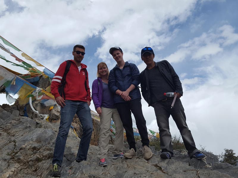
8 Days Ganden to Samye Trek
Best time for trekking: mid-May to mid-October
Trekking difficulty index: difficult
Joy index: high
Overview
Ganden to Samye Tibet trekking route is considered as a traditional hike route in Tibetan tour. It is a rewarding and nice pilgrimage trip you will not miss. Along the route you will have a overall view of Tibetan Buddhism and religious culture, clear lakes, high snowy passes and mountains, lush alpine meadows, sporadic herders’ camp, tranquil Tibetan villages, time-honored sacred sites. And your tour will end at the forlorn and wild surroundings near the Samye Monastery.
Most Recommended Tour Itinerary: 8 Days Ganden to Samye Trek
Specific Details
The route: between two much noted Tibet monasteries: Ganden and Samye Monastery.
Distance: about 80 km.
Trekking duration: 4 to 5 days
Permit: Tibet Entry Permit
Highest point: Shogu-La Pass(5630m)
Difficulty: Medium to difficult
Accommodation: camping
Food: cooked/ yourself preparation
General Itinerary
Day 1: Ganden to Yama Do (5-6 hours, 17km, 300m ascent, 450m descent)
Your trek begins at Ganden Monastery. We could help you hire yaks or porters to carry your bags if you find this convenient. The trek today lasts 5 to 6 hours. You will walk along an ancient trail and take in scenic views of unusual beauty. Walk along a ridge and reach the ancient Hepu village. In the afternoon, you’ll walk through Ani Pagong, a narrow part of the trail was once home to a nunnery. In the late afternoon, you ascend to Yama Do.
Day 2: Yamma Do to Tsotuo-chu Valley (5-6 hours, 10km, 1000m ascent, 450m descent)
This trek takes 5 to 6 hours. You would trek from Yamo Do early in the morning through a steep gully to the banks of a stream. Climb to Shogu-La Pass and begin the descent from there through fields of glacial boulders. Tsotup Chu is a large stream that flows through the valley, and you will cross this stream towards the end of the trek.
Day 3: Tsotup-chu Valley to Herders’ Camps (5 hours, 14km, 300m ascent, 400m descent)
Today you follow the Tsotup Chu route towards the rocky mountain pass of Chitu La. Descend from there into the exquisitely beautiful camping grounds and fields around the tributary of the Tsotup Cho, walking through the picturesque Herder’s camp along the way. You will stay overnight at or around the Herder’s Camp.
Day 4&5: Herder’s Camps to Samye monastery (8 hours, 39km, 1200m descent)
Trek from Herder’s Camp to Wango (25 km). This is a 6 hours trek. The trail here widens and the walking becomes easier. Follow the trail through beautiful rivulets of water and fertile forests. You will camp around the Herder’s camps and spend a fantastic night there.
At the last day of trekking, from Wango you will trek to Samye monastery. It takes 2 hours to reach it. Along the route you will see spectacular views from Pisha and the vista of the Samye valley. From the high point of Dragmar, you could explore many temples and ruins. At Samye itself, it is one of the oldest and holiest Buddhist sites. Its ancient buildings are a Tibetan architectural masterpiece.
Scenic Spots along the Route
The route has much to offer, lakes, mountains, beautiful alpine landscapes, nomad camps, villages, sacred sites and two monasteries. There are many varieties of trees, scrubs, and rhododendrons in full bloom, and vistas of meadows that will take your breath away. For this route, you should not underestimate the difficulty in the trekking as the whole route is located at high-elevation wild.It would be better for those trekkers with high elevation experience for the route is relatively hard and rugged.
What to Eat during Trek
Traditional Tibetan meals; Basic cookers and simple meals could be provided by our guides. You could hire chef for your meals along the route. You’d better prepare some high energy snacks for possible hunger en route.
Horse, Yak and Porter
We can help you hire the yaks with their caretakers to load your trekking gears. If you are tired in the trek, you could hire horse to ride. The price for the rent varies according to different seasons and specific journeys.
Accommodation
You’ll camp in the tents or Ganden monatery guest house
3.12 Days Trekking from Nyenchen Tanglha to Holy Lake-Namtso
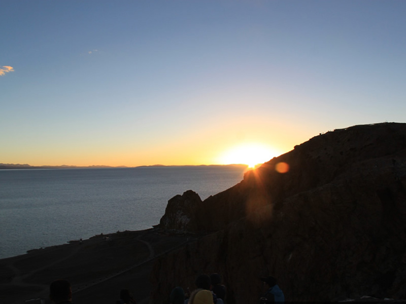
12 Days Trekking from Nyenchen Tanglha to Holy Lake-Namtso
Best time for trekking: mid-May to mid-October
Trekking difficulty index: medium
Joy index: high
Overview
The starting point of the trek is Damxung valley (4130 m) along the Qinghai-Tibet Highway. Then you will wend your way through a rocky defile, the gateway to a high-elevation forest in which dwarf willow and rhododendron are dominant floras. A number of stream crossings aside you. Fantastic views of sparkling Namtso and Tashi Do are visible from many vantage points on the trail. You can also sight the green grassland and colorful nomad camps along the way.
Most Recommended Tour Itinerary: 12 Days Trekking from Nyenchen Tanglha to Holy Lake-Namtso
General Itinerary
Day1: the first day of a short trekking
You will be transferred to the starting point of trekking at Damxung (4130 m) along the Qinghai-Tibet Highway, Today you will just have a short trek and then go through a beautiful meadow and visit a monastery en route.
Day2: trekking 7-8 hours to herders’ camp
Pass through glaciated valley and reach a herder’s camp, where you camp for the night. The trekking time is 7-8hours.
Day3: cross Kong La in about 6-7 hours
Cross Kong La from where you have spectacular views of Lake Namtso and the Nyenchen Thangla ranges. You will descend to a broad basin and hike along green meadows. The whole trekking lasts 6-7 hours.
Day 4: head to Tashi Dorje and Lake Namtso 7-8 hours
Hike along green meadows and pass through several nomad camps and their herds of animals. Have lunch by the lake. Then follow the jeep trail all the way to Tashi Dorje hermitage. Lake Namtso, the biggest salty lake of Tibet, is 70 kilometers in length and 30 kilometers in width covering an area of 1,920 square kilometers at an altitude of 4,700 meters above sea level. It is said the holy lake and the holy mountain Nyenchentangla are a couple of lovers, who guard the vast pasture and cattle together.
Day 5: hike around Lake Namtso
Explore the Tashi peninsula by walking around the holy hill, the cliffs of which have been eroded over the centuries. Piles of Mani stones stand on the way. Then visit the nomads in yak hair tents who have been living on the pastures between the holy Namtso and Nyenchentangla.
Main Scenic Spots along the Route
In addition to the panoramic views you will see along the traditional route, you will have other activities including visiting meadows, passing through glaciated valley, visiting herder’s camp, having lunch by Namtso Lake, viewing Nyenchen Thangla ranges, walking in a broad basin and hiking along green meadows.
The highlights of the trekking would be visiting the nomads in yak hair tents who have been living on the pastures between the holy Namtso and Nyenchentangla. Camping aside the lakes give you chance to feel the myth and quietness in a remote country several thousand miles away from you home.
What to Eat during Trek
Traditional Tibetan meals; Basic cookers and simple meals could be provided by our guides. You could hire chef for your meals along the route.
Horse, Yak and Porter
We can help you hire the yaks with their caretakers to load your trekking gears. If you are tired in the trek, you could hire horse to ride. The price for the rent varies according to different seasons and specific journeys.
Accommodation
There are no hotels along Lake Namtso for accommodation. At the hot seasons, the herdsmen will put up temporary tents for you to spend the nights. On the Tashi peninsula, and Tashi monastery there are some simple hotels and inns without running water. So you may prepare some purified water with you. For most time of the night there is no light. There are chances that the herdsmen would generate electricity by their own electromotor. So you may bring some candles for the night.
Altitude sickness
The whole trekking route is located at high altitude areas, so you’d better adjust yourself in advance in Lhasa. You could also buy some medicine such as Rhodiola Rosea to solve this sickness. See more at medicine to tackle altitude sickness
4.9 Days Tsurphu to Yangpachen Trek
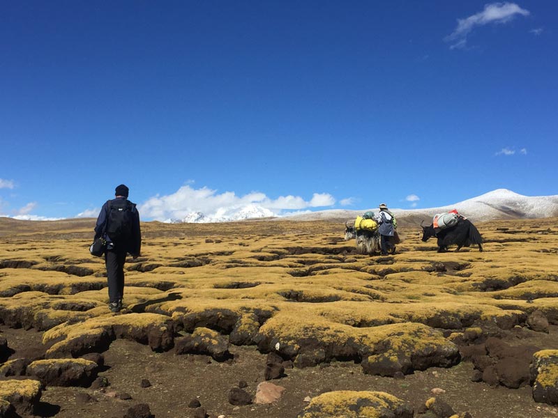
9 Days Tsurphu to Yangpachen Trek
Best time for trekking: mid-April to mid-October
Trekking difficulty index: medium
Joy index: high
Overview
This route begins at Tsurphu Monastery and ends at Yanpanche Monastery. Tsurphu monastery is the temple that created the system of reincarnation of living Buddha.
Most Recommended Tour Itinerary: 9 Days Tsurphu to Yangpachen Trek
General Itinerary
Day1: Tsurphu Monastery/Leten(trekking 4 hours, 11km)
The trek begins at Tsurphu Monastery, and the trekking duration in the first day lasts 4 hours with 11km distance.
Day 2: Leten/Bartso(trekking 5-6 hours, 15km)
During the second day you will trek along a big valley, up to the highest spot Lasar La(5300m). Then you will head to Bartso. The whole trek lasts 5 to 6 hours with a distance of 15km. You will camp around Bartso for the night.
Day 3: Bartso/Dorje Ling Nunnery (Trekking 4 hours, 15Km)
On the third day you will trek to Djore Ling Ani Gompa (nunnery) from Bartso camp. The journey lasts about 4 hours with 15km distance.
Day 4: Dorje Ling Nunnery/Yangpachen Monastery/Lhasa, trekking 4 hours, 14km
The final day you will trek 4 hours with 14km distance from Dorje Ling Nunnery to Yangpachen, where our guide will bring you for a hot spring bath.
Scenic Spots along the Route
Along the route, trekkers have a large chance to view various species of mountain goats in gray rocks and meet small nomadic communities’ camps for herding months. You could also have a stop in a yak-hair tent for a cup of salt butter tea or some fresh yak milk. Walk on a high plateau with an overlook of rock-enclosed huts. You will meet magical valleys strewn with lichen-coated boulders, meandering streams and expansive, powder-blue sky. When descending into the Yangpachen valley, you will wonder at its wide open plateaus, spiky grass hummocks and tundra-like parched, cracked patches of earth.
The scenery along the Tsurphu to Yangpachen trekking route route is a mix of alpine tundra, monasteries, hot springs, nomads and remote nunnery. The highlights of the trekking would lie in the majestic grassland sceneries in June. In the final destination of Yanpachen, you could have a hot spring bath to clean the tiredness in your trek.
What to Eat during Trek
Traditional Tibetan meals; Basic cookers and simple meals could be provided by our guides. You could hire chef for your meals along the route. You’d better prepare some high energy snacks for possible hunger en route.
Horse, Yak and Porter
We can help you hire the yaks with their caretakers to load your trekking gears. If you are tired in the trek, you could hire horse to ride. The price for the rent varies according to different seasons and specific journeys.
Accommodation
You’ll camp in the tents or guesthouse of monasteries or nunnery.
Best time for trekking
Mid-April to mid-October; late June is the best time for vibrant grass and wildflower in grassland.
5.12 Days Classic Trek from Tingri to EBC via Ra-chu Valley
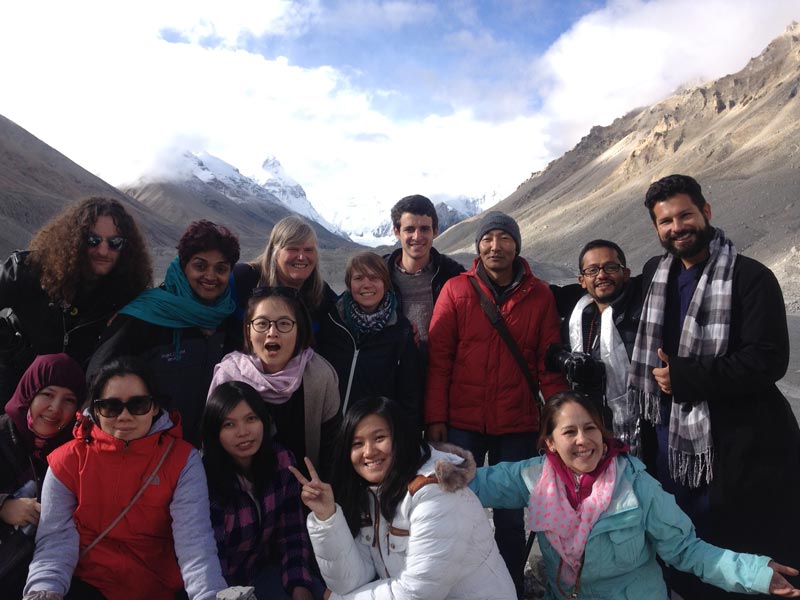
12 Days Classic Trek from Tingri to EBC via Ra-chu Valley
Best time for trekking: From May to October
Trekking difficulty index: difficult
Joy index: high
Overview
Trekking from Tingri to Everest Base Camp is a most classic route for hiking in Tibet. You will finish 70km trekking in 4 days at an average altitudes ranging from 4400m to 5300m.
Most Recommended Tour Itinerary: 12 Days Classic Trek from Tingri to EBC via Ra-chu Valley
Specific details
Route: Tingri-EBC
Distance: 70km trekking
Duration: 4-5 Days
Permits: Tibet Entry Permit
Start: Tingri (4390m)
End: EBC (5200m)
Highest Point: EBC (5200m)
Difficulty: Medium to difficult
Accommodation: Camping
Food: Self-sufficient
General Itinerary
Day 1: Trek from Old Tingri to Lungthang (4510 m) (5 hours/12km/150m ascent)
Your trekking begins from Old Tingri all the way to the Tingri plain. The route will pass part of the Ra-chu Valley. You will see beautiful valley scenery with extensive meadows and packs of sheep and goats. The rest of the day you can visit a small temple in Chholun. This region is home to herders and barley harvesters.
Day 2: Trek from Lungthang to Lamna La (5150 m) (8 hours/21km/200m ascent)
The challenging trekking really starts today as we go up into the mountains. Much uphill walking will be done as you climb towards the top of Lamna La. And you would camp above the top of this pass.
Day 3: Trek from Lamna La to Zommug (4790m)
In the morning you descend steeply into lush vegetation area. The trek will allow you to meet the indigenous yak herders and their families. Your camp will be pitched in the small village of Zommug. Trekkers are about to view the amazing sunset in this barren town.
Day 4: Trek to Rongbuk (4980m) and EBC (5100m)
It is the last day of your trekking you will zigzag your way to the final destination of Rongbuk and Everest Base Camp. Along the way you could also visit the Dza Rongbuk monastery and gompas. They are remains of historical sites.
Main Scenic Spots along the Route
The whole trek is a combination of solitude, wildlife sighting and physical challenge, rambling Tibetan brown bear, onagers and gazelle along the trail. You could hang around Rongbuk Monastery, a temple that is located at the highest altitude in the world with its archaic architectural style. The monastery is a combination of old religion and local customs and tastes. On the way to Everest Base Camp you will also have enough time to explore the valleys and glaciers below the massive north-face of Mt. Everest and view the most magnificent scenery on the world’s highest mountain.
There is a high chance for you to meet a Tibetan brown bear rambling in the wild and other animals. This trekking route requires you to have a sound physical condition and stamina to overcome harsh natural environment and possible weather hazard.
What to Eat during Trek
Traditional Tibetan meals; Basic cookers and simple meals could be provided by our guides. You could hire chef for your meals along the route. You’d better prepare some high energy snacks for possible hunger en route.
Horse, Yak and Porter
We can help you hire the yaks with their caretakers to load your trekking gears. If you are tired in the trek, you could hire horse to ride. The price for the rent varies according to different seasons and specific journeys.
Accommodation
You’ll camp in the tents during the whole trekking or guesthouse of Rongbuk monastery for one night.
Best time for trekking
From May to October would be the best time when it is warmer, with its average temperature ranging from 15-25 Celsius degrees, and blue skies and clear weather. Climate change in EBC may be dramatic. Even in summer, temperatures can fall well below zero Celsius degree and freeze at night in the mountain areas. Sometimes, snow may trap you into tent. In winter, it is too cold and windy to do this trek. Heavy snow should be a great risk for trekking at such elevation.
6.14 days Trekking at the foot of eastern side of Mount Everest – Gama Valley

14 Days Trekking at the foot of eastern side of Mount Everest – Gama Valley
Best time for trekking: April to June and September to October
Trekking difficulty index: medium
Joy index: high
Overview
Gama Valley lies in the east slope of Mt. Everest. It is praised as one of the “Top Ten Landscapes in the World”, “the most beautiful valley in the world” and “one of the top ten classic trekking routes in the world” by explorers from home and abroad. Early in 1921, Gama Valley was recommended as the most beautiful valley in the book Exploration of Mt. Everest by British explorer Barry.The Gama Valley abounds in diversified vegetation and rare animals and the valley has been considered as “a botanical gene bank”. It would be a once-in-a-life chance to have a trekking tour in Gama Valley that you will never forget during your life time.
Most Recommended Tour Itinerary: 14 days Trekking at the foot of eastern side of Mount Everest – Gama Valley
General Itinerary
Day 1: from Chutang Village to Youpa Village
Your trek begins from Chutang village and the initial trek is the easiest and could be taken as a warm-up. The road in this section is paved with gravel and is accessible to vehicles.
Day 2: from Youpa Village to Showotso
The tough trekking starts from Youpa village. This trek lasts 6.4 kilometers at an altitude of 3750 to 4656m. When you reach Showotso (4656m), the unmatched scenery here will dispel all your tiredness. Small and tranquil, lake Showotso flows gently in the corner of the valley.
Day 3: Showotso – Shauwula Pass – Orchid Valley
Today’s trekking is the hardest from Showotso to Shauwula Pass. It is considered as the most difficult route of the entire trekking. As long as you make it through this pass, the focal area of Gama Valley will be within reach.
Day 4: Orchid Valley – Sakyitang Base Camp
Along this route you will find that Orchild Valley is blanketed by lush vegetation and vibrant forest with unknown flowers. The air here is filled with refreshing oxygen. In May, you can see Azalea in full blossom around every corner of the valley.
Day 5: Sakyitang Base Camp – Gama Valley Base Camp
In today’s trekking, you have to cross some damp primeval forests, where leeches abounds in large numbers, so you’d better have a rest in places where sunshine can reach and stay on dried turf. Tourists have to pass a swamp in the second half of the trek of the day.
To make the trek easier, locals bridged the swamp with trunks of trees. In a place so much isolated to outside world, you still have a good chance to see the footprints of Sherpas(a mountainous minority) who travel at ease on this mysterious and little known land.
Day 6: Gama Valley Base Camp to Chengtang village
In today’s journey you have to be more careful, for in this section of the route landslide occurs sometimes, on the mountains and tourists should follow the old path. After this day, the final destination is near at hand. This day, you will have the feeling mixed with fatigue and excitement after take so far distance. Our destination is Chentang Village. It is well known for its wine made from millet.
Day 7: Have a good rest and relax yourself in Chentang Village
Day 8: from Chentang Village to Dinggye County
It takes about three hours trekking from Chentang Village to the nearest road and you have to climb a mountain ridge to get there. Then, you will have 4-5 hours ride to reach Dinggye county.
As Chentang Village is located at an altitude of 2200m while Dinggye county at 4500m, you will experience the sudden change of scenery within just 100 kilometers, from warm and humid climate with rain forest, farmland, waterfalls to alpine climate of snow-capped mountains and freezing wind.
Main Scenic Spots along the Route
The whole trekking route is within Mt Everest Nature Reserve. During the route, you will see small and tranquil lakes flowing gently in the corner of valleys. If you come in May, you will find the Orchild Valley blanketed in unknown flowers with lush vegetation and vibrant forest. You could also see azalea in full blossom and buds of orchid on the banks of the lake, and you will smell lovely scent of orchid in the air, silhouetted in faraway snow-capped mountains.
In and around Gama Valley Base Camp, you will be wondered at the towering primeval forest with its usnea and Spanish moss hanging on branches of gigantic trees. Here tourists may wonder if they had stepped into the world of Avatar. There is a big chance to meet grumpy wild yaks, rocky and bumpy along the routes. The sudden change of scenery and weather during a single day marks the highlight of the whole travel.
In a word, among the whole trek, you could sightsee broad-leaf forest, needle-leaf forest, brushwood, Alpine meadow, Alpine desert, permanent snow zone, snow mountains, glaciers, and dramatic change of natural sceneries from river valleys(2100 meters in altitude) to highest peak(6000 meters in altitude) within just dozens of kilometers.
Best time for trekking
April to June and September to October are the best time to travel Gama Valley. During these periods, tourists are able to have an excellent visibility as a result of good weather, and you can fully appreciate the beauty of Mt. Everest, and other mountainous range and orchids are in full blossom from May to June.
How to Get Gama Valley
Gama Valley Trek starting from Tingri. Foreign travelers are not allowed to take regular bus in Tibet. You could rent a car or SUVs from our travel agency for the whole trip. It takes 6~7hrs from Shigatse and 10~11 hours from Lhasa to New Tingri.
What to Eat during Trek: During the trekking, you will have to cook meals yourself. Basic cookers and simple meals could be provided by our guides. You could hire chef for your meals along the route. So we suggest that you buy some high energy snacks in Lhasa such as chocolate, dehydrated fruits and meat, candy bars and instant noodles and any food that will quickly replenish your lost energy or hunger en route.
Horse, Yak and Porter
The only transportation to Gama Valley is through yaks and horses. A round trip to Gama Valley generally takes ten days. We can help you hire the yaks with their caretakers to load your trekking gears. If you are tired in the trek, you could hire horse to ride. The price for the rent varies according to different seasons and specific journeys.
Accommodation
You’ll camp in the tents during the whole trekking.
Attentions
The whole trip takes about eight days, so to complete the trek needs very sound physical conditions, strong willpower as well as stamina. Before you make a decision please carefully evaluate your fitness for such a tour.
7.15 Days Challenge to Everest Advance Base Camp Trek [6340M]
![15 Days Challenge to Everest Advance Base Camp Trek [6340M]](https://www.tibettravel.org/blog/wp-content/uploads/2017/01/tibet-everest-advance-base-camp-trek.jpg)
15 Days Challenge to Everest Advance Base Camp Trek [6340M]
Best Time to Travel: Spring (April and May) and Autumn (October)
Trekking difficulty index: difficult
Joy index: high
The trek starts from EBC(5460m) to Advance Base Camp (6340m). It takes 4-5days and has a distance of 28km. It is world’s highest trekking route, taking you closest to the summit of Mt Everest. The route offers you most majestic landscapes you could ever imagine in such a high altitude including Rongbuk Monastery, moraine hills, Rongbuk Glacier, Changste glacier, imposing pinnacles, ridges and the rock summit of Everest. This trek requires you to have a sound physical condition and stamina to overcome harsh environment and possible weather hazards. It also needs basic technical climbing gears and mountaineering skill.
Most Recommended Tour Itinerary: 15 Days Challenge to Everest Advance Base Camp Trek [6340M]
General Itinerary
Day 1: Trek from Everest Base Camp to Camp 1 (5460M)
Your first trek would be to Base Camp 1, the first stop (5450m). You will walk through the Rongpuk Glacier along the way to C1. You may enjoy watching this massive glacier as they are among some of the best in the world. You will take a trail that rises to the east side of this ice cap and heads toward the peak of Mt. Everest. The trek is fairly short, but the high altitude may make you feel tired so you should have more relaxation and enjoy exploring this amazing area.
Day 2: Trek to Interim Camp (5760M) from Base Camp 1
Your trekking trail today will begin from gravel hills to the west of the glacier. Another scenic day waits for you to explore and you will spend the night at the interim camp. You will find youself surrounded by ice pinnacles us in all directions. It is an amazing experience only found in such a high altitude.
Day 3: Trek to Camp 2 (5970M)
Today you will ascend farther to the intricate maze of ice as you meet the Changste glacier. It would be a fabulous experience to hike on the world’s highest mountain watching the most magnificent glaciers at such an altitude. You will find yourself surrounded on all sides by varying glaciers and hanging ice in total quietness.
Day 4 Trek to ABC (6340M) and return to Camp 2
It is completely up to you today to decide whether you just trek to Advance Base camp and spend the night there, or simply hike there during the day and return to Base Camp 2. Advance Base Camp lies in the center of flattened gravel mounds next to the glacier. This is your last trekking day you will meet many imposing pinnacles, ridges, and even the rock summit of Everest. ABC is only 2400 meters from the top. It is a fantastic experience that you almost reach the highest top of the world.
Main Scenic Spots along the Route
The whole trek crosses the Tibetan highlands and ventures into the Advance Base Camp of Mount Everest (North side). Here you could experience the beautiful, mountainous landscapes of Tibet known as the ‘Roof of the World’. The roads you take are the same trails used by the Everest summiteers and you finish your journey at the Everest Advanced Base camp at 6,340m. You will move upwards along undulating moraine hills beside the Rongphu Glacier and appreciate the peculiar shape of glaciers and then reach the Intermediate Camp (5800m). You finally reach the Advanced Base Camp of the world’s highest mountain; along the process Everest will guarantee you a sweeping view of the majestic mountain ranges.
Best Time to Travel:
Spring (April and May) and Autumn (October) is the best seasons for the Everest Advanced Base Camp Trek.
What to Eat during Trek
Along the route, there are only basic meal choices like Tibetan bread, dal (lentil soup) bhat (rice), and tsampa porridge will be available. During the trekking, you will have to cook meals yourself. Basic cookers and simple meals could be provided by our guides. You can hire a chef along with you, so you can eat freshly cooked food. We suggest you buy some high energy snacks in Lhasa such as chocolate, dehydrated fruits and meat, candy bars and instant noodles and any food that will quickly replenish your lost energy or hunger en route.
Horse, Yak and Porter
We can help you hire the yaks with their caretakers to load your trekking gears. ABC is the limit where a healthy yak could ever reach in such a region. The price for the rent varies according to different seasons and specific journeys.
Accommodation
You’ll camp in the tents during the whole trekking. You will prepare the tents along with relevant mountain gears in advance, and you could hire all these gears from our guides.
Physical Condition & Experience Requirements
Trekking to the Everest Advanced Base Camp (6,340m) requires high physical fitness along with previous experiences at trekking in high altitudes. It will help if you have previous trekking experience preferably in high altitudes. It is also important that you have a positive attitude and a strong determination.
Oxygen
To trek at such an altitude will be unsafe without proper auxiliary equipments such as the oxygen intake equipment. You should have an adequate oxygen preparation and supply before your start your trek in case of such need in a high altitude. While trekking in mountainous regions, you should properly wear the oxygen mask or wind-proof goggles so that you will not lose your sight. And do ask trekking partners to remove the frost on the oxygen mask if it occurs in your trekking.
8.15 Days Kailash and Manasarova Small Group Tour
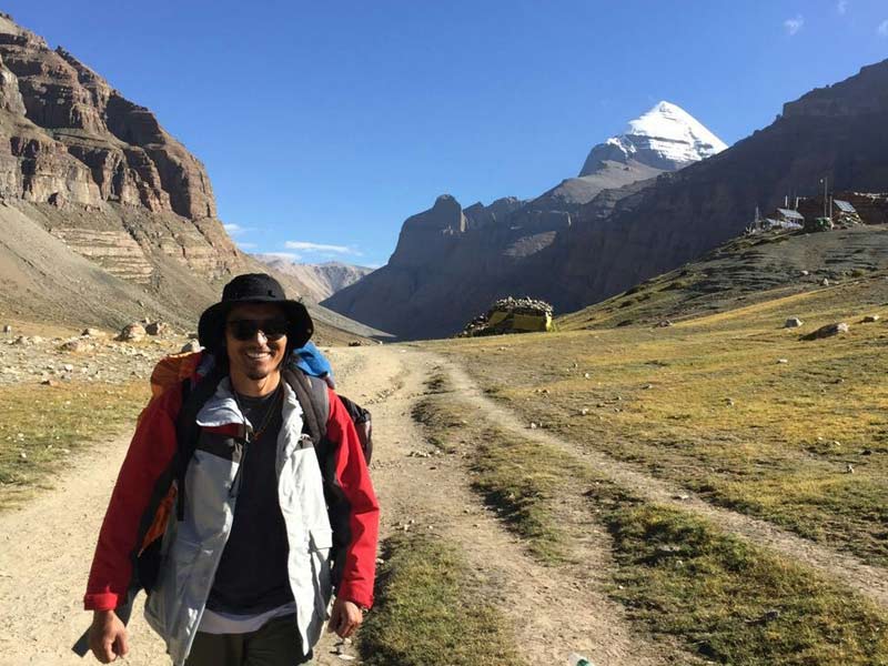
15 Days Kailash and Manasarova Small Group Tour
Best time for trekking: From May to October
Trekking difficulty index: medium
Joy index: high
Overview
Mt. Kailash is recognized as one of the loftiest mountains in the world. It is the religious center for Hinduism, Tibetan Buddhism, Bon – native religion in Tibet and Jainism. Some 6000 meters above sea level, Mt. Kailash is the main peak of Gangdise Range with symmetrical pyramid-shaped sides. Historically, there used to be many Chinese and foreign monks preaching there. Thus, it became the center of worship for four sects for a long time, including Buddhism, Hinduism, Jainism and Bon. Mount Kailash trek lasts about three days with a total distance of 52km. The route starts at Darchen (4500m), crossing the Dolma-la pass (5630m) on the second day and ends at Dzultripuk, and then get back to the starting point on the third day. Along the route trekkers could sightsee scenic spots including grassy plains, nomads, deep valleys, monasteries, Dolma-la pass, rivers, miraculous Milarepa cave, temples and shrines.
Most Recommended Tour Itinerary: 15 Days Kailash and Manasarova Small Group Tour
General Itinerary
Day1: from Darchen to monastery Drirapuk (6 hrs, 20km)
The traditional pilgrims undertake 52 km trekking circuit around Mount Kailash, commencing at Darchen (4574m). After trekking for two hours from a village called Sarshung(the starting point of the trekking), you will come upon a grassy plain populated by nomads. It will take another two hours before you reach Drirapuk monastery (4920m).
Day 2: from Drirapuk to Dzultripuk monastery (18km, 7-8hours)
The second day would be hard and tough for Dolma-la pass is 6.4km ahead and 762m above Drirapuk in altitude. It is about 5630m above sea level. After taking a rest there, you will descend staircase bringing you to Lhachu valley floor, about one hour‘s walking distance from the pass. You will have another four hours trekking to the today’s final destination. It is better to walk on the right side of the river and finally get to Dzultripuk where you could watch miracle cave of milarepa.
Day 3: from Dzultripuk back to Darchen (14km, 3-4hours)
Today, we will sightsee Milarepa cave, where the temple and shrines have been built around. Then you will exit from the valley, which could be achieved within three hours. At the ending point of the valley, the driver will come to pick you and take you back to Darchen.
Main Scenic Spots Along the Route
Along the route tourists could sightsee scenic spots including grassy plains, nomads, deep valleys, monasteries, Dolma-la pass, rivers, miraculous Milarepa cave, temples and shrines. During the first day in your route, you will meet Mani stones strewn with many prayer flags, Lhachu Valley, Buddhist towers which are the marks of the holly Mt. Kailash. On the second day you will come to a most renowned “Silwutsel Charnel Ground”, which means the place of death. You will have to take a rest in the Dolma-la pass because of its high altitude. You could feel the mysterious atmosphere of the pass. After the decent from the pass, you come to the Merciful Lake. It is said that man could cleanse his sins and vices in this lake. You third day will visit the Dzultripuk temple, where you could take photos with the sculptures there and leave you unforgettable memories.
Best Time for the Kailash Tour
From May to October would be the best when it is warmer. At other time of the year, the areas around the Mt. Kailash are covered by heavy snow and ice.
How to Get Mt. Kailash
There are two ways from Lhasa to Mt. Kailash. One is part of Xinjiang-Tibet Highway which is mostly favored by travelers. One the way, you could get spectacular views of the Yarlung Zangpo Valley, Gangdisê Mountains, Himalaya Mountains, snow-capped peaks, beautiful alpine lakes and vast grassland dotted by yaks and sheep. The second way is to rent a car. Tibet Vista could offer you a 4WD with experienced driver and guides. And we could also make the trip arrangements for you.
What to Eat during Trek
During the trekking, you will have to cook meals yourself. Basic cookers and simple meals could be provided by our guides. You could hire chef for your meals along the route. We suggest that you buy some high energy snacks in Lhasa such as chocolate, dehydrated fruits and meat, candy bars and instant noodles and any food that will quickly replenish your lost energy or hunger en route.
Horse, Yak and Porter
We can help you hire the yaks with their caretakers to load your trekking gears. If you are tired in the trek, you could hire horse to ride. The price for the rent varies according to different seasons and specific journeys.
Accommodation
You’ll camp in the tents in guesthouses of Drirapuk and Dzultripuk monastery during the whole trekking.
Attentions
The whole trekking takes about three days at a relatively high altitude. Please properly evaluate your physical fitness before take a trekking tour.
Gears Needed for a Typical Trekking in Himalaya Regions
Generally speaking, trekking gears needed for travelling in Mt. Everest regions should be far better than those used for less challenging trekking routes. Following equipment and brands are recommended:
·Alpine Trekking Boots (such as Millet, La Sportiva)
·Down Jacket ( such as Mountain Hardwear, The North Face and Marmot)
·Hiking Poles and Crampons
·Hiking poles are needed for travelling below the snowline (no more than 6600m) and LEKI is a good recommendation
·Sunglasses and gloves
·Headwear
·Sleeping Bag and Moisture-proof Pad
·Headlight and Battery
·Thermal Flask
·Medicine
Packing List Tips
1. Small things like sunglasses and gloves might be easily gotten lost or be worn as travelers are supposed to stay in many campsites in Everest regions. Therefore, bringing a couple of more these stuff are advisable. Sunglasses are used to shield yourself from high-altitude sunlight while anti-fog goggles with sound air permeability are required in extreme weather. Besides, gloves should be wind-proof, filled with down.
2. One should prepare some personal medicines for altitude illness, diarrhea, and cold, and other medicines like painkillers, antibiotics, etc are also needed for precaution.
3. A thermal flask is indispensable equipment for any mountaineers. A flask that can carry 800ml-1000ml will be appropriate.
4. One wool or down ski-style cap or scarf is needed for warmth and protection from strong wind.
5. Having a sound sleep is vital for a day’s trekking at high altitude. One should prepare at least no fewer than 2 of them
By trekking in Tibet, you can enjoy the unique landscapes on the roof of the world and have a full insight of Tibetan culture and landscapes. You can sense the subtle and harmonious relationship between man and nature once you step on this land. The above listed trekking routes are only parts of our most favored tour programs Tibet Vista could offer and you will find more information in our website for your reference.
.jpg)


0 Comment ON "Ultimate Guide to Tibet Top 8 Trekking Routes in 2023"