
 Search
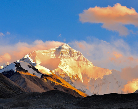


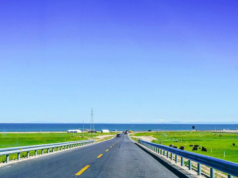
Starting from Xining in Qinghai Province of China, the Qinghai Tibet Highway is the longest and highest asphalt highway in the world, stretching for 1,937 kilometers up to and across the Tibetan Plateau. With an average elevation of over 4,000 meters, this 10-meter wide road winds its way along almost the same route as the Qinghai Tibet Railway, at some points even running parallel with the tracks. The busiest of all the five highways, it is open to traffic all year round and crosses mountains, desert, and vast prairies on its long route to Lhasa.
The highway crosses four mountains, spans three rivers, and traverses the huge expanse of the Changtang Grasslands, which cover almost one-third of the total area of Tibet. Built between 1950 and 1954, the road has undergone refurbishment on two occasions and is now graded as a Secondary Highway. Crossing the Kunlun Mountain (4,700m), the Fenghuoshan Mountain (4,800m) the Tanggula Mountain (5,150m), and the Nyenchen Tanglha Mountain, the road is one of the most stunning routes to Tibet and encompasses some of the most spectacular scenery along the way.
Why We Choose Qinghai Tibet Highway?
The Qinghai Tibet Highway is the easiest and safest route to Tibet, and although the drive from Xining through Golmud to the plateau is steep and hard, the road condition is very good, and driving is not too hard along the route. It also offers some of the most stunning landscapes in Tibet, and for those traveling to Tibet for a tour; it is like having another tour of Tibet on the way, passing through lands that many tours do not include on the Tibetan Plateau.
For first-time travelers to Tibet, the road from Xining to Lhasa is the best route to take, as well as the easiest to drive. And with such amazing scenery on the way, it is an adventure of discovery, taking in the high mountains, shimmering lakes, and the vast plains. it is also the best route to take to acclimatize before reaching the capital city of Lhasa. Starting at Xining, which lies at 2,275 meters, the city is the ideal place to spend a day or so acclimatizing to the increased altitudes. Once done, it is then out on the road, heading up through Golmud to the plateau, before dropping in altitude slightly as the road heads south towards Lhasa. Acclimatization is important when traveling to Tibet, and done properly, you can reduce the risk of altitude sickness during your stay on the plateau.
Qinghai Tibet Highway Travel Route and Altitude Changes
From Xining (2,275m), the road heads upwards past the beautiful Qinghai Lake to Golmud, at 2,828 meters, and on upwards through Nachitai (3,600m), Wudaoliang (4,665m), and the Tuotuo River Bridge, at 4,580 meters, before reaching the peak of the road’s altitude, at the Tanggula Mountain Pass, at 5,231 meters. Tanggula Mountain is also where you cross from Qinghai Province into Tibet Autonomous Region and the highest point of the road.
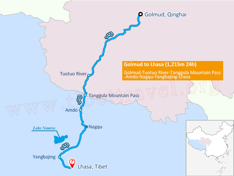
Qinghai-Tibet Highway Map
As the road heads south, it passes through Amdo, at 4,700 meters, slowly decreasing in altitude as it passes through Nagqu (4,507m), Damxung (4,265m), and Yangpachen (4,300m), before ending in the capital city of Tibet, Lhasa, at 3,650 meters above sea level.
Highlights of Xining to Lhasa Overland Trip
The road from Xining to Lhasa is full of scenic spots and natural landscapes prevail all along the route. The first thing you see as you leave Xining is the famous Qinghai Lake, as the highway passes along its southern shores, and then takes you to the stunning Chaka Salt Lake, which provides much of northwest China’s natural salt.
Qinghai Lake
Golmud, on the way up to the plateau, is one of the key junctions of land transportation from Tibet to the outside world. While there is not much to see in the town itself, it does offer great views of Yuzhu Peak, which can be seen some distance to the south, and Yuxu Peak which lies off to the west of the town.
The road also crossed the Tuotuo River, the headwater for the famous Yangtze River in China. Rising from the Geladong Mountain, the river joins the Chima’er River, and forms the Tongtianhe River. In Sichuan and Yunnan it is known as the Jinshajiang River, and as it flows east becomes the massive Yangtze River.
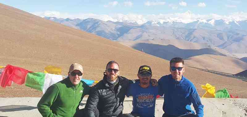
The highest point of the highway is at the Tanggula Pass, the entry point into Tibet. At 5,231 meters, it is so cold that the earth is permanently frozen, and the average temperature throughout the year is below zero degrees. Even in summer, the pass can sometimes be blocked by snow, but the view from the pass is spectacular, and the stone monument at the peak of the pass is inscribed with the altitude, giving you a great opportunity for a selfie at the highest point of the highway.
Once over the Tanggula Pass, the road drops somewhat as it passes into the Changtang Grassland, which covers almost one-third of the Tibetan Autonomous Region. A huge expanse of prairie, the grasslands extend for as far as the eye can see, and are an amazing sight, dotted with herds of yaks tended by their nomadic herders.
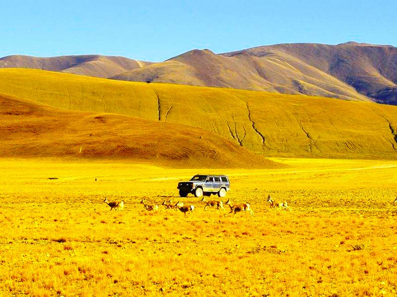
You view the wildlife in Hoh Xil Nature Reserve
You also pass through the Hoh Xil Nature Reserve, the home of the endangered Tibetan antelope, as well as many other species of animals and birds. On a good day, you can see herds of wild yaks, wild donkeys, and the beautiful white-lipped deer roaming the prairie, protected from extinction by the nature reserve.
Just before you drop down to Lhasa, the road crosses the stunning Nyenchen Tanglha Mountain Range, the closest range of mountains to Lhasa, and part of the Gangdise Mountain/Nyenchen Tanglha Mountain belt that runs across the center of the plateau. Among these mountains, you will pass close by one of the most beautiful spots in Tibet, the Namtso Lake, one of the three holy lakes in Tibet, and revered by Tibetan Buddhists as sacred.
>>Check the detailed itinerary of 11 Days Travel through Qinghai-Tibet highway
Best Time to Travel Overland to Tibet from Qinghai
While the route can be driven all year round, it is not advisable, as the winter months can bring some very heavy snow in the north of Tibet, especially around the area of Tanggula Mountain. The best time to drive the route is when the weather is better, from May to September, when the skies are clearer and the climate is warmer. The shoulder seasons from May to June and September to October are best, as there is more chance of rain during the rainy season from July to September, although most rainfall on the plateau usually occurs only a few times a week, and normally in the late afternoons.
Travel Visas and Permits Need
For traveling to Tibet along the highway, there are certain permits that are required for you to make the trip. Foreign travelers are not permitted to travel alone in Tibet, and from the Tanggula Mountain Pass, the road is inside Tibet itself. All trips to Tibet must be booked through a registered tour operator, such as Tibet Vista, and be part of an organized tour.
The first permit you need, aside from your Chinese Entry Visa, is the Tibet Travel Permit, issued by the Tibet Tourism Bureau in Lhasa. This is required to get into and travel around Tibet, and can only be obtained by the tour operator once you have confirmed your itinerary and booked your tour. The tour operator then uses a scanned copy of your passport to make the application and will deliver the permit to your hotel in China before you leave.

Tibet Travel Permit
As you will be taking a road route, once you enter Tibet at Tanggula Mountain, you will need to have a guide and private driver with you at all times. These will also be arranged by your tour operator and will accompany you from Xining for the duration of your tour in Tibet.
Because you will be traveling through regions of Tibet that require other permits, your tour operator will also apply for these before you depart. The second permit you need is the Alien’s Travel Permit, which allows visitors to travel to certain opened areas of Tibet outside Lhasa, such as Shigatse, Lhatse, Gyantse, and Lake Namtso. For travel through the Nagqu Region of Tibet, and other areas that are classed as military sensitive areas, such as Mount Everest and Mt. Kailash, you will need to have your tour operator obtain the Military Permit from the Office of Foreign Affairs. For those traveling on to the region along the border with Nepal, which includes Mount Everest, the Border Permit will also be required, though this can be applied for after you arrive in Lhasa.
Dining and Accommodation along Qinghai Tibet Highway
Many of the stops along the Qinghai Tibet Highway cater to mainly local travelers since few foreign visitors take the route due to strict controls on traveling into the region. Sichuan cuisine and other Chinese food can be found in plenty of rest stops along the route, and you can also take along plenty of instant noodles and packet foods to eat along the way, as all the rest stops normally have boiling water for such snacks.
Biscuits, nuts, dried fruits, and chocolate or high energy granola bars are also a good idea to take with you, as the high altitude saps your energy faster than in lowlands, and you will need to replace it quickly on the plateau region. There are also many guesthouses along the route between Xining and Tanggula Mountain, and after that, you can even find some good hotels that offer bed and breakfast accommodation along the roadside.
Qinghai Tibet Overland Tour Packing List
Traveling this route, with the extreme cold in the north of Tibet and west of Qinghai, there is a real need for very warm clothing. With daily temperatures close to freezing most of the year, this is definitely a place where many layers of clothes are required. Good strong boots should also be included, as the ground at the rest stops and viewpoints, as well as any other places you decide to stop and take a wander, is pretty rough, and the terrain is mostly rocky and uneven.
A hat and sun cream is essential, as the sunlight is stronger in the higher altitudes, and can easily burn your skin, even though it may not feel warm. With a thinner atmosphere, more solar radiation gets through, so it is best to be protected. Lip balm and moisturizer are also useful to stop chapped lips and dry skin from the ever-present wind on the plateau, which can be biting cold in the highest areas. Gloves and long underwear are also useful, as they will keep your extremities warm, and prevent inadvertent cases of frostbite.
If you take medications, please speak to your doctor before taking your trip, as there is no way to obtain most medications on the plateau, and even in China, you may find it very hard to get prescription medication. Make sure you take enough to cover your trip duration, with a little over for emergencies, and get your doctor’s recommendation on whether it is safe for you to take medication for altitude sickness.

"Ultimate Guide to Xining Lhasa Overland Tour via Qinghai Tibet Highway"