
 Search
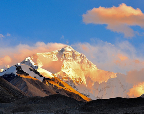


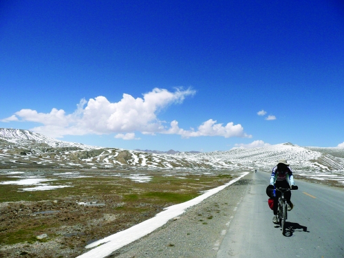
This is absolutely a journey of challenges. Lhaze County is located at 5053 highway mileage column of the 318 national highways. From there, there are several kilometers of gentle slopes and 25 kilometers of steep slopes before 5083 highway mileage column. Gyatso La Mountain Pass at an elevation of 5248 meters is close to this mileage column. From there, there are 22 kilometers of steep downhill slopes and after that roads are basically even. At 5131 mileage column is Baiba Village of Tingri County, a station before entering Qomolangma. After the checkpoint, the highway starts to cross the mountain. After Basong Village, there are 13 kilometers of gentle slopes before reaching Rongbuk Monastery. If the weather permits, you can see the silhouette of the world’s highest peak, Mt. Qomolangma that you have already seen in pictures. Rongbuk Monastery is an ideal place to observe Qomolangma, for it provides accommodations and meals charging similar price to that of Baiba Village. It is about 8 kilometers away from Mt. Everest Base Camp and you can see Qomolangma in most sections of these 8 kilometers of road.
More about Tibet riding 》》》


"Riding On The Roof Of The World"