
 Search
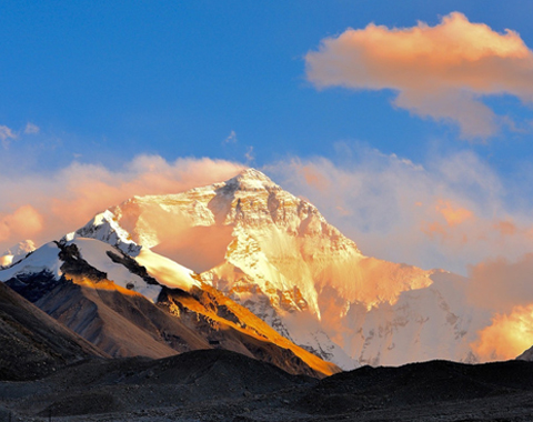


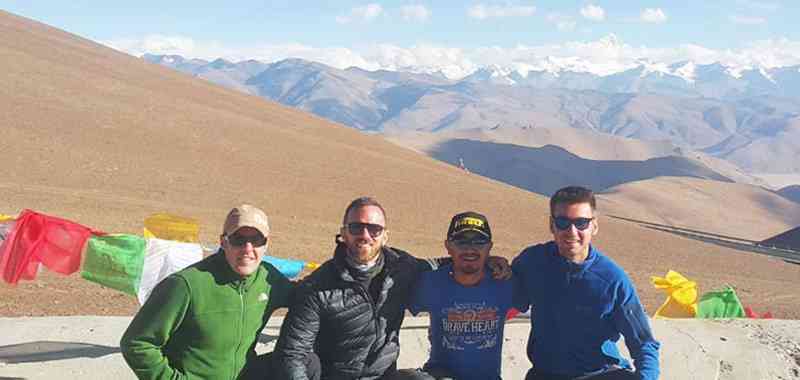
Tibet Autonomous Region contains many small counties that are known as prefectures because they are under the governance of prefects. One such beautiful prefecture of Tibet is Ngari. Ngari has the capital of Gar County. Sharing a total area of 304,683 square kilometers, the county is extremely beautiful. Lying in the northwestern region of Tibet, it has an elevation of 4500m.
Ngari prefecture is extremely beautiful.
Once the heart of the ancient Guge Kingdom, Ngari now, is famous amongst the tourists for its accessibility for Mount Kailash the famous mountain and also the relics of Guge Kingdom and the holy lake, Manasarovar. This article is an attempt to give a clear overview of the famous Ngari of Tibet and the various important tourism sites in it.
How to Get to Ngari Prefecture
Ngari Prefecture is accessible through the three main routes namely, the northern route, the southern route and via the Xinjiang Tibet highway, which has been paved through Ngari.
Northern Route
While journeying from Lhasa to Ngari, you will find the Northern route longer than the other two. From Lasa, you will have to travel either to Ngamring County, from where the Northern route will emerge. The road is not only long but also quite dusty and bumpy. But despite having ups and downs and uneven surface, the drive condition is good. The first part of the journey travels through the road of Lhatse to Raka, up to the turn off. It is advised that while following this route, try to acclimatize your body as the road from Raka, up to Ngari has a constant ascent above 4500 and even 5000m.
The tourists deliberately choose the Northern route despite its bouncy and uncomfortable journey because of the immense scenic charm it provides. The landscape around this road appears to be enigmatic consisting of enormous salt lakes, coloured mountains and green valleys. Also you will come across stretches of meadows with herders and there yaks, antelopes and numerous other domestic as well as wild animals including marmots, blue sheep and wild asses. It is a good idea that while you choose this route either from your return from Mount Kailash trekking or to your journey to Ngari, do at least camp for an evening. For camping, you might need a bit of expenditure but the scenic beauty of the place is worthy of the expenditure.
Southern Route
The southern route to travel Ngari from Lhasa is comparatively shorter than that of the Northern route. Here also, you need to travel from Lhasa to Ngamring County from where the two different routes will emerge. The road is about 1300 long and it starts from Lhaze and passes via Zhonba to reach Burang. In the Southern route, you will come across the glimpse of Mount Kailash and Mapham Yutso Lake region through which the route passes. The road condition of the southern route is much better than that of the northern route. There are practically no bumps and uneven surfaces. However you will not get any buses and have to board a private vehicle. The altitude of the whole route is at 5000m and therefore it is better that you acclimatize your body before you delve into the journey.
Xinjiang Tibet Highway
The Xinjiang Tibet highway amongst them is the longest. It starts from Yecheng, Xinjiang and travels straight towards Shiquanhe town, winding south at a distance of about 1179 km. The condition of the road is quite harsh, and has an elevation of 4000 m for 100 kilometers and 5000m for 130 kilometers. The road condition is not that good, and it is still a bumpy journey down the Xinjiang Tibet highway to Ngari. The highway starts from Lhasa and continues west of the China India Highway. However, like the Northern route, it passes through immense scenic beauties. There will be about ten snow-capped mountains on the way. They belong to the Kunlun range. The Xinjiang Tibet Highway is considered to be the highest road in the world. Though it is a difficult journey down this road, it is going to gift you a splendid scenic charm that is going to be memorable.
Top Tourist Attractions in Ngari, Tibet
Mount Kailash
Mount Kailash can be said to be the chief reason amongst the tourists and the pilgrims to pace towards Ngari prefecture. The magnanimous mountain stands enormously holy amongst the people belonging not only to Tibet but also from other religion. It stands at an elevation of 6638m and is surrounded by many interesting monasteries and scenic charms. The elevation of mount Kailash urges the professional mountaineers and the trekkers to trek the high altitude mountain.

Mount Kailash
Also as kora is performed around the mountain, there are distinct kora routes around it that gifts some of the best experiences of human life. The beholding of sunrise and the sunset with the chanting of the mantras is surely going to sweep you off your feet. You can also visit the many stupas having the north face of Mount Kailash as the background. You can camp in the monasteries like Drirapuk Monastery or Zutulpuk Monastery and experiences the authentic charm of Tibetan life.
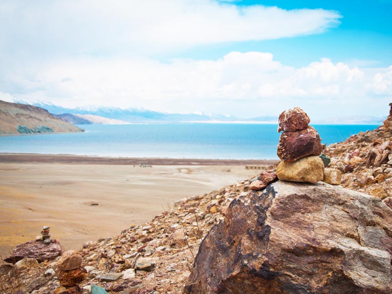
Lake Manasarovar
This is a gigantic fresh water lake situated near mount Kailash. This lake is also considered holy by the various sects of religion and as a result a distinct kora is performed around this lake by the Tibetans. It stands at an elevation of 4590m and is considered to be one of the most beautiful lakes in Tibet.
Lake Manasarovar
Surrounded by snow clad mountains and having crystal blue coloured water, the lake exudes a serene beauty. Watching sunrise and sunset across this lake is a pure bliss. Also performing kora around this lake is an altogether new experience. You can camp along the bank of this lake to bask in the truest charm of the place.
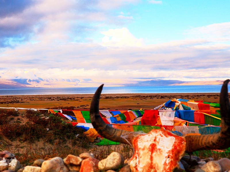
Guge Kingdom
The relics of the Guge Kingdom are located in the Ngari prefecture. It is one of the most ancient kingdoms that had their origin in Ngari prefecture. Now, being shattered to just relics only, the kingdom area has not lost its important. In Tibet, it is one of the most culturally important preserved sites. The relics of the Guge Kingdoms now consist mainly of the ruins of the old summer palace. The ruins contain about 800 caves and 445 rooms along with secret paths, storerooms containing arms and armaments, fortresses, granaries, 28 Buddhist pagodas and different kinds of burial places. Outside the ruin, you will find city walls. There are distinct places like Mandala Hall, Scripture Hall and Gongkang. These halls are in a very good condition still now.
Guge Kingdom
There are five temples located in the precincts of the ruins, namely the White temple, Red temple, Samsara temple, imperial palace and the Assembly palace. The ruin covers a very large area of land as much as 720,000 square meters, epitomizing a culturally and artistically rich civilization. The whole ruin shows the intricate construction of an entire kingdom with footpaths, residences, higher platforms signifying kings’ palaces and the 4 secret tunnels to ensure the kingdom’s safety. The ruin not only hordes the elaborate picture of an entire kingdom but also contains many artifacts, murals, pictures of Sakyamuni and royal families. The temples are the storehouse of history of the kingdom and contain many different scriptures.
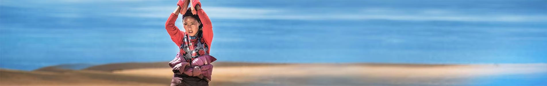
Pangong Tso Lake
Pangong Tso lake is also known as ‘high grassland lake’ in Tibet. It stands at an elevation of 4350m and is a very beautiful lake. The lake contains salt water and is a brakish water lake. During the winter, the lake gets transformed into ice completely. This lake in Ngari is of tremendous importance as it is a habitat of many floras and faunas. Thus it is important not only in Tibet, but also internationally.
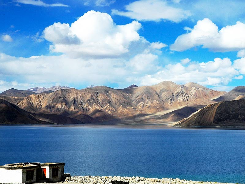
Pangong Tso lake
Every year, you can see birds like Brahmini ducks, bar-headed goose and wildlife like Marmot and Kiang. The lake is surrounded by brown coloured arid mountains and has two different types of water colour-one is crystal clear dark blue belonging to the Indian side and the other is pale blue. It is a treat to the eyes, to witness this lovely saline watered lake in Tibet, along with the faunas it sustains.
Lake Rakshastal
Lake Rakshashtal is located in the western side of Manasarovar and in the southern side of Kailash. It is a salt watered lake having dark blue water. This lake holds a mythological significance as the Tibetans believe that this lake had been created by Ravana, the demon king of Lanka, owing to his severe punishment in this particular region. With the fleecy clouds in the sky and the etched brown mountains around it, the lake is of much scenic charm. The lake also hordes four islands named Topserma, lachato, Dola and Dosharba.
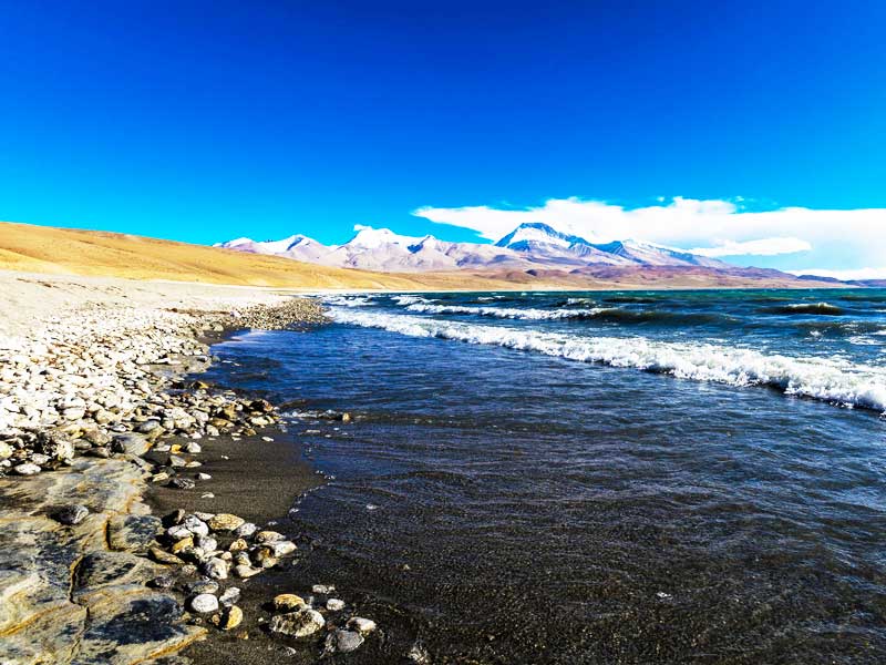
Lake Rakshastal
Tsada Clay Forest – Grand Canyon
The Tsada Clay forest is a miraculous creation by the crustal movement of the Himalayas. The golden hue of the shining or the setting sun with the background of the plateau makes the place magnificently beautiful. The forest or the Grand Canyon covers about thousands of square meters and is generally formed by the movements of Himalayan ranges along with water and erosion of the ruins. The ruins come usually with various shapes. The place is of top tourist attraction because of the beautiful photographic scenery here.
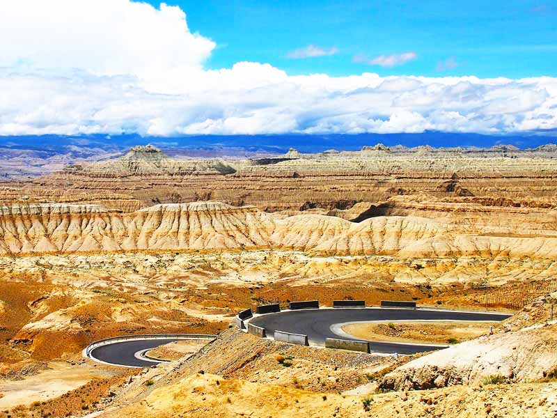
Tsada Clay Forest – Grand Canyon
Ngari Dark Sky Park
The Ngari Dark sky park shows some best night beauties exhibited by the Tibetan night sky. It is located at an altitude of 4200m. The exact park is located in the south of Shiquanhe town, in a distance of 25 kilometers. The park also features instruments for sky observation, photography and study. It is best for the people having an indulgence for star gazing.
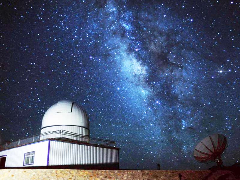
Ngari Dark Sky Park
Rutog Rock Painting
These are some of the best things for tourists’ attraction as they prove the presence of a culturally enhanced civilization in Ngari. They cover an area of almost 200-300 square kilometers. These paintings are usually found in the north and the south of Pangong Tso lake. The paintings include the hand drawings of sun, moon and of mundane things like cattle, horses, mountains, houses, antelopes and other things. These paintings vividly portray the everyday lives of the nomads of Tibet.

Rutog Rock Painting
Classic Itinerary of Kailash and Manasarovar Tour
The itinerary of the fifteen day touring of Kailash and Manasarovar from Lhasa is-
Day 1 Lhasa Arrival
The journey will begin with the arrival in Lhasa. Take rest for the day and indulge in sightseeing in Lhasa for two days to acclimatize your body.
Day 2-3 Lhasa Tour – Potala Palace, Johkang Temple, Barkhor Street, Drepung and Sera Monastery
Visit the important tourist attractions in Lhasa like Jokhang temple, Potala palace, Drepung Monastery, Sera monastery and indulge in shopping in Barkhor Street. Enjoy your stay in Lhasa and take rest overnight.
Day4 Shigatse via Gyantse Tour – Gyantse kumbum – Mount Nyenchen Khangsar – Yamdrok tso – Pelkor monastery
The following day we will get out on our journey to Shigatse via Gyantse. On the way we will come across the famous Gyantse kumbum, Mount Nyenchen Khangsar, Yamdrok tso, Pelkor monastery and many such other interesting sites. You will reach Shigatse after about nine hours covering a distance of 360km. take rest for the night.
Day 5 Tashilhunpo Monastery – Gyatsola Pass – Gawula Pass – Everest Base Camp – Rongbuk monastery
In the morning, visit the famous Tashilhunpo Monastery and then set out for your journey to the Everest Base Camp. On the way, you will stop at Lhatse for meal. Then continuing through the Tsola Pass, Gyatsola pass and Gawula Pass, we will finally reach Everest base camp region. We will stay overnight in Rongbuk monastery.
Day 6 Mount Everest – Mount Shishapangma – Saga
In the morning, we will witness the sunrise in the Mount Everest and head straight towards Saga. On the way, you will get to see Mount Shishapangma, world’s fourteenth highest peak and the lake Peiku tso, a lake having turquoise colour. We will also be able to see wild deer and antelope. On reaching Saga, we will stay in some local guesthouse.
Day 7 Saga Valley – Mayomla Pass – Mount Naimonyani – Lake Manasarovar – Mount Kailash
In the following day, we will make a journey from Saga to Darchen, via lake Manasarovar. The total distance of the journey will be 450 km. You will get to witness the beautiful Saga Valley and witness Mayomla Pass. You can also enjoy the famous Mount Naimonyani and then finally reach the southern foot of Mount Kailash by passing the famous lake Manasarovar. We are required to stay overnight in local guesthouse.
Day 8 Darchen – Sarshung Valley – Lachu Valley – Mount Kailash – Drirapuk Monastery
The following day, we need to travel from Darchen to Drirapuk. The trek will include a distance of 13km while driving includes 7km. The travel occurs via the Sarshung valley. From the Sarshung valley, we will take the yaks and the porters and trek via the Lachu valley. After enjoying the western and northern face of mount Kailash, we will finally enter Drirapuk monastery. In Drirapuk monastery, we will stay overnight.
Day 9 Drirapuk – Dromala Pass – Zutulpuk Monastery
The next day, we have to travel from Drirapuk to Zutulpuk monastery. The total trek distance is about 18km. In the trek, we have to pass over the highest pass namely Dromala Pass. On the way to Zutulpuk monastery, you will see the pilgrims prostrating in the kora route. After reaching Zutulpuk monastery, stay overnight there.
Day 10 Zutulpuk Monastery – Darchen
The following day, you have to return from Zutulpuk monastery to Darchen. The trek distance will be 7km and the driving distance will be 5km. You will see many piles of Mani stones on the route. The trek will get around noon. We will rest in the lodging.
Day 11-15 Darchen – Saga – Sakya – Shigatse – Gyantse – Lhasa
From the following day, we will commence our return journey. First we will visit Saga from Darchen. Then on the next day we will travel Sakya from Saga and likewise we will reach Lhasa via Shigatse and Gyantse.
>> Most Recommended Tour Itinerary: 15 Days Kailash and Manasarova Small Group Tour
Best time to visit Ngari
The best time to visit Ngari is around May to June and again September to October. During these times, the weather remains perfect and the scenic beauties can be well captured during this time.
Photographic tips
• Mount Kailash is the favourite amongst the photographers for shooting. The best time to shoot mount Kailash is spring and autumn as during this time the snow clad peak will not be covered with dense clouds.
• You have to have the Tibet Travel Permit, Alien Travel Permit, Foreign Affairs permit and Military permit.
• Before thinking of photographing any place, particularly Kailash and lake Manasarovar, do check the weather reports.
• For photographing lake Manasarovar and Rakshastal, you will need ultra wide photographic lens.
• For both the Guge kingdom and Tsada Clay forest, the best time for photographing will be during the sunset.
• Do take only the necessary gears along with you and arm yourself with sunglasses, sunscreens and medicines of all kinds.


"Ultimate Guide to Ngari Prefecture, Tibet"