
 Search
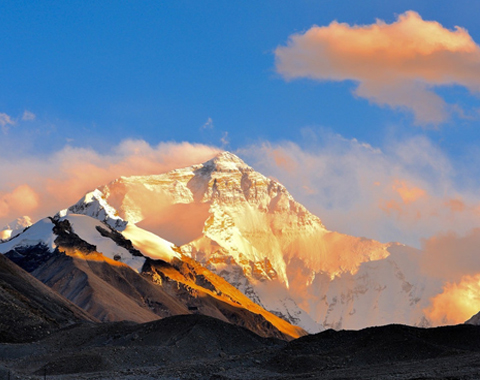


The Tibetan areas mentioned here are not limited to Tibet but include Tibet, Sichuan, Qinghai, Gansu, and Yunnan provinces. Since 2011, I have been to the Tibetan areas for more than once a year. And even compared with this year’s journey to the north of Xinjiang, I still think the trip to Tibetan areas is my true love. The rare beauty of Tibetan holy mountain has been endowed with the meaning of faith. Usually, tourists have to travel long distances and overcome many difficulties with perseverance and belief to appreciate their spectacular vistas.
Here I am going to introduce the top eight most famous mountains in Tibetan areas: Benri Mountain, Mount Yala, Mount MoErDuo, Mount Kawagebo (Meili Snow Mountain), Animaqing Mountain, Gado Jowo Sacred Mountains, the Himalayas and Mount Kangrinboqe(Mt.Gangrenboqi or Mt.Kailash), as well as five corresponding travel routes.
The way of Tibetan people worshiping the holy mountains is not mountaineering or climbing, but prostrating themselves step by step to the sacred site or taking a pilgrimage kora route around it. As for ordinary tourists, we can follow the trek with the pilgrims. These routes are first-hand experienced by myself, and I will try my best to combine them based on distances and sort them from easy to difficult according to the body requirements for the travelers.
1. Mountain Namjagbarwa and Benri Mountain
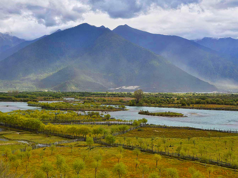
Benri Mountain
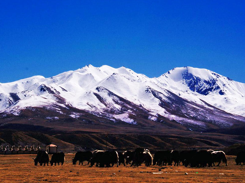
Namjagbarwa, also known as “the spear piercing to the sky”, is located at about 7,782 meters above sea level. As a holy land of Bonism, it has not been topped.
Benri Mountain, also the sacred mountain of Bonism, has an elevation of 4,500 meters. Bon religion believers usually walk in a counterclockwise direction, contrary to Tibetan Buddhists.
Geographical Position:
East of Nyingchi, Tibet.
Best Viewing Place:
Sejila Mountain Pass(4,200 meters) and Suosong village(3,171 meters) for Mt.Namjagbarwa; Mirui Village (2,800 meters) for Benri Mountain.
Travelling Route:
Generally speaking, tourists can appreciate those two mountains along Sichuan Tibet Highway G318.
First of all, we need to get to Nyingchi by Chengdu Nyingchi flight, Chengdu overland to Nyingchi via G318, Lhasa overland to Nyingchi via G318.
If you drive along G318 to Nyingchi, you can view Mt.Namjagbarwa from Sejila Mountain Pass in far distance. I have compared the angle of other positions, and finally found that the most striking scenery can be only obtained from Sejila Pass. Following the county road 401, you can go to the Benri mountain sightseeing zone.
If you fly to Nyingchi, you can take a glimpse of Benri Mountain along Gangpai Highway at the junction of the two rivers (the Yarlungzangbo River and Niyang River) and then go ahead to village Suosong and stay one night there. If time allows, you will be likely to enjoy the stunning sunset over Mt.Namjagbarwa. On the next day, you can go back along the Yarlung Zangbo River, pass through the Danniang and Mirui, and finally get to the Niyang /Benri scenery zone. Along the county road 401, you can see the anti-clockwise Benists. In autumn, the Niyang scenery near the sacred Benri Mountain reach its best.
2. Mount Yala and Mount MoErDuo
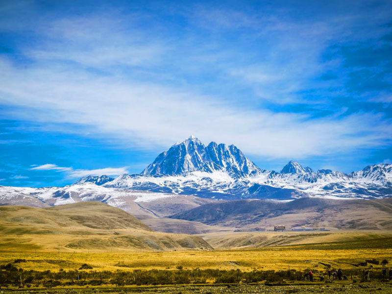
Mount Yala
Mount Yala, 5884 meters above sea level, is a famous sacred mountain in Kham Tibetan area. It is the place for Tibetan people in Huiyuan temple and surrounding areas to worship. Till now, no one has climbed to the summit.
Mt.MoErDuo, a holy mountain of Bonism, situated at the north-west of Mount Yala, has an elevation of 5000 meters. Not only is it the Jiarong Tibetan cultural center, but also the birthplace of the Dadu River.
Geographical Position:
Danba, Sichuan
Best Viewing Place:
Tagong Grassland(3730 meters) for Mount Yala; Zhonglu County(2, 200 meters) for Mount MoErDuo.
Travelling Route:
Sichuan Tibet Highway small loop: Chengdu – Hailuogou – Kangding – Zheduo Mountain – Xinduqiao – Tagong/Bamei – Danba – Chengdu
After arriving at the Xinduqiao, you can go north to the Tagong Grassland, appreciating the crown-shaped Yala Mount in far distance. Passing over Bamei to Danba, you would spend one hour driving to Zhonglu County, over-viewing the majestic MoErDuo Mount.
Frankly speaking, the route is not high at all, but it would take you a long time to cross over the twists and turns. The road condition of Sichuan Tibet Highway is not so good in this section.
3. Mount Kawagebo(Mount Kawagarbo, Meili Snow Mountain)
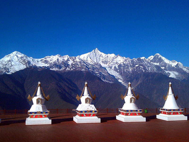
Meili Snow Mountain
Mount Kawagebo with an elevation of 6740 meters is the patron saint of Kargyu Section of Tibetan Buddhism. As the head of the top eight Tibetan sacred mountains, Mount Kawagarbo is protected from being climbed.
Geographical Position:
Deqin, Yunnan
Best Viewing Place:
Temple Feilai(3400 meters)
Travelling Route:
It’s highly recommended you to visit Meili Snow Mountain from Lijiang or Chengdu and exit from Shangri-la. Starting from Chengdu, you would pass over Litang, Daocheng, Xiangcheng and then follow Provincial Road 217 to Feilai Temple, where you can stay overnight for the stunning sunrise on the next day. If your time is tight, you can also take a flight from Shangrila Airport after visiting Mount Kawagebo.
4. Animaqing Mountain and Gado Jowo Sacred Mountain
Animaqing Mountain
Gado Jowo Sacred Mountain is the sacred mountain for Tibetan people in Yushu area, which is also reputed as the king of holy mountains in the Yangtze River basin.
Mountain Animaqing, situated at the altitude of 6,282 meters above sea level, is the sacred mountain for Benists and Amdo Tibetans. The legend goes that there are three great soul mountains in Tibetan areas, namely, Mountain Kailash in the upper, Nyenchen Tanglha Mountains in the middle, and Animaqing Mountain in the lower. It is the snow mountain that sits at the Yellow River source.
Geographical Position:
Gado Jowo, Yushu, Qinghai; Animaqen, Maqin, Qinghai
Best Viewing Place:
Gaduo Township for Gado Jowo Mountain; Xueshan Township for Mountain Animaqen
Travelling Route:
Starting from Xining, you can travel along National Highway G214 till Maduo, the transfer point. From Maduo, you need to pass through Bayankala Mountain Pass and then turn to S308 and Gaduo Township, and finally arrive at Mount Gado Jowo.
After that, you can move back to Maduo and head north to the Huashixia. Follow the newly built highway, you can go straight to Xueshan Township to capture the close view of Mountain Animaqen. Finally, you can travel the same way back to Xining.
5. Himalaya Mountains and Mount Kailash (Mount Kangrinboqe)
Mount Kailash
Most people’s cognition of the Himalayas comes from the famous Mount Everest, but not everyone knows that it’s also one of top eight holy mountains in Tibetan area. Towering on the southern edge of the Qinghai-Tibet Plateau, the Himalayas, the highest and most majestic mountain range in the world, distributes in China Tibet, Pakistan, India, Nepal, Bhutan and other neighbouring countries, with the main summit of Mount Everest standing at the border between China and Nepal. Extending from Mount Nanga Parbat in northwest Tibet to Mount Namjagbarwa in east Tibet, the Himalaya covers a total length of 2,450 km, spanning a width of 200 to 350 km.
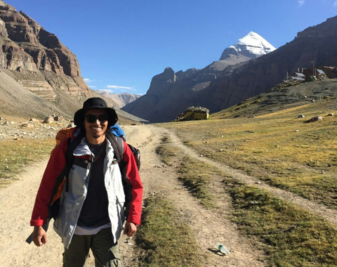
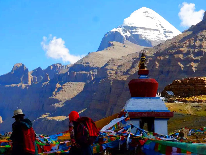
Having the summit altitude of 6656 meters above sea level, Mount Gangrenboqi, one of the top ten famous mountains in China, is the second highest peak of the Gangdise Mountains. In Tibetan language, Kangrinboqe means the mountain of the Gods, which is also considered as the center of the world by Hinduism, Tibetan Buddhism, Tibetan Bonism and ancient Jainism.
Gang Rinpoche is also known as Kailash in English. It’s said that sincere pilgrims can wash away the sin of their lifetime by one Kailash Kora; save themselves from the pain of the hell by ten Kailash Koras; enter the realm of Nirvana by one hundred koras of Mount Kailash. So it is doomed to be the ultimate goal of religious believers.
Geographical Position:
Mount Everest, Shigatse Prefecture, Tibet; Mount Kailash, Ngyari Prefecture, Tibet
Best Viewing Place:
Mount Everest Base Camp(5200 meters) for the Himalayas, Kangrinboqe -5620 meters.
Travelling Route:
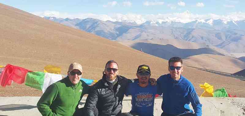
If you wanna visit Mt.Everest and Mt.Kailash in just one go, here we strongly suggest you to follow the big loop of Ngari Prefecture. After passing by Dingri County in Shigatse, you will enter the Mt. Everest National Nature Reserve. If the weather allows, you’ll be likely to enjoy the golden sunset over Mt.Qomolangma and shoot the starry night over the Everest Base Camp. Then we’ll drive over Saga, Zhongba, to Darchen and get ready for the 52-kilometer-long Kailash Kora. After that, you can choose to fly back to Lhasa, or you can go through the big loop of Ali Prefecture to embrace the numerous turquoise lakes.


"Top Eight Holy Mountains in Tibetan Area"