
Sichuan (Chengdu) to Tibet Overland
Sichuan-Tibet Highway (called Kangzang road before renamed) is the longest high altitude road in China at present. It was built from April, 1950 to December, 1954. Starting from Chengdu of Sichuan to Lhasa of Tibet, it is part of G318 (Shanghai to Zhangmu). Besides, constructing the road was the hardest task in China because of the complex terrain. In fact, Sichuan-Tibet highway was divided into Northern (2,293km) and Southern (2,149km) routes at Xindu Bridge, namely Sichuan Northern Road to Tibet Overland and Sichuan Southern Road to Tibet Overland. Both of them lead to Lhasa, the capital of Tibet Autonomous Region, that is to say you can travel from Chengdu to Lhasa by road if you are in Sichuan province. By the way, you can contact with us if you want to make your Chengdu road trip to Tibet more perfect.
▲The Best Travel Time: the best driving time is May, June, September, October and November; in addition, July and August are available but more rainfall.
▲The Feature of Scenery: Sichuan-Tibet highway is the most dangerous but most beautiful road route, where you can feel the real nature. Snow mountain peaks, mountain passes and deep gorges can be seen along the road route.
▲The Feature of Culture Experience: you can make friends with Khampa, nomad and Tibetan people and so on, and feel their culture and customs. Besides, you still can visit local monasteries, temples and some villages.
▲Tips: you maybe encounter landslip in the rainy season, so just be more careful and well-prepared before you go. What's more, it's not available to drive to Tibet in winter (from December to April) because of the heavy snow.
Although the travel along the Sichuan-Tibet routes maybe a little rough and time-consuming, you deserve to feel a little smug in the knowledge that you have completed one of the world's great road trips. So just do it!
History of Sichuan-Tibet Highway
Sichuan-Tibet Highway which was originally called Kangding-Tibet Highway (a section of No. 318 National Trunk Highway) starts from Chengdu of Sichuan on the east and ends at Lhasa of Tibet on the west. It is 2,415 kilometers long including 1,304 kilometers in Tibet. On December 25, 1954, it was open to Lhasa (Sichuan-Tibet Highway north line).
Since the opening of the Sichuan-Tibet Highway north line, Dongerluo-Zhubalong-Bamda south section has been under construction, and it was completed section by section between 1954 and 1969. Key reconstruction has resulted in the current Sichuan-Tibet Highway south line, which has 1,285 kilometers in Tibet. Sichuan-Tibet Highway traverses high mountains, lakes and valleys, crosses primeval forest and numerous dangerous sections. It has fine views along the line, with unique customs and practices.
The opening of the Sichuan-Tibet Highway has played an important role in Tibet economic development, social stability and consolidation of southwest defense, and energetic promotion of East Tibet social and economic development. It is a link connection Tibet and southwestern provinces and regions and also the economic pulse of East Tibet. However, due to the social and historical conditions and complicated natural factor restriction, Sichuan-Tibet Highway is weak in disaster resistance, involving various disasters.
To further improve throughput ability of Sichuan-Tibet Highway and improve East Tibet communications conditions, during the period of "the Seventh Five-year Plan", the state started to invest massive capital in opening maintenance, rectification and reconstruction. So far, 612 kilometers highway section of the Nyingchi-Lhasa section and county transit sections has been laid with bitumen pavement, traffic congestion time has been shortened year by year, and car ride conditions have remarkably improved.
Sichuan Tibet Highway Northern Route (2,412km):
This is one of the two main routes of the Sichuan-Tibet highway. It links the Tibetan areas of western Sichuan with Tibet proper and almost 150km longer than the southern route.
-small-update.jpg) (Simple click to enlarge the map)
(Simple click to enlarge the map)
Sichuan Tibet Highway Northern Route Map
From Chengdu to Danba (348km tar road):
Now, let's start the journey from Chengdu, the hometown of giant pandas. The road condition is not bad, so you will get to Dujiangyan city in two hours, where you should visit Dujiang Dam, a world-famous water conservancy project built by Libing and his son in Qin Dynasty. It's a great project and still works until now. It was accepted as a world cultural heritage in 2000 because of its scientific design, long history and useful purpose.
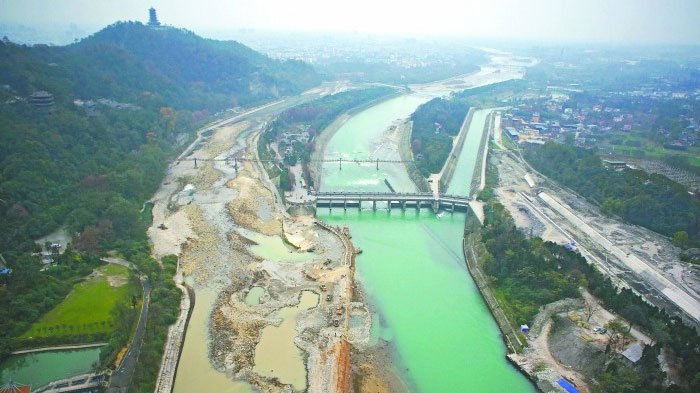 Dujiang Dam
By the way, you can pay a visit to Dujiang Dam together with Qingcheng Mountain, which is a famous Taoist mountain with beautiful scenery and was accepted as a world cultural heritage at the same time with Dujiang Dam.
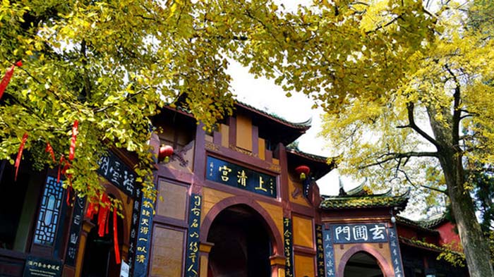 Qingcheng Mountain
After Dujiangyan, the next scenic spot will be Wolong National Nature Reserve, a protected area located in Wenchuan County and established in 1963. It covers an area of about 200,000 hectares in the Qionglai Mountains region. The national nature reserve is well-known for the Panda Research Center, which houses more than 150 highly endangered giant pandas. What's more, the nature reserve is also a home to many other endangered species including red pandas, golden monkeys, white-lipped deer and many precious plants. So it's really worth your visit. By the way, you can visit Wenchuan Earthquake Museum when you are near Wenchuan. It's necessary to mourn for those who lost life in 5.12 Earthquake.
 Lovely giant pandas in Wolong National Nature Reserve
I think you must be very relaxed in the first few days, so just keep moving. The scenic spot will be Mt. Siguniang when you get near to Xiaojin. Siguniang means "four pretty girls" in Chinese. Obviously, there are four mountains standing there, just like four pretty girls. Separately, they are at an elevation of 6,250 metres, 5,664 metres, 5,454 metres and 5,355 metres. The mountains will show you a variety of plants living in a nice climate.
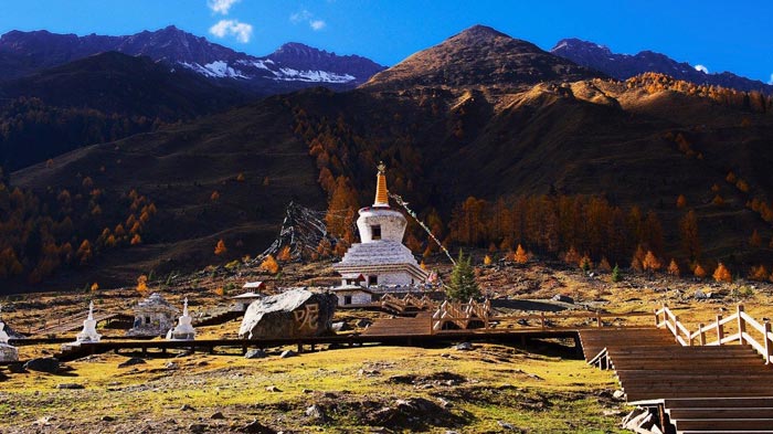 Mount Siguniang
From Danba to Bamei (82km, tar road):
57km away from Xiaojin is Danba County, which is under the administration of the Garze Tibetan Autonomous Prefecture and is famous for the Danba Ancient Block Towers built by local Qiang ethnic minority. So Danba was called a kingdom of block towers.This kind of block towers always were built by groups and can be used for fighting and living. What's more, it is cast-iron and good-looking.
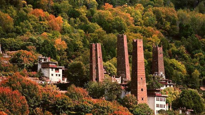 Danba Ancient Block Towers
Except block towers, you still can visit Jiaju Tibetan Villages, where local Tibetan lives, and all of them are unique Tibetan style and full of fairy tales, so it enjoys the reputation of Tibetan Fairy world.
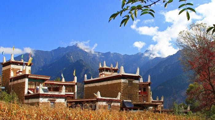 Jiaju Tibetan Villages
I think the Danba county must leave a deep impression for you, but you should keep moving; and the next destination will be Bamei, 82km away from the Danba. Bamei is famous as the birthplace of the 11th Dalai Lama. The must-see spot there is Huiyuan Monastery, located at 8km northeast of the town and built by the seventh Dalai Lama. You must be tired because of the long journey, so I advise you to have a rest in the monastery.
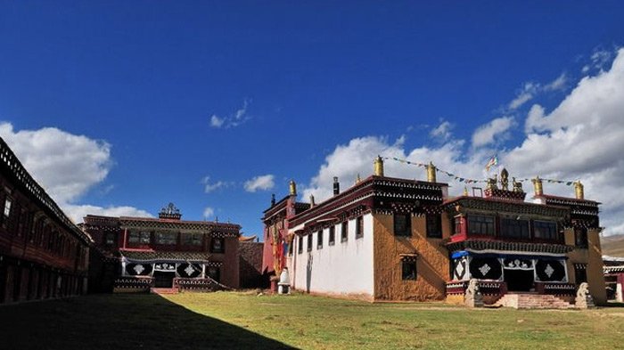 Huiyuan Monastery
From Bamei to Garze (243km, tar road):
One more 77 kilometers starting from Bamei, it will be Daofu, home to the 450-year–old Gelugpa-school Nyitso Monastery, one of the largest monasteries in this region. Keep moving, you will get to the town of Garze when you pass by the Luhuo. Garze sits in a valley at 3,400m, surrounded by the sleeping giants of the Chola range. It's really a natural place to break your trip, where you can visit Tibetan villages and monasteries, for example, Garze Monastery which is just north of the town and is the region's largest monastery with over 500 monks. Another monastery is Den Monastery in the southern part of the town. It is smaller but older and much more atmospheric. What's more, Garze has the region's best antique shops and many general stores selling Tibetan goods.
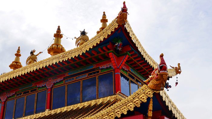 Garze Monastery
From Garze to Dege (205km, tar road):
On the way from Garze to Dege, you will pass by Yulong La-tso, a stunning, holy alpine lake. The lake is backed by the huge glaciers of 6,018m. And it's possible to walk an hour or two up the left side of the lakeshore for a glacier view. Besides, many places are suitable for camping around the lake, and there are some pretty Tibetan villages for you to visit.
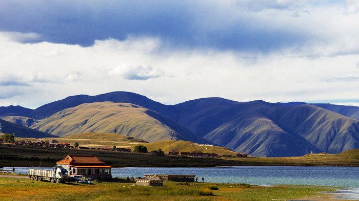 Yulong La-tso
After Yihun La-tso, it won't take you too long to get to Dege, which forms the cultural heartland of Kham while the Chinese influence is evident and growing rapidly here. The old town and surrounding villages are all in Tibetan style. There are many historically important monasteries in the valleys south of Dege.
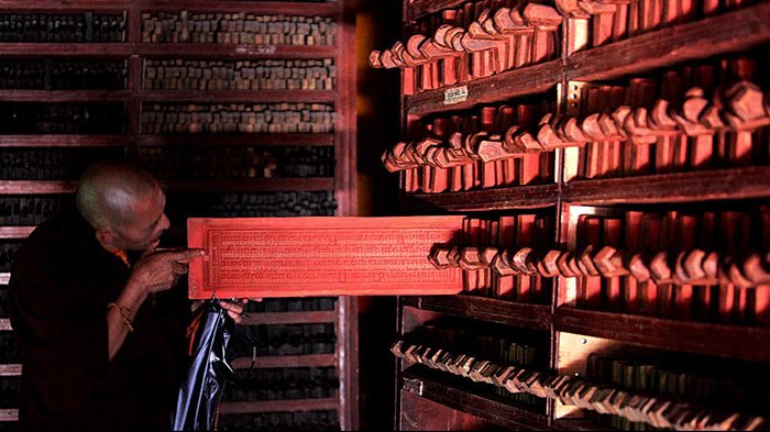 Bakong Scripture Printing Press and Monastery
During the 18th–century, the Bakong Scripture Printing Press and Monastery was located at the heart of Dege. The press houses more than 217,000 engraved blocks of Tibetan scriptures from all the Tibetan Buddhist orders, including Bon. The collection makes up an astonishing 70% of Tibet's literary heritage. Those texts include ancient works about astronomy, geography, music, medicine, and Buddhist classics. Within the monastery, dozens of workers hand-produce over 2500 prints to order each day, as ink, paper and blocks fly through the workers' hands at lightning speed. So it's really well worth a look.
From Dege to Chamdo (253km, tar road):
Ok, you are getting into Tibetan prefecture when you pass by Dege. It's 109km from Dege to Jomda. After crossing the Jinsha river, you can have a good rest in Jomda, where the Wala Monastery is located.Then, your next stop will be Chamdo county, the seat of government of Chamdo Prefecture. Chamdo county covers an area of 10,700 sqaure kilometers and has a population of 78,000, of which 90% are Tibetan. And the average temperature there is 7.6 degrees centigrade. The most famous and popular spot is Jampaling Monastery, also known as the Changbalin or Qiangbalin Si Monastery. At its height, it contained five main temples and housed some 2,500 monks. It was destroyed in 1912 but the main hall (which was used as a prison) and two other buildings survived; and it was rebuilt in 1917 after the Tibetan army retook Chamdo. It now houses about 800 monks.
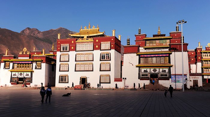 Jampaling Monastery
From Chamdo to Lhasa (989km, tar road):
Now, congratulations, you are already in Tibet, and you can feel the real Tibet. It will be a long road from Chamdo to Lhasa, some part of the road condition is not good enough. However, I advise you move slowly and pay more attention to the scenery. In sequence, you will pass Riwoqe county, Degnqen County, and Baqing before you get to Nagchu prefecture, which is the largest prefecture of Tibet Autonomous Region. This Prefecture is divided into 11 different counties and Nagchu county contains the capital of Nagqu.There is a must-see scenic spot, Namtso Lake, which is a mountain lake on the border between Damxung County of Lhasa Prefecture and Baingoin County of Nagqu Prefecture. This salt lake at an elevation of 4.718m is the largest lake in the Tibet Autonomous Region. What's more, Namtso is renowned as one of the most beautiful places in the Nyainqentanglha mountain range.
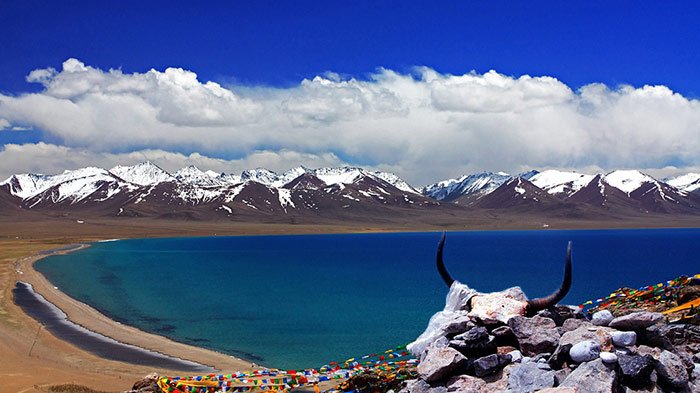 Namtso Lake
Ok, the last destination is not far from you now. You dream is coming true. I guess you must be a little tired, but don't worry, because you can have a wonderful hot spring in Yangpachen, about 245km away from Nagchu. Yangbajing is a town approximately 87 kilometers(54 miles), north-west of Lhasa. It is famous for the Yangbajing hot springs and power station. The Yangbajing hot springs field is at an altitude of 4,290-4,500m, which makes it the highest altitude set of hot springs in China, and possibly in the world. The power station has been harnessed to produce much of the electricity for the capital Lhasa, so it is important for local people.
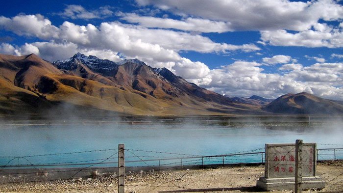 Yangbajing Hot Springs Field
After the wonderful hot springs, one more 75kilometer, you will get to Lhasa, which is the political, economic and cultural center, also the Administrative capital of Tibet Autonomous Region. Lhasa is one of the highest cities in the world. It contains many culturally significant Tibetan Buddhist sites such as the Potala Palace, Jokhang and Norbulingka palaces, and some other scenic spots. It's no doubt that the Potala Palace is a must-see site, which firstly was built by Tibetan king, Songtsen Gampo, as a present for his bride princess Wen Cheng of Tang Dynasty.
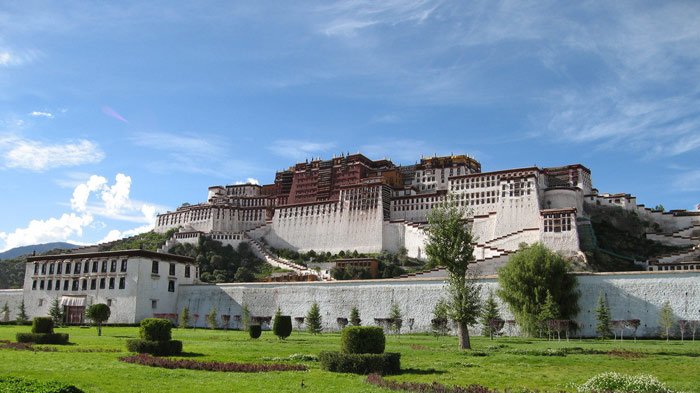 Potala Palace
Except the Potala Palace, Jokhang Temple located on Barkhor square, is also a mark of Tibet. It is the most scared and important temple for local Tibetan people. What's more, the temple's architectural style is a mixture of Indian vihara design, chinese Tang Dynasty design, and Nepalese design. It was founded during the reign of king Songsten Gampo. It is said that it was built for the two brides of the king, Princess Wencheng of the chinese Tang Dynasty and Princess Bhrikuti of Nepal. Both wives are said to have brought important Buddhist statues and images from China and Nepal to Tibet.
Another must-see place is Norbulingka, which is a palace and surrounding park in Lhasa. It served as the traditional summer residence of the successive Dalai Lamas from the 1780s up until the 14th Dalai Lama who was exile in 1959. Norbulingka palace is also recognized as a UNESCO World Heritage Site.
Sichuan Tibet Highway Southern Route (2,146km):
The road condition is ok in Sichuan, but it's a little bad in Tibet; and you will witness different kinds of scenery, such as valleys, grasslands, and mountains. By the way, you can contact with us if you are interested in the trip to Tibet by road.
-small-update.jpg) (Simple click to enlarge the map)
(Simple click to enlarge the map)
Sichuan Tibet Highway Southern Route Map
From Chengdu to Kangding (297km, tar road):
Now, the exciting journey starts from Chengdu, and the first stop will be Ya'an, located at the western edge of the Sichuan Basin and on the upper reaches of the Yangtze. I advise you to try the fish of Ya'an. It's really delicious.
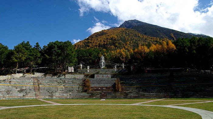 Riding Mountain
It will not take you too long to get to Kangding, only 230km away from Ya'an, the capital of Garze Tibetan Autonomous Prefecture. Kangding was an important trading town for many centuries, where Chinese brick tea was carried by porters from Chengdu and other centers to trade for Tibetan wool. The Riding Mountain and Mugecuo Lake are the famous scenic spots there. The Riding Mountain is a very beautiful and charming mountain in China. The Mugecuo Lake, also known as savage sea, is one of the most biggest highland lakes. At an elevation 2600-3780m, it was comprised by lakes, forest, hot springs, snow peaks and strange stones, so it's really a beautiful place.
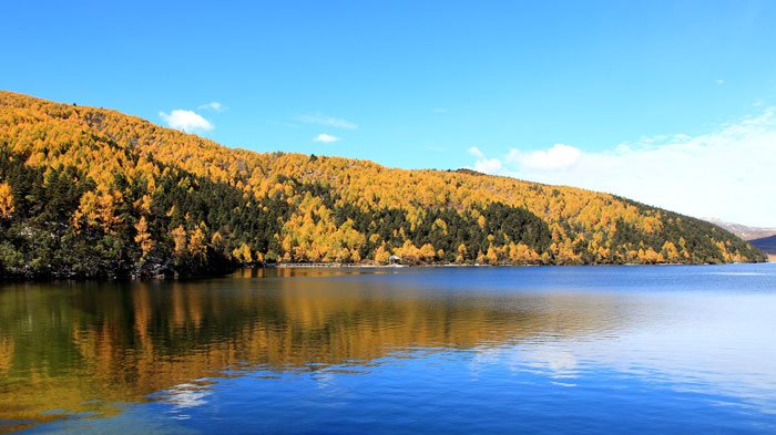 Mugecuo Lake
From Kangding to Xinduqiao Bridge (71km, tar road):
Almost forget, Hailuogou which is famous for the low altitude Glaciers is located not far from Kangding and at an elevation of 2,850m. The attractions there include ice fall, virgin forest and khampa culture. What's more, you can view the scenery of different seasons in a day.
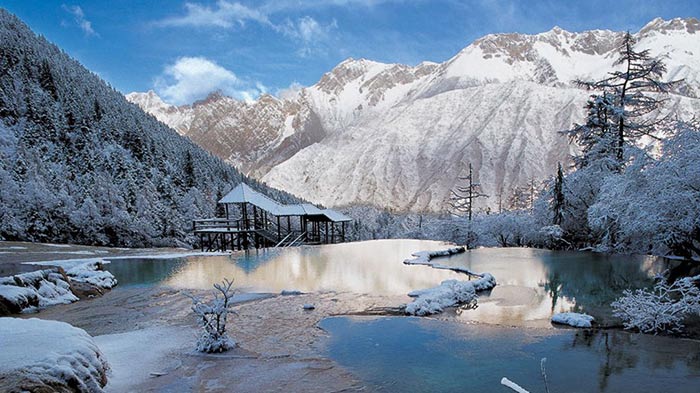 Hailuogou
Your next stop will be Xinduqiao Bridge when you finished the sightseeing of Kangding. It is the place where the Sichuan-Tibet highway was divided into Northern and Southern routes. At an elevation of 3,300m, the Tibetan villages is a unique scenery, but the natural scenery is more beautiful. I am sure you will be attracted by the wonderful place, so just take more pictures.
From Xinduqiao Bridge to Litang (205km, tar road):
You still can pay a visit to Juli Monastery, a very old monastery, if you get enough time in Xinduqiao Bridge. At present, the road condition maybe not so good, but you will get to Litang town when you pass by Yajiang. It's only 205 kilometers. At an elevation of over 4,000m, Litang is not uncommon for travelers to feel the affects of altitude sickness. The town is famous for its annual horse-racing festival, held from 1 to 7 August. It's a great time to visit this place when the town swells with tens of thousands of local Khampas and their colourful Tibetan tents. Litang is also famed as the birthplace of the 7th and 10th Dalai Lamas. There's some scope for hiking around Litang; and it will be a good experience.
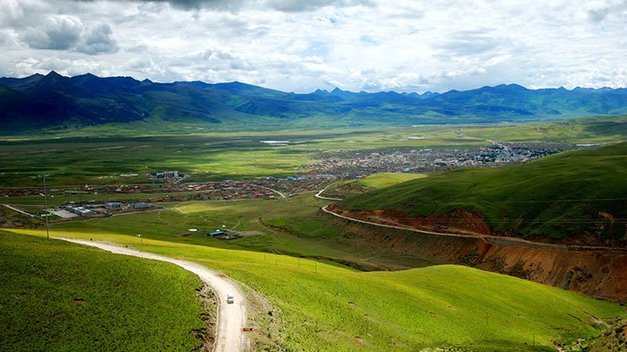 Litang Town
From Litang to Markam (276km, tar road):
Maoya Grasslands lie in the west of Litang and is surrounded by many mountains. I am sure the huge grasslands will give you a different experience. In addition, I advise you to visit the Maoya grasslands together with Genie mountains which are the Tibetan Buddhist mountains. The Genie mountains are formed by three main peaks, separately at an elevation of 6,224m, 5,807m and 5,780m. All of them are very scared in the local people. In addition, the Pucuogou natural ecological reserve is 36km away from the road to Batang, where you can see hundreds of hot springs, that is, Chaluo geothermal area, the biggest hot springs groups in Sichuan.
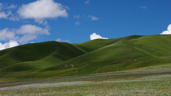 Maoya Grasslands
From Markam to Zogang (157 km, sand road and tar road)
Now, congratulations, you are already in Tibet. I think you must be a little tired, but you should be more focused yourself, because the wonderful journey is still long, and the road conditions is not good enough. OK, the next stop is Zogang county, located in the southern of Chamdo Prefecture. It is a very important traffic hub since the ancient time. Most of the population is Tibetans there, and the natural scenery is various, besides, both Lancang River and Nujiang River cross over the Zogang county.
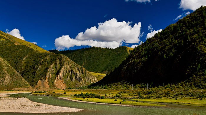 Zogang County
From Zogang to Ranwu (290 km, sand road and tar road)
Keep moving, you will get to Bangda county, where you can feel the Bangda Prairie, groups of flocks and herbs roaming there. The animal husbandry is well-developed in Bangda county. Besides animal husbandry, this kind of grasslands environment produces many medical plants, such as Cordyceps, Fritillaria, and Rhodiola Rosea and so on. Bangda county is also a traffic hub. The famous Chamdo Bangda airport is located there, and it's the highest airport in the world, at an elevation of 4,334 metres (14,219ft).
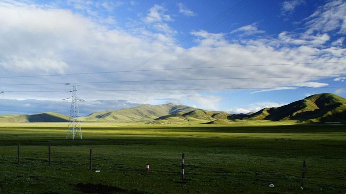 Bangda Prairie
Finishing the trip of Bangda county, your next destination will be Ranwu town in Nyingchi prefecture, about 195 kilometers, at an altitude of 3,807 metres. The town of Ranwu is quite close to the original Tibetan village. To the southeast of the village is a large chorten and a small temple, the most famous scenic spot is Ranwu Lake, located in the southwest of Baxoi county of Chamdo. It can be divided into three parts. The blue water, white snow peaks, and the green grasslands make it a charming place.
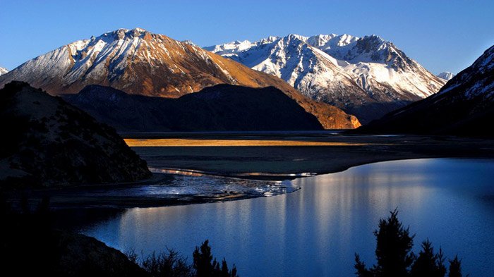 Ranwu Lake
From Ranwu to Nyingchi (358 km, sand road and tar road)
I think you may be a little tired because of this long journey, so I advise you to slow down and have enough rest, and try to feel Tibet with a relaxed mood, and the next stop will be Bomi county, one of the commodity grain base in Tibet. It produces plenty of fungus and tricholoma matsutake.
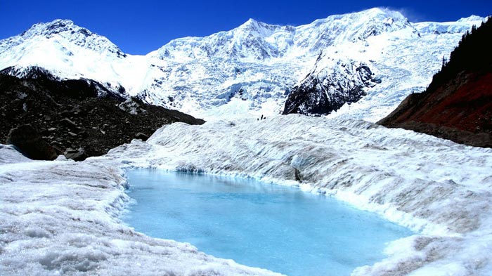 Midui Glaciers
What's more, plenty of glaciers appear because of the climate and terrain reasons in this area. The most famous is Midui Glaciers. The main peak is at an elevation of 6,800 meters. It's called "the world wonder of glaciers" by the geographer, in addition, it enjoys the title that one of the most beautiful glacier in China, so you really can not miss it, and I advise you to visit Midui glacier together with Midui village, a local Tibetan village.
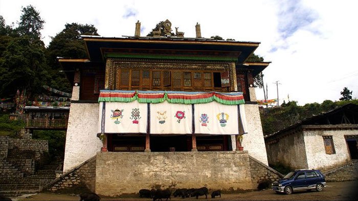 Duodong Temple
Besides, I will recommend you Duodong Temple if you are interested in Tibetan culture and religion, which is located in southwest of Bomi county. You still can visit Gangxiang Nature Reserve if you are energetic, 4600 hectare in all, where you will witness many kinds of rare animals and plants.
Keep going, you are getting near to Tongmai village, now, you have to focus yourself again, the road condition is becoming complicated, specially, there is a section called Tongmai natural barrier.You will enter into this section when you pass by Tongmai bridge. The sand road is narrow with dangerous rock and river aside, so it's necessary to drive carefully and slowly, I am sure you will get an unforgettable experience from the road section. Now, I advise you to pay more attention to yourself and vehicle. Maybe you will have some altitude reaction. All you should do is to try to adapt it and have enough rest. Besides, you should check your vehicle carefully, because the sand road is bumpy, it needs your vehicle to work well.
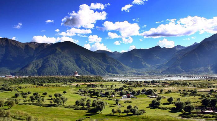 Lulang Forest
After Tongmai, your next destination will be Lulang town, where you can see snow peaks, virgin forest and countryside and so on. Lulang Forest is a famous scenic spot, where grow many kinds of rare plants. I am sure you will be attracted by this natural scenery. I think it's necessary to introduce a food to you since you are Lulang town, that is Shiguo chicken, it's really delicious and unique.
From Nyingchi to Lhasa (401 km, tar road)
Nyingchi is the lowest place in the Qinghai-Tibet plateau, at an average elevation of 3,000meters, and it enjoy the high reputation of "Tibetan JiangNan". Visiting Nyingchi is a nice try. The ecological environment is protected well and the climate is very suitable. The old Monba and Lhoba are living in Nyinghchi. They still keep their lifestyle and religious faith. I think it's necessary to talk about the Bayi which develop fast as a modern industry town, and it's the political, economic and cultural center in the Nyingchi prefecture. Besides Bayi town, you can't miss Nyang River, which is a major river in south-west Tiebt and the longest tributary of the Yarlung Tsangpo river, and it flows past the town of Bayi. The river joins the Yarlung Tsangpo in Cemeng, Nyignchi, with an average flow of 538 cubic meters per minute, and it has an aquatic potential of 2.08 million kilowatts.
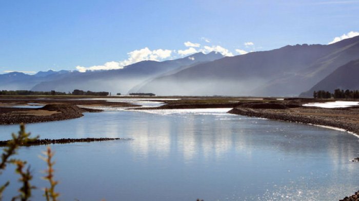 Nyang River
Keep moving, one more 140 kilometers, you can visit Basum Lake when you get near to Gongbujiangda. It is a sacred lake for local people, and it was awarded the title of international forest park in 2001. The water is very clean and you can see snow peak, Seagulls and white cranes from it, so the scenery is really attractive. It will take your tired feeling away.
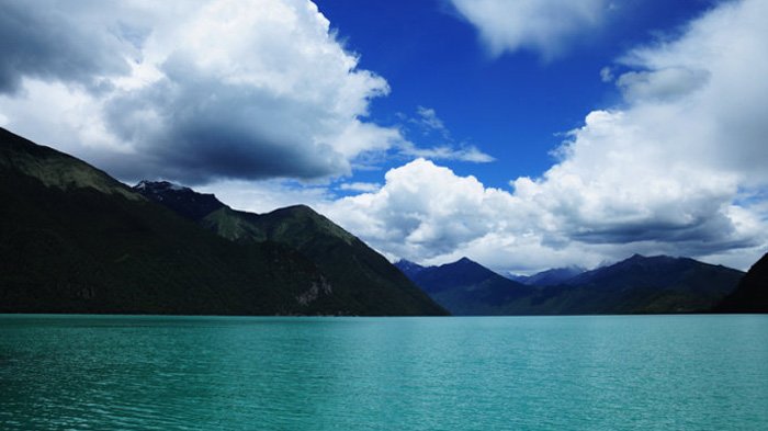 Basum Lake
The road is not bad when you move forward, but there is a place called Mila mountain pass for you to cross over, located at an elevation about 5000 metre. The road will be narrow and bumpy then, but you can have a good rest when you get there. It will be agreeable to overlook the whole Tibet area and take some picture with the boundary monument. I guess you must be touched by the beautiful Tibetan scenery. You will get to the Gongbudajiang County when you cross over Mila mountain pass, known as Tibetan JiangNan because of the warm climate and enough rainfall.
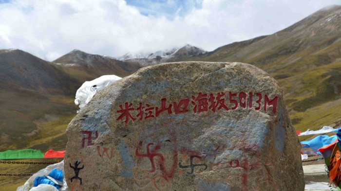 Mila Mountain Pass
OK, I think it's time for celebration, because Lhasa is just in front of you now, which is the political, economic and cultural center of Tibet Autonomous Region, also the Administrative capital. Lhasa is one of the highest cities in the world. You can tour around Lhasa city and visit culturally significant Tibetan Buddhist sites such as the Potala Palace, Jokhang and Norbulingka palaces, and many other scenic spots. It's no doubt that the Potala Palace is a must-see site, which firstly was built by Tibetan king, Songtsen Gampo, as a present for his bride princess Wen Cheng of Tang Dynasty.
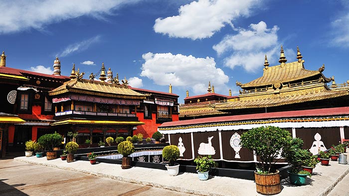 Jokhang Temple
Besides the Potala Palace, the Jokhang Temple is also a mark of Tibet, which is located on Barkhor square. It is the most scared and important temple for local Tibetan people. The style of this temple is a mixture of Indian vihara design, chinese Tang Dynasty design, and Nepalese design. It was founded during the reign of king Songsten Gampo. It is said to be built for the two brides of the king, Princess Wencheng of the chinese Tang Dynasty and Princess Bhrikuti of Nepal, both of whom are said to have brought important Buddhist statues and images from China and Nepal to Tibet.
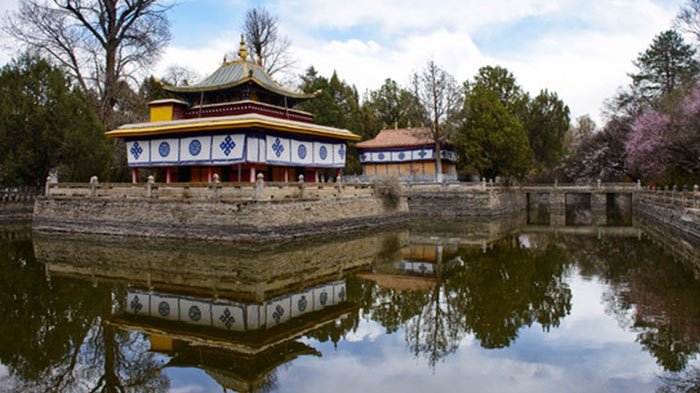 Norbulingka
Another must-see place is Norbulingka, which is a palace as well as a park in Lhasa. It served as the traditional summer residence of the successive Dalai Lamas from the 1780s up until the 14th Dalai Lama who was exiled in 1959. Norbulingka palace is also recognized as a UNESCO World Heritage Site.
It is just the beginning of your Tibetan journey when you get to Lhasa, There are still many other wonderful scenic spots and cultural sites waiting for you. I can't list them all out here, so just enjoy yourself.

Mr. Derek Wong is sales manager of Tibet Vista Tour as well as designer of Tibet Vista websites and has been providing specialized travel services to Tibet Vista travelers for years. He has continued to hone his professional expertise by completing numerous travel specialist courses to China and Tibet and Nepal and Bhutan.

.jpg)


0 Comment ON "Sichuan (Chengdu) to Tibet Overland "