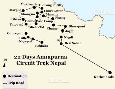
22 Days Annapurna Circuit Trek Nepal
(NT-22ACT) Kathmandu- Besi Sahar-Nagdi-Jagat-Dharapani-Chame-Pisang-Manang-Khangsar-Tilicho Base Camp-Tilicho Tal-Khangsar-Churi Lattar-Thorung Phedi-Muktinath-Marpha-Ghasa-Tatopani-Ghorepani-Hille-Nayapul-Pokhara
-
Tour Type:
Escorted by private guide and vehicle; leave 365 days a year!
-
Trip Level:
Moderate - suitable for ones physically fit; have experiences of high altitude travel.
-
Trip Level Guide:
- Easy - suitable for all level of fitness, family with kids and senior groups.
- Moderate - suitable for ones with average level fitness, family with kids bigger than 12 yrs.
- Moderate to Strenous - suitable for ones physically fit; have experiences of high altitude trek.
- Strenuous: suitable for adventures and individual with physically fit and healthy.
-
Season:春
Spring夏
Summer秋
Autumn冬
Winter
Overview
Other than EBC trek, the trek in Annapurna region has long been considered as the best treks in Nepal. This epic 22-Day Annapurna Circuit Trek takes you for the most geographically and culturally diverse region in Annapurna. You will experience a variety of diverse cultures, tribes and castes as the Brahmins, Chettris, Newars, Gurungs, Magars, Manangis and the Tibetans, together with world's deepest river gorge, Kali Gandaki and incredible mountains Annapurna I (world's 8th highest) & Fishtail, etc. let alone unexpected encounter with lovely wildlife.
At a Glance
Day 1Arrive in Kathmandu
Day 2Drive to Besi Sahar (823m) from Kathmandu. ( around 10hrs’ drive )
Day 3Trek to Nagdi (860m)
Day 4Trek to Jagat (1,340m)
Day 5Trek to Dharapani (1,943m)
Day 6Trek to Chame (2,713m)
Day 7Trek to Pisang (3,185m)
Day 8Trek to Manang (3,530m)
Day 9Rest day at Manang
Day 10Trek to Khangsar (3,650 m)
Day 11Trek to Tilicho Base Camp (4,950 m)
Day 12Trek to Tilicho Tal (4,920 m) & back track to Khangsar
Day 13Trek to Churi Lattar
Day 14Trek to Thorung Phedi (4,220m)
Day 15Trek to Muktinath (3,802m)
Day 16Trek to Marpha (2,667m)
Day 17Trek to Ghasa (2,012m)
Day 18Trek to Tatopani (1,189m)
Day 19Rest day at Tatopani
Day 20Trek to Ghorepani (2,874m)
Day 21Trek to Hille (1524m)
Day 22Trek to Nayapul & drive to Pokhara (884m)
Day to Day Itinerary
Day 1: Arrive in Kathmandu
Upon arrival in Kathmandu’s Tribhuvan International Airport, our Nepali guide will greet you and get you transferred to the hotel and help you check in. Besides, welcome soft drink will be served.
In the afternoon, you will participate in the pre-departure trek briefing followed by equipment check.
At night, you may enjoy the welcome dinner at a Nepali restaurant featuring cultural program.
Stay overnight at hotel
Day 2: Drive to Besi Sahar (823m) from Kathmandu. ( around 10hrs’ drive )
Drive to Besi Sahar covering about 173 kilometers or so from Kathmandu to Besi Sahar, where the trek starts. Drive duration: 10 hours.
Besi Sahar (823 m) is the main town of Lamjung district. Until recently this market town of 2000 inhabitants was called Besigaon. However, since the opening of the road to Manang, in the late seventies, the village became a compulsory stop over for those who go trekking around the Annapurna and was renamed Besi Sahar.
Insider Tips: If you can’t put up with the long drive, you may opt for flight from Kathmandu to Pokhara. At your request, after breakfast our staff will transfer you to the Kathmandu’s Domestic airport to board the flight to Pokhara (25min).
Stay overnight at Besi Sahar
Day 3: Trek to Nagdi (860m)
We start by heading northwards, until we reach the District Forest Office. Then ascend for 150 meters, heading towards Pam Khola on the other side of the small bridge. The track goes up again till the hamlet of Sanuti, less than thirty minutes away.
Walk across fields of paddy, barley and corn to reach the village of Bhalam in about an hour. Then we cross Khudi Khola on a suspension bridge to reach the first Gurung village also named Khudi (792m). It takes about two and half hours to reach the Nagadi village (860m) from Khudi.
Stay overnight at Nagdi
Day 4: Trek to Jagat (1,340m)
Start by moving north up to a suspension bridge crossing the Nagdi Khola. At this point, the track on the right leads to the village of Utsa. The path going up towards Mardyangdi leads to the village of Lampata in the Manang District. The climb is quite steep and it takes about two hours to reach Bahundanda, a village sitting on the headline at a height of 1314 meters. Bahundanda means “Brahman’s hill” which explains the origin of the people. Stop here for lunch and to enjoy the view of Mount Phungi (6379m), towards the North.
After lunch, climb down a steep slope for about thirty minutes until we reach the Dhule Khola, cross over to reach the village of Besi. In about one hour, get to see the magnificent waterfall at Syange (1136m) flowing from the high plain hamlet of Ghulima. From here it takes about two hours to reach Jagat, a village along the ridge of the mountain, at a height of 1340m.
Stay overnight at Jagat
Day 5: Trek to Dharapani (1,943m)
In the morning after ascending for about forty-five minutes, one will reach Bhatti, from where it will take another thirty minutes to reach the village of Chamje (1433m). It takes about one hour to reach the hamlet of Sattare (‘top of the hill’, in Tibetan) from Chamje. Lunch at Sattare.
After lunch, walk along the ridge of the hills and then uphill for about an hour through the bamboo forest to reach the village of Tal, set in the middle of the broad valley at a height of 1707 meters. Tal means ‘lake’ in the Nepali language. From Tal, it takes about two hours forty-five minutes to reach Dharapani (1943m), which means ‘stream’.
Stay overnight at Dharapani
Day 6: Trek to Chame (2,713m)
It takes 45 minutes to reach the village of Bagarchap (2164m), which literally means ‘the river bank’. Bagarchap marks the barrier between the humid valleys of the south, which is to be crossed on the way, and dry regions of the high- Marsysngdi. That the monsoon is more or less absent in this region is evident by the change in vegetation.
From Bagarchap, it will take an hour to climb up to the hamlet of Dhanagya (2300m), lunch spot. After lunch it takes us about 2-½ hrs to 3 hrs through the hamlet of Thanchock and Besi Salla (which means “the Garden of Pines”) to reach Kodo (and also called Koto) meaning ‘Millet’ and then to the village of Kyupar (2600m). Outside the village a police check post controls the access to the Nar Phu Khola Valley, which leads to Tibet. Chame, the headquarter of Manang District, is forty five minutes walk away.
Stay overnight at Chame
Day 7: Trek to Pisang (3,185m)
After reaching the school at Chame, move to cross the bridge to get to the northern bank of Marsyangdi. Walk along the river to reach the village of Bratang (2919m), mainly populated by Tibetans. Stop for Lunch. On the way to Bratang, pass through a splendid pine forest with splendid views of Lamjung and Annapurna II and IV.
After lunch it’s about two hours walk to reach the top, where trekkers traditionally plant a pine sapling, not only to establish that they have made it to the top, but also to contribute to the reforestation of the area. Go down to Pisang (3185m) from here and it takes about an hour to reach there. There are neither houses nor any water resources on the way down.
Stay overnight at Pisang
Day 8: Trek to Manang (3,530m)
After crossing the Pisang Khola there is a forty-five minutes steep climb up to a steep pass. From the top of the pass, get a glimpse of Paunda Danda (4655m), Mount Pisang and Manang valley, with Mount Tilicho in front. On the way down to Hongde come across a check post where the trekking permits will be rechecked. Lunch at Hongde.
After Hongde, the valley widens with the Annapurnas III and IV (7555m and 7525m) to the left, East and West Chulus(6584m and 6419m) on the right, towards the horizon, there are views of peaks of Mount Thoroung(6481m) and to the east, the crown of Mount Pissang. From Hongde, climb up to the ancient village of Braga (3505m).
Have leisurely time to wander around Braga to see this picturesque village with its flat roofed houses and to visit Gompa, not only the largest in the region but also the richest with its fine collection of thangkas (religious scroll paintings) and prayer books. It takes only forty-five minutes to reach Manang from here, which sits on the plateau of 3530 meters.
Stay overnight at Manang
Day 9: Rest day at Manang
Take an extra day to rest and acclimatize before proceeding to higher altitudes. Optional walk in the afternoon to the north of the village, which offers a panoramic view of Annapurna II and IV to the southeast and Gangapurna (7455m) and Tarke Kang or Ice Dome (7202m) to the southwest.
Stay overnight at Manang
Day 10: Trek to Khangsar (3,650 m)
The Khangsar trail goes downhill to a chorten, and then turns northwest and heads down towards the river. Stay on a north bank and head west, following a trail alongside the river. Follow the power lines along the ridge on a wide trail and then traverse along the south side of the ridge through a blue pine forest. Cross the suspension bridge and climb up the ridge. Khangsar is collection of traditional building surrounding a large village square. The top storey of each house has been whitewashed, but a complex web of power lines detracts somewhat from the picturesque aspect of the village.
Stay overnight at Khangsar
Day 11: Trek to Tilicho Base Camp (4,950 m)
Beyond Khangsar and the Tilicho Base Camp, the trail climbs steeply to a small chorten, then climb more gently through juniper and sea buckthorn bushes to a crest at 3900 m. Traverse into a side valley, cross a stream and climb to some herders huts and a trail junction at 4050 m. The high trail to Tilicho Base Camp leads to the right, which is the safest route to Tilicho Tal.
Stay overnight at Tilicho Base Camp
Day 12: Trek to Tilicho Tal (4,920 m) & back track to Khangsar
The trail to Tilicho Tal starts up a valley. It. Then, traverses onto a moraine making a long climb to 4710 m. There are outstanding views of Khangsar Kang, Tarke Kang, and Gangapurna as well as great views down the valley to Manang and Upper Pisang. The trail then makes a series of steep switchbacks, climbing for an hour to a false summit and on to a crest at 5010 m. From here to the lake the trail is lined with hundreds of large stone slabs set on end. Passing two Lakes, the trail crest at a cairn and prayer flags where one will have their first view of the Lake (4920 m), 4 Km long and 2.5 Km wide. It is the lake situated at the highest place. After visiting Tilicho Lake, backtrack to Khangsar.
Stay overnight at Khangsar (4250 m)
Day 13: Trek to Churi Lattar
From Khangsar, the trail goes descending to Gungsang crossing Jharsang khola. The route passes through sparse forests of Juniper, rose and berry, a few meadows and Mani. Beyond is Yak Kharka, also known as Koche. Lunch at Yak Kharka and continue trek to Churi Lattar.
Stay overnight at Churi Lattar
Day 14: Trek to Thorung Phedi (4,220m)
After leaving Churi Lattar the path climbs up till Thorung Phedi. These Himalayan pastures are domains of yak, a bovine of Tibetan origin, reared for its wool, milk and to transportation of goods. The thar, a kind of wild goat that lives in herds, is also found here.
It takes about one hour to reach Thorung Phedi after lunch. Thorung Phedi means ‘foot of the hill’ and it is situated at a height of 4220m on a small hill overlooking a high plateau.
Stay overnight at Thorung Phedi
Day 15: Trek to Muktinath (3,802m)
We have to cross about twenty hills on the way to reach the summit, Throungla Pass at 5,415 meters and it takes about 4 ½ -5 hrs to reach there. On the way up one sees many prayer flags several cairns (small mounds of rock). From the top one gets the views of the Yakgawa Kang or Thorungse (6481m) to the north, and Khatung Kang (6484) to the south and the Annapurnas along with the Gangapurna to the southeast. In the horizon to the west, Dhaulagiri (8169m) and Mount Tukuche (6920m) are also visible. From the summit the descent to Muktinath (3802m) takes about three hours and the difference in altitude is of 1600m. S
tay overnight at Muktinath
Day 16: Trek to Marpha (2,667m)
After crossing the hamlet of Ranipauwa, adjacent to Mukntinath, one will reach the village of Jharkot (3612m), mainly populated by Tibetans. It takes about two hours through rocky terrain and horse caravans to reach Kagbeni (2807m). It will take about two –three hours to reach Jomsom (2713m) from Kagbeni, the administrative headquarters of the region.
There is an airport with regular flights to Pokhara, a bank, post office, hospital and few hotels. One has to show our permits again before moving on to Syang (30 Min. away) and then to Marpha (2667m) our camping place for the day. Marpha is famous for its apple liquor and it has a charm of its own with its black-salted streets and unusual architecture.
Stay overnight at Marpha
Day 17: Trek to Ghasa (2,012m)
Start walking along the bank of the river Kali Gandaki for an hour and half to reach the village of Tukeche (2951m), dominated by the name of the same peak, which stands at the height of 6930m. This beautiful village is populated by Thakalis, whose houses reflect just how significant this centre of Trans- Himalayan trade is.
After Tukeche, the path meanders along the Kali Gandaki valley for about one and half hours to reach the village of Lajung (2560m). Outside the village, there is against pine where villagers sacrifice chickens and goats to propitiate the Goddess Kali.
The hamlet of Sokung (2951m) is another thirty minutes away. From here it takes about forty-five minutes to reach the hamlet of Dhampu. Here we have to cross the river to enter into Kalopani (or ‘black water’) located at 2530m.We will have lunch here and enjoy the impressive views of Dhaulagiri, the Nilgiris (South: 6839m, Central: 6940m and North: 7061m) and Annapurna I (8091m).
From Sokung the path climbs up and down over a low altitude tropical forest to reach the village of Ghasa(2012m) which is two and a half hours away. On the way, we have to show our permits at the check post in the village of Lete (2438m).
Stay overnight at Ghasa
Day 18: Trek to Tatopani (1,189m)
It will take about forty five minutes to reach the hamlet of Panoi Thaala and fifteen minutes more to reach Deorali, the boarder hamlet between the Mustang and Myagdi district. After crossing several hills from here, start to descend until one reaches the bridge leading to the west of the river. Few minutes walk from here will take us to the village of Rupse Chhara (1550m), near a huge waterfall. Stop for lunch.
From Rupse it takes about forty-five minutes to reach the village of Dana (1446m), distinctive because of its large houses and decorative windows. In about two hours’ easy descent is Tatopani (1189m), the campsite. ‘Tatopani’ means ‘hot springs’ for which the village is famous.
Stay overnight at Tatopani
Day 19: Rest day at Tatopani
Rest day at Tatopani.
Day 20: Trek to Ghorepani (2,874m)
It will be a hard day since one has to cover a long distance with a difference in altitude of 1700 meters. From Tatoapani it takes two to three hours to reach the village of Ghara (1768m) and another hour to reach the village of Sikha(1920m), lunch spot.
After lunch, climb through terraced cultivations for about an hour and half to reach the village Chitre (2316m) and then across a rhododendron forest until Ghorapani, which is about an hour away. Ghorapani (2874m), meaning ‘water place for horses’ is, in fact, a stop over for donkey caravans travelling from Jomsom- Pokhara.
Stay overnight at Ghorepani
Day 21: Trek to Hille (1524m)
Start by going through a subtropical forest for about an hour. Reach the village, Nayathanti (2450m), which is inhabited by the Magar tribe, traditionally recruited by the British Army to serve the Gurkha regiment. From here it takes another hour to reach Banthanti (2250m). Stop here for lunch with Machapuchare (6993m) in the background. Nepalese people regard Machapuchare or ‘fishtail’ as a sacred mountain because it is yet to be conquered by man.
After Banthanti, the forest disappears only to be replaced by terraced cultivations that spread to the village of Ulleri, about thirty minutes away. Climb down a flight of steps for about two hours to reach Hille (1524).
Stay overnight at Hille
Day 22: Trek to Nayapul & drive to Pokhara (884m)
The descent starts to become easier as one proceeds to Birethanti (1037m). Stop for lunch here. After lunch trek for about half an hour along the banks of the Modi Khola to reach Naya Pul. End trek, meet the waiting vehicle and drive to Pokhara for one and a half hour.
Stay overnight at the hotel in Pokhara
Service Guide
The costs include:
- All meals and accommodations at the Lodges / Tea Houses;
- Sleeping bags with liners;
- Services of English speaking trek leader;
- Experienced Sherpa assistant and a team of reliable porters;
- Airport transfers from and to Hotel;
- Drive from Kathmandu to Bensi Sahar;
- Drive from Nayapul to Pokhara;
- Annapurna Conservation Area Project (ACAP) entrances permit fees with necessary documentation;
- Contribution to Porter insurance and Equipmen;
- The porter’s wages and the guide’s daily allowances including his wages, meals and accommodations.
The costs exclude:
- Items of a personal nature such as bar bills telephone calls, laundry, extra mileage and any extra costs incurred due to natural calamities, flight delays etc.;
- Personal insurance, evacuation and medical expenses;
- Items not specified in the above in “Cost Includes”.
Contact us for your dream trip now !
Enquire NowYou May Also Like
-
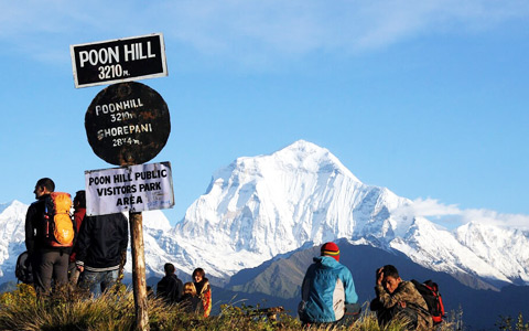 6 Days Ghorepani Poon Hill Trek
Kathmandu - Pokhara - Tikhe Dhunga - Ghorepani - Tadapani - Kathmandu
-
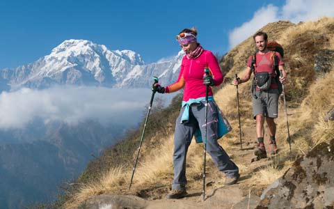 9 Days Royal Trek in Pokhara
Kathmandu - Pokhara - Kalikasthan - Syaklung - Chisapani - Pokhara - Kathmandu
-
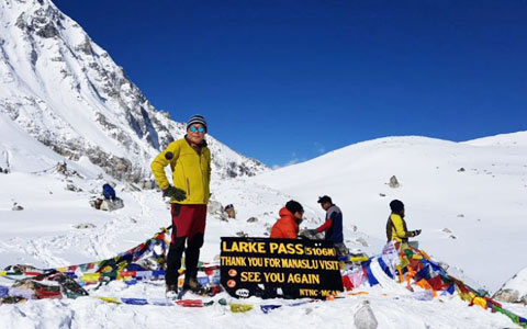 17 Days Manaslu Circuit Trek
Kathmandu - Soti Khola - Machha Khola - Jagat - Deng - Namrung - Lho Gaun - Samagaun - Samdo - Dharamsala - Bhimphedi - Tilje - Chamje - Kathmandu
-
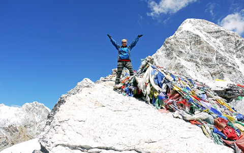 19 Days Ultimate EBC Trek via Gokyo Valley
Kathmandu-Lukla-Phakding-Namche-Thyangboche-Phiriche-Lobuje-Kala Pattar-Gorak Shep-EBC-Gorak Shep-Dzongla-Gokyo-Renjo La-Thame-Monjo-Lukla-Kathmandu

If you prefer a more in-depth trek in Annapurna region and challenge your physical limit, then the epic 22-Day Annapurna Circuit Trek Nepal can be a better choice over Annapurna Base Camp/Sanctuary Trek. You get more diverse trekking experiences and a panoramic view of all the best of lofty peaks in Annapurna region. Highly recommended.
Tibetan Travel Guru,Lobsang Tsering
Get A Quotation of this Tour
Get Started - 22 Days Annapurna Circuit Trek Nepal
You’re getting closer to your dream Tibet vacation! Fill out this form so our travel designers can start helping you plan a trip.
Privacy Policy: Your information is kept strictly confidential. Tibet Vista will never sell, trade, or give away your contact information to a third party.

.jpg)


