

.jpg "Tibetan Local Travel Agency")


Your Definitive Maps of Tibet Plateau and Tibet Tourism
To help you plan a successful and pleasant Tibet tour, Tibet Vista freshly made a collection of maps of Tibet. You can find the detailed tourist maps of Tibet, including where is Tibet located, Tibet political map, Everest Base Camp tour map, holy Mount Kailash map, Tibet Nepal map, Tibet India map, Lhasa city map, Tibet road map, flights and trains to Lhasa map, and more Tibet travel maps of the famous tourist attractions and activities like the Namtso Lake, Yamdrok Lake, Everest trek map, Kailash trek map, etc.
We will keep updating the available maps and uploading more new maps of Tibet to provide more Tibet tourism information by mapping our Holy Land - Tibet. So stay tuned.

Where is Tibet Located on a Map?
Tibet is situated on the Qinghai-Tibet plateau in China, with an average altitude of above 4,000m, neighboring India, Nepal, Bhutan, and Myanmar. Use the following complete Tibetan location maps to get a better understanding about this spiritual realm.
 Map of Tibet Location in World
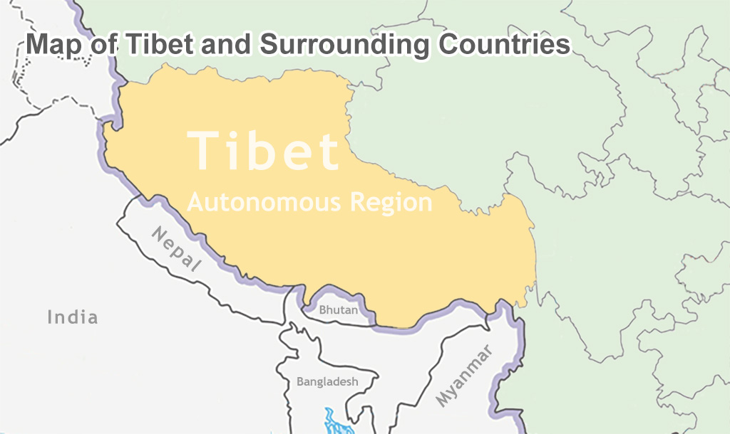 Map of Tibet and Surrounding Countries
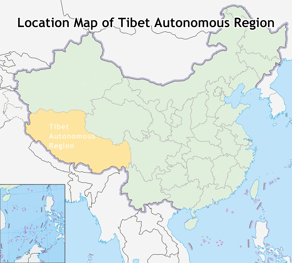 Map of Tibet Location in China
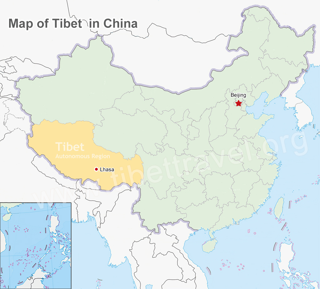
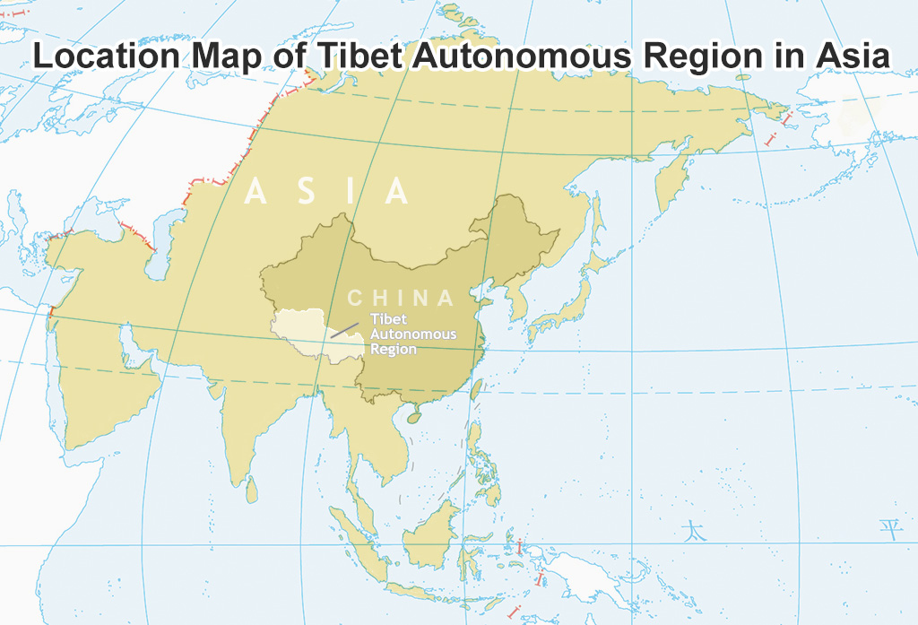 Map of Tibet Location in Asia
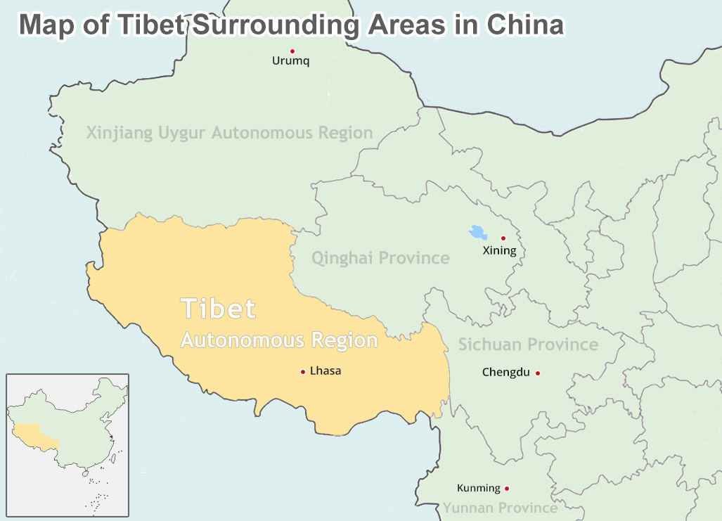 Map of Tibet Surrounding Areas in China
Tibet Political Map
Tibet consists of 7 administrative divisions - Lhasa, Shannan, Shigatse, Nagqu, Ngari, Nyingchi and Chamdo; among which Lhasa, Chamdo and Shigatse are the most populated regions.
>> Read more about Tibet political maps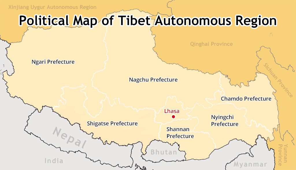 Different administrative divisions in Tibet
 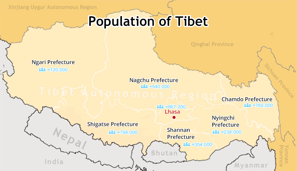 Demographic change of Tibet
Tibet Nepal Maps
Geographically, Tibet and Nepal jointly share the majestic Himalayan Range (Mt.Everest) in Asia, and both are superb tourists' draws for adventure and sightseeing. Find the detailed tourist maps of Tibet and Nepal to plan a significant adventure trip.
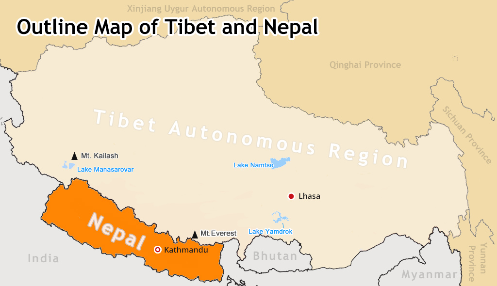 Map of Tibet Nepal Outline
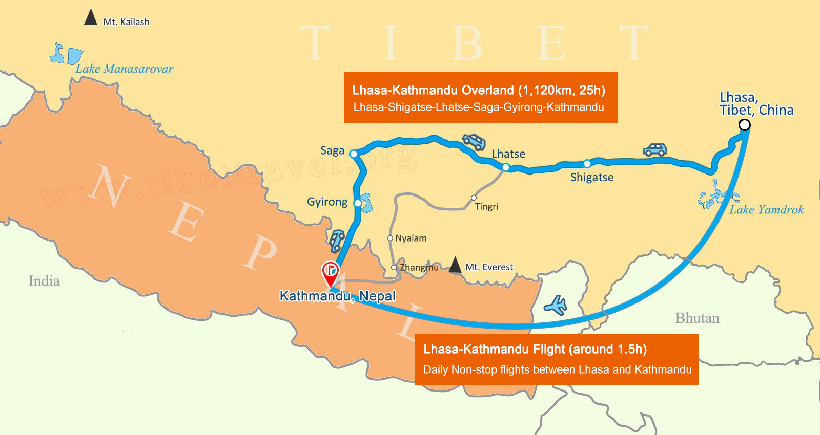 Lhasa to Kathmandu Map by Flight and Overland
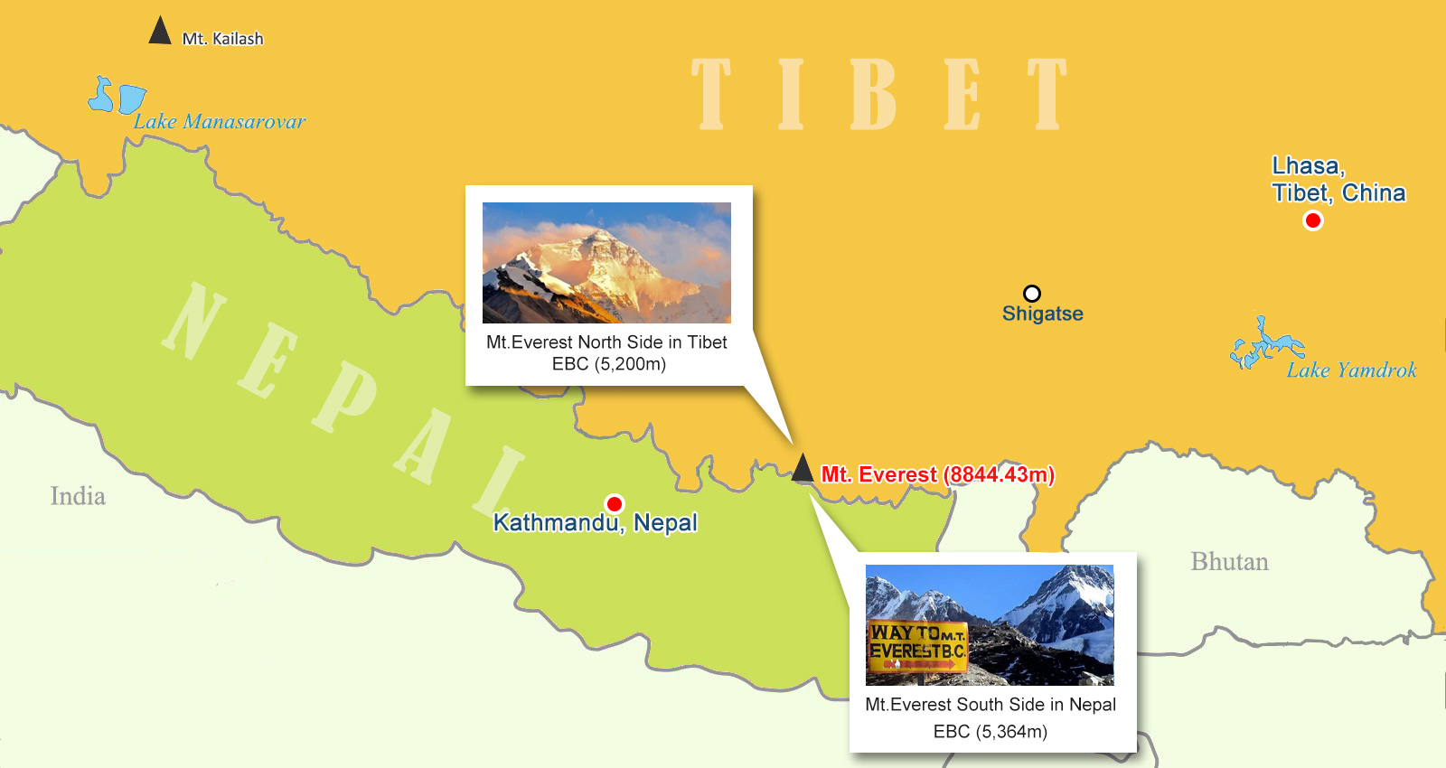 Mt. Everest Nepal Tibet Map
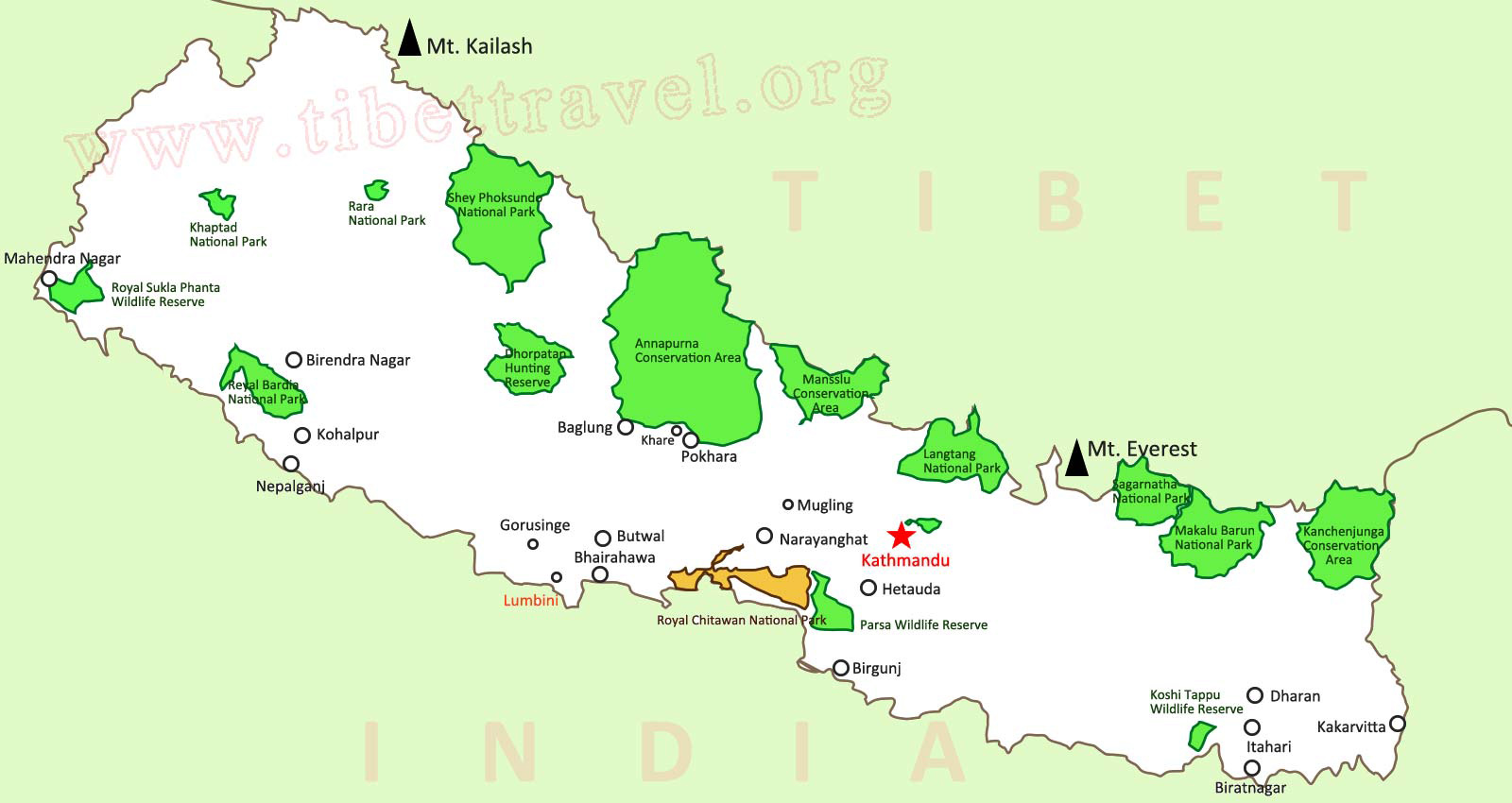 Top attractions in the map of Nepal
Where is Lhasa Located on a Map?
Located in the southeastern part of the Tibet Autonomous Region, the city of Lhasa lies on the northern bank in the middle reaches of the Lhasa River, a tributary of the Yarlung Zangbo River. It consists of three urban districts and five rural counties in total, surrounded by Shigatse City, Nagchu City, Nyingchi City and Shannan City.
 Map of Lhasa Location in China
.jpg) Map of Lhasa Location in Tibet
Map of Lhasa Location in Tibet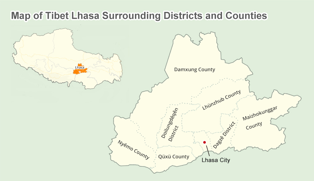 Tibet Lhasa Surrounding Districts and Counties on Map
 Tibet Lhasa City and Surrounding Cities and Prefectures on Map
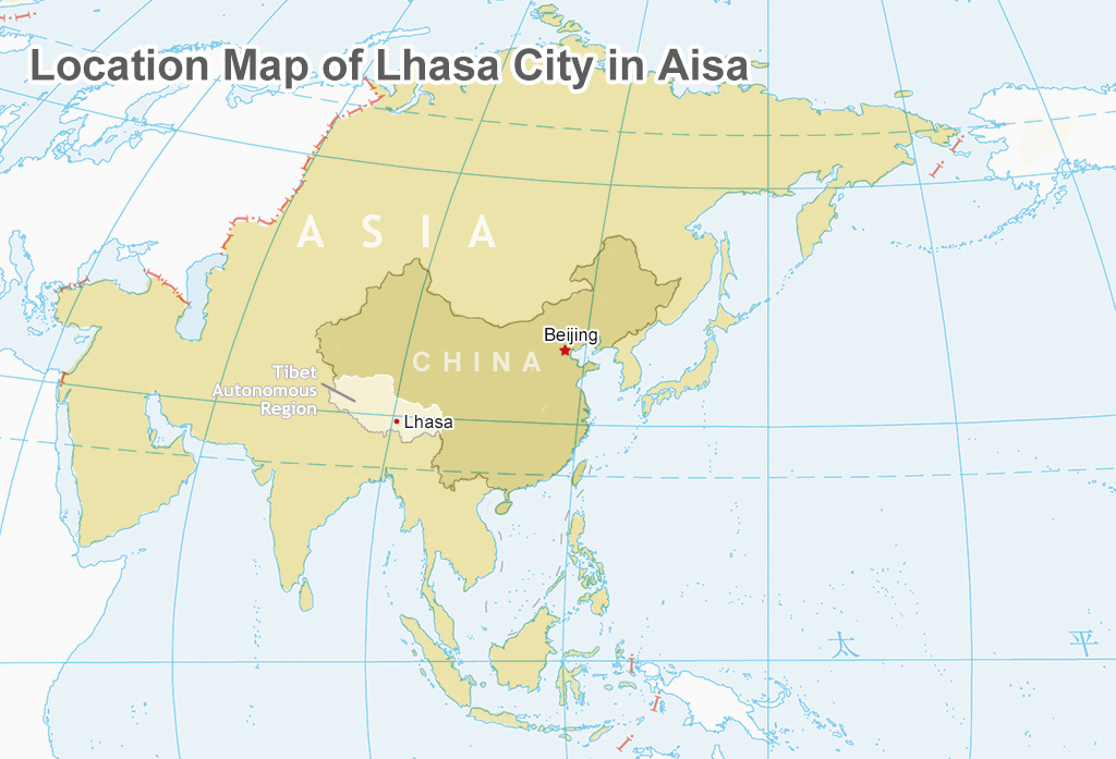 Map of Lhasa Location in Asia
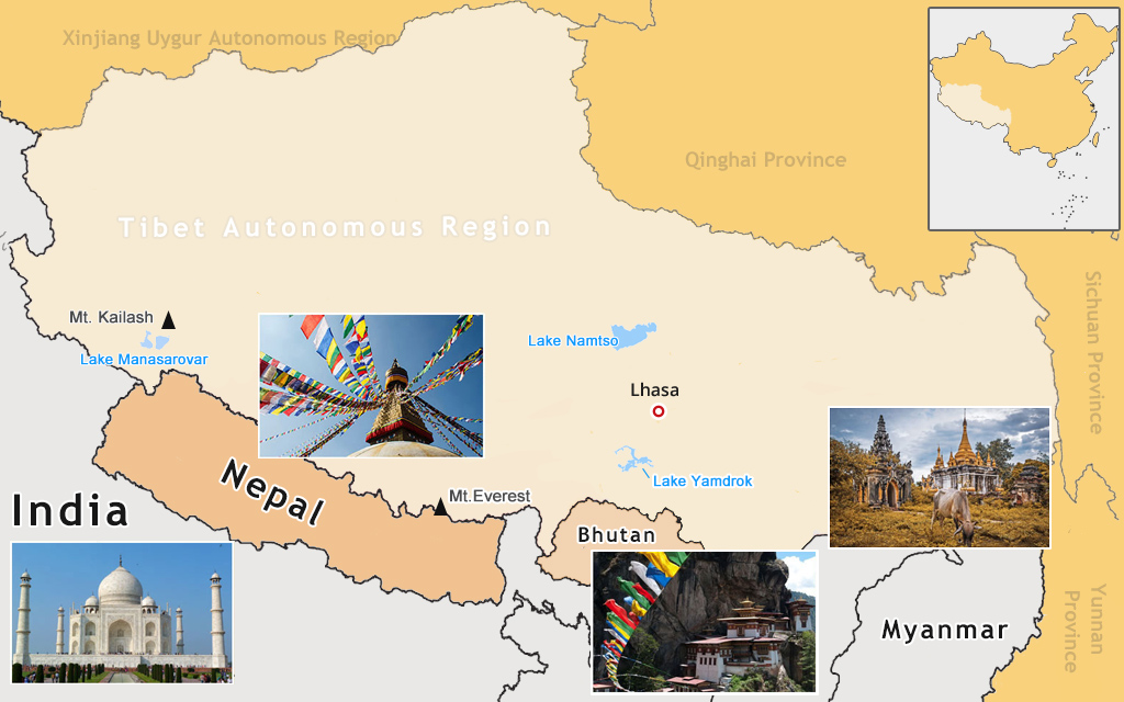 Tibet Lhasa and Surrounding Countries in Asia on Map
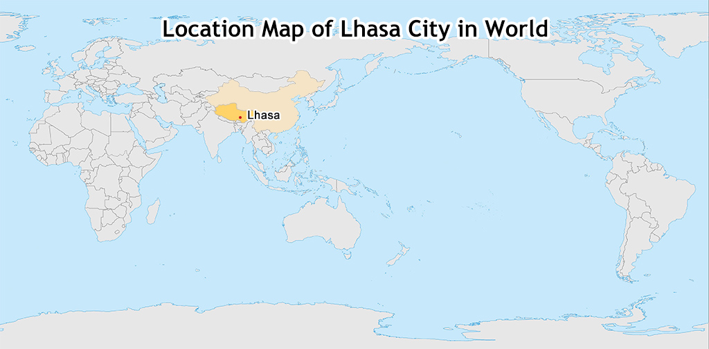 Map of Lhasa Location in World
 Tibet Lhasa Flight Map
Lhasa City Map
Lhasa, the capital city of Tibet Autonomous Region, is the spiritual and secular heart. It is home to a prestigious array of Tibetan Buddhist sites and the first impression of Tibet Tour for the majority of tourists. Find out the highlights attractions inside and around historical Lhasa city.
 Lhasa City on Map
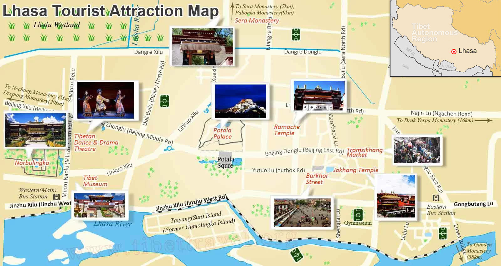 Attraction around Lhasa on Map
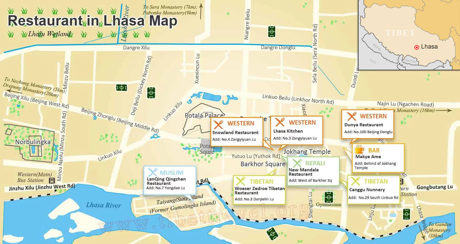 Restaurant in Lhasa on Map
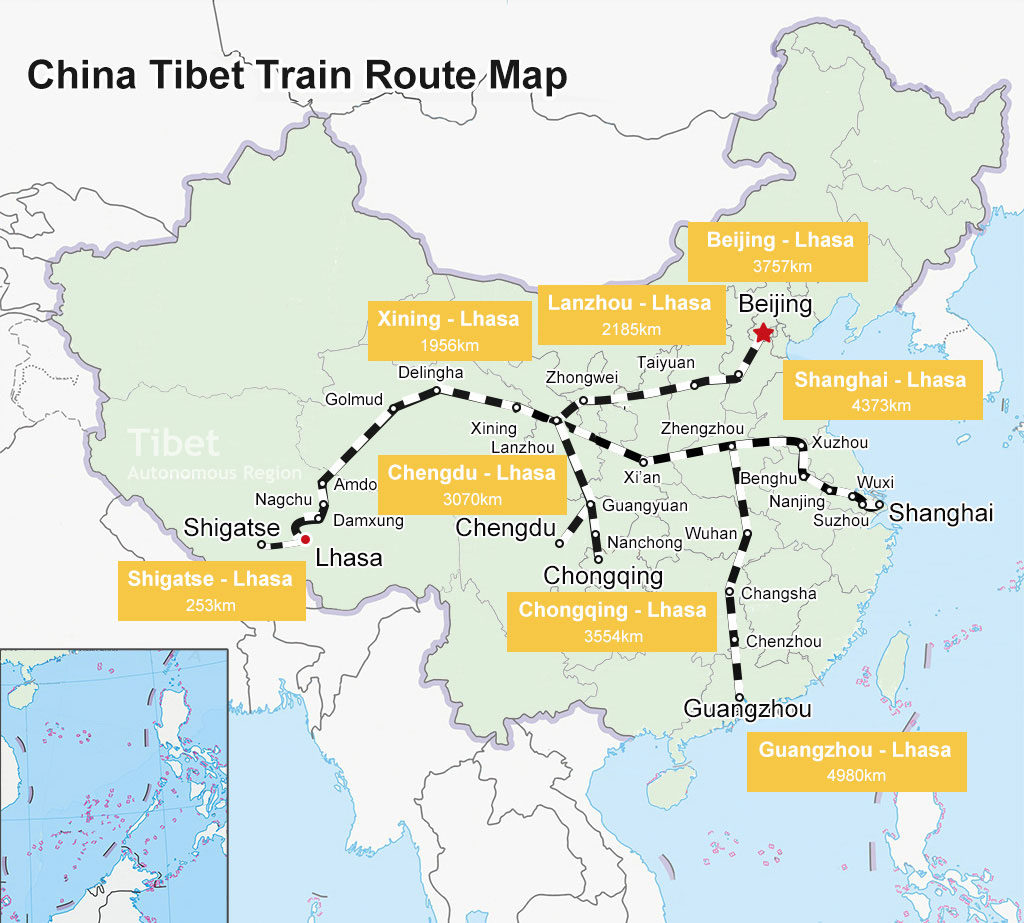 China Tibet Train on Map
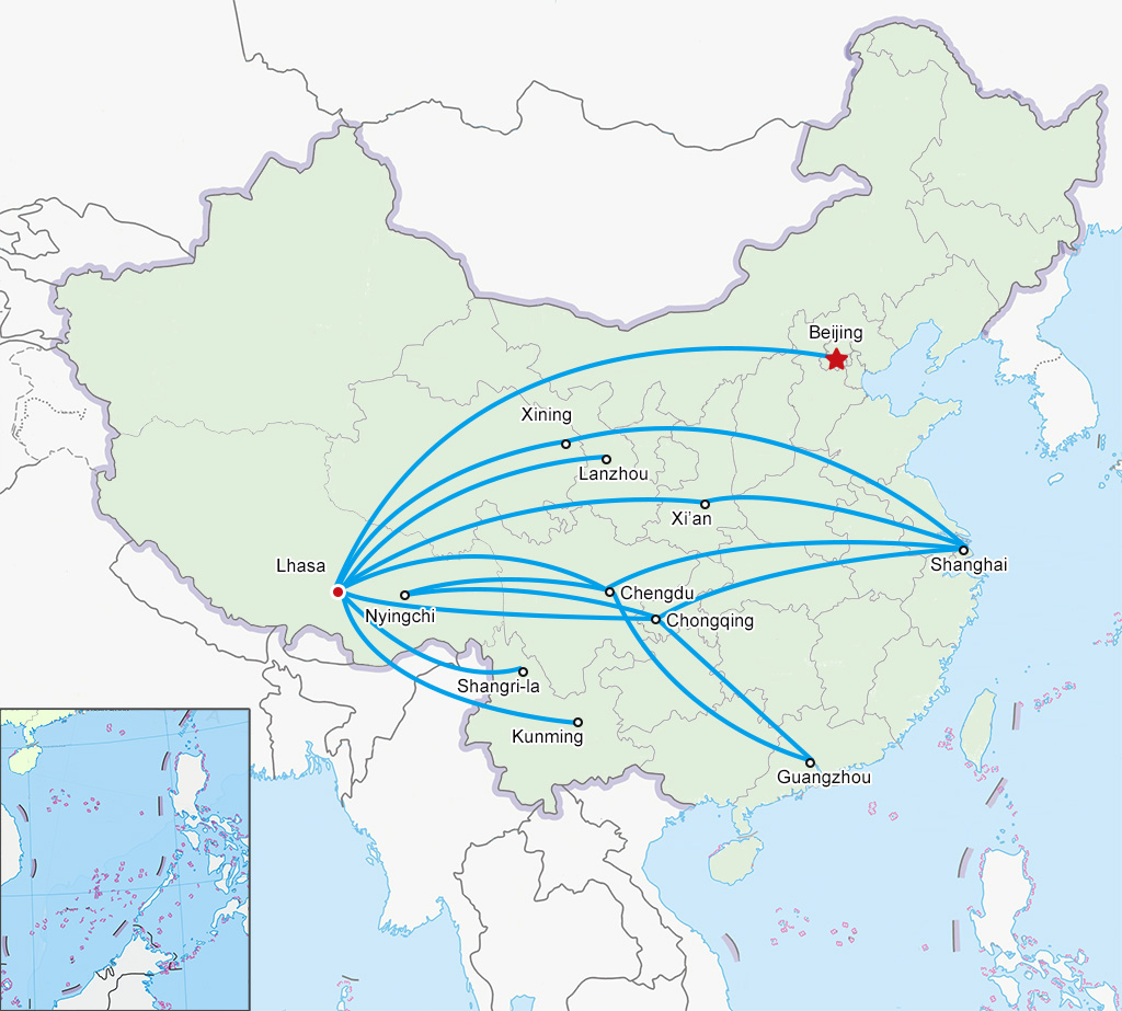 Domestic Flights to Lhasa on Map
Old Lhasa Town and Kora Map
Actually, Old Lhasa Town is an old residential area located near Beijing East Road, with Jokhang Temple as the core and the Barkhor Street as the ring road, covering the total area of more than 20,000 square meters. There are many small temples and monasteries scattering in the backstreets of Old Lhasa Town, which need you to carefully find them out. Following our map of Lhasa old town and kora, you can get a clear idea of what to see and how to visit Lhasa town in Tibet:
>> Read more about Old Lhasa Town and Kora Map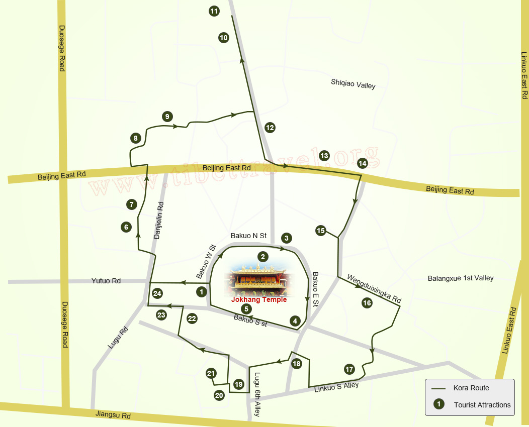 Map of Lhasa Old Town and Tourist Attractions
Everest Base Camp Map
Mt. Everest (8844.43m), situated in the majestic Himalayas in Asia, proudly dominates the other lofty mountains as the highest summit in the world. Make the most of our hand-made Mt.Everest tourist maps to plan an adventure trip for mountaineering and sightseeing.
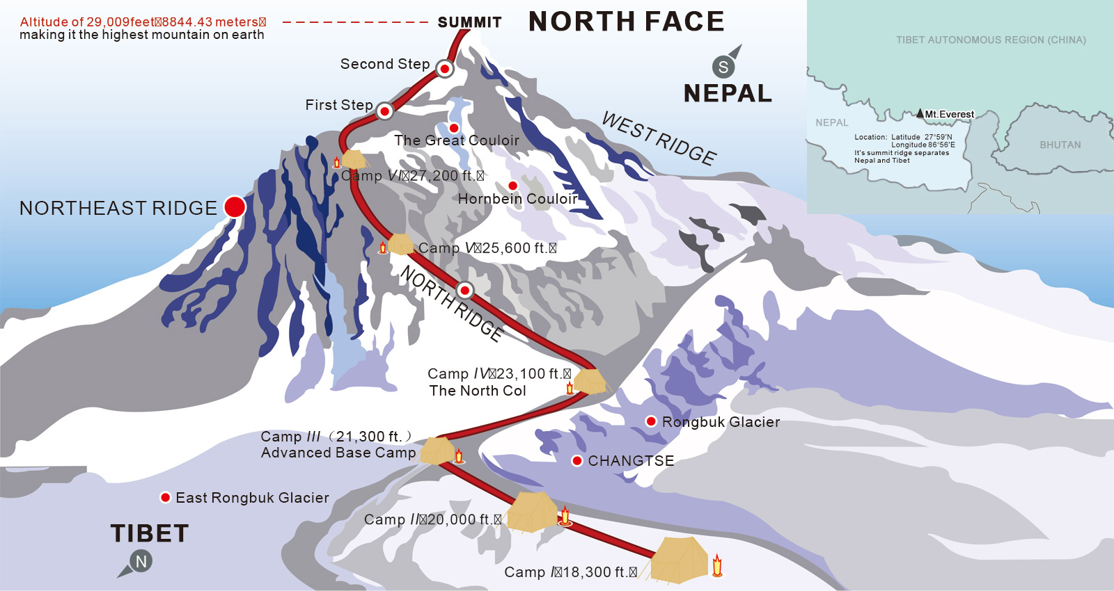 Mount Everest North Face Map
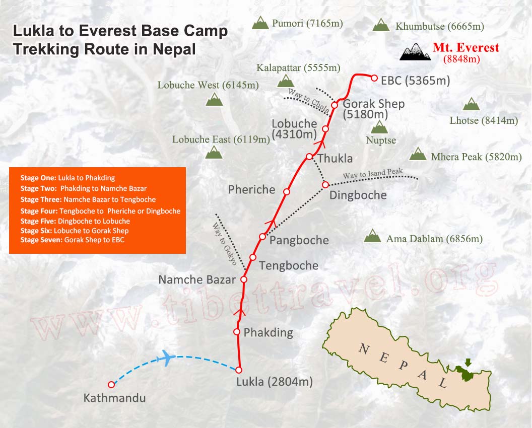 Nepal Everest Trekking Route Map
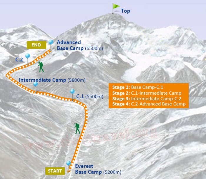 EBC to ABC Trek Map
 Old Tingri to Everest Base Camp Trekking Route Map
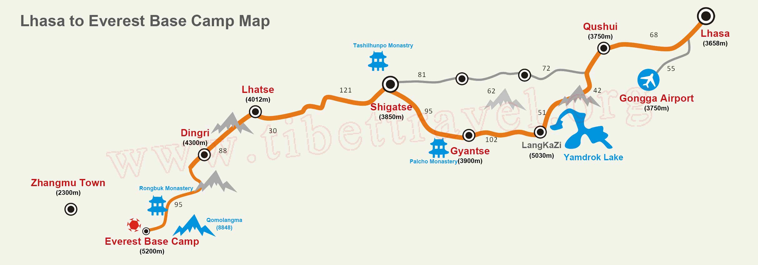 Lhasa to Everest Base Camp Map
 Gama Valley to Eastern Slope of Mt. Everest Base Camp Trekking Map
>> Read more about Ultimate Mt Everest Tourist Route Maps
>> Read more about Everest Base Camp Trekking Maps in Tibet
Mount Kailash Maps
Mt. Kailash, known as the “king of the holy mountains” In Buddhism, Hinduism, Bon religion and Jainism, has been an ultimate pilgrimage destination for global pilgrims for thousands of years. Our carefully-drawn maps of Mount Kailash are helpful for you to make an ultimate adventure to the holy mountain.
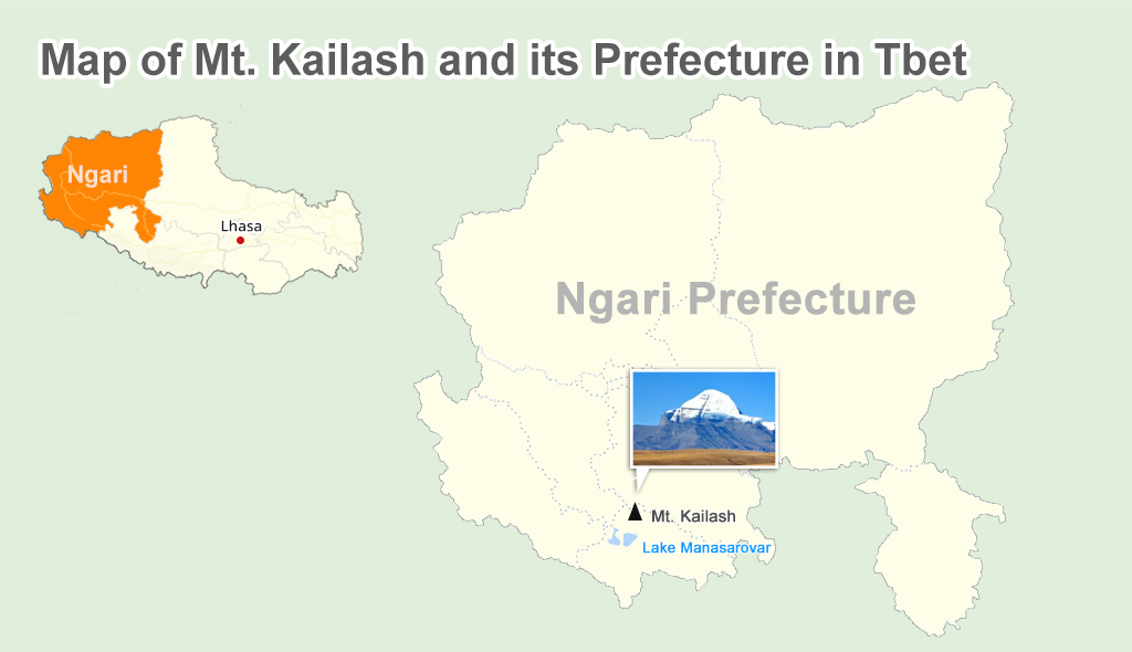 Map of Mt. Kailash and its Prefecture in Tbet
 Map of Sacred Manasarovar Lake in Ngari
 Map of Accommodation around Mount Kailash and Lake Manasarovar
 Map of Ngari tourist attraction around Mount Kailash
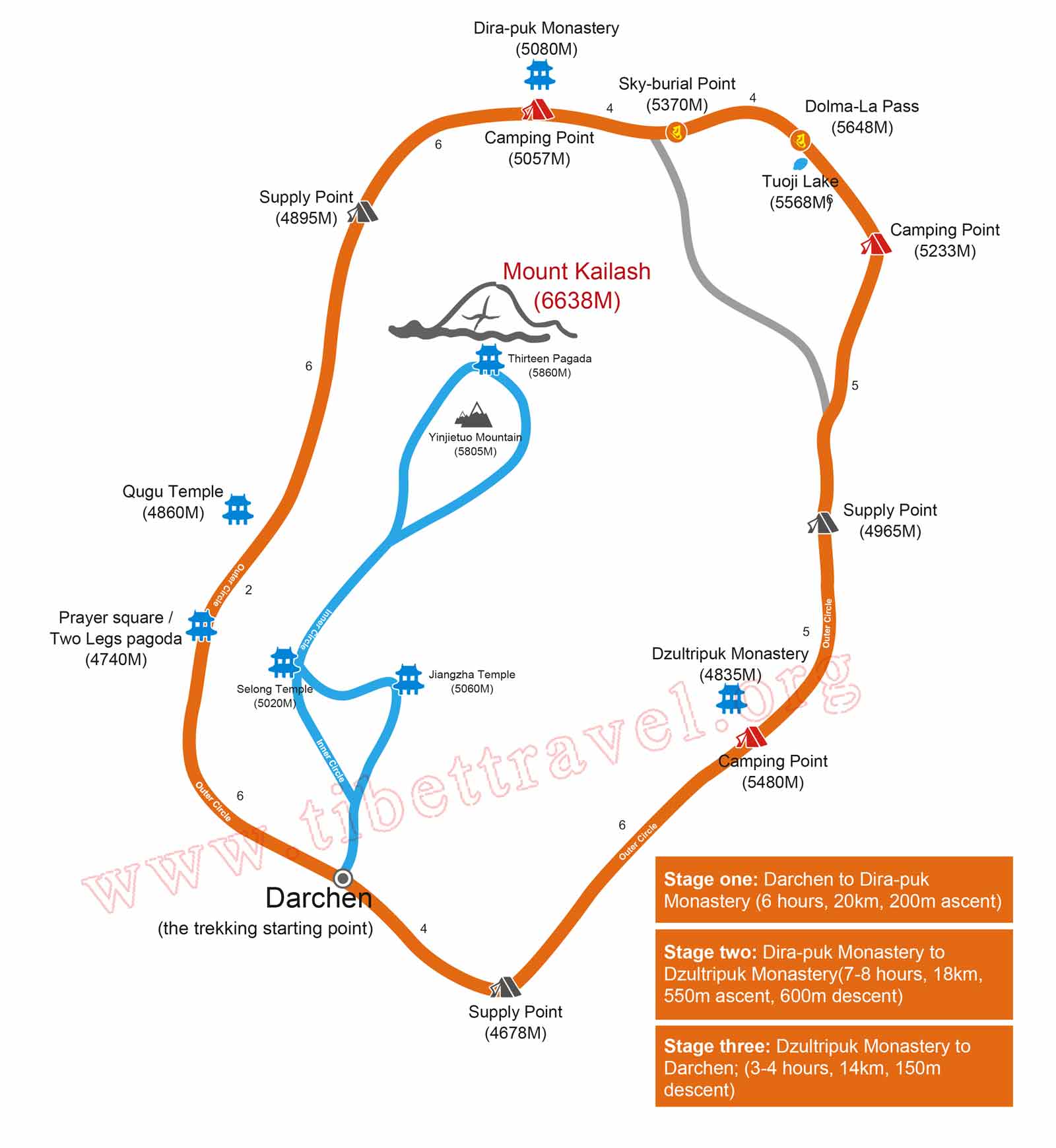 Time-honoured Pilgrimage Route Map around Holy Mt. Kailash
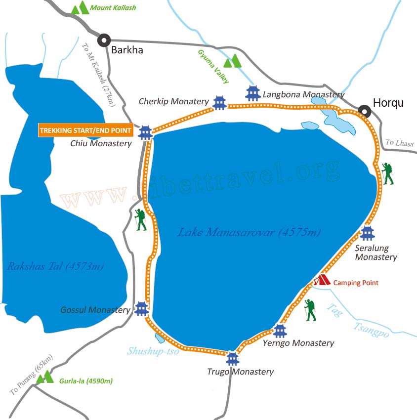 Venerated Manasarovar Lake Yatra Map
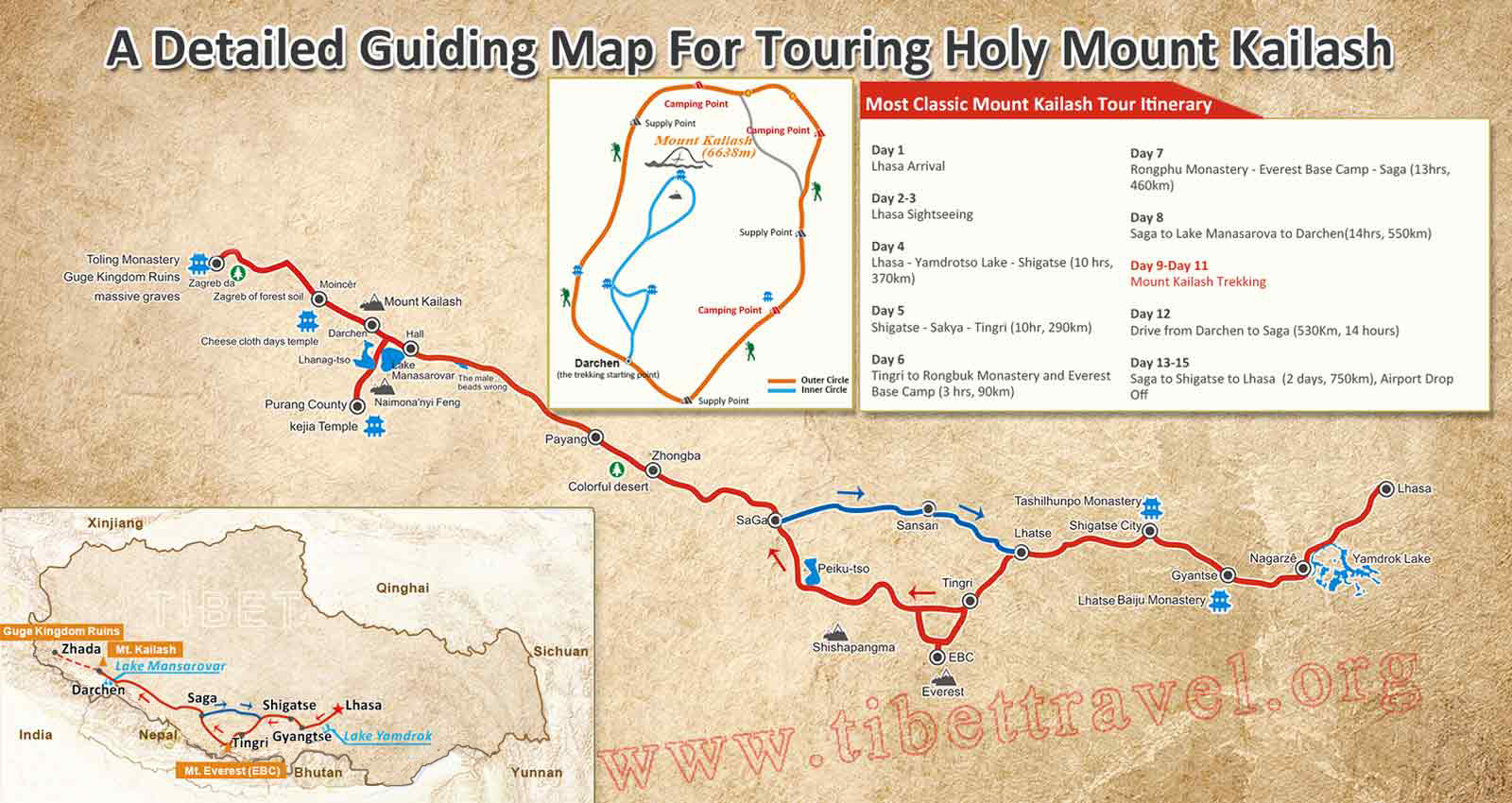 Detailed Map of 15-day Kailash and Manasarova Kora Tour
Shigatse and Yamdrok Lake of Tibet
Shigatse is the second largest city of Tibet, with the biggest draw of the 600-year-old Tashilhunpo Monastery. Travelling from Lhasa via Yamdrok, Shannan prefecture to Shigatse has been a classic and well-established Tibet tour route for years. Use the following detailed maps to know the locations and tourism information of Shigatse and Yamdrok Lake in advance.
.jpg) Map of Shigatse and Yamdrok Lake in Tibet
Map of Shigatse and Yamdrok Lake in Tibet Shigatse Prefecture Location Map
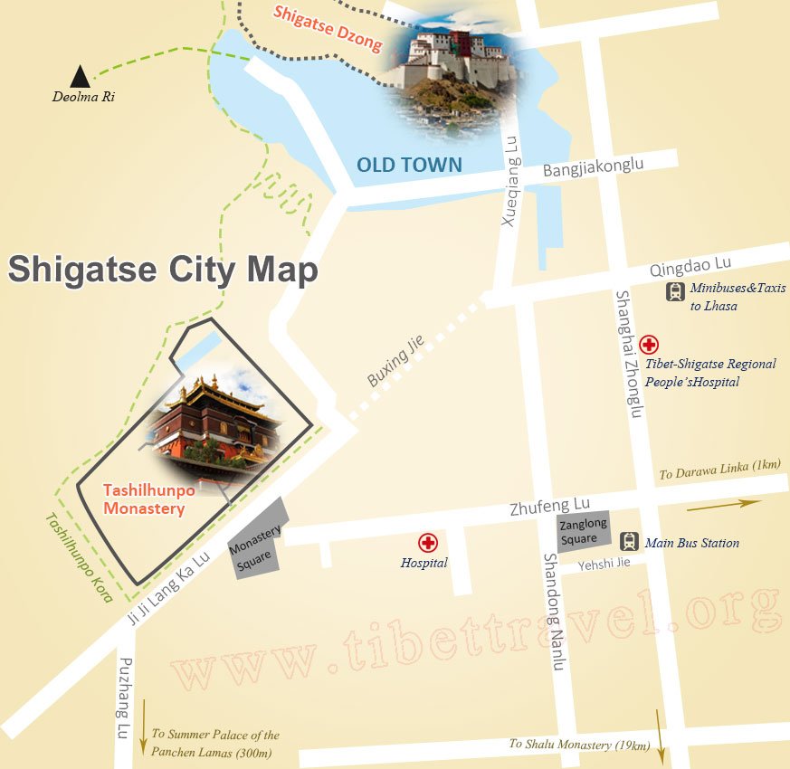 Map of Shigatse City in Tibet
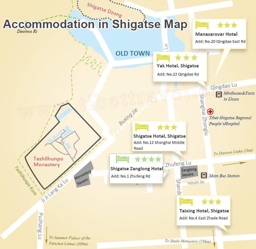 Shigatse Accommodation on Map
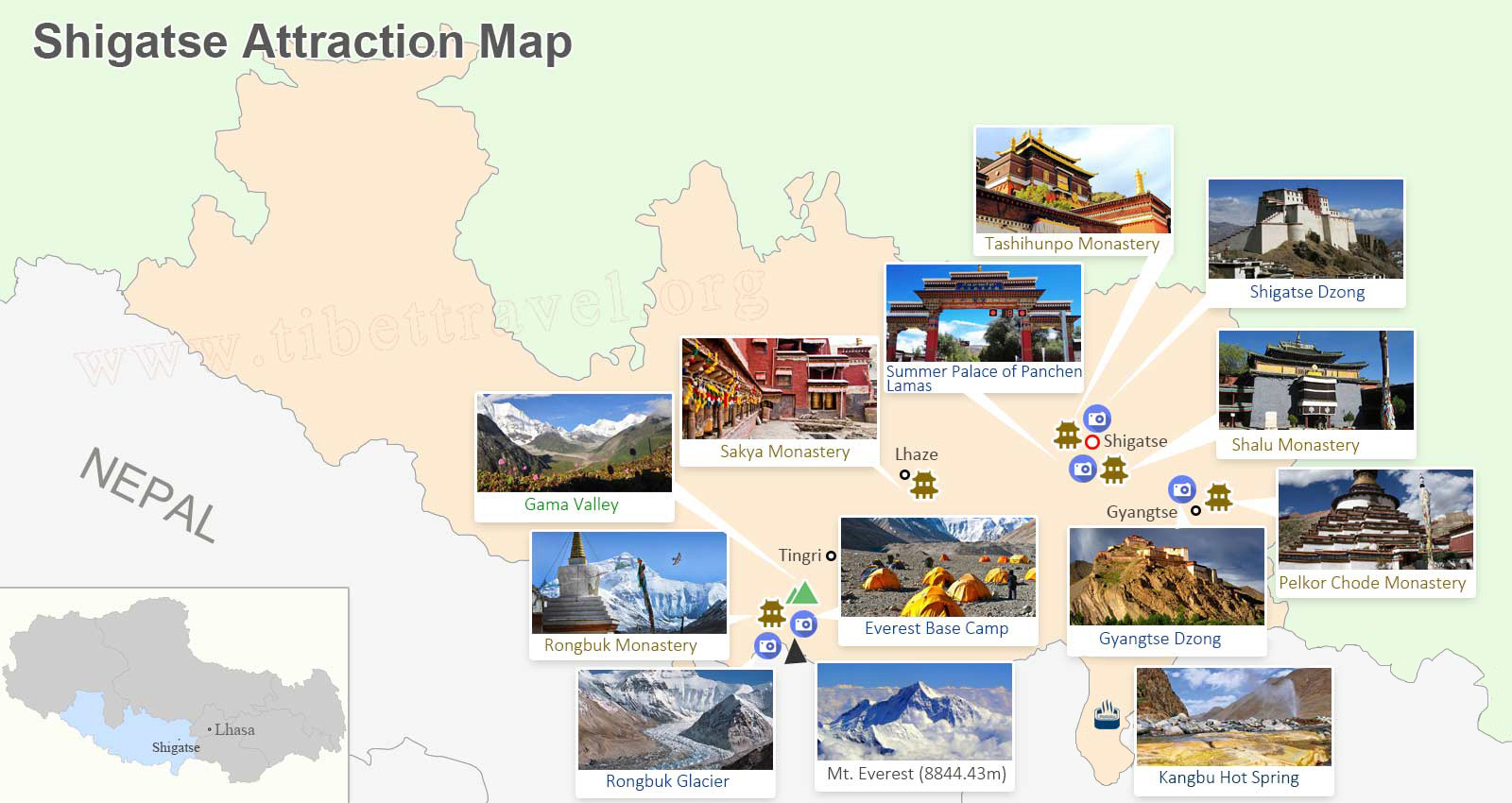 Shigatse Attraction Map
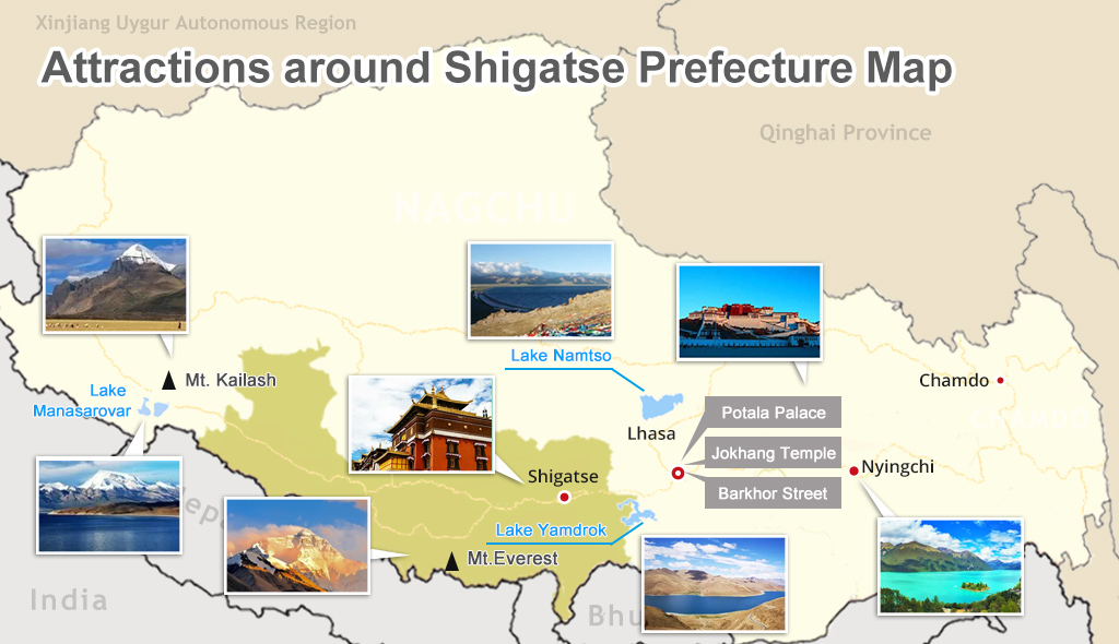 Attraction around Shigatse on Map
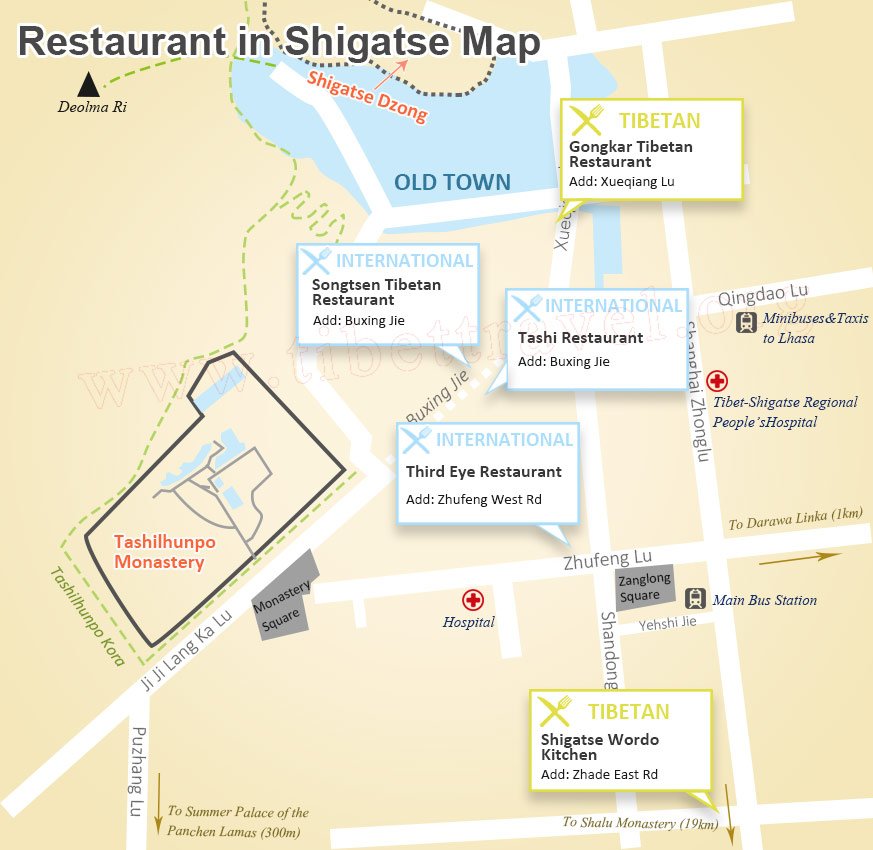 Restaurant in Shigatse on Map
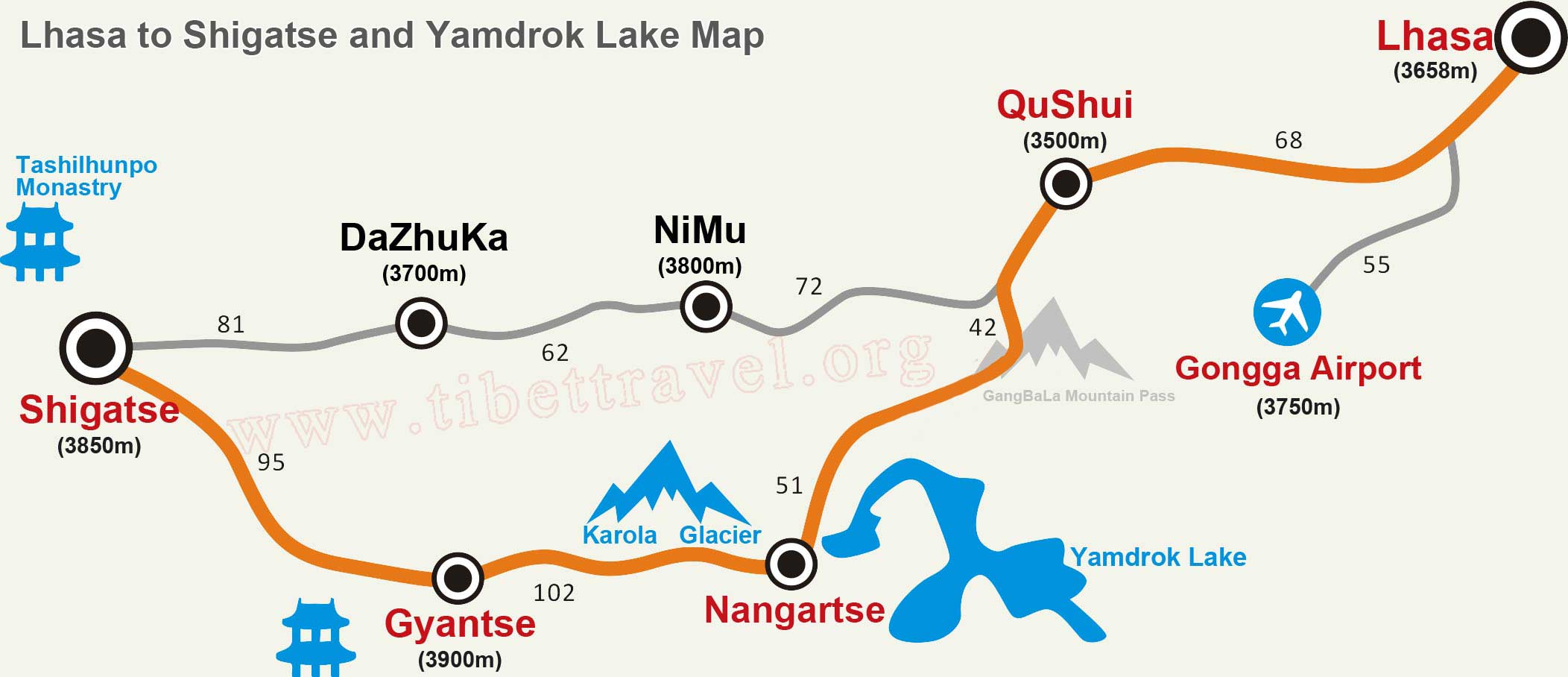 Lhasa to Shigatse and Yamdrok Lake Map
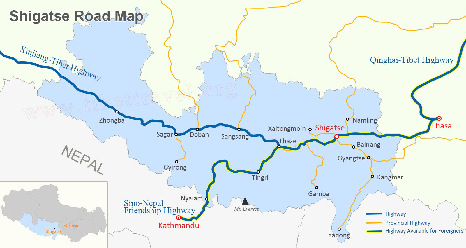 Shigatse Road Map
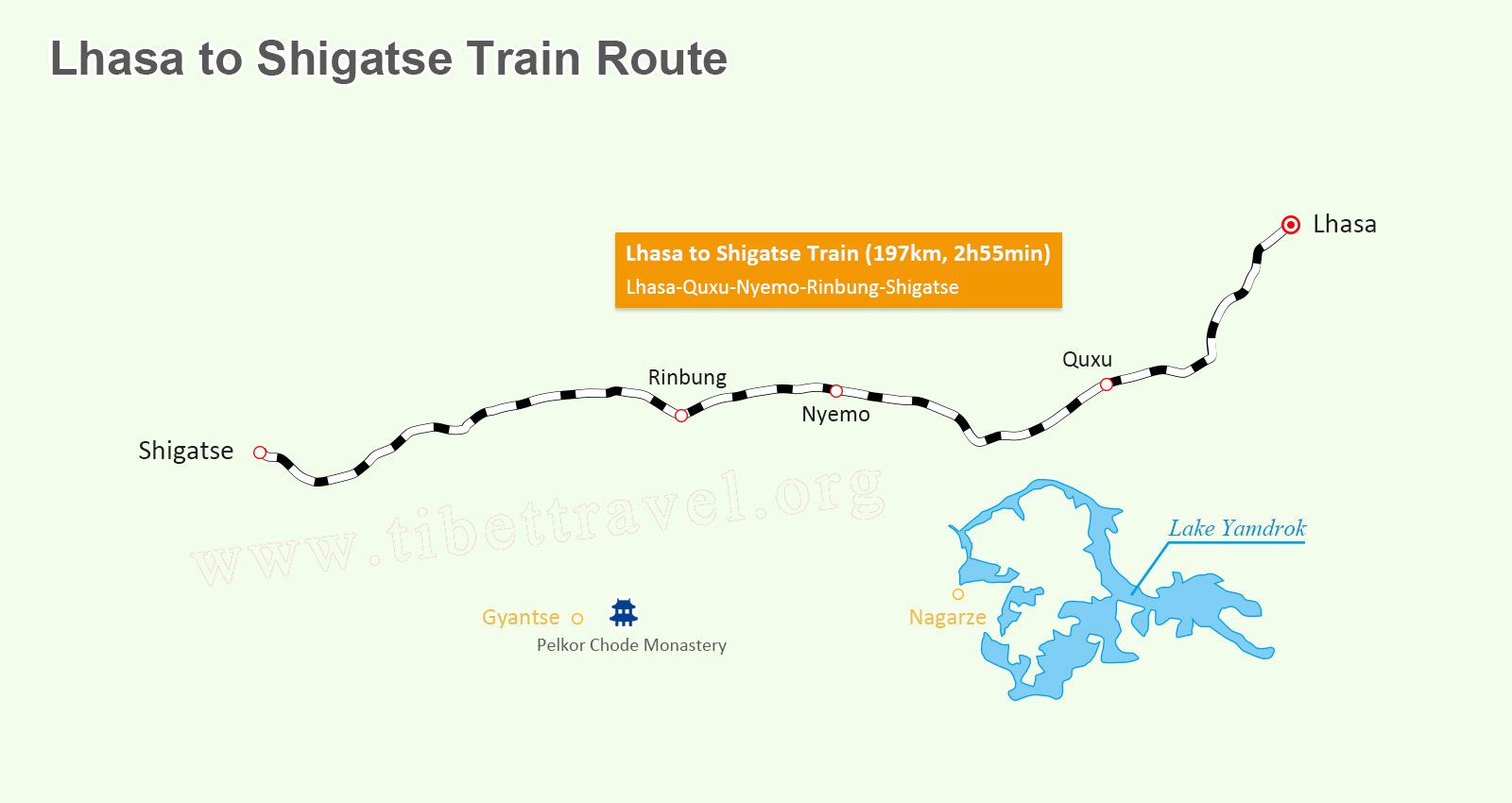 Lhasa Shigatse Train on Map
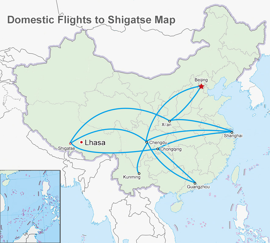 Domestic Flights to Shigatse on Map
>> Read more about maps of Shigatse Prefecture
Namtso Lake Maps of Tibet
Believed to be one of the three foremost sacred lakes in Tibet, Namtso Lake, to the majority of global tourists, undoubtedly remains a highlight for Tibet tour. Plan a memorable trip by using the following Namtso Lake tourist maps.
>> Read more about maps of Namtso Lake.jpg) Map of Namtso Lake in Tibet
Map of Namtso Lake in Tibet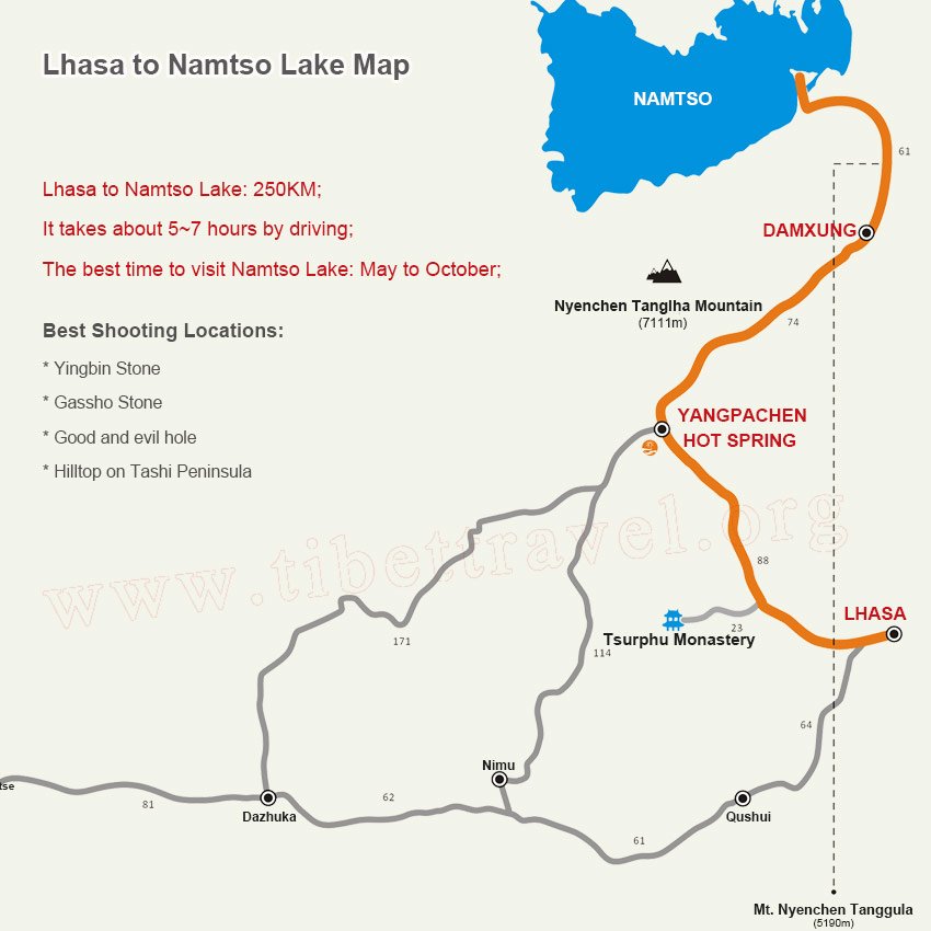 Lhasa to Shigatse and Yamdrok Lake Map
Tibet Railway Map
Taking a train to Tibet has become the top choice for many domestic and foreign tourists to access to Tibet. Presently, there are direct trains to Tibet from Xining, Beijing, Shanghai, Guangzhou, Chengdu, Chongqing and Lanzhou as the following maps.
 China Tibet Train Route Map
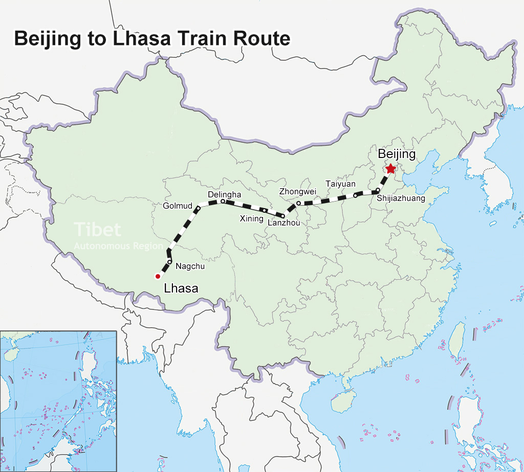 Beijing to Lhasa Train Map
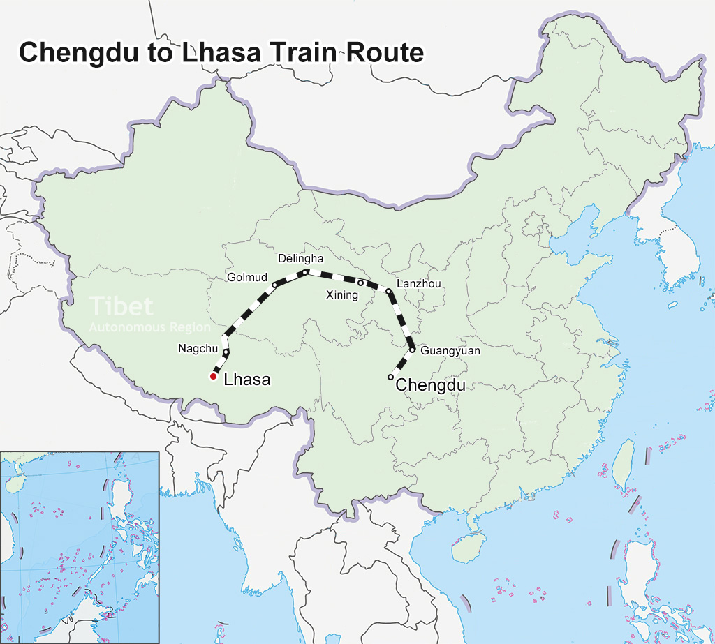 Chengdu to Lhasa Train Map
 Chongqing to Lhasa Train Map
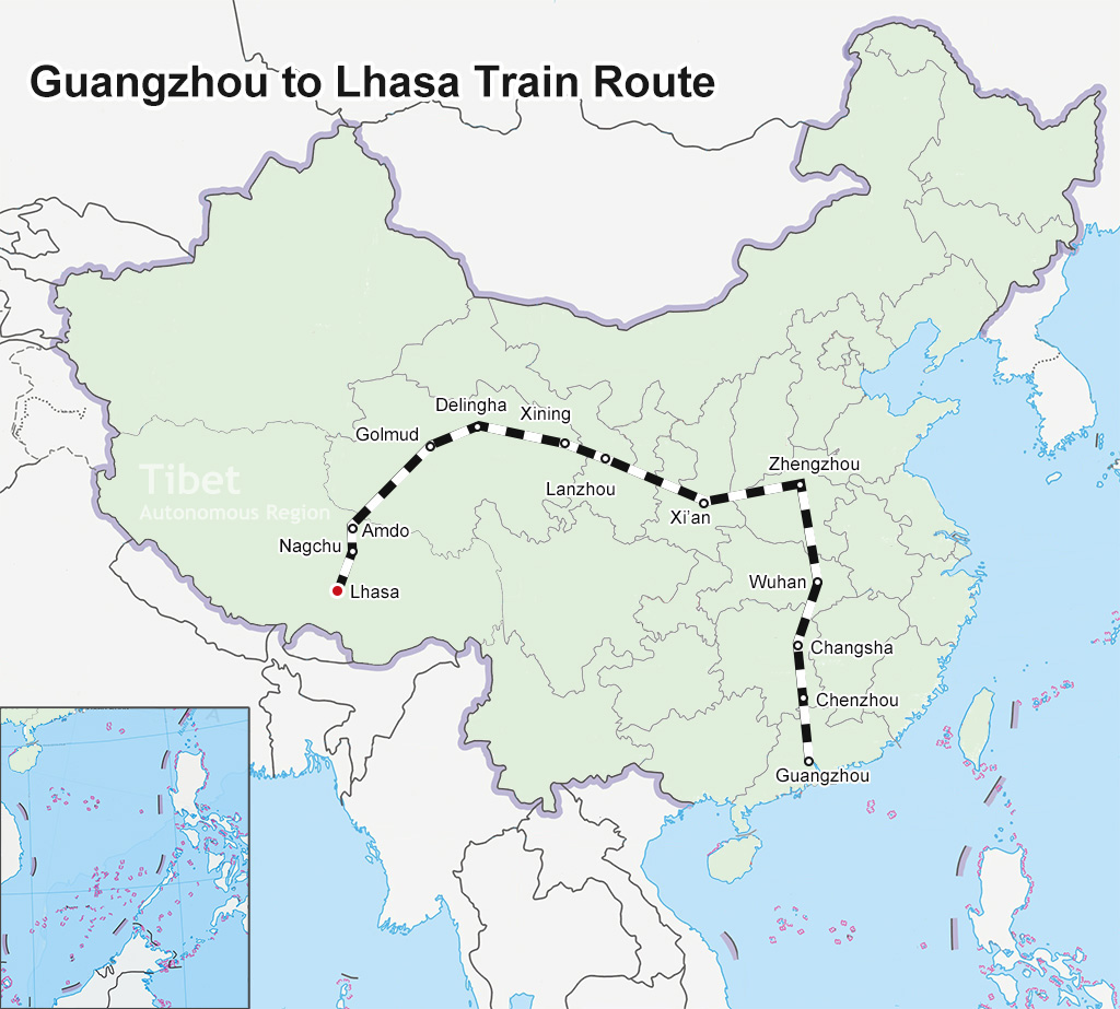 Guangzhou to Lhasa Train Map
 Lanzhou to Lhasa Train Map
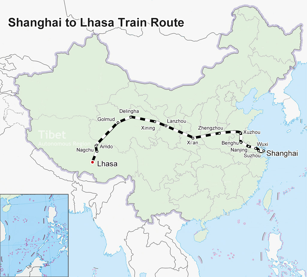 Shanghai to Lhasa Train Map
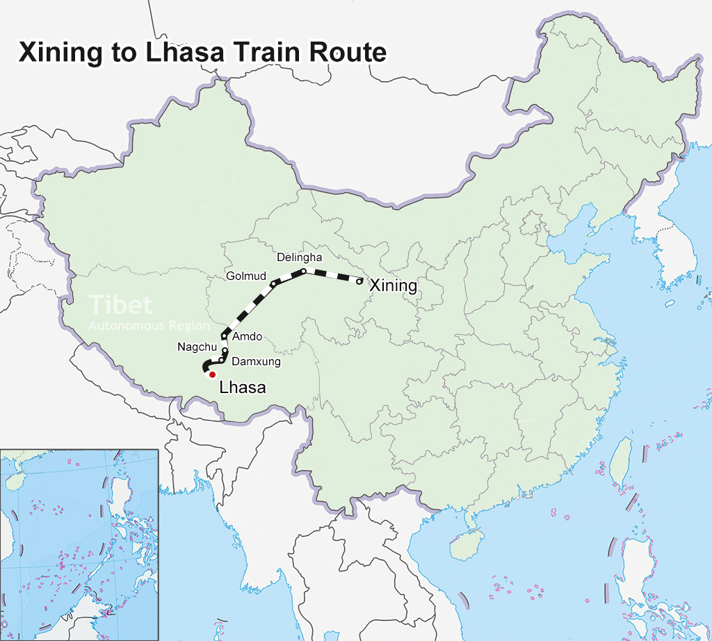 Xining to Lhasa Train Map
Tibet Road Map
Roads into Tibet from China Mainland and road conditions in Tibet are greatly improved in recent years. In total, there are 5 highways connecting Tibet with other parts of China, they are highlighted in blue in the map as following.
>> Read more about Tibet road map.jpg) Tibet Road Map
Tibet Road MapTibet Trek Map
Trekking “the roof of the world” is one of the most challenging things to do. The altitude, weather and rugged terrain present significant opportunities for trekkers. If you’re up to it, hiking past nomad tents to remote settlements will surprise you. Here we offer the most pratical Tibet trek maps for you.
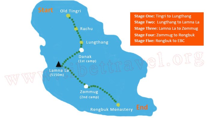 Everest Base Camp Trek Map - from Old Tingri to Everest Base Camp (70km)
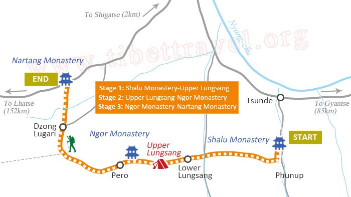 Shalu to Nartang Trekking Map
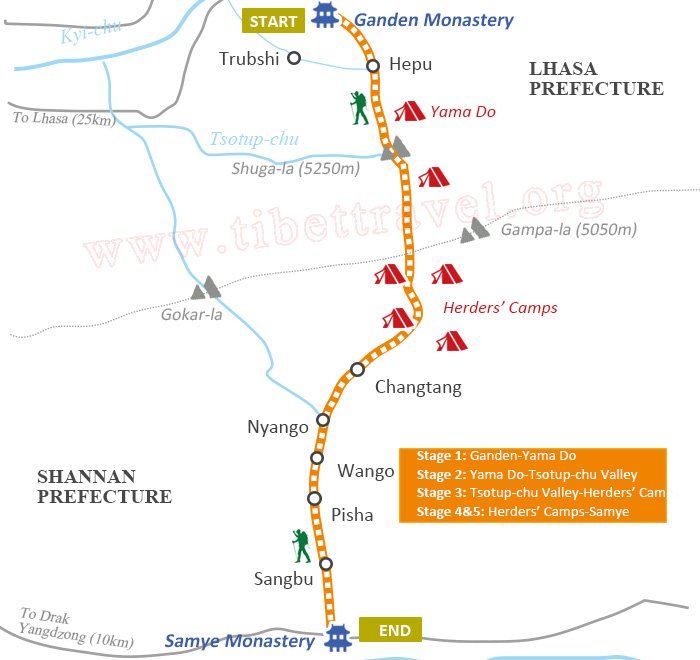 Ganden to Samye Trek Map (80km)
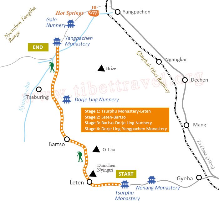 Tsurphu to Yangpachen Trek Map
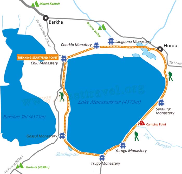 Lake Manasarovar Kora Trek Map
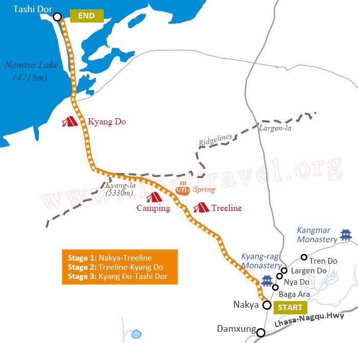 Nyenchen Tanglha Trek Map
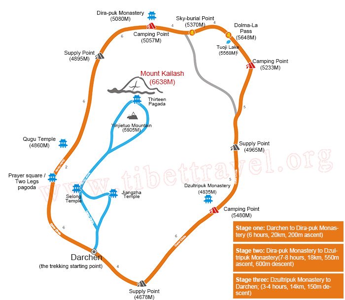 Mt. Kailash Kora Trek Map
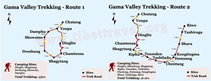 Everest to Gama Trek Map
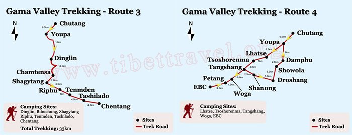 Everest to Gama Trek Map
Ngari Maps and Prefecture
Nagri (also Ali) prefecture in northwestern Tibet is known as the roof of the roof of the world for it is situated at an elevation of 4,500 meters above sea level. It's the place where the Himalayas, the Gangdise, the Kunlun Mountains and Karakorum Mountains meet. This area is dotted with beautiful lakes and rivers, great mountains and glaciers, vast grasslands, spectacular snow mountains, as well as pastures and clay forests.
.jpg) Ngari Prefecture Location on Map
Ngari Prefecture Location on Map Shiquanhe Map
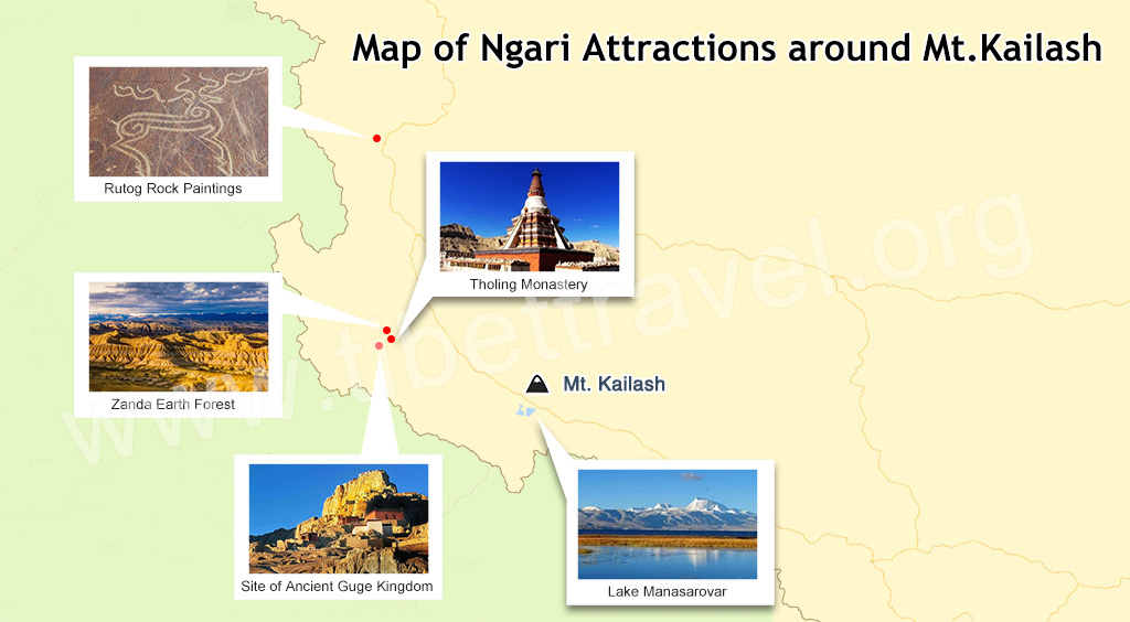 Ngari Attraction Map
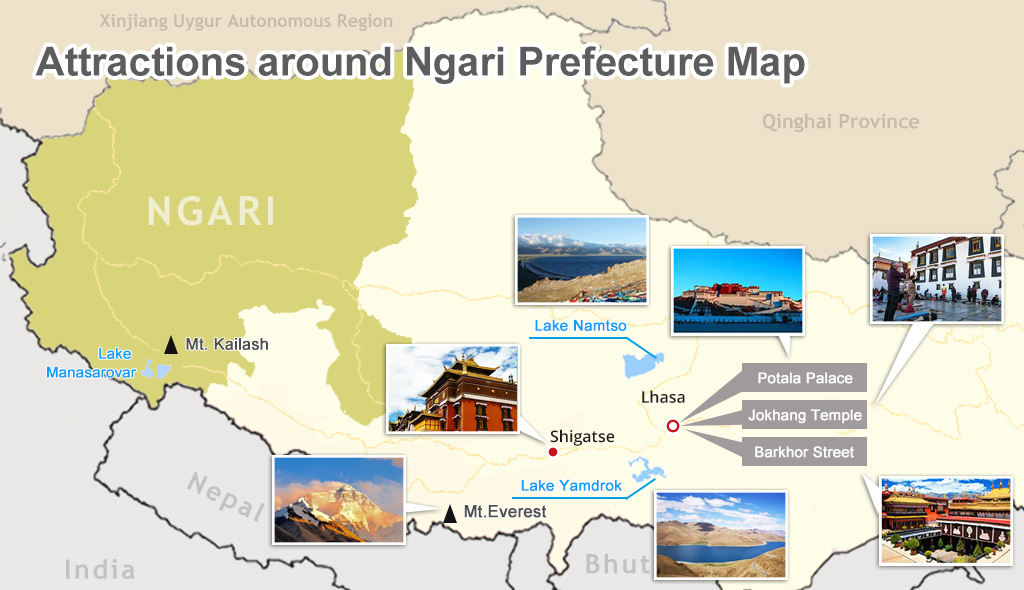 Attraction around Ngari Map
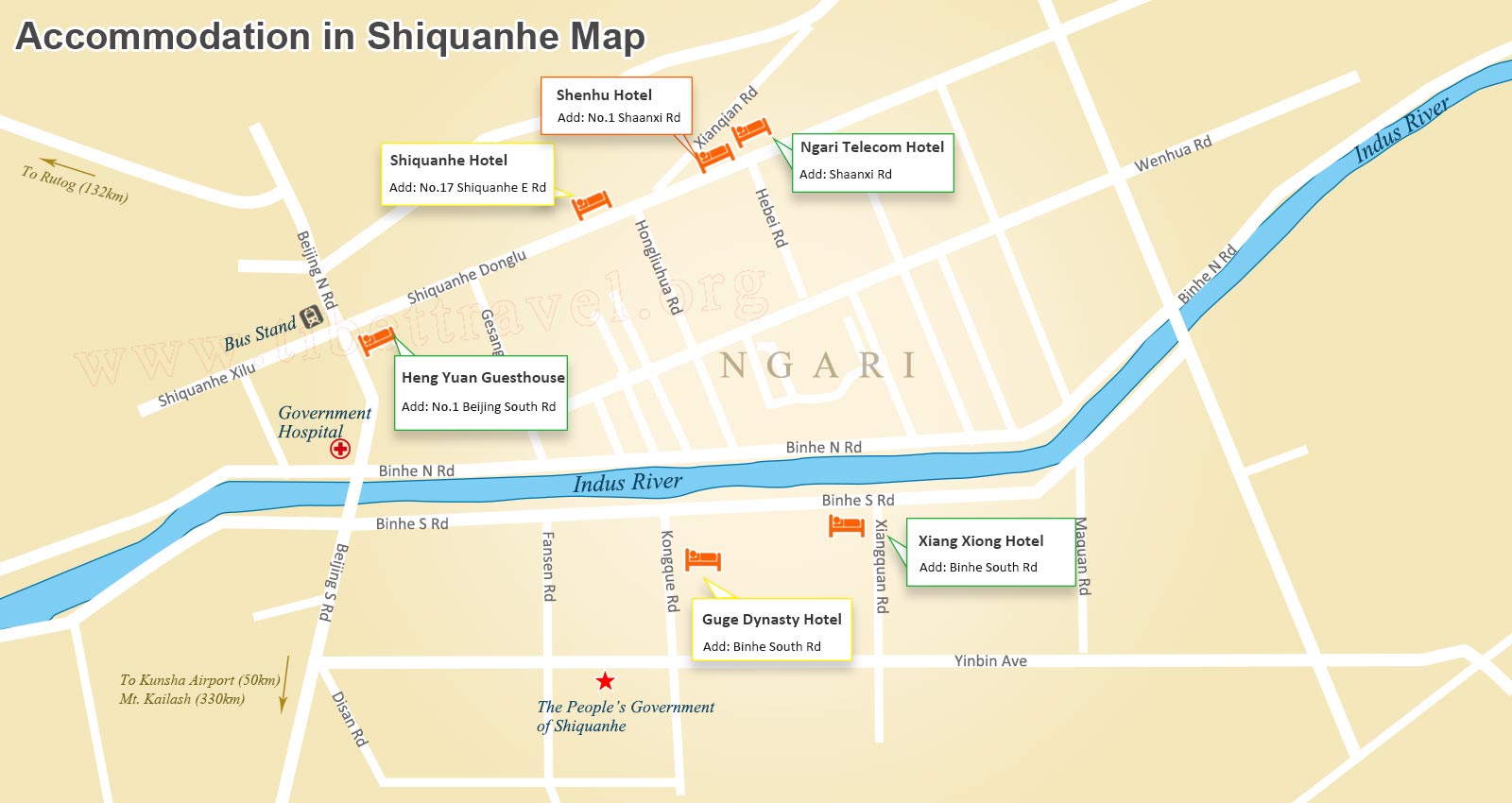 Shiquanhe Hotels on Map
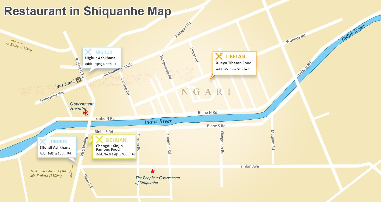 Restaurant in Shiquanhe Town on Map
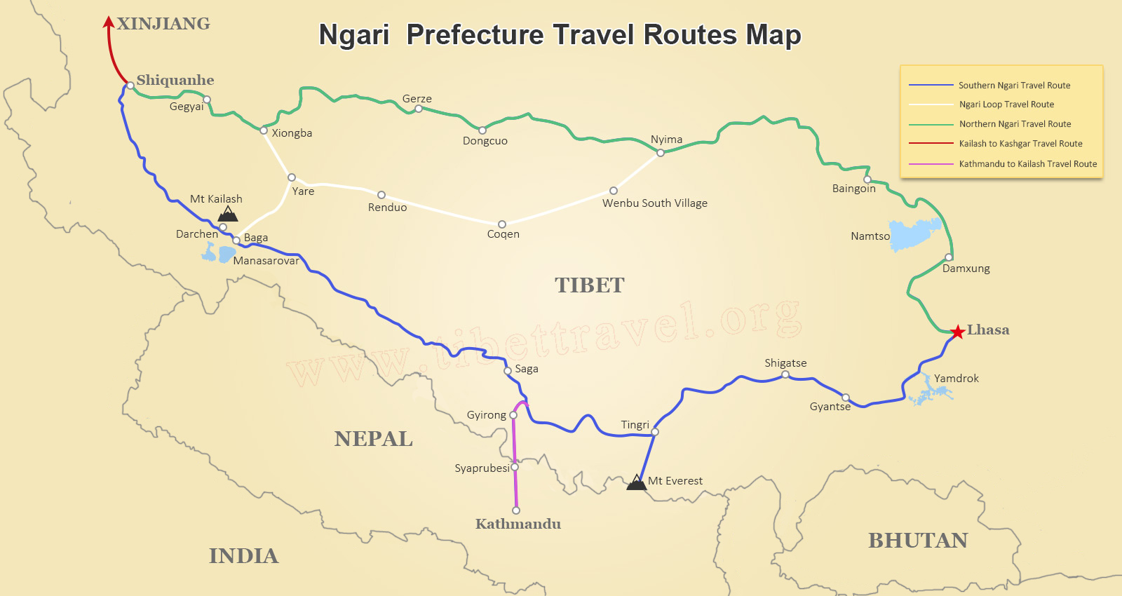 Ngari Road Map
 Domestic Flights to Ngari on Map
Nyingchi Maps and Prefecture
Nyingchi, also known as Linzhi, is a prefecture-level city in the southeast of the Tibet Autonomous Region. It borders with Lhasa to the east, Shannan to the southwest, Qamdo to south and Nagqu to the north. It is also the home of the Yarlung Zangbo Grand Canyon, the largest canyon in the world, and the stunning Namcha Barwa Peak. If you are planning a tour to Nyingchi, you can use the following detailed maps to know the locations and tourism information of Nyingchi.
.jpg) Nyingchi Location on Map
Nyingchi Location on Map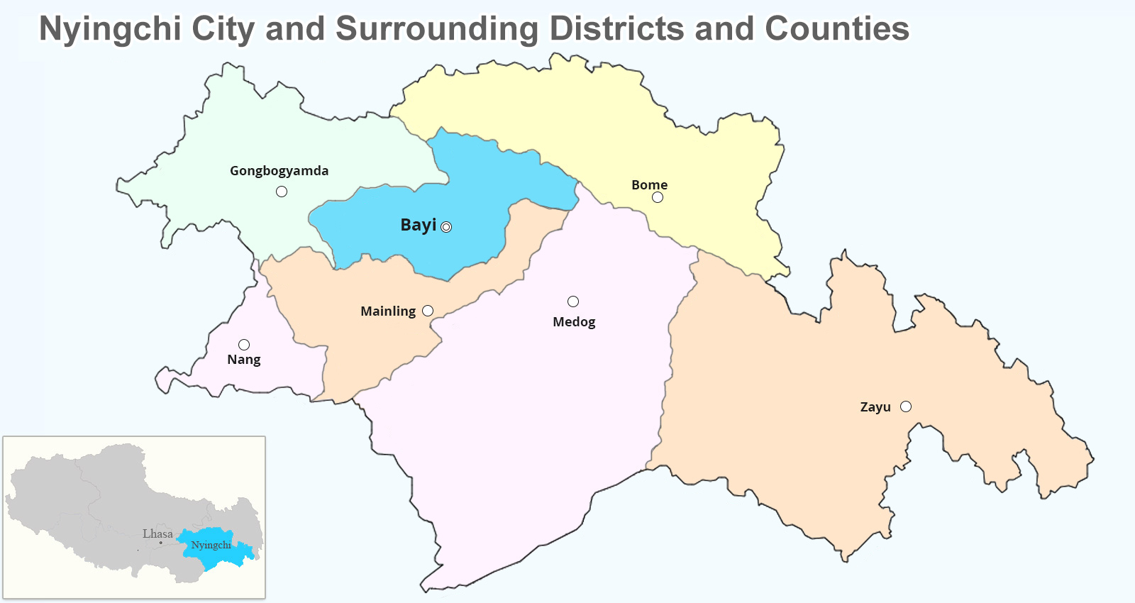 Nyingchi City Map
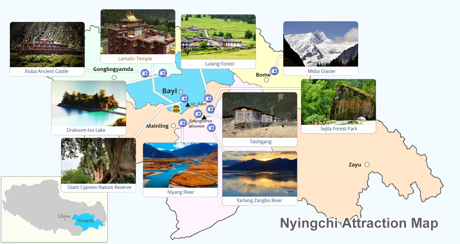 Nyingchi Attraction Map
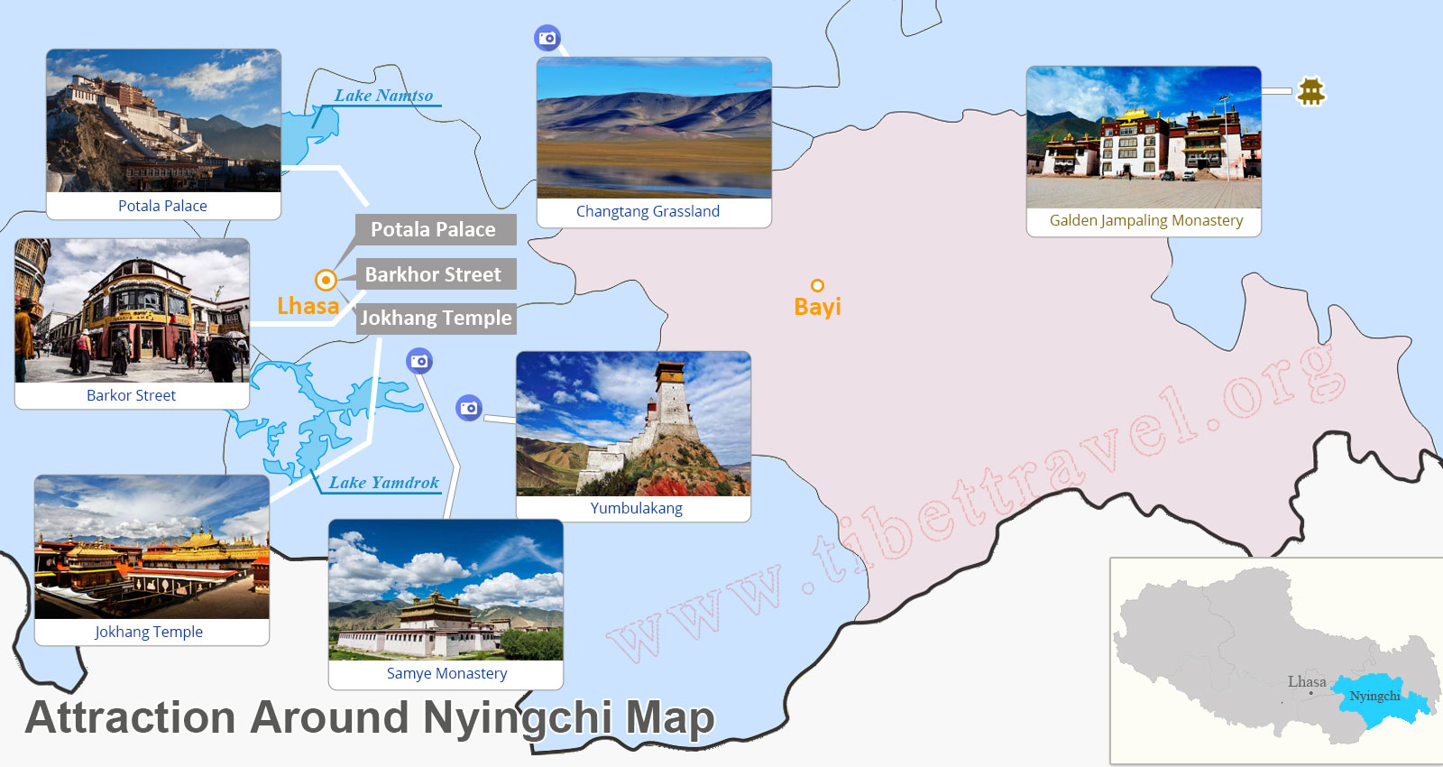 Attraction around Nyingchi Map
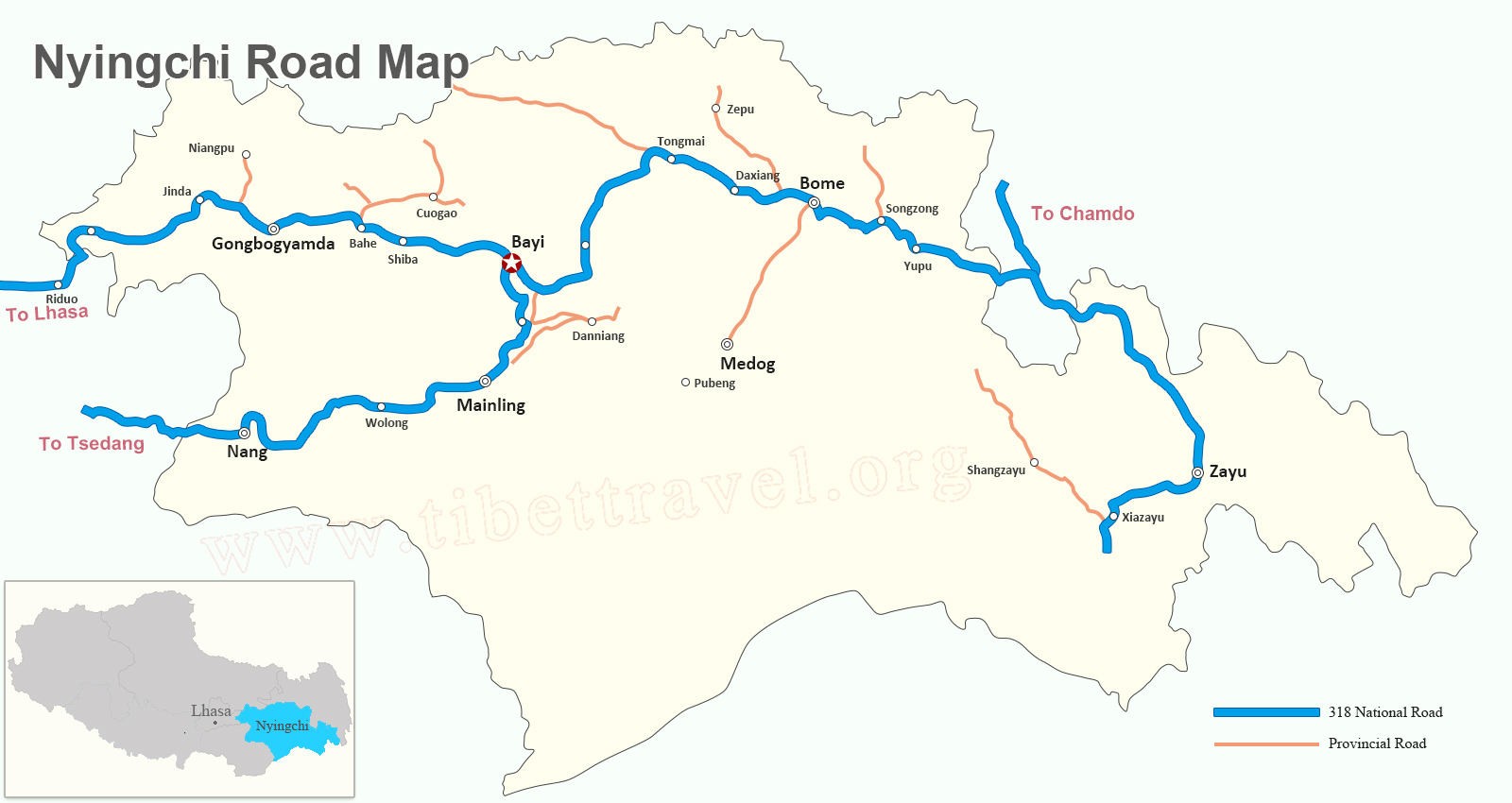 Nyingchi Road Map
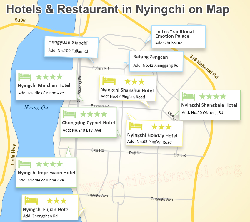 Nyingchi Hotels and Restaurants on Map
Nagchu Maps and Prefecture
Nagchu (also Nagqu) is a prefecture-level city located in the northern part of Tibet - between Tanggula Mountains and Nyainqentanglha Mountains. It borders Xinjiang and Qinghai Province, and neighbors Chamdo Prefecture to east, Lhasa, Nyingchi, Shigatse to south and Ngari to west. In addition, it is the place where Namtso Lake, Tangra Yum Tso, Siling Tso, Relics of Xiangxiong Kingdomwhich and other scenic spots located. Using the following complete Nagchu maps to get a better understanding about this prefecture in Tibet.
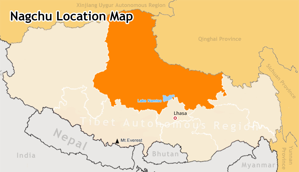 Nagchu Location Map
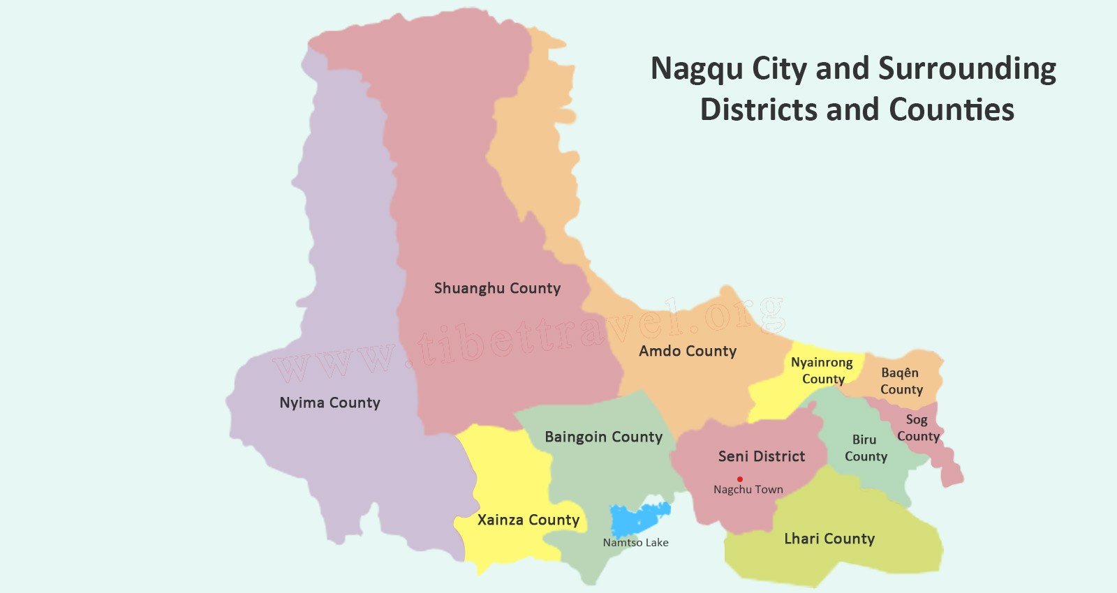 Nagchu City Map
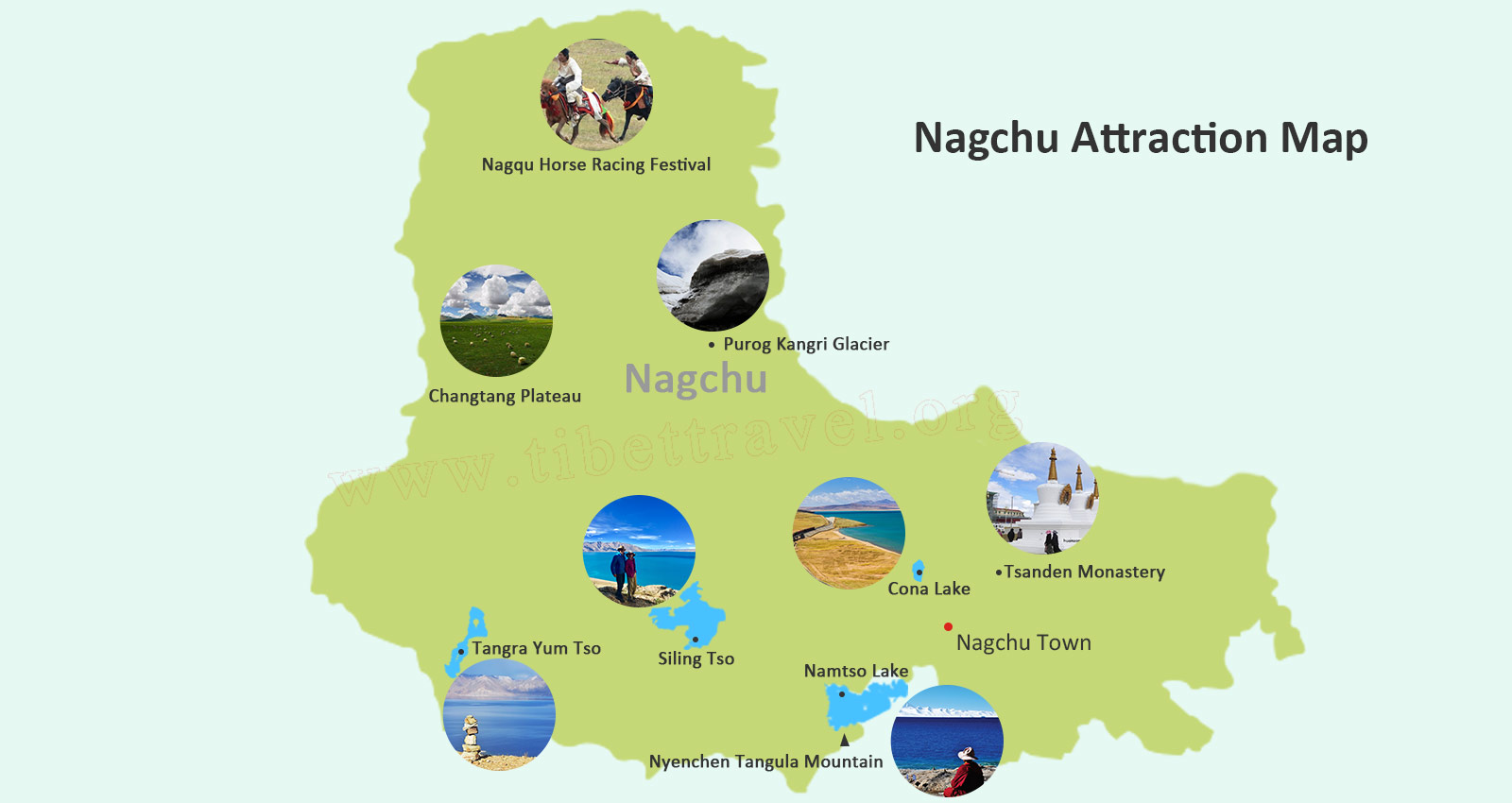 Nagchu Tourist Attraction Map
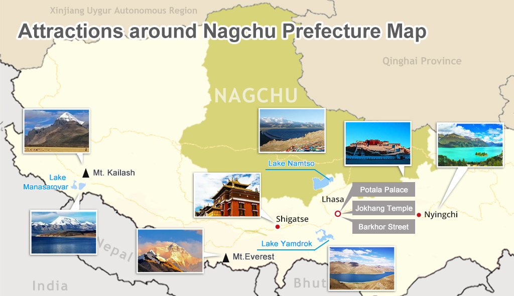 Attraction around Nagchu Map
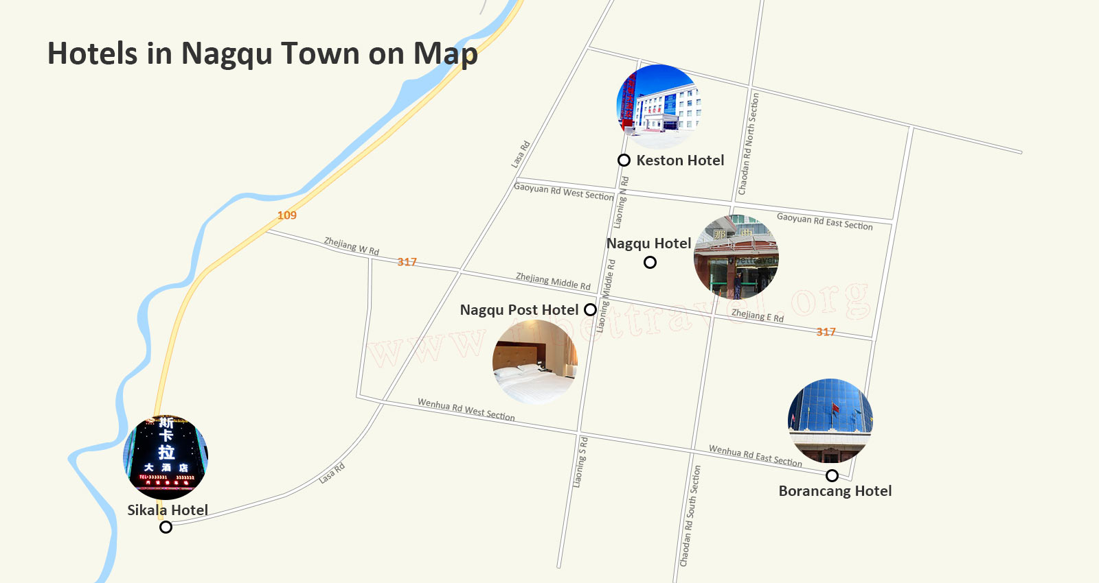 Nagchu Hotels on Map
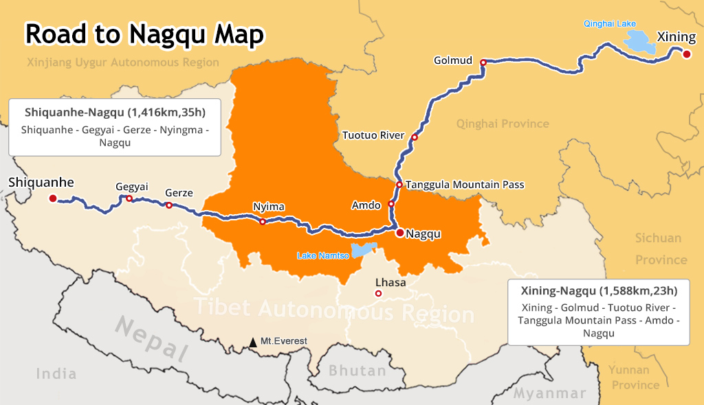 Nagchu Roads Map
Shannan (Lhokha) Maps and Prefecture
Shannan (also Lhokha) is the most southerly prefecture in Tibet, with Lhasa to the north, Shigatse to the west, and Nyingchi to the east. The southern border of Lhoka lies on the Chinese border with Bhutan to the southwest and the Indian State of Arunachal Pradesh to the southeast. Possibly the single most historic area of Tibet, Lhoka has a wealth of things to see around the region, and traveling into this ancient cradle of Tibetan civilization can feel a little like traveling back in time to the days of the ancient kings of Tibet.
.jpg) Lhoka Location Map
Lhoka Location Map Map of Lhoka City and Surrounding Districts and Counties
 Lhoka Tourist Attraction Map
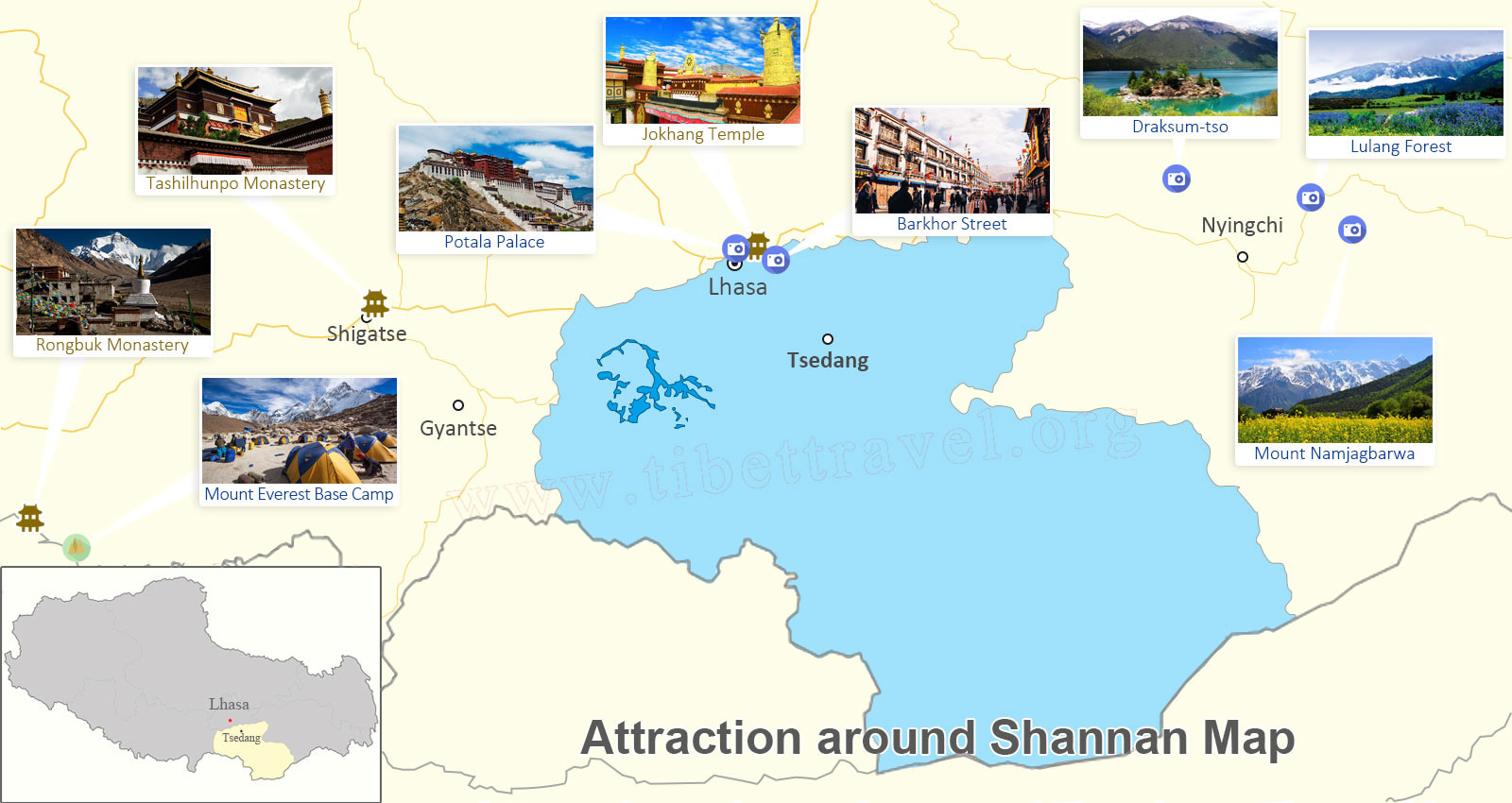 Attractions around Lhoka Map
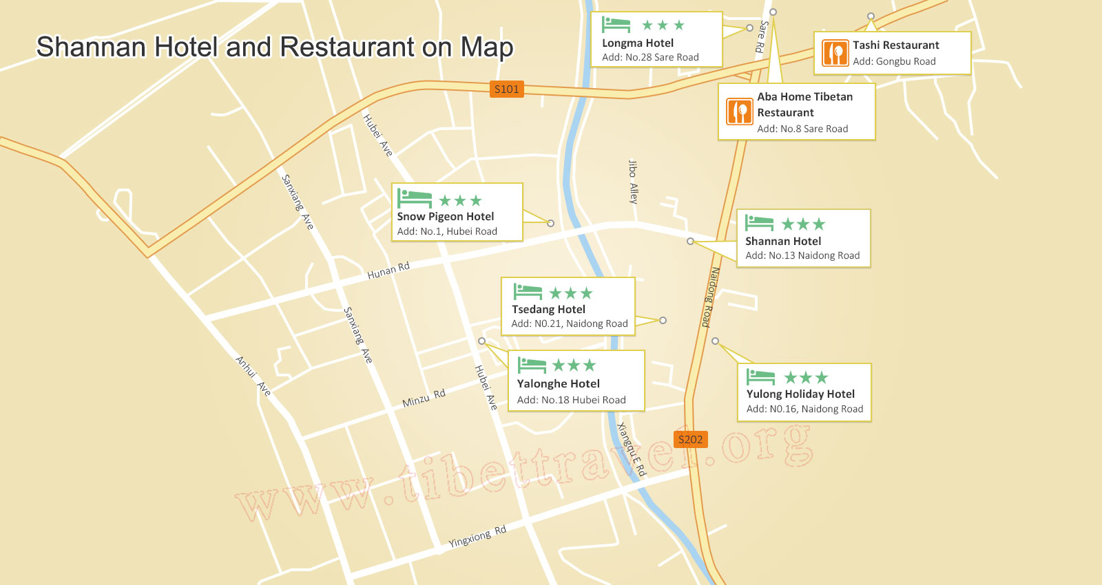 Map of Tsedang Hotels and Restaurants
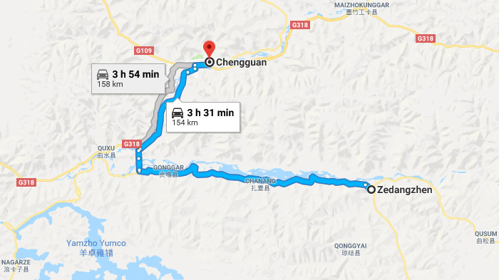 Lhasa to Tsedang Road Map
Chamdo Maps and Prefecture
Chamdo is one of the six districts of the Tibet Autonomous Prefecture of the People’s Republic of China, and was once a part of the ancient region of Kham. Qamdo Prefecture lies in the far east of the Tibet Autonomous Region, on the lower edge of the Tibetan plateau. The prefecture is surrounded by Lhasa to the west, Nagqu to the northwest, Qinghai Province to the north, Sichuan Province to the east, Nyingchi to the south, and the northwest corner of Yunnan Province connecting to the most southeasterly corner of Chamdo.
 Qamdo Location Map
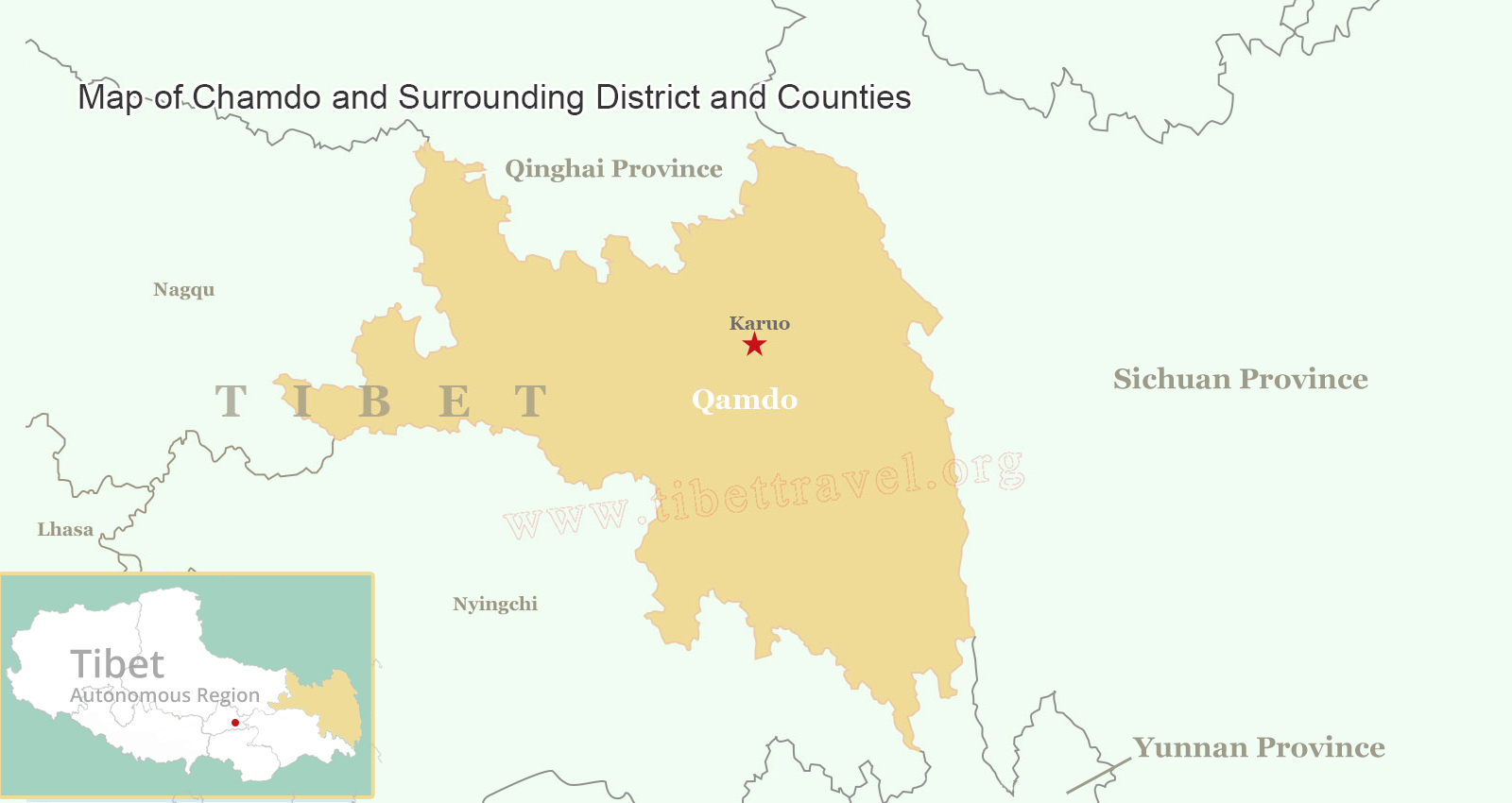 Map of Chamdo and Surrounding District and Counties
 Qamdo Tourist Attraction Map
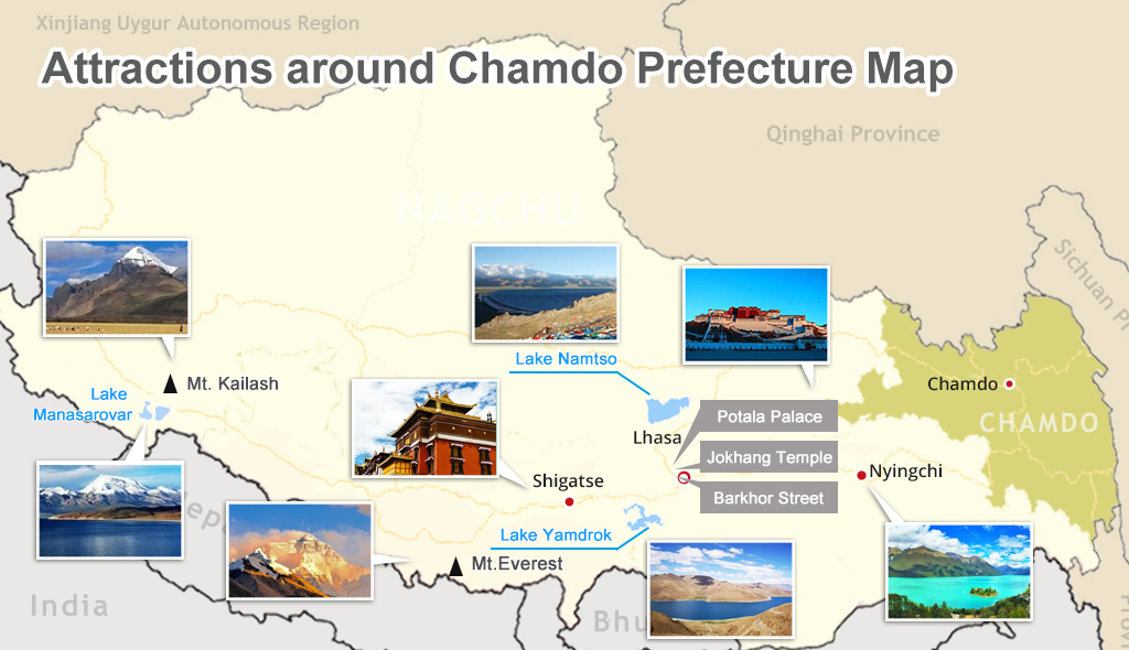 Attractions around Chamdo on Map
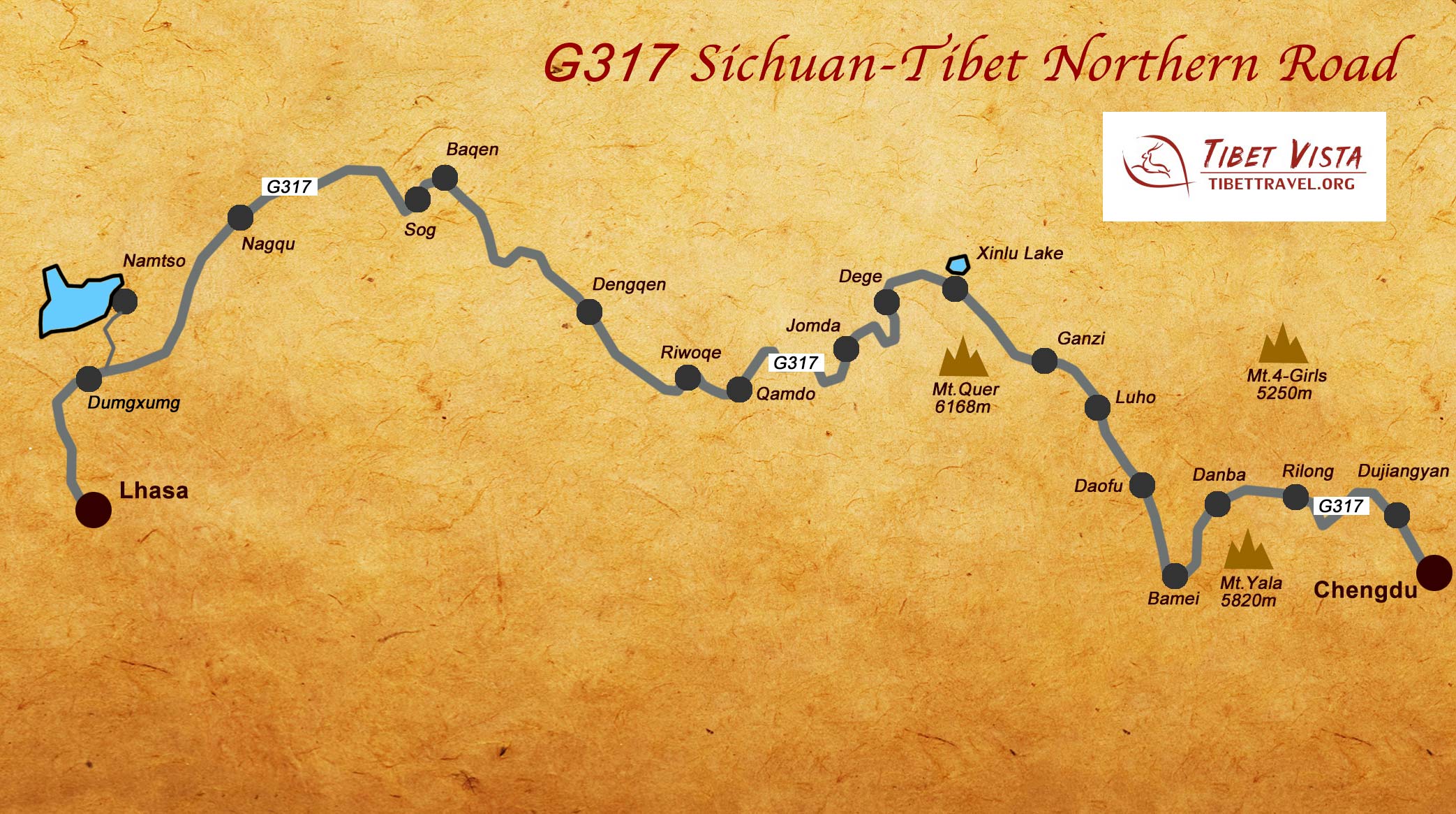 Sichuan Tibet Highway Northern Route Map
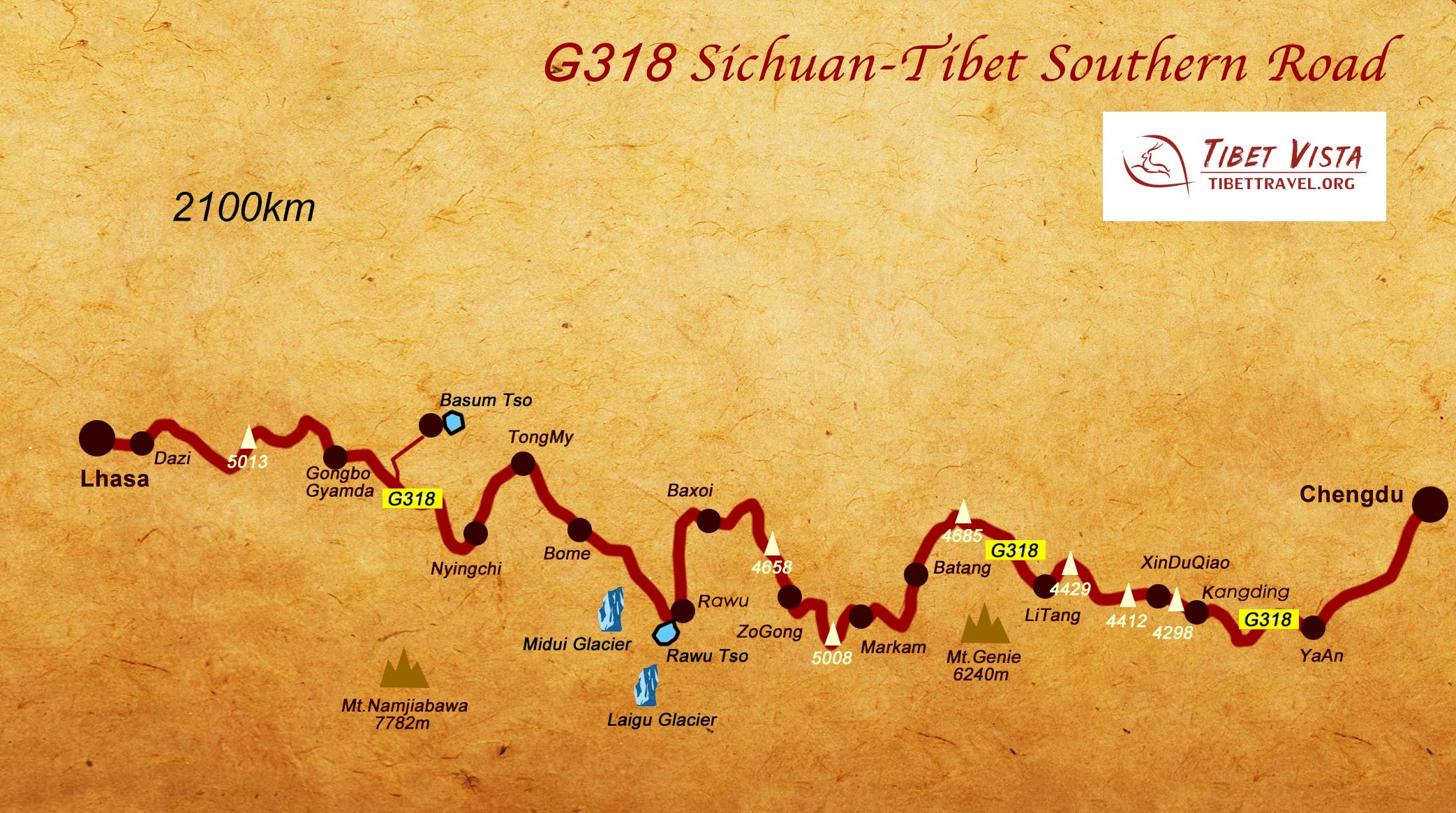 Sichuan Tibet Highway Southern Route Map
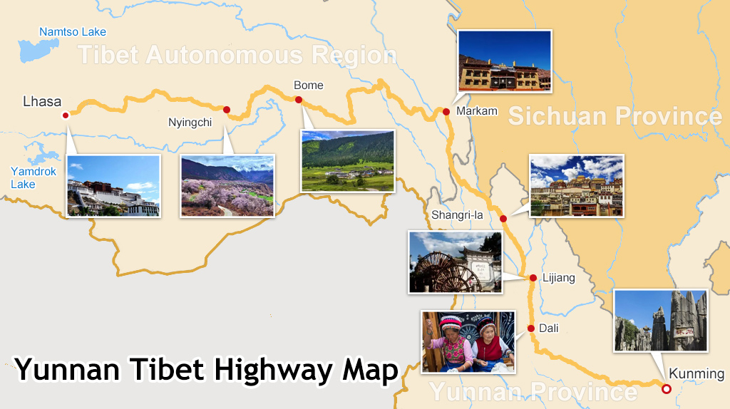 Yunan Tibet Highway Map
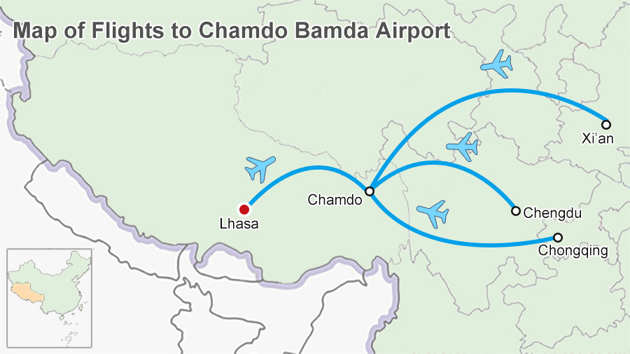 Map of Flights to Qamdo Bamda Airport
- Tibet Maps
- Where is Tibet Located on a Map?
- Tibet Political Map
- Tibet City Maps
- Tibet Road Map, Road Map of Tibet
- Where is Lhasa: how can I find the holy Lhasa City on map and get there?
- Lhasa City Map
- Lhasa Town: ultimate guide to your day tour in Lhasa
- Tibet Nepal Map: Locations, Border and Tourist Map
- Mt. Everest Base Camp Maps
- Shigatse and Yamdrok Lake Maps
- Namtso Lake Maps
- Tibet Railway Maps
- Map of Shigatse City, the Second Largest City in Tibet
- The Ultimate Mt Everest Tourist Route Maps
- Everest Base Camp Trekking Maps in Tibet
- Tibet Trek Map
- Map of Ngari Prefecture, Western Tibet
- Tibet Climate and Weather Map
- Most Comprehensive Maps of Nepal to Help you Plan a Lifetime Nepal Trip More Easily
- Bhutan Maps
- Map of Tibet and Bhutan
 2016 Version HD Tibet Tourlist Map Download FOR FREE (4.4M)
 2017 Version HD Tibet Tourlist Map Download FOR FREE (5.6M)

0 Comment ON "Your Definitive Maps of Tibet Plateau and Tibet Tourism"