

.jpg "Tibetan Local Travel Agency")


Tibet Mountains: An Ultimate Guide to Tibet’s Magnificent Mountain Ranges and Famous Peaks
The mountains of Tibet are one of the world’s most fascinating wonders. Formerly a sea bed, today these mountains soar higher than any other part of the planet and offer some of the most stunning views a tourist can ever experience in person.
Still, before you visit, you’d likely want to know a bit more about Tibet’s mountain ranges and peaks so that you can figure out exactly where you’d want to go, for how long, what you’d most want to see, and more. So, below is our ultimate guide to Tibet’s magnificent mountain ranges and famous peaks.
Tibet Mountains: Most Famous Highest Mountains of Tibet
![]() Main Mountain Ranges in Tibet: Basic Information
Main Mountain Ranges in Tibet: Basic Information
![]() The Himalayas: The Famous Mountain Range located between Nepal and Tibet
The Himalayas: The Famous Mountain Range located between Nepal and Tibet
![]() The Gangtise - Nyenchen Tanglha: the Residence of Holy Mount Kailash
The Gangtise - Nyenchen Tanglha: the Residence of Holy Mount Kailash
![]() Karakoram Range: the Second Highest Mountain Range in the World
Karakoram Range: the Second Highest Mountain Range in the World
![]() Tanggula Mountains: the Birthplace of the Yangtze River
Tanggula Mountains: the Birthplace of the Yangtze River
![]() Kunlun Mountains: the One that Qinghai-Tibet Railway Passes
Kunlun Mountains: the One that Qinghai-Tibet Railway Passes
![]() Hengduan Mountain Range: the One that G318 Highway Passes
Hengduan Mountain Range: the One that G318 Highway Passes
Main Mountain Ranges in Tibet: Basic Information
There are many famous mountains on the Tibet Plateau, featuring high altitudes and large coverage. Tibet mountains can be classified as the east-west Tibet mountain range and the north-south Tibet mountain range. The former occupies a large part of the Tibetan Plateau and consists of five mountain ranges from south to north, namely the Himalayas, the Gangtise - Nyenchen Tanglha, Karakoram Range, Tanggula Mountains, and the Kunlun Mountains.
 (Simple click to enlarge the map)
Tibet Mountains Map
When it comes to the north-south Tibet mountain range, it refers to the Hengduan Mountain Range in the southeast of Tibet. The mountains of Tibet are approximately distributed in the shape of an arc. They span in the middle section and become narrow at both ends.
The Himalayas: The Famous Mountain Range located between Nepal and Tibet
Located on the south side of the Tibetan Plateau, the Himalayas goes from east to west, which is mainly lying on the border between China, India, and Nepal. It’s made up of many parallel mountains arranged from south to north, namely Mt.Xifalike, the small Himalayas, and the large Himalayas.
Having an average altitude of 6,000 m, the Himalayas is 2,400 km in length, around 200 to 300 km in width. More than 50 mountains have an elevation of over 7,000 meters, among which 11 mountains are 8,000 meters above sea level. Mount Everest is the main peak of the Himalayas at a height of 8,848.13 meters.
 Map of Highest Mountains in the Himalayas
The Himalayas has many large-scale contemporary glaciers and widely-distributed glacial landforms like cirque, glacial horn, etc. Serac forests are spreading miles upon miles below snow lines. The north slope of the Himalayas is relatively flat, while the south slope is high and precipitous.
And the snow line on the south slope is much lower for abundant rainfall brought by the southwest monsoon from the Indian Ocean.
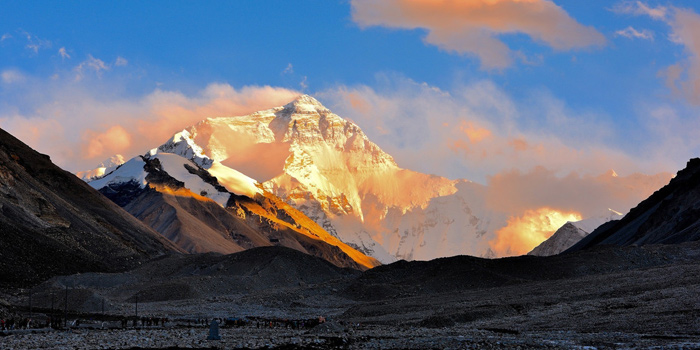
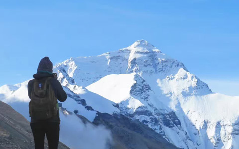
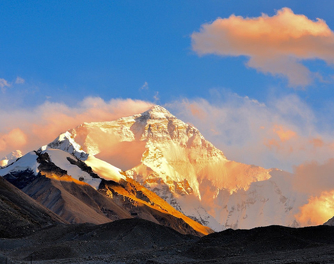
Mount Everest (World’s Highest Mountain)
As the highest mountain on earth, Mount Everest (Mount Qomolangma) is 8,848.13 meters in height, standing on the border between China and Nepal. Mount Everest is a typical fault block mountain and the Everest Summit consists of brown marble and crystalline limestone. According to scientific reports and documents, Mt.Everest has kept rising at the speed of 3.2 to 12.7 mm per year and has broken the record set by herself.
 Mount Everest is the most famous peak of the Himalayas.
Affected by the southeast monsoon and northwest cold current, the climate in Mt.Everest is complicated and unstable. Weather on Mt.Everest varies greatly within a single day. The best months to trek Everest Base Camp are March, April, May, September, and October because of the milder weather.
It’s somewhat of a myth that there are only two routes up Mt. Everest. In reality, there are about 20 such routes, but the vast majority of climbers prefer the two most-traveled and safest routes – the Northeast Ridge via Tibetan China and the South Col/Southeast Ridge from Nepal.
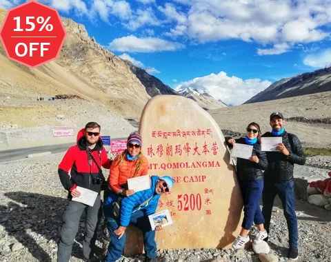
To get to Mt. Everest, you can typically take a Tibet train or flight to reach Lhasa first. Then we’ll drive you two days from Lhasa to Tingri along Friendship Highway and move southwards to Rongbuk Monastery (5,154 meters) to get ready for EBC trekking.
Other Notable Mountains in the Himalayas
As the fourth-highest mountain on earth and Tibet’s second-highest mountain, Mt.Lhotse is 8,516 meters high and is just 3 km away from Mt.Everest. As a mountain between China and Nepal, its east side is in Tibet while the west side belongs to Nepal.
Mt.Lhotse has a complex terrain and changeable weather. Its wind speed is lower than Mt.Everest but the precipitation is larger. Rainstorms and snowslides often happen from June to mid-September.
 Lhotse is the second highest mountain in Tibet.
The minimum temperature in winter drops to 60 centigrades below zero. The climate is relatively stable from March to May and September to October. Up to now, no one has succeeded in reaching the summit of Mt.Lhotse from China's side.
To get to Lhotse, we usually drive along Friendship Highway from Lhasa to Tingri for two days and then move southwards to Rongbuk Monastery (5,154 meters). The total distance amounts to 780 km.
Makalu, on the other hand, is the fifth-highest mountain on Earth and Tibet’s third-highest. Mt.Makalu has an elevation of 8,463 meters. The north side belongs to Tibet, while Nepal has the south side. Majestic glaciers with cracks spread across the whole area, making snowslides occur on Mt.Makalu frequently.
 Makalu is the third highest mountain in Tibet.
Getting to Makalu usually takes two days to drive along Friendship Highway from Lhasa to Tingri and then head about 180 km westwards to Shajitang Base Camp (3,600 m).
As the sixth highest mountain on earth, Cho Oyu has a height of 8,201 meters. Lying on the border between China and Nepal, the north is owned by China, and the south by Nepal. It’s about 100 km away from Mt.Everest and has a similar climate.
 Cho Oyu is the six highest mountain on earth.
It’s easy to get to Cho Oyu by driving 718 km from Lhasa to Tingri via Shigatse and Lhatse, and then moving southwards to Jiabula Glacier Base Camp (4,959 m).
Shishapangma is the 14th-highest mountain in the world and has an altitude of 8,012m. It’s the only 8000-meter-high mountain completely situated in Tibet, China. But the widespread ice cracks and frequent snowslides are the great barriers for Tibet mountaineers and climbers.
 Shishapangma is the 14th highest mountain on earth.
Getting to Shishapangma requires a 670 km drive along Friendship Highway from Lhasa to Tingri and then 208 km to the base camp at the north foot of the mountain.
Where to See the Mountains of the Himalayas
There are many ways to experience the Himalayan mountains. One of the best panoramic views of Mt. Everest, for example, can be seen from the Shigatse Prefecture in Tibet which offers a fantastic view of the northeast ridge up to Everest’s summit.
Trekking through the Gama Valley is also a great way to explore the Himalayas. Lying to the east of Mt. Everest, it’s considered one of the most beautiful valleys in the world, offering a truly unforgettable exploration of the Himalayan landscapes.
 View Himalaya Mountain range at Gawula Pass of Tibet.
Hands down, the best place to enjoy the Himalayas is, however, the Gawula Pass, which is located along the classic route from Lhasa to Everest Base Camp. That mountain pass has an altitude of 5,198 meters above sea level and offers a phenomenal view of Mt. Everest as well as other Tibetan mountains such as Mt. Lhotse, Mt. Shishapama, Mt. Makalu, Mt. Cho Oyu, and others. With Tibet Vista, you can explore these and many other passes and picturesque locations in the Himalayas.
The Gangtise - Nyenchen Tanglha: the Residence of Holy Mount Kailash
Lying in the central part of Tibet Autonomous Region, the Gangtise – Nyenchen Tanglha range starts from Jiali in Chamdo and extends southeast to Boxoila Ling in Hengduan Mountain Range, west to Shiquanhe in Ngari, south to the Brahmaputra Valley. It divides northern Tibet from southern Tibet and southeastern Tibet, which is also the boundary between inland rivers and outflow rivers in Tibet. It’s 400 km long from east to west, and 80 km wide from north to south.
At an average altitude of over 5,800 meters, the Gangtise - Nyenchen Tanglha has 25 mountains over 6,000 meters. Mountain Kailash, the main peak of the Gangtise, is 6,638 meters high. Mount Nyenchen Tanglha, the main peak of Nyenchen Tanglha, is 7,117 meters in height.
 Nyenchen Tanglha Mountain
There is no distinct boundary between the Gangtise and Nyenchen Tanglha. The border is roughly located at 90 degrees east latitude. Compared with the Gangtise, Nyenchen Tanglha is widely covered in snow and has more valley glaciers and cirque glaciers.
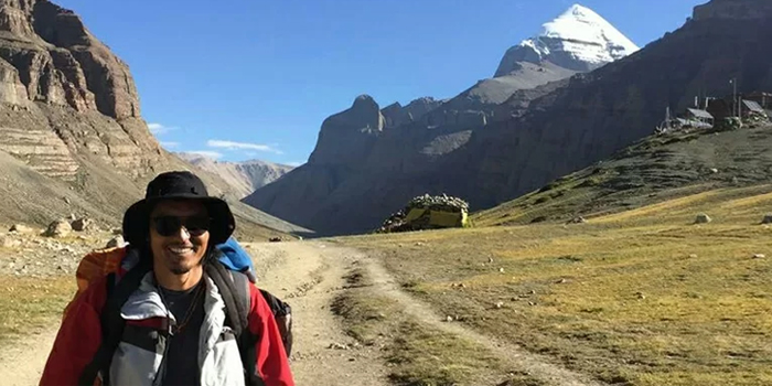
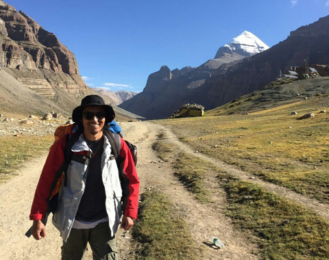
Mount Kailash (Tibet’s Holiest Mountain)
Seated at Pulan in Ngari Prefecture, Mountain Kailash, the second-highest peak of the Gangdise has an altitude of 6,638m. As the holiest mountain in Asia, Mt.Kailash is regarded as the pilgrimage center by Bon, Tibetan Buddhism, Hinduism, and Jainism.
 Mount Kailash is the most sacred mountain in Tibet.
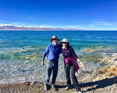
It’s said that Kailash kora can wash away people’s sins in their lifetime. Even if you are not a pilgrim, the most intoxicating picturesque scenery of Mount Kailash and Lake Manasarovar is worth seeing! To visit Mt. Kailash, you can fly to Lhasa and then transfer to Mt.Kailash.
The overland trip from Lhasa to Mt. Kailash itself is an exciting journey. After staying in Lhasa for a couple of days to acclimate to the high altitude, you can embark on the classic route.
This route will take you to the ancient town of Gyantse, and then the city of Shigatse, crossing the beautiful Yamdrok Lake and Korala Glacier. This effectively overlaps with the first part of the classic route between Lhasa and EBC (Everest Base Camp).
From Shigatse, the journey continues west to Darchen and through the holy Manasarovar Lake until you reach Mt. Kailash. For the best experience, you can check out our 15-day Kailash and Manasarovar group tour.
Karakoram Range: the Second Highest Mountain Range in the World
Standing in the northwest of the Qinghai-Tibet Plateau, Karakoram Range is conjunct with the Pamirs, the Himalayas, and Mount Tanggula. The major part is on the border between Xinjiang Uygur Autonomous Region and Kashmir and stretches eastwards to Tibet.
As the second highest mountain range in the world, Karakoram Range has an average altitude of 6,000 m. Lying on the boundary between China and Pakistan, the 8,611-meter-high Chhogori (K2), the main peak of Karakoram Range, is also considered the second-highest mountain peak on earth.
 Karakoram Range
Karakoram pass plays a vital role in transport between Xinjiang and Kashmir. Influenced by the Indian Ocean monsoon and westerlies, Karakoram Range has become the largest mountain glacier development area in the middle latitudes of the planet.
When visiting Karakoram from the Tibetan side you can take the frontier road from Lhasa. That will lead you to the Kashgar skirts in the northern and eastern margins of the Karakoram range in China.
Tanggula Mountains: the Birthplace of the Yangtze River
Situated in the center of the Qinghai-Tibet Plateau, it connects with Karakoram Range in the west, Nu Shan in Hengduan Mountains in the southeast, and separates Tibet Autonomous Region from Qinghai Province. Beginning from the small Tanggula Mountains in the north, it ends at Ando, Nagqu Prefecture in the south.
 Tanggula Mountains Pass
The width from north to south amounts to 160 kilometers. The major part of the Tanggula Mountains is over 6,000 meters in height. As the highest peak of the Tanggula Mountains, Dandongfeng is 6,621 meters above sea level and is regarded as the birthplace of the Yangtze River.
A large number of valleys and basins are scattered among Tanggula Mountains. With grasses flourishing, it is an excellent pasture land. Both the Qinghai-Tibet Highway and the Qinghai-Tibet Railway are good ways to reach the Tanggula Mountains as they cross the Tanggula Mountain Pass and connect the Qinghai province with the Tibetan Autonomous Region.
Kunlun Mountains: the One that Qinghai-Tibet Railway Passes
Kunlun Mountains tower in the north of the Qinghai-Tibet Plateau and form the boundary between Tibet and Xinjiang. The mountains go from the Pamirs in the west and eastwards to the northwest of the Sichuan Basin.
This mountain range is 2,500 km long from east to west, 150 km from north to south, and 5,000 to 6,000 meters in altitude. Stretching across Central Asia, it’s famous as the Spine of Asia for its great height and length. Thousands of glaciers are spreading over the Kunlun Mountains, among which the longest one reaches 25km.
 Tibet train passes through the Kunlun Mountains.
If you take the Tibet train through the Kunlun Mountains you’ll see many gorgeous peaks and passes. These include the Kunlun Goddess Peak, the mountain’s highest peak at 7,167 meters, the Ulugh Muztagh Peak (6,973 meters), and Bukadaban Feng (6,860 meters).
On the eastern side of the Kunlun Mountains, you can also see the imposing Yuzhu Peak (6,224 meters) and Amne Machin (or Dradullungshong) at 6,282 meters. You can also see the beginnings of several of Asia’s most impressive rivers here – the Karakash River (Black Jade River) and the Yurungkash River (White Jade River), as well as China’s two longest rivers – the Yangtze River and the Yellow River.
Only two main roads cross the Kunlun Mountains – Highway 109 which connects Lhasa with Golmund and Highway 219 which connects Lhatse and Yecheng.
Hengduan Mountain Range: the One that G318 Highway Passes
Seated on the southeast of Qinghai-Tibet Plateau, the Hengduan Mountain Range is a general name for the north-south mountains in the east of Tibet, and the west of Sichuan and Yunnan. The ridges and valleys of Hengduan are as follows from west to east:
Boxoila Ling - Gaoligong Mountains, Nujiang Valley, Tenasserim Chain - Nu Shan, Lanchangjiang Valley, Ningjing Shan (Mangkang Shan) - Yunling Mountains, Jinsha River Valley, Chola Mountain (Que'er Mountain) - Shaluli Mountains, Yalong River Valley, Daxue Mountains - Zheduoshan - Jinping Mountain, Dadu River Valley, Qionglai Mountains - Daliang Mountains.
 Mt. NamchaBarwa (7782m) is the one that G318 Highway passes.
The height of the mountains goes down from north to south. But the depth of valleys goes up from north to south. The altitude difference between mountains and valleys ranges from 1,000 to 2,500 meters. The north part turns out to be a good place for grazing in the summer. However, there are more rapids and shoals in the south.
If you take the overland trip from Chengdu to Lhasa, you will travel through the Hengduan Mountain Range. Along this epic road journey, you will see a series of breathtaking peaks and other sights, such as Xinduqiao, Haizishan Mountain, the Seventy-Two Bends, the Lulang Forest, Mt. NamchaBarwa (7782m), the Sejila Mountain Pass (4728m), Basumtso Lake, the Mila Pass (5013m), etc., before reaching Lhasa.
Insider Tips for Visiting Tibet Mountains
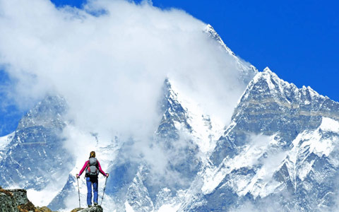
Traveling through the mountains of Tibet is an incredibly memorable experience for a lot of great reasons but it also hides its risks, even when you’re not climbing Tibet’s many peaks. High altitude sickness or acute mountain sickness (AMS) is one such notable risk that can happen even on a train.
AMS can occur when you move from a lower altitude to a higher altitude too quickly and don’t give your body the chance to adapt to the different atmospheric pressure and the lower oxygen contents in the air. That’s why Tibetan trains traveling through such high altitudes have additional oxygen supply systems on them.
 Our Tibetan tour guide accompanies the client to Everest Base Camp.
If you do happen to experience high altitude sickness, it’s important to try and calm down, reach for additional oxygen supply when available, get to a lower altitude as soon as possible, and reach out to a medical professional if need be.
The easiest way to avoid any such issues is to travel slowly, drink a lot of water, eat light, and – of course – always use a good travel agency such as Tibet Vista that ensures your safety and well-being.
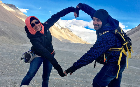
With almost 30 years of experience, Tibet Vista is a trusted agency that prioritizes the care of its travelers and their health. We take every necessary precaution and are prepared for any unforeseen circumstances, having encountered a wide range of situations over the past several decades. Our ultimate goal is to provide a worry-free and seamless journey for every client visiting Tibet.
Conclusion
Traveling through the many mountains of Tibet is something you should do at least once in your life as it offers countless amazing sights and experiences. As it presents its challenges, however, such a trip should be done properly and with the help of the right travel agency like us. This can minimize the risks of altitude sickness or other potential issues, and make sure that you get the absolute most out of your Tibet trip and don’t miss anything.

With exceptional passion and outstanding leadership, Mrs. Catherine has dedicated herself to Tibet inbound tourism and China tour for 15 years. As one of the handful females who see great potential of Chinese inbound tourism, Catherine has made great contribution to promoting Tibet tourism and enhancing the employment of Tibetans and prosperity of local Tibetan community.
Over the years, she travelled overseas with Tibet Tourism Bureau many times to promote Tibet tourism. Currently, Catherine works as the marketing director of Tibet Vista, an opinion leader behind the whole team of Tibet Vista.
Related Articles & Posts
Most Popular Tibet Tour Packages
-
Lhasa - Gyantse - Shigatse - Everest Base Camp - Shigatse - Lhasa
USD939
View Details -
Lhasa - Gyantse - Shigatse - E.B.C - Saga - Kailash Trek - Darchen - Lake Manasarovar - Saga - Gyirong - Tingri - Lhasa
USD2059
View Details -
10 Days Lhasa to Everest Base Camp and Namtso Lake Small Group Tour
Lhasa - Gyantse - Shigatse - EBC - Shigatse - Lhasa - Namtso Lake - Damxung - Lhasa
USD1289
View Details -
8 Days Driving Across Himalaya Overland Adventure from Kathmandu to Lhasa
Kathmandu - Gyirong - Everest Base Camp - Tingri - Shigatse - Gyantse - Lhasa
USD1069
View Details -
4 Days Lhasa Impression Small Group Tour: Explore the Heart of Tibet and Mingle with the Locals
Lhasa
USD509
View Details -
Lhasa - Gyantse - Shigatse - Everest Base Camp - Gyirong - Kathmandu
USD979
View Details -
Lhasa - Gyantse - Shigatse- Lhasa
USD799
View Details -
13 Day Lhasa, Mt. Everest, Mt. Kailash, Lake Manasarovar and Kathmandu Adventure Tour
Lhasa - Gyantse - Shigatse - EBC - Saga - Darchen - Kailash Trek - Darchen - Saga - Gyirong - Kathmandu
USD2059
View Details