
Altitude Change and Major Peaks along Sichuan-Tibet Highway Southern Route G318
At present, there are 4 highways from China mainland to Tibet, including: Qinghai-Tibet Highway, Sichuan-Tibet Highway, Yunnan-Tibet Highway and Kashgar-Tibet Highway. The Sichuan-Tibet Highway, originally called the Kangding-Tibet Highway, is a high-elevation road starting from Chengdu, the capital of Sichuan province, in the east and ending at Lhasa, the capital of Tibet Autonomous Region, in the west. The road was started in April 1950, and opened for traffic on Christmas Day in 1954. The Southern Route officially opened in 1958, and was originally known as “South line”. It starts from Ya’an, separating from State Road 108 to the west over the Erlang Mountain.
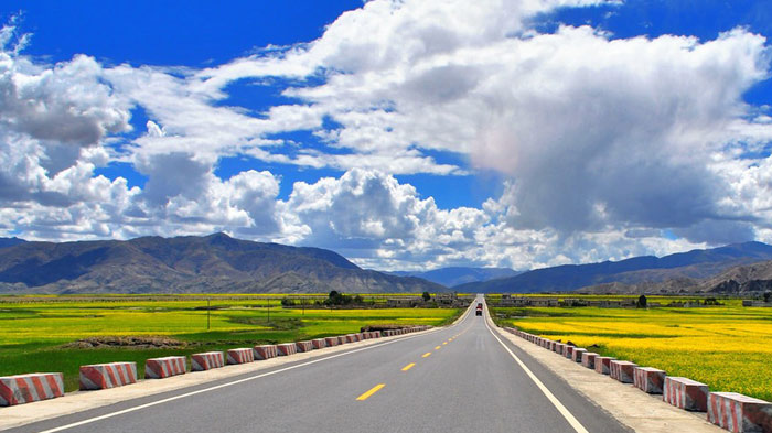 The Sichuan-Tibet Highway
There are two major routes that one can take to get from Chengdu to Lhasa, the Northern Route and the Southern Route. The Southern Route is the more popular route for travelers heading to Tibet, and is an experience full of adventure like no other. Filled with high mountain passes and clear blue lakes, the route follows the old Tea and Horse Road that once ran from Eastern China all the way to India, and beyond.
Travel Route of Sichuan-Tibet Highway 318
Travel Route of Sichuan-Tibet Highway 318: Chengdu - Ya'an - Kangding - Xinduqiao - Litang - Batang - Markam - Zogang - Bangda - Basu - Ranwu Lake - Midui Glacier - Bomi - Lulang Forest - Bayi - Niyang - Lhasa (2,246 kilometers)
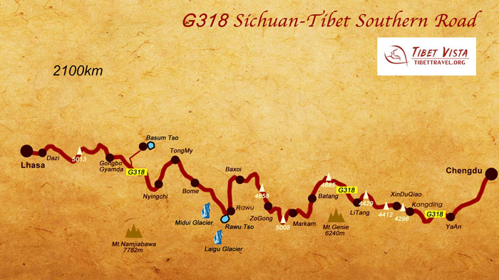 (Simple click to enlarge the map)
Sichuan Tibet Highway Southern Route Map
The Southern Route is considered to be one of the most spectacular drives in the world, with more beautiful scenery than anywhere else along such a long stretch of highway. The route starts in Chengdu, and heads west towards Ya’an, on the edge of the Sichuan Basin. From there it continues to Kangding, where it joins the G318 National Highway that runs for 5,476 kilometres from Shanghai in Eastern China to Zhangmu on the border with Nepal. Kangding is the staging point for many treks in the mountains to the north and south of the town, including Yala Jokul Scenic Area, Mugecuo Lake, Mount Gongga, and Mount Paoma.
Further along you come to Xinduqiao, a picturesque small Tibetan town, famous for its plateau pasture scenery, with vivid green grassland, streams, mountains, and Tibetan houses, before moving on further to Litang. Famous for its expansive grasslands and annual horse racing, Litang is a great place to stop and explore. Next comes Batang, a small township that consists mainly of sheep farmers, hence the name, and Markham, the county seat of Markam County in Chamdo prefecture.
At Zogang, you can visit the ancient fortress of the old Tea-Horse Trading Route, before moving on to Bangda and Basu, where you can visit the famous Ranwu Lake and see the beautiful Lagu Glacier, and then follow it with a visit to the Midui Glacier, the lowest glacier in the world. Known as the “Tibetan Switzerland” for its lush green valleys, Bomi lies along the highway and is one of the favored tourist resorts in Nyingchi Prefecture.
Lulang Forest lies alongside the highway as you travel west, with its natural museum of plants and trees, and known as a fairyland for the gods. Lying on the Niyang River, Bayi is an important timber and wool-producing town, known before the 1960s as Lhabagar. Niyang Township also lies on the banks of the Niyang River, and you will find that once past there you are soon in Lhasa.
Major Peaks and Mountain Passes along Sichuan-Tibet Highway Southern Route G318
The southern section of Sichuan-Tibet Highway (G318), known as China’s Landscape Corridor, unfolds a scroll of the most beautiful sights in the world along the road that encompasses the most varied scenes on our planet including plains, mountains, canyons, rivers, forests and local-style dwelling houses.
Start from Chengdu and drive on the G318, and you will pass over more than 10 high mountains (over 4, 000 meters above the sea level) and cross three great rivers, the Jinsha River, Nujiang River and Lancang River.
Emei Mountain, at 3,099 meters, is one of the four sacred mountains of China, and just a short drive south of Chengdu.
Erlang Mountain lies on the road to Kangding, at 3,437 meters above sea level. The mountain is notable for its cragginess and constant bad weather, and for the Erlangshan Tunnel, which bores through the mountain for more than four kilometers.
Kangding is the one of the most famous towns in the Tibetan Area in Sichuan Province. It is the transportation, culture, business and politic center of Gantze Tibetan Autonomous Prefecture. The noted Paoma Mountain and Mugetso Lake near Kangding attract a large number of tourists with their picturesque natural landscapes of mountain and lake.
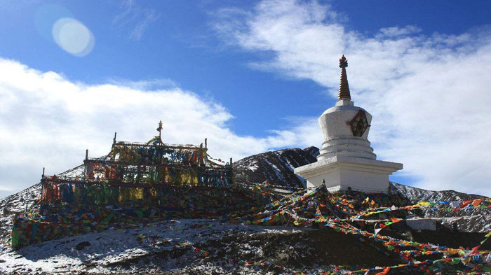 Zheduo Mountain
Zheduo Mountain is the watershed of Dadu River and Yalong River. The Zheduo Mountain Pass enjoys an altitude of 4,290 meters. Tourists making a self-driving tour to Tibet along the Sichuan-Tibet Highway will have the chance to experience a quite different folk culture once you climb over the Zheduo Mountain.
The road going up to Gao'ersi Mountain Pass is bumpy and hard to drive, and is often muddy. Unrestored and unrenovated, the mountain road up to the pass is 24 kilometers long, and some sections have no guardrails. This is one of the many sections of road that require special care when driving, as there are many trucks and other vehicles coming the other way. At an altitude of 4,412 meters, the view from the top is spectacular, looking down into the deep, forested valley below. At the peak of the pass is a signboard in Chinese that reads” Gao’ersi Mountain Pass 4412 meters Altitude”, which makes a great backdrop for photos.
Going over Haizi Mountain Pass on a nice section of asphalt road, there is a viewing platform on the left side of the National Highway G318, a good place to stop to grab a bite for our lunch and admire the view. Haizi Mountain Pass sits at an elevation of 4,685 meters, and from the viewing platform you get a great view down the mountain to the mirror-like limpid blue Sisters Lakes, sitting side-by-side.
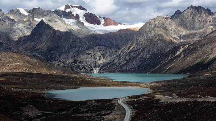 Haizi Mountain Pass
Dongda La Mountain Pass is the second highest pass on the entire Southern Route, at 5,008 meters, and the 25-kilometer long road up to the pass and down the other side is dirt and gravel, making for tricky driving. However, the slope is gentle for the 1,900-meter increase in elevation, giving you plenty of time to take in the amazing views of the mountain in front of you.
Heading up to Yela Mountain Pass takes you through the famous “99-turns”, which are the number of switchbacks going up to the mountain pass at 4,618 meters above sea level. At the top, above the lines of colorful prayer flags, are the signs proclaiming: "Keep the smoothie of Sichuan-Tibet Line: forge the traffic iron army.” Drivers should pay particular attention to the 99-turns road, as the dirt and gravel road is actually cambered to the downhill side, to allow water run-off in the rain and snowmelt. The road back down the other side is also tricky, due to it being very steep, and quickly dropping around 1,200 meters to a rather dangerous bridge.
The road up to the top of Sejila Mountain Pass, which sits 4,728 meters above sea level, is a smooth asphalt surface, which is easy to drive. From the top, one has a great view of the boundless forest of the Namjagbarwa Mountain in the distance, and the sacred mountain of Benrila on the western slope, which is a holy land to the Bon sect. There are many different colors of azalea flowers scattering around Sejila Mountain, red, blue, white, yellow, pink, and purple and cover a huge area around the mountain from April to the end of June.
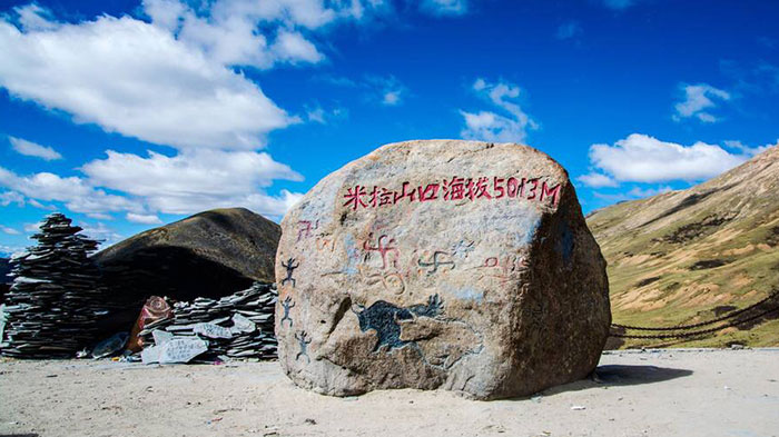 Mila Mountain Pass
Mila Mountain Pass is the highest point of the Southern Route of the G318 National highway, at 5,13 meters, and is the geographical junction of Nyingchi and Lhasa. One of Tibet’s many Snow Mountains, Mila is covered all year round in snow, and has a unique climate. While the eastern side of the mountain is lush and green with many plants and flowers, the western side is a dry, arid landscape full of dust and rocks. The summit of the pass is also the home to some unusual tenants. Three yak sculptures stand on the rocks at the top of the pass, festooned with prayer flags, and looking out over the bleak, arid side of the mountain.
>> Read more about Highlights of Classic Chengdu to Lhasa Overland Tour (318 Southern Route)
How to Avoid and Deal with Altitude Sickness
Considering the road starts from Chengdu, with an elevation of just 500 meters, and ends in Lhasa, at an altitude of 3,656 meters on the high Tibetan Plateau, it is little wonder that people driving along the road experience a little altitude sickness on the way. The drive takes, on average, around fifty hours, so if you are driving non-stop, using more than one driver of course, then you will have no time to acclimatize to the altitudes as you ascend to the plateau.
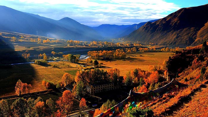 Xinduqiao is a picturesque small Tibetan town
Once you pull out of Chengdu, you will ascend rapidly to an altitude of 2,560 meters by the time you reach Kangding, a distance of 327 kilometers that takes only six and a half hours. By the time you reach Xinduqiao Bridge, 720 kilometers and 14 hours into your journey you are already above 3,000 meters, and above the optimum altitude for acclimatizing from a near sea-level elevation.
To acclimatize properly, the best place to stop for the day would be in Kangding, at 2,560 meters. Stopping for a day there would allow you to acclimatize properly to the higher altitudes, and get you ready for the increased altitude as you rise up towards Litang, at 3,954 meters above sea level. From there, it is almost level, with little difference in altitudes as you travel along the highway, except for the trips up and down the mountains and passes, although they should not affect you adversely.
If you do start to feel the effects of altitude sickness while driving, you should pull over immediately and allow someone else to drive, or stop to rest and allow your body to get used to the increased elevation for at least a day. If you are travelling with your guide in the tour vehicle, you should report it to your guide, and look for some help before moving to higher destinations.
Join-in the Most Popular Sichuan Tibet Tour
Other Dos and Don'ts
1. In the interest of safety, it is best for self-driving tourists to adhere to road safety rules when driving to Tibet, especially during the peak season when the road is busiest. Slower driving is best due to the sharp bends.
2. Know the signs of altitude sickness and learn to recognize them. Pull over if you feel any of the symptoms. (such as headache, rapid pulse, shortness of breath, light-headedness, bleeding, vomiting, etc.)
3. Watch out for unexpected natural disasters along the road. The Southern Route is prone to mudslides and landslides. Always pay attention to weather information when approaching the dangerous section of the highway, in order to avoid the rain and driving at night.
4. Ensure your vehicle is in good condition and novices are not allowed to drive, as the road can be treacherous at times.
5. Inexperienced tourists should avoid traveling to Tibet alone and should preferably be accompanied by an experienced team leader who is responsible for directing the group.

Hi, I am a pretty and outgoing Tibetan girl. I have 6-year experience in guiding all kinds of Tibet tours.

.jpg)


0 Comment ON "Altitude Change and Major Peaks along Sichuan-Tibet Highway Southern Route G318"