

.jpg "Tibetan Local Travel Agency")


Tibet Travel Guide
Tibet travel guide offers up-to-date Tibet travel information on Tibet attractions, hotels, and restaurants, means of transportation, weather, maps, shopping, nightlife, pictures, Tibet travel advice, as well as Tibet tour services including Tibet travel permit, private Tibet tour, Tibet group tour, Tibet trekking and cycling, religious kora, etc.
By following the highlights of Tibet tour and handy travel tips, tourists can easily navigate your way to the favorite attractions at the right time. For clients with special requirements, our seasoned travel consultants will work with you to customize your Tibet tour. Please feel free to contact us for free consultancy in detail.
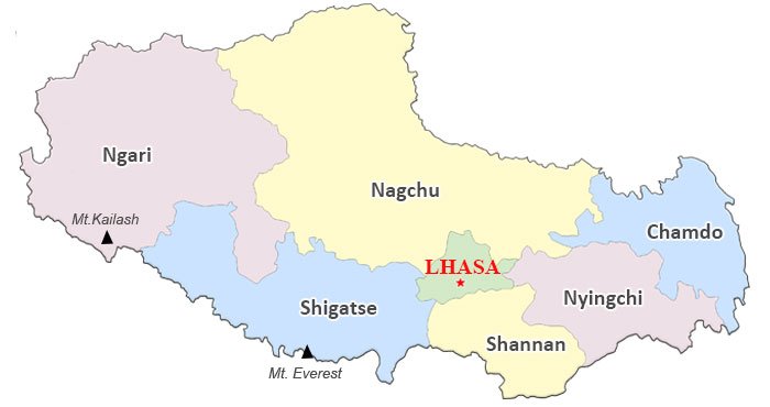
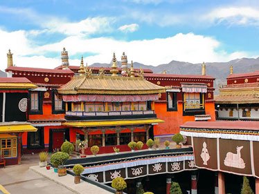
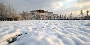
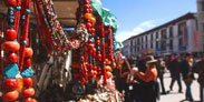
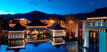
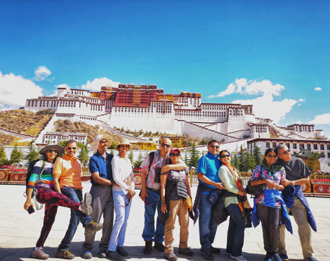
 Lhasa
Lhasa
Lhasa is the spiritual heart of Tibet and focus of Tibet tour. The religious and secular life in Lhasa forms a big draw for global tourists.
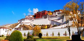
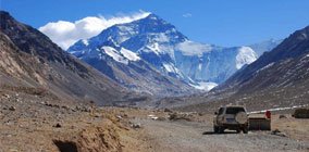
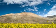
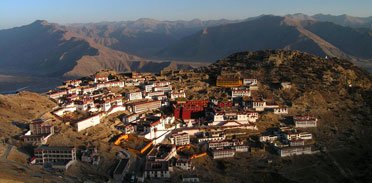
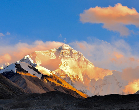
 Shigatse
Shigatse is the second largest city of Tibet, only next to Lhasa. It’s the best place to enjoy soaring mountains along majestic Himalayas, esp. Mt. Everest.
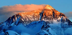
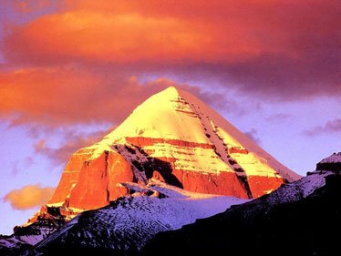
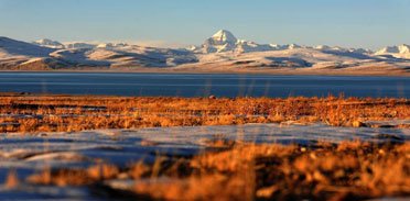
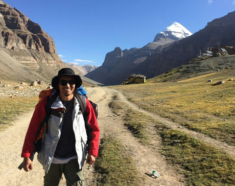
 Ngari
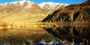
Ngari
Ngari is the highest region in western Tibet with vast wilderness. It is the ultimate destination for kora around the holy Mt. Kailash and Manasarovar Lake.
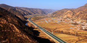
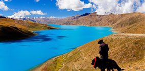 Lhokha
Lhokha is the closest prefecture to Lhasa. Yarlung Tsangpo River, fertile land and pleasing climate make it the cradle of Tibetan civilization.
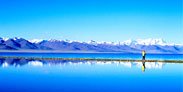
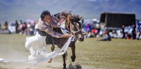 Nagchu
Nagchu is the biggest prefecture in Tibet with boundless prairie, superb livestock and indigenous Tibetan nomads. Sacred Namtso Lake lies on the border between Nagchu and Lhasa.
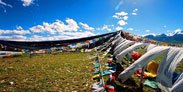
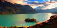
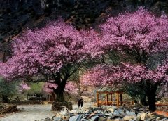
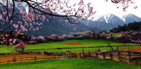 Nyingchi
Nyingchi is the only region in Tibet with lowest altitude and massive pristine forest. The enchanting pastoral scene is especially popular with Asian tourists.
 Chamdo
Chamdo is the eastern gateway to Tibet as well as the center of Kham. The earliest Tibetans are believed to originate from this region.
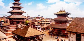 Nepal
Nepal
Travelling from Tibet to Nepal has been a classic travel route for centuries. Tourists can enjoy amazing Himalayas from both side, plus world-class trekking in Nepal.
Best Ways to Kathmandu from Lhasa
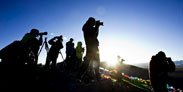
Tips on Everest Base Camp Trekking
The Regular Bus from Lhasa to Nepal
How to Get Tibet Permit and Chinese Visa from Kathmandu to Lhasa
Latest Tibet Travel Articles
Check for more Tibet travel advices and information.
Top Tourist Attractions, Monasteries and Lakes
Of all the highlights of Tibet tour, the awe-inspiring Himalayan Mountains, holy Tibetan Buddhist Monasteries and incredible alpine lakes are the most captivating features of Tibet. If you still have yet decide where to visit, following the highly recommended tour destinations will give you a clue.
How to Get to Tibet & Transportation in Tibet
Nowadays, travelling to Tibet is easy and fun. So far, two of the most common and effective ways to Lhasa, Tibet is via domestic flight and Qinghai-Tibet Railway in China, including international flight from Kathmandu, Nepal. Of course, you may choose your means of transportation to Tibet, based on your time and budget.
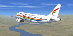 Flight to Tibet
Flights Between Kathmandu and Lhasa
Flights Between Beijing and Lhasa
Flights Between Shanghai and Lhasa
Flights Between Chengdu and Lhasa
Flights Between Chongqing and Lhasa
Flights Between Xi'an and Lhasa
Flights Between Nanjing and Lhasa
Flights Between Kunming and Lhasa
Flights Between Shangri-la and Lhasa
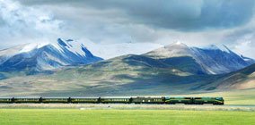 Train to Tibet
 Overland Routes
 Roads to Tibet
Transportation and Road Conditions
The Conditions of the Ways to Tibet
Toyota 4500 SUV quit the stage of Tibetan history
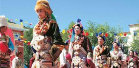
Tibetan Tour Calendar & Travel Tibet Month by Month
Travelling to the right place at the right time is of primary importance to tourists with specific needs, such as EBC trekking, festival tour or cycling, etc. In each month, Tibet has varied festivals and something different to offer to world-wide visitors. Find your favorite month and get well-prepared before heading to Tibet.
 Travel Tibet in Jan.
People have finished a year's work, and begin to prepare for Tibetan New Year.
 Travel Tibet in Feb.
Experience authentic Tibetan culture and local customs at low cost.
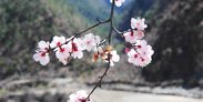 Travel Tibet in Mar.
Nyingchi in spring is a fantastic place with peach blossoms, Mt. Namjagbarwa, Yarlung Zangpo Cayon.
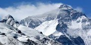 Travel Tibet in Apr.
It is the best time to view and climb Mt. Everest. There are climbers and visitors from different countries.
 Travel Tibet in May
It is also a great time to visit Everest Base Camp. The number of visitors to Tibet increases.
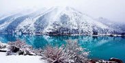
 Travel Tibet in Jun.
June is a wonderful time to visit the Lake Namtso and the Nyainqentanglha Range north of Lhasa.
 Travel Tibet in Jul.
The great time of visiting grassland dotted with flowers in full bloom.
 Travel Tibet in Aug.
Golden time to visit vast grasslands and enjoy grand festivals.
 Travel Tibet in Sept.
Great time to visit Mt.Kailash and Lake Manasarova, with favourable weather.
 Travel Tibet in Oct.
The rainy season ends and mountains are clear again. Do an overland trip from Lhasa to Kathmandu.
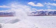
 Travel Tibet in Nov.
Winter comes to Tibet but mountains are at their most beautiful time.
 Travel Tibet in Dec.
Fewer tourists visiting Tibet, good discounts are available.
Supplementary Tibet Travel Guide
The supplementary travel guide concerning hotels, weather and trekking, altitude, etc. of Tibet prepares you for literally all aspects of Tibet tour, Tibetan culture and customs. If you have time and find it interesting to skim through all the encyclopedic information, we are convinced that you will be a Tibet travel guru.
Latest Tibet Travel News
Tibet travel news, stories and tips from our travel experts. See more Tibet travel news.
-
Tibet Vista: A Social Responsible Tour Organizer
Aug 14,2023 -

Tibetan Monks Debate in Drepung Monastery
Jun 10,2023 -
Tips for Traveling to Tibet in Spring
Feb 17,2022
Most Recommended Tibet Small Group Tour Packages
-
1 ,2 ,3 ,11
8 Days Lhasa to Everest Base Camp Small Group Tour: Marvel at Mt.Everest Real Close from 4 Different Viewing PlatformsTour Route:Lhasa - Gyantse - Shigatse - Everest Base Camp - Shigatse - Lhasa
Almost all the itineraries covering Everest Base Camp originate from this classic itinerary. The travel route to EBC involves all the awe-inspiring attractions, religious sites and magnificent natural wonder.
From USD939 p.p.
View Details -
1 ,2 ,3 ,14
7 Days Lhasa to Kathmandu Overland Small Group Tour: Traverse from the North Side to the South Side of Mt.Everest for the Best of the HimalayasTour Route: Lhasa - Gyantse - Shigatse - Everest Base Camp - Gyirong - Kathmandu
This tour combines the classic itinerary of visiting Tibetan cultural and natural beauty with a stopover in EBC. Tourists will finally end up in Kathmandu via Gyirong.
From USD979 p.p.
View Details -
1 ,8 ,11 ,12
15 Days Kailash and Manasarova Small Group Tour: A pilgrim’s final fantasy and the greatest overland trip in Tibet.Tour Route:Lhasa - Gyantse - Shigatse - E.B.C - Saga - Kailash Trek - Darchen - Lake Manasarovar - Saga - Gyirong - Tingri - Lhasa
This is truly a journey to feel, magnificent temples, mountain passes, snow-capped peaks, nomad camps, pilgrims of Tibet. Start the trip from exploring the heart of central Tibet.
From USD2059 p.p.
View Details -
1
4 Days Lhasa Impression Small Group Tour: Explore the Heart of Tibet and Mingle with the LocalsTour Route:Lhasa
This classic Lhasa city group tour is the best choice for tourists who have limited time or visit Tibet for the first time. After visiting the must-sees in Lhasa, you will have a comprehensive impression of Tibetan culture and pave the way for your revisit in the near future.
From USD509 p.p.
View Details