
Gurla Mandhata Expedition: ultimate guide to Mount Namo Nanyi climb
Praised as the ”Goddess Mountain” by local Tibetans, Mount Namo Nanyi is located in the western part of Himalayas in Purang County, Ngari Prefecture, Tibet. Also known as Mount Gurla Mandhata, Mount Namo Nanyi stands by the holy Lake Manasarovar and faces sacred Mount Kailash at a distance. Both Namo Nanyi and Kailash are always covered by heavy snow, so travelers could enjoy the amazing snowscape all around the year. Namo Nanyi is the 34th highest peak in the world and the fifth highest mountain among the five Goddess Mountains of the Himalayas. It is the holy mountain that controls the intelligence and life span for Tibetans.
The highest peak in the Nalakankar Himal, Mount Namo Nanyi has six main mountain ridges and there are dozens of mountains with an altitude of more than 6,000 meters on these ridges. The cliffs are pretty precipitous and there is an arête with a height difference of 2,000 meters on the east side of Namo Nanyi. Furthermore, there are five magnificent giant glaciers on the west of the peak. Mount Namo Nanyi was opened as a mountaineering region and scientific research area in the 1980s. Geologic investigations and some mountaineering activities organized by a Chinese and foreign joint mountaineering team were held here and in 1985, the Sino-Japan Joint Mountaineering Team conquered Namo Nanyi successfully.
Mt. Gurla Mandhata Expedition: How to Plan Mount Namo Nanyi Climbing Tour
Planning a climbing expedition to Namo Nanyi requires all the same preparations as any mountaineering expedition. Sitting at 7,694 meters (25,243 feet) above sea level, this stunning mountain lies in the far west of Tibet, to the south of Lake Manasarovar in Purang County. Just 55 kilometers from the border with Nepal at Hilsa, a crossing point for Indian and Nepali pilgrims into Tibet, it is one of the few mountains over 7,500 meters that is wholly inside the Tibet Autonomous Region (TAR).
The base camp of the mountain lies on the northwestern slopes, at an altitude of around 5,650 meters, and is the start and end of the climb to the summit. The route to the summit that is mostly used is the same one used by the Sino-Japanese team in 1985, following the northeast ridge route over the Zalompa Glacier, which is the easiest route to the summit. There are two other routes to the summit, from the south and east, but these are much harder, and only suitable for very experienced mountaineers. The route from the northwest, while being the easiest of the three, is still not suitable for novices, and some experience of mountain climbing at altitudes above 6,500 meters is required to reach the summit.
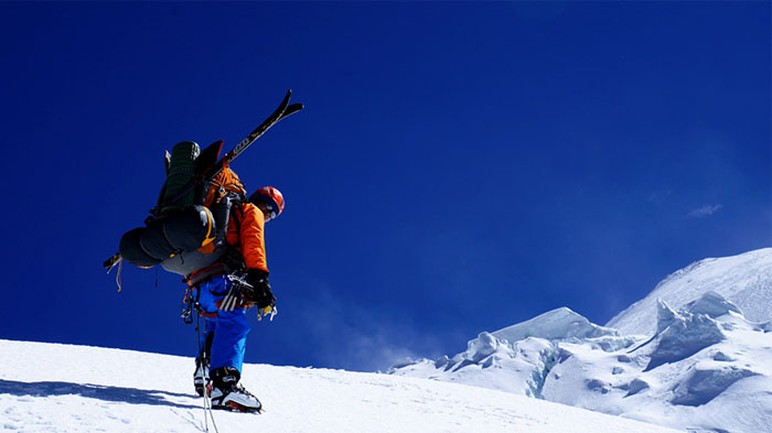 The best time to climb Mount Gurla Mandhata are from September to November and April to May.
Foods and Hotels in Gurla Mandhata Climb
While there are some three-star hotels and plenty of hostels and guesthouses in Burang Town, once you head off for the base camp of the mountain at 5,650 meters, your accommodation will be in tents for the entire climb, and food will only be what you bring with you. There are no guesthouses at the base camp of Gurla Mandhata either, so be prepared for some heavy-duty mountain camping.
Best Time to Climb Mount Gurla Mandhata
As with most mountaineering in Tibet, there are certain times of the year when it is best to take on the climb to the summit, and at Gurla Mandhata, it is no different. While it is possible to visit the base camp at almost any time of year, with the exception of January and February when there can be too much snow to reach it, climbing to the summit can only be done from September to November and April to May. An ascent to the summit is classed as a Major Mountaineering Expedition, and can only be done with the right permits from the Chinese government and by being on an approved expedition.
How to Get to Mount Namo Nanyi, Ngari from Lhasa, Kashgar, and Kathmandu
From Lhasa, the mountain is around 1,255 kilometers, and getting there is similar to the route that takes you from the Tibetan capital Lhasa to Mount Kailash. The road, which is all paved asphalt for the entire distance from Lhasa, follows the G318 Friendship Highway heading west as far as Lhatse in Shigatse Prefecture, and then heads northwest to pass through Saga and Paryang to get to Hor Qu in Burang County of Ngari Prefecture. From there, you will head around the north of Lake Manasarovar, and then cut south along the local roads to Burang Town, from where you can start your expedition to the mountain. The drive from Lhasa takes around four days, and for the actual climb of the mountain, including time to acclimatize as you ascend, you will need at least 14-19 days.
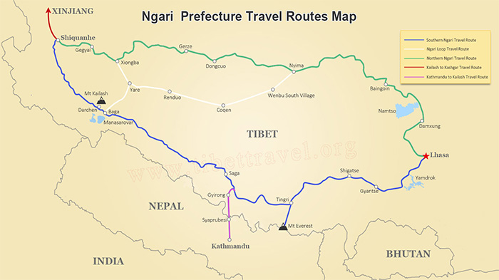 (Simple click to enlarge the map)
Ngari Road Map
There is a route you can take to Namo Nanyi from Kashgar in Xinjiang Province to the north, which follows the famous Xinjiang Tibet Highway as it snakes its way south. The route follows the G315 south from the city of Kashgar as far as Kargilik, where it transfers onto the G219 Xinjiang Tibet Highway, which runs through Ngari all the way to Darchen, at the foot of Mount Kailash. A distance of around 1,647 kilometers, this trip can take around four days to reach the lower slopes of the mountain.
From Kathmandu in Nepal, you actually have a choice of routes. You can take a flight to Lhasa and follow the overland route to Burang County, though this is a long and arduous journey when you consider that Kathmandu is actually closer to Burang than Lhasa. The best route to take is to consider the overland route through Gyirong Port, on the Sino-Nepal border to the northwest of Kathmandu. This route takes you into Shigatse Prefecture at Gyirong Town, which is only a 700-kilometers drive from the mountain following part of the route from Lhasa to Burang County.
>> Mount Kailash Tour from Nepal: Kailash tour options from Kathmandu, Nepal.
Top Tourist Attractions around Mount Namo Nanyi in Ngari
There are a wide range of things to see and do in this part of Ngari for those visiting but not yet climbing the mountain, and if you have time, getting around to visit them is an exciting and adventurous experience.
Mount Kailash
The most sacred mountain in the world, Mount Kailash lies to the north of Gurla Mandhata and Lake Manasarovar, and is the highest mountain in the Gangdise Range of the Trans-Himalaya. Believed to be sacred in four separate religions, the mountain has never been climbed, and is now protected by the Chinese government to ensure no attempts to set foot on its slopes ever occurs. It is also the location of the most arduous trek in Tibet, the 52-kilometer Kailash Kora Trek, which follows the pilgrimage route around the base of this sacred mountain.
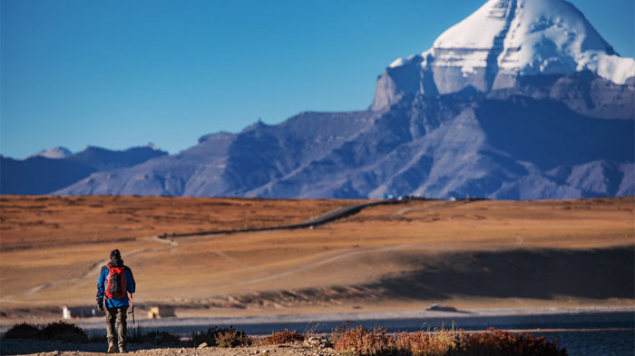 It usually takes 3 days to complete the 52-km-long Kailash kora trek.
Lake Manasarovar
Sitting pretty between Kailash and Namo Nanyi, Lake Manasarovar is one of the Great Three Sacred Lakes of Tibet, and is revered in the same four religions as Mount Kailash - Hinduism, Buddhism, Jainism, and Bon. Believed to have been created in the mind of Lord Brahma and manifest on earth, this sacred lake is renowned for its purity, and it is believed that to drink from the lake, or bathe in its waters, can cleanse one of the sines of an entire lifetime. If interested, you can also take the Manasarovar Kora with devout pilgrims.
Lake Lhanag-tso
Also known as Lake Rakshastal, Lhanag-Tso is the twin lake to Manasarovar, and lies on the other side of the ridge to the west of Manasarovar. A bitter saline lake, this crescent-shaped body of alpine water has no living things in its depths, and is believed to be the opposite of Manasarovar, like Yin and Yang. However, while Manasarovar holds a place of reverence in Buddhism and Hinduism, Lake Lhanag-Tso holds no such significance, and is actually known as the Devil Lake.
Guge Kingdom
An ancient kingdom in western Tibet that followed and grew from the collapse of the former Tibetan Empire, which fell after the death of King Langdharma in the 9th century. Established by the king’s great-grandson, who escaped from the insecure conditions of U-Tsang in around 910 AD, he headed west and established his own kingdom in Ngari in around 912 AD. The capital of this great kingdom was centered at Tsaparang in the Garuda Valley, and the Guge Kingdom lasted for more than 700 years, until it was overthrown by Ladakh forces in 1630. Now, all that remains of this amazing kingdom are some ruins on the cliff where the capital and royal palace lay.
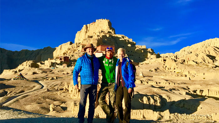 Our local Tibetan tour guide will tell you the mysterious history of Guge Kingdom.
What to Pack for Visiting Mount Namo Nanyi
If you are planning a trip to Tibet to visit the base camp of Namo Nanyi, then your packing list should include warm clothing, even if you are traveling in the summer months. Ngari is a cold and arid land, and while most of Tibet sees higher temperatures in the summer, in Ngari it can still get down to almost freezing at night.
Basic Packing Requirements for Mt. Namo Nanyi
● Strong hiking boots (even if you are not trekking as the terrain is rough and rocky around most of the area)
● Waterproof hiking pants and windproof outer pants
● Wind and waterproof jackets, as light as possible
● Good woolen socks and warm underwear
● Thermal shirt and pants for colder weather
● Several layers of medium thickness trekking t-shirts
● Waterproof rain shell
● Heavy Jacket for extreme cold weather
● Fleece or down jacket
● Warm gloves, preferably Gore-Tex
● A good warm hat or beanie
● Sunglasses for eye protection
● Trekking poles (if trekking)
● Medium Backpack
● Sleeping bag and tent (if camping)
● Torch or headlamp
● First aid kit
● Quick-drying alpine towels
● Water bottles
Travel Permits Needed
There are also the correct permits that are required for a trip to Ngari Prefecture in Tibet, as there is no permissible independent travel in Tibet. All travelers should be on a pre-arranged tour of Tibet with a registered Tibet travel agency, who will handle all of the permit applications on your behalf. The permits you need for this trip to Gurla Mandhata include:
Tibet Travel Permit - This is required for entry to Tibet and to travel around in the area of Lhasa.
Alien’s Travel Permit - Required for travel to the “unopened” areas of Tibet outside Lhasa, including Shigatse.
Restricted Areas Permit - This is often called the “Military Permit”, and is required for travel to military-sensitive areas such as Ngari, Nyingchi, etc.
Frontier Pass - While most tours will not actually cross the border out of China, the Frontier Pass is required for all tourists traveling in the areas of the Chinese border with India, Nepal, and Bhutan, which includes Mount Everest and Mount Kailash.
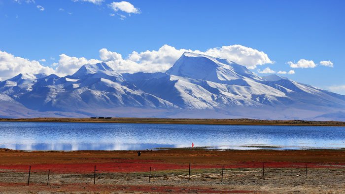 Snow-capped Mt.Namu Nanyi lying beside Lake Manasarovar
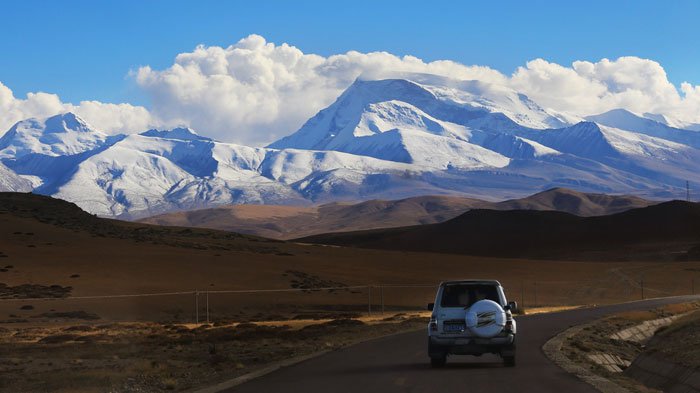 Majestic Mt. Namu Nanyi on the wayside
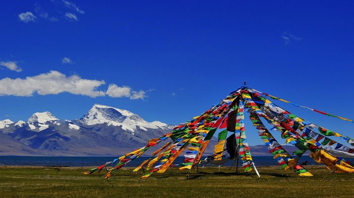 Breathtaking view of Mt. Namu Nanyi with colorful prayer flags under blue sky

Kham Sang is responsible and honest with more than six years of guide experience in Tibet.She has strong interpersonal skills and can communicate effectively with tourists.

.jpg)


0 Comment ON "Gurla Mandhata Expedition: ultimate guide to Mount Namo Nanyi climb"