Mount Everest History and Its Famous Explorers
Located on the border between Nepal and Tibet, Mount Everest (known in Tibetan as Qomolangma and in Nepali as Sagarmāthā) is the world’s highest mountain, and one of the most popular tourist destinations in the world. The border between Nepal and Tibet runs directly across the peak of the mountain, and the two base camps, north and south, are in Tibet and Nepal respectively. Far out from the nearest towns and villages, Mount Everest stands tall on the border, proud king of the mighty Himalayas.
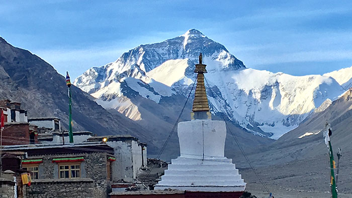 Mount Everest
Brief History of Mount Everest Expedition
As the highest peak in the world, the mountain soon attracted many explorers and mountaineers, who would spend many years attempting to scale this huge peak, and the first “official” expedition set off in 1921. Despite numerous attempts to reach the summit, it was not until 1953 that a British expedition finally managed to reach the top, a feat that has made them world famous.
At the time, Nepal did not allow entry to foreigners, and the first expeditions took on the mountain on the North Col from the Tibetan side. The first attempt reached a little over 7,000 meters before falling back, and the 1922 British expedition were the first climbers to reach above 8,000 meters on any mountain in the world. However, seven porters were killed on the descent, making them the first of many deaths on the mountain by climbing expeditions.
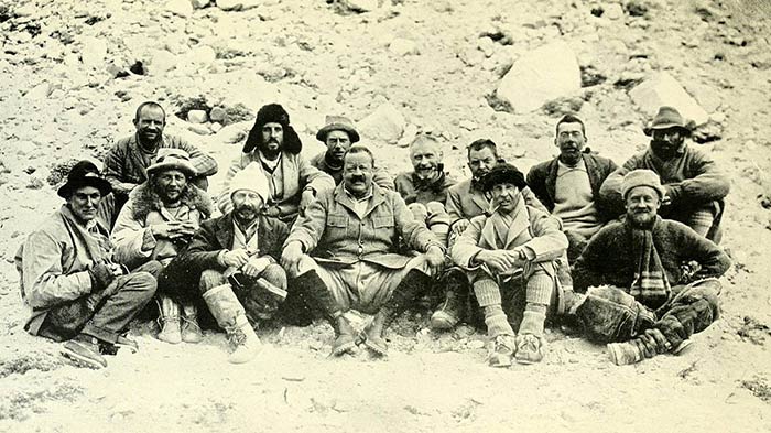 The 1922 British expedition were the first climbers to reach above 8,000 meters on any mountain in the world
In 1924, an expedition led by George Mallory and Andrew Irvine made an attempt to scale the infamous North Col to the summit. On June 8, the two climbers were seen above the team, making a push for the summit only 800 meters from the top when bad weather hit the mountain, engulfing the climbers completely. Mallory’s body was eventually found 8,155 meters up the mountain 75 years later, but that of Irvine has never been found, and it has never been established whether the two ever actually reached the summit. Since that fateful day, almost 300 people have died on the mountain, many of whose bodies were never recovered.
It was almost thirty years before the next British expedition was sent to the mountain, this time taking the southeast ridge route that had been climbed to a height of 8,595 meters the year before by one of the Sherpa guides during an expedition from Switzerland. The expedition, led by Colonel John Hunt, included the now-famous Sherpa guide Tenzing Norgay and New Zealand mountaineer, Edmund Hillary. On May 29, 1953, Hillary and Norgay made a final push up to the summit, and became the first known men to ever reach the peak of the world’s highest mountain.
Seven years later, on May 25, 1960, the Chinese expedition led by Wang Fuzhou Gonpo and Qu Yinhua made the first ascent to the summit using the dangerous and infamous North Col Route.
Geographical Formation of Mount Everest
Geographically speaking, Mount Everest, and the rest of the Himalayas, is relatively young as mountains go. Over 250 million years ago, the supercontinent of Pangaea broke apart, creating the main continental areas we roughly know today, and the continental tectonic plates. As recently as 65 million years ago, the Indian and Asian plates collided. The collision was caused by the movement of the Indian plate northwards at a rate of around fifteen centimeters a year, which caused huge ripples in the earth’s crust along the boundary of the Indian and Asian plates, some of which can be seen in satellite photography of Eastern Tibet and western Sichuan and Yunnan.
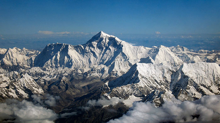 Himalayas
Over the course of millions of years, the Indian plate moved north, pushing the ground up and creating the mountain range known as the Himalayas, as well as the Karakoram Mountains of Pakistan, the Hindu Kush, and the Tien Shan Mountains of Northern China. This movement was also responsible for the lifting of the land now known as the Tibetan Plateau, which was shoved towards the sky in one giant piece as the Indian Plate pushed underneath the edge of the Asian Plate.
The Indian plate is still moving, according to geologists, at a rate of around 1.7 inches per year, towards the Eurasian Plate to the north. However, being of a greater size and with a stronger tectonic anchor, the Eurasian Plate refuses to budge, forcing the Indian Plate under it. Geologists have estimated that the Indian Plate will continue its movement north, covering around 1,000 kilometers in the next 10 million years.
How Do People Measure the Summit of Mount Everest?
One of the biggest disputes of the last century has been the actual official height of Mount Everest. After the initial estimate of 12,002 feet (8,840 meters) was revised in 1955 by an Indian survey to an actual height of 29,029 feet (8,848 meters), the Chinese survey of 1975 confirmed the height given by India as 8,848.13 meters, including the snow cape of the mountain.
In 1999, and American expedition to Everest, directed by Bradford Washburn, attached a satellite GPS (Global Positioning System) locator to the mountain at the highest rock point they could find. This GPS reading gave the American team a height of 8,850 meters, including a snow cape depth of one meter. This height has never been officially recognized, although it is still widely quoted in the United States as the “true” height of the mountain.
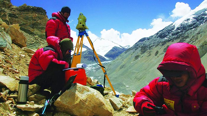 Chinese were measuring the summit of Mount Everest in 2015
However, in 2005, China was able to use modern techniques to measure the actual “rock height” of the mountain, and gave a confirmed result of 8,844.43 meters. Using more accurate geoid data and a better positioned GPS locator, as well as almost ideal weather conditions for the satellite link, the State Bureau of Surveying and Mapping and the Chinese Academy of Sciences together announced their new findings, stating that the depth of the snow cape on the mountain was actually 3.5 meters thick.
For years, the disagreement ensued as to the actual height, since China insisted it should be the rock height, and Nepal claimed the snow height was correct. It was not until 2010 that the agreement was made that the “official” height of Everest would include the snow cap at 8,848 meters, while Nepal would recognize the recorded “rock height” of the mountain by China as 8,844.43 meters.
Today, while the listed “official” height of the mountain according to the Royal Geographic Society is 8,848 meters, Nepal has set up a new survey to re-measure the height of the mountain following the 2015 earthquake. Scientists believe that, while the continuous shift of the Indian Plate is constantly pushing the Himalayas upwards by around 4mm per year (as well as in a northeasterly direction by around 3-6mm per year), the earthquake may have taken a few inches off the accurate recorded height.
The earthquake also destroyed the famous Hillary Step, an almost vertical rocky outcrop that once stood 12 meters high on the mountain’s southeast ridge. The outcrop was named after Sir Edmund Hillary, and British mountaineer, Tim Mosedale, who reached the summit of Everest on May 16, 2017, confirmed its disappearance.
Famous Mount Everest Explorers and Their Expeditions to Everest
The first famous explorers of Everest can be none other than Tenzing Norgay and Sir Edmund Hillary, the first climbers to officially reach the summit. However, while it was Hillary’s first attempt at the mountain, Norgay had already been up to more than 8,000 meters with a Swiss expedition the year before, and had been part of four other previous attempts to scale the mountain. Born in Nepal in 1914, he was originally named Namgyal Wangdi by his Tibetan parents. The name Tenzing Norgay - which means “wealthy fortunate follower of religion - was bestowed on him by the founder of the Rongbuk Monastery in Tibet, Ngawang Tenzin Norbu. Norgay went on to become the sirdar, or leader, of the Sherpa team on the successful 1953 expedition, which earned him the fame his new name had predicted.
The ill-fated expedition of 1924 has long been an unsolved mystery in the annals of Everest. Led by George Mallory and Andrew “Sandy” Irvine, the expedition started its climb on April 28. On June 6, after two failed attempts to reach the summit, Mallory and Irvine made their fateful attempt to get to the peak. The two climbers never returned, and the expedition packed up and left on June 11. Nine years later, the ice-axe belonging to Irvine was found near the First Step, and in 1999, the frozen and preserved body of George Mallory was found at a height of 8,159 meters, almost 600 meters from the summit. The body of Andrew Irvine was never found.
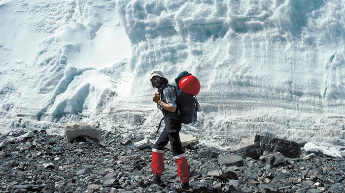 Reinhold Messner
One of the world’s all-time great climbers, Reinhold Messner, was the first person to reach the summit of Everest without using additional oxygen in 1978. Moreover, to cap that record, he did it again two years later, as a solo climb, again without supplemental oxygen tanks.
One of the most remarkable climbers to summit Everest is the octogenarian Japanese climber, Yuichiro Miura. His first record breaking summit of the mountain was done in 2003, aged 70, then again in 2008, at the age of 75. After being beaten by Nepali climber Min Bahadur Sherchan that same year, Miura went back to reclaim his title in 2013, and the grand old age of 80 years and 224 days. Miura was also the first person to ski down Everest, descending almost 4,200 feet from the South Col.
However, almost nothing beats the feat of famous Sherpa mountaineer, Apa Sherpa. Nicknamed “Super Sherpa”, this Nepalese mountaineer has reached the summit of Mount Everest a staggering 21 times. Although you could say that British nobleman, Sir Ranulph Twisleton-Wykeham-Fiennes, is just as amazing. The first explorer to reach both the North and the South Poles by surface means, Fiennes took on his “Third Pole” expedition in 2009, reaching the summit of Mount Everest and his own career as an explorer at the age of 65!
More Mount Everest Base Camp Travel Guide
 Mt.Everest Fact
- Everest Base Camp Nepal vs Everest Base Camp Tibet
- Mount Everest History and Its Famous Explorers
- The Difference of Mt.Everest in Nepal and Tibet
- Kathmandu to EBC Distance: how far and how to get to EBC in Nepal and Tibet from Kathmandu
- How Many Base Camps on Everest in Both Sides of Tibet and Nepal
 Everest Base Camp Tour Guide
- When is the Best Time to Visit Tibet Everest Base Camp in 2024
- When is the Best Time to Enjoy EBC Trek in Nepal
- The Best Hotel at Everest Base Camp in Tibetan Side
- Guide to Tibet Everest Base Camp Tour in Winter
- How to Get to Everest Base Camp (EBC) from Nepal?
- How to Get to Mount Everest Base Camp from Lhasa
- What Documents Do I Need for Everest Base Camp Tour in Tibet and Nepal?
 Everest Trekking Guide
- What to Pack for Everest Base Camp Trek
- Tingri to Everest Base Camp Trekking
- Everest Trek: Trekking Routes along The Gama Valley
- Everest Base Camp Trekking Maps in Tibet
- Ultimate Packing List for Everest Base Camp Trek in Tibet
- Best Trek in Nepal: Everest Base Camp Trek vs. Annapurna Circuit Trek
- Top 2 EBC Trekking Routes in Tibet
- EBC Trek in Tibet vs. EBC Trek in Nepal

Recommended Everest Base Camp Tour Packages
-
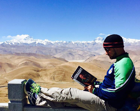 7 Days Lhasa to Kathmandu Overland Small Group Tour: Traverse from the North Side to the South Side of Mt.Everest for the Best of the Himalayas
Tour Route: Lhasa - Gyantse - Shigatse - Everest Base Camp - Gyirong - Kathmandu
From USD979 p.p
-
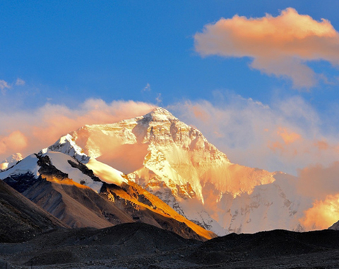 8 Days Lhasa to Everest Base Camp Small Group Tour: Marvel at Mt.Everest Real Close from 4 Different Viewing Platforms
Tour Route:Lhasa - Gyantse - Shigatse - Everest Base Camp - Shigatse - Lhasa
From USD939 p.p
-
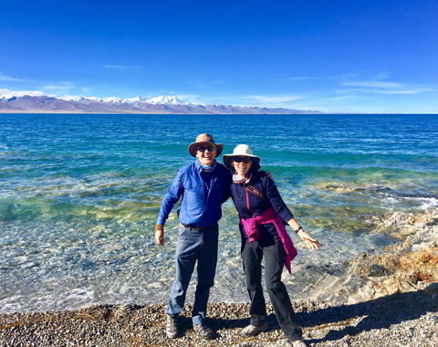 10 Days Lhasa to Everest Base Camp and Namtso Lake Small Group Tour
Tour Route:Lhasa - Gyantse - Shigatse - EBC - Shigatse - Lhasa - Namtso Lake - Damxung - Lhasa
From USD1289 p.p
-
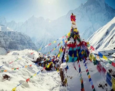 17 Days Nepal Everest Base Camp Trek Tour
Tour Route:Kathmandu - Phakding-Namche Bazaar-Tengboche- Dingboche- Lobuche-Gorakshep- Everest base camp-Kathmandu

.jpg)



0 Comment ON "Mount Everest History and Its Famous Explorers"