
Tibet City Maps
June,10 2023 BY Cindy Xiao
0 COMMENTS
Tibet, also known as the “third pole”, is the highest region in the world with an average elevation of 4,300 meters. It is commonly known as the "Roof of the World". Tibet is undoubtedly a heaven with its unparalleled scenic beauty and unmatched cultural extravagance.
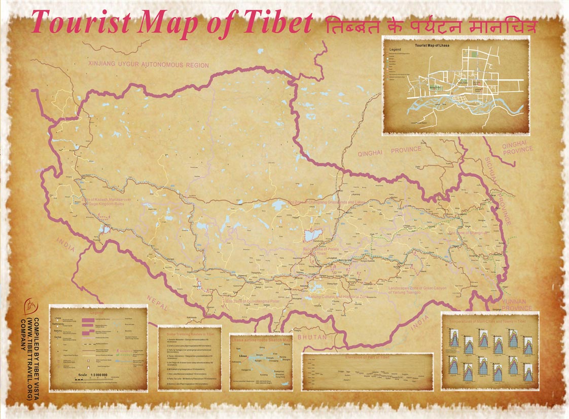
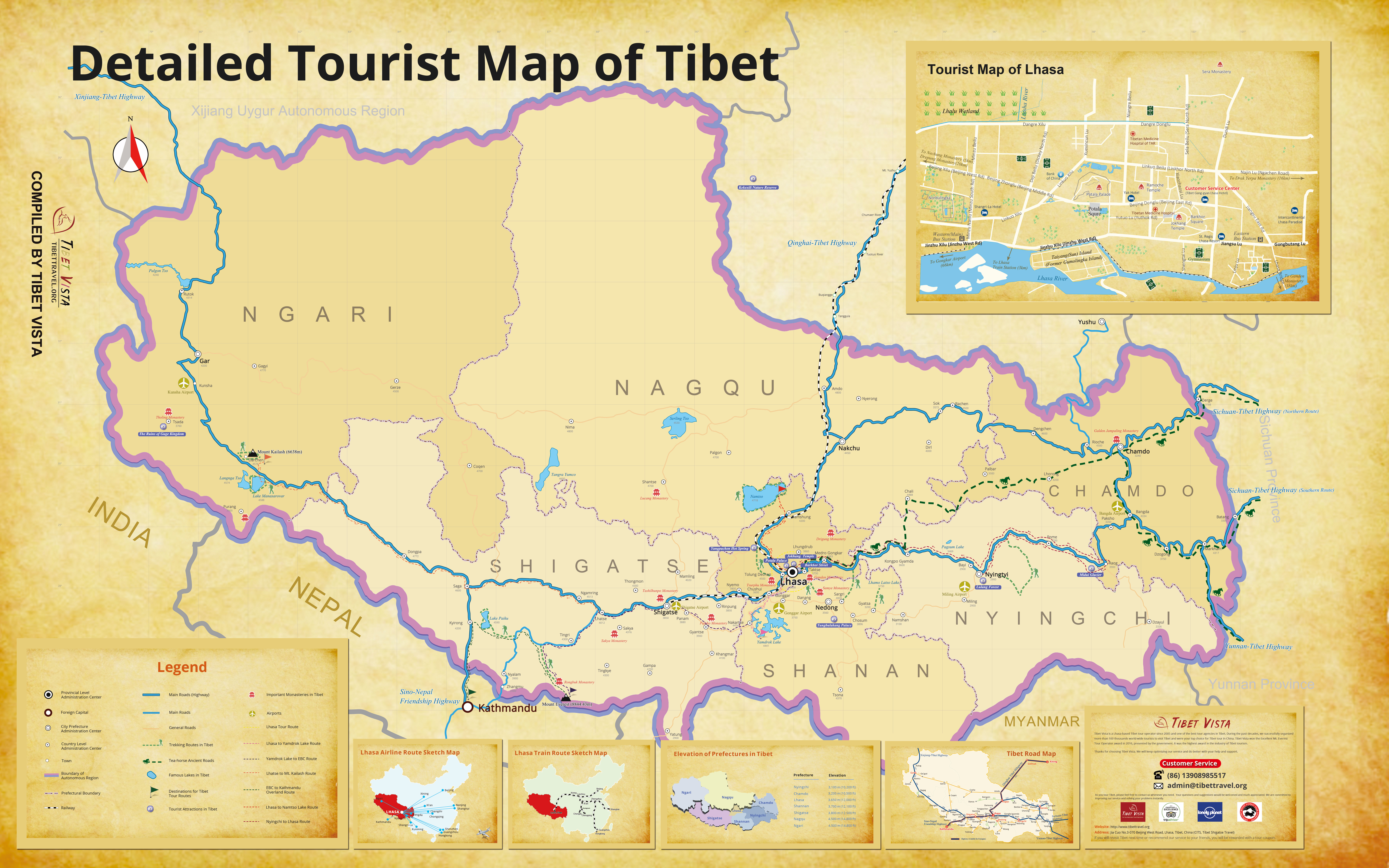
Tibet is made up of 1 city (Lhasa City) and 6 prefectures (Shigatse, Lhoka, Ngari, Nagchu, Nyingchi, Chamdo). Now please check the detailed city maps of Tibet.
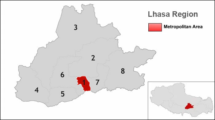
| No. | Geographic Names | Population | Area(km²) | Density |
| 1 | Chengguan District | 279,074 | 525 | 531.56 |
| 2 | Doilungdeqen County | 52,249 | 2,672 | 19.55 |
| 3 | Lhunzhub County | 50,246 | 4,100 | 12.25 |
| 4 | Damxung County | 46,463 | 10,234 | 4.54 |
| 5 | Nyemo County | 28,149 | 3,266 | 8.61 |
| 6 | Quxu County | 31,860 | 1,624 | 19.61 |
| 7 | Dagze County | 26,708 | 1,361 | 19.62 |
| 8 | Maizhokunggar County | 44,674 | 5,492 | 8.13 |
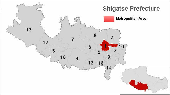
| No. | Geographic Names | Population | Area(km²) | Density |
| 1 | Shigatse City | 90,000 | 3,654 | 25 |
| 2 | Namling County | 70,000 | 8,113 | 9 |
| 3 | Gyantse County | 60,000 | 3,859 | 16 |
| 4 | Tingri County | 50,000 | 13,859 | 4 |
| 5 | Sagya County | 40,000 | 7,510 | 5 |
| 6 | Lhatse County | 50,000 | 4,505 | 11 |
| 7 | Ngamring County | 50,000 | 20,105 | 2 |
| 8 | Xaitongmoin County | 40,000 | 13,960 | 3 |
| 9 | Bainang County | 40,000 | 2,806 | 14 |
| 10 | Rinbung County | 30,000 | 2,123 | 14 |
| 11 | Kangmar County | 20,000 | 6,165 | 3 |
| 12 | Dinggy County | 20,000 | 5,816 | 3 |
| 13 | Zhongba County | 10,000 | 43,594 | 0 |
| 14 | Yadong County | 10,000 | 4,306 | 2 |
| 15 | Gyirong County | 10,000 | 9,009 | 1 |
| 16 | Nyalam County | 10,000 | 7,903 | 1 |
| 17 | Saga County | 10,000 | 12,411 | 1 |
| 18 | Gamba County | 10,000 | 3,936 | 3 |
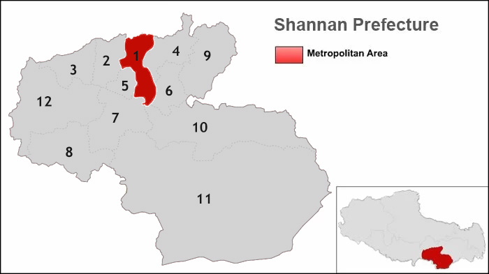
| No. | Geographic Names | Population | Area(km²) | Density |
| 1 | Nedong County | 60,000 | 2,211 | 46 |
| 2 | Zhanang County | 40,000 | 2,157 | 19 |
| 3 | Gonggar County | 50,000 | 2,283 | 21 |
| 4 | Sangri County | 20,000 | 2,634 | 8 |
| 5 | Qonggyai County | 20,000 | 1,030 | 19 |
| 6 | Qusum County | 20,000 | 1,936 | 10 |
| 7 | Comai County | 10,000 | 4,530 | 2 |
| 8 | Lhozhag County | 20,000 | 5,570 | 4 |
| 9 | Gyaca County | 20,000 | 4,493 | 5 |
| 10 | Lhunze County | 30,000 | 9,809 | 3 |
| 11 | Cona County | 10,000 | 34,979 | 0 |
| 12 | Nagarz County | 30,000 | 8,109 | 5 |
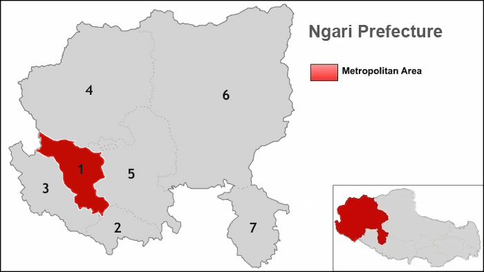
| No. | Geographic Names | Population | Area(km²) | Density |
| 1 | Gar County | 8,334 | 13,179 | 0.8 |
| 2 | Burang County | 9,058 | 24,602 | 0.4 |
| 3 | Zanda County | 7,179 | 18,083 | 0.6 |
| 4 | Rutog County | 9,485 | 77,096 | 0.1 |
| 5 | Gegyai County | 15,875 | 46,117 | 0.2 |
| 6 | Gerze County | 22,284 | 135,025 | 0.1 |
| 7 | Coqen County | 14,378 | 22,980 | 0.4 |
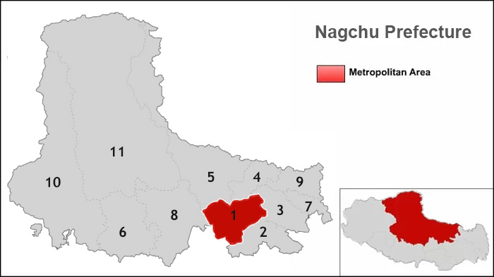
| No. | Geographic Names | Population | Area(km²) | Density |
| 1 | Nagchu County | 80,000 | 16,195 | 5 |
| 2 | Lhari County | 20,000 | 13,056 | 2 |
| 3 | Biru County | 40,000 | 11,680 | 3 |
| 4 | Nyainrong County | 30,000 | 9,017 | 3 |
| 5 | Amdo County | 30,000 | 43,411 | 1 |
| 6 | Xainza County | 20,000 | 25,546 | 1 |
| 7 | Sog County | 30,000 | 5,744 | 5 |
| 8 | Baingoin County | 30,000 | 28,383 | 1 |
| 9 | Baqen County | 40,000 | 10,326 | 4 |
| 10 | Nyima County | 20,000 | 72,499 | 0 |
| 11 | Shuanghu County | 10,000 | 116,637 | 0 |
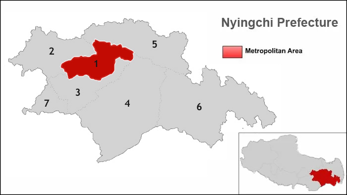
| No. | Geographic Names | Population | Area(km²) | Density |
| 1 | Nyingchi County | 30,000 | 8,563 | 4 |
| 2 | Gongbo'gyamda County | 30,000 | 12,960 | 2 |
| 3 | Mainling County | 20,000 | 9,507 | 2 |
| 4 | Medog County | 10,000 | 31,394 | 0 |
| 5 | Bome County | 30,000 | 16,770 | 2 |
| 6 | Zayu County | 20,000 | 31,305 | 1 |
| 7 | Nang County | 10,000 | 4,114 | 2 |
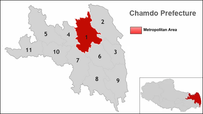
| No. | Geographic Names | Population | Area(km²) | Density |
| 1 | Chamdo County | 100,000 | 10,794 | 9 |
| 2 | Jomda County | 70,000 | 13,164 | 5 |
| 3 | Gonjo County | 40,000 | 6,323 | 6 |
| 4 | Riwoqe County | 40,000 | 6,355 | 6 |
| 5 | Dengqen County | 60,000 | 12,408 | 5 |
| 6 | Zhag'yab County | 50,000 | 8,251 | 6 |
| 7 | Baxoi County | 40,000 | 12,336 | 3 |
| 8 | Zogang County | 40,000 | 11,837 | 3 |
| 9 | Markam County | 70,000 | 11,576 | 6 |
| 10 | Lhorong County | 40,000 | 8,048 | 5 |
| 11 | Banbar County | 30,000 | 8,774 | 3 |

As a huge fan of traveling myself, I'm desperate to share my travel experience as well as professional travel advice with you.

.jpg)



0 Comment ON "Tibet City Maps"