

.jpg "Tibetan Local Travel Agency")


Facts about the Friendship Highway from Lhasa to Kathmandu Overland
Lhasa and Kathmandu attract tourists from all over the world for many of the same reasons. Both are places with ancient culture and unique scenic beauty. It's natural for travelers to want to visit both destinations in one trip, and the Friendship Highway makes it easy to do. Stretching overland through the region's natural wonders, here are some facts about the Friendship Highway from Lhasa to Kathmandu.
![]() 1. Basic Information about the China-Nepal Friendship Highway
1. Basic Information about the China-Nepal Friendship Highway
![]() 2. Lhasa to Kathmandu Overland Road is One of the Highest Roads in the World
2. Lhasa to Kathmandu Overland Road is One of the Highest Roads in the World
![]() 3. Lhasa to Kathmandu Overland is One of the Most Picturesque Roads in the World
3. Lhasa to Kathmandu Overland is One of the Most Picturesque Roads in the World
![]() 4. Lhasa to Kathmandu Overland is One of the World's Most Popular Overland Trips
4. Lhasa to Kathmandu Overland is One of the World's Most Popular Overland Trips
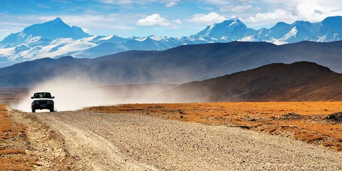
![]() 5. Lhasa to Kathmandu Overland Road Condition is Well Paved
5. Lhasa to Kathmandu Overland Road Condition is Well Paved
![]() 7. It's Available all Year Around to Take the Lhasa to Kathmandu Overland Trip
7. It's Available all Year Around to Take the Lhasa to Kathmandu Overland Trip
![]() 8. Lhasa to Kathmandu Overland route has a vast altitude difference
8. Lhasa to Kathmandu Overland route has a vast altitude difference
![]() 9. Join in Our Fully Upgraded Lhasa to Kathmandu Overland Trip
9. Join in Our Fully Upgraded Lhasa to Kathmandu Overland Trip
1. Basic Information about the China-Nepal Friendship Highway
Having deep, shared roots in history and culture, it's only natural that a modern highway would connect Tibet and Nepal. The Friendship Highway, also known as the China-Nepal Highway, is an 806 km route that connects the capital of Tibet province, Lhasa, with the China-Nepal border.
 The Route Map of Lhasa to Kathmandu Overland Tour
The Highway actually follows two separate roads. It follows the Lhasa River from Lhasa before turning west through the Yarlung Valley to Shigatse. The road continues to Lhatse before it forks into two routes. The main Friendship Highway turns south for the Sino-Nepal Friendship Bridge between Zhangmu and Kodari. The other route takes a scenic journey west through Saga and then turns south to the Gyirong Border.
2. Lhasa to Kathmandu Overland Road is One of the Highest Roads in the World
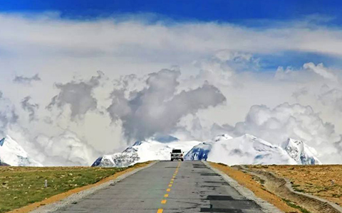
The Lhasa to Kathmandu Overland Road is a testament to human engineering as it winds through some of the world's highest elevations. It is renowned as one of the highest roads in the world and leaves travelers breathless as it passes through challenging mountain passes at over 5,000m.
The first and highest of these passes is Gyatsola Pass, which sits at an impressive 5,280m. Located in the Himalayan range, it is a physical and mental challenge with the thin air and steep ascent. Lalung La Pass sits at 5,050 meters and is another important milestone along the route. Less mentioned, but no less impressive, is Tong La Pass at 5,150 meters. Together, they mark the passage through the Himalayan range and are a breathtaking highlight of the high-altitude section of the overland Lhasa to Kathmandu road.
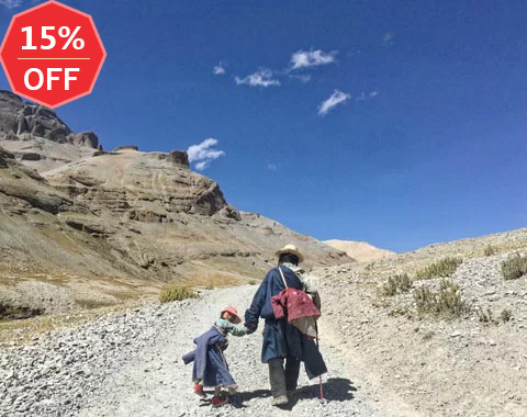
3. Lhasa to Kathmandu Overland is One of the Most Picturesque Roads in the World
The Lhasa to Kathmandu overland route passes through some of the most picturesque natural beauty in the world. Right from the start is the Gampala pass, where the turquoise Yamdrok Lake can be seen ringed by snow-capped mountains, including Holy Mount Nyenchen Khangsar towering at 7191m. On the same leg of the journey, you'll see Korola Glacier, the largest in Tibet, and the ancient city of Gyantse.
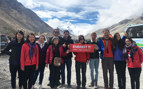
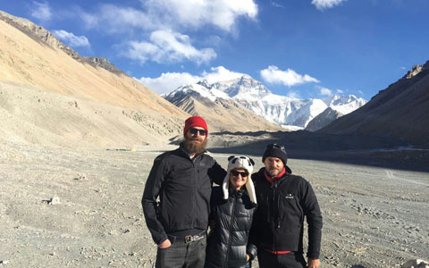
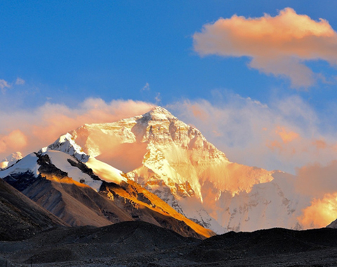
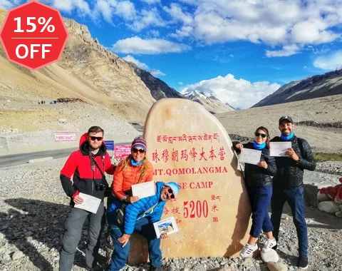
Through the Himalayan range are awe-inspiring views of the famous mountains, including the giant Mount Everest. Spending the night at Everest Base Camp, you'll be able to see the mountain in the golden hues of sunset before the Milky Way emerges at nightfall. The scenery evolves throughout this area, with the mountain peaks soaring in contrast to the forests, waterfalls, and bottomless canyons.
 Enjoy the majestiv Mount Everest on the way from Lhasa to Kathmandu
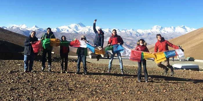
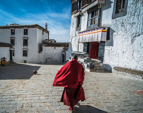
The route also includes many important cultural locations. Lhasa has the iconic Potala Palace and famous monasteries such as Drepung Monastery and Sera Monastery. Simila Pass is a place to hang prayer flags. And, in the Himalayas is the Rongbuk Monastery, the highest in the world. All are places that show off how Tibetan culture has integrated itself with the beautiful natural surroundings.
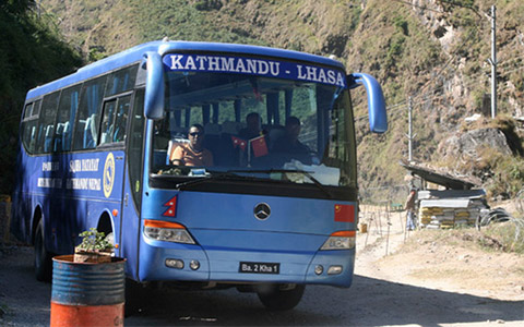
4. Lhasa to Kathmandu Overland is One of the World's Most Popular Overland Trips
The Lhasa to Kathmandu Overland tour is one of the most sought-after and popular overland adventures worldwide. It attracts nature lovers, adventure seekers, and travelers seeking a deep cultural experience. Traveling overland across the expanse of Tibet and through the Himalayas combines all these experiences into a unique journey.
Making the journey first involves spending time in Lhasa to adjust to the high altitude. While there, you'll be treated to many of the most iconic sites in Tibet, like the Potala Palace and Jokhang Temple, while also experiencing life among local Tibetans in Barkhor Street or a traditional teahouse. Natural scenery is on full display at places like Yamdrok Lake, and the steep ascents through the high-altitude passes of the Himalayas will fill you with a sense of adventure.
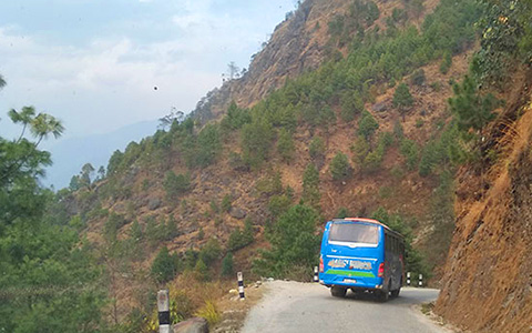
5. Lhasa to Kathmandu Overland Road Condition is Well Paved
Most of the route between Lhasa and Kathmandu is in very good condition with paved and well-maintained roads. The road between Lhasa and Shigatse is smooth, allowing the distances to be covered quickly. Continuing on to Lhatse is much the same, with a well-marked highway in modern condition.
 The road condition of Lhasa to Kathmandu Overland tour is quite good.
The trip from Tingri south to Everest Base Camp is a little slower. The winding, gravel road is safe but takes more time to pass over. Road conditions get better after EBC on the way to the Nepal border. A paved asphalt road extends right to the crossing point, but on the Nepal side, things become rough again. Taking time on the last part of Kathmandu is no problem, though. The slower speed gives time to take in the new scenery at a relaxed pace.
6. Lhasa to Kathmandu Overland Road is Also one of the Most Popular Way for Motorbiking Cycling Adventurers
The ultimate adventure ride is motorbiking or cycling from Lhasa to Kathmandu. The winding roads through mountain passes and serene valleys are an ideal backdrop for a two-wheeled adventure. A motorbike or bike trip also offers an intimate and more immediate connection with the landscape.
 Lhasa to Kathmandu Cycling tour via the Everest Base Camp in Tibet
Biking the overland route is a challenging and flexible way to make the journey. It takes at least 16-19 days to cycle, including some time in Lhasa, to acclimatize. The route includes visiting EBC at 5,200m and some demanding high-altitude stretches through Lhatse, Tingri, and Zhaxizong. It's not an easy trip to make, but the sense of accomplishment is much greater.
7. It's Available all Year Around to Take the Lhasa to Kathmandu Overland Trip
The overland trip from Lhasa to Kathmandu can be done all year round, but different seasons offer a different experience. Most of the trip is through Tibet, so the weather there has the biggest impact on travel conditions. April to mid-June and September to November are the most popular times to take the overland journey. During these times, Tibet has very stable and mild weather. Temperatures are warm, up to the low 20s, and rain is minimal. It makes for comfortable traveling and excellent chances for clear mountain views.
July and August are the monsoon season. Slippery roads can slow travel, but summer rains fall primarily at night, so views of the landscape during the day remain clear. The main caution during this time is potential landslides near the Gyirong border.
Winter, from November to February, is a budget-friendly time to go. Tourism in the region is at its lowest, so it is possible to find good deals on accommodations and tour packages. The winter landscapes with snow-covered mountains and frozen lakes can also be breathtaking. Temperatures can be very cold, though, dropping well below 0°c. Icy roads and snowfall can also make some passes inaccessible.
8. Lhasa to Kathmandu Overland route has a vast altitude difference
Traveling from Lhasa to Kathmandu overland involves passing through a wide range of different altitudes. Lhasa is at 3,650 meters above sea level, already very high. From there to Shigatse, the road ascends to 4,790m at the Gampala Pass before descending to Shitgatse at 3,900m.
Next is the climb through the Himalayas through the Gawu La Pass at 5,198m, a visit to the highest monastery in the world, Rongbuk Monastery, at 5,154m, and then Everest Base Camp at 5,200m. The high altitudes of the Himalayas continue with other mountain passes over 5,000m before the descent to the Gyirong Valley. Elevations there range from around 2,700 to 3,500 meters. After crossing the border, there is another slow descent to Kathmandu, where the trip ends at around 1,400 meters. Along the way, you'll have spanned around 4,000 meters of elevation.
 Witness Mt. Everest, the world's highest peak, from Gawula Pass at 5,189 meters above sea level.
9. Join in Our Fully Upgraded Lhasa to Kathmandu Overland Trip
Our fully upgraded 7-Day Lhasa to Kathmandu Overland Small Group Tour is an epic journey with the best tour services available. Join the tour to experience the amazing overland trip led by the most celebrated Tibetan guide and most experienced driver.
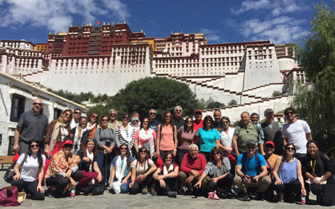
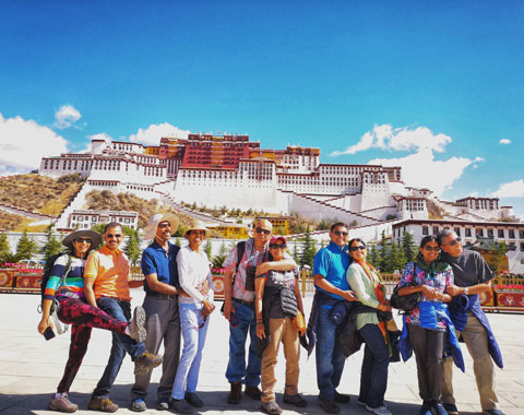
You'll be welcomed in Lhasa with a 5-star dinner and can relax at one of the most luxurious hotels in the city, such as the Luxury St. Regis Lhasa Resort, Intercontinental Lhasa Paradise, or Shangri-La Lhasa Hotel. Then, you'll have time to explore Lhasa while adjusting the altitude with VIP tour transfers between the best sites like the Potala Palace and Drepung Monastery.
 Start the epic overland tour from Lhasa to Kathmandu from the Potala Palace
A spacious and comfortable vehicle will carry you through the overland journey. Along the way, there will be time to take in sites such as Holy Yamdrok Lake, Everest Base Camp, and Rongbuk Monastery. At each stage, you'll stay in the best available hotel and eat at popular eateries for a great experience of local cuisine. Finally, after crossing the border, you'll be met with a jeep for transfer to Kathmandu. All your luggage will be taken care of, and you'll be able to relax and appreciate the scenery.
Conclusion
The Friendship Highway is a marvel that makes the overland trip from Lhasa to Kathmandu possible for anyone. Nowhere else in the world is it possible to see such vast ranges of remote wilderness as on the journey along this route. Experience the wonders of Tibet and Nepal with our expertly crafted tours. Contact us for more information or to book your trip now.

Energetic, responsible and reliable, Sonam is a guide with more than seven years experience informing visitors about heritage sites and attractions places in Tibet.
Related Articles & Posts

Most Popular Tibet Tour Packages
-
Lhasa - Gyantse - Shigatse - Everest Base Camp - Shigatse - Lhasa
USD939
View Details -
Lhasa - Gyantse - Shigatse - E.B.C - Saga - Kailash Trek - Darchen - Lake Manasarovar - Saga - Gyirong - Tingri - Lhasa
USD2059
View Details -
10 Days Lhasa to Everest Base Camp and Namtso Lake Small Group Tour
Lhasa - Gyantse - Shigatse - EBC - Shigatse - Lhasa - Namtso Lake - Damxung - Lhasa
USD1289
View Details -
8 Days Driving Across Himalaya Overland Adventure from Kathmandu to Lhasa
Kathmandu - Gyirong - Everest Base Camp - Tingri - Shigatse - Gyantse - Lhasa
USD1069
View Details -
4 Days Lhasa Impression Small Group Tour: Explore the Heart of Tibet and Mingle with the Locals
Lhasa
USD509
View Details -
Lhasa - Gyantse - Shigatse - Everest Base Camp - Gyirong - Kathmandu
USD979
View Details -
Lhasa - Gyantse - Shigatse- Lhasa
USD799
View Details -
13 Day Lhasa, Mt. Everest, Mt. Kailash, Lake Manasarovar and Kathmandu Adventure Tour
Lhasa - Gyantse - Shigatse - EBC - Saga - Darchen - Kailash Trek - Darchen - Saga - Gyirong - Kathmandu
USD2059
View Details