Everest Base Camp Trekking Maps in Nepal
As is known to many people, Nepal is one of countries perfect for trekking. With 8 of the top ten mountain peaks in the world, Nepal owns unique advantages to attract numerous adventurous mountaineers and hikers. Among all the well-known trek routes in Nepal, the one runs to the Everest Base Camp is quite popular, followed by thousands of people every year, due to its rich history and spectacular views. Here we provide you with the detailed Everest Base Camp trekking maps in Nepal.
Where is Everest Base Camp located in Nepal?
As Mount Everest, the highest peak in the world, is co-owned by China and Nepal, there are actually two Everest Base Camps located at the opposite sides of the peak respectively. The Everest Base Camp in Nepal side, also called South Base Camp, is in the south side of the Mt. Everest. At an altitude of 5,364m, it is situated in the Sagarmatha National Park of Nepal. Use the following map to get a better understanding about the location of the Everest Base Camp in Nepal.
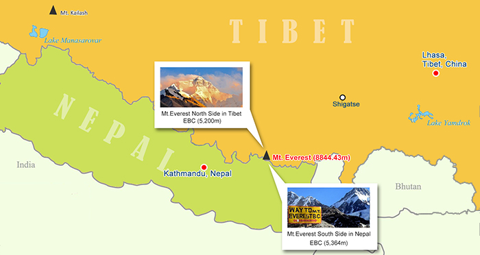 (Simple click to enlarge the map)
Location of Everest Base Camp Map
Trekking Maps of Everest Base Camp in Nepal
Normally, tourists would firstly fly to Lukla Airport from Kathmandu, before starting the arduous trek to the Everest Base Camp from Lukla. Although there are alternatives to trek to Lulka, these routes take more time and are less popular. Therefore, to save more energy for the hard trek to EBC, many people choose to fly to Lukla. From Lukla, there are several trekking routes leading to the camp, and each features different durations, scenery attractions and difficult levels. Tourists are advised to choose the suitable one based on an overall consideration.
Route 1: Lulka to Everest Base Camp Trekking Map
The route is the classic one designed for most trekkers with average physical fitness and good health. Starting at Lukla, the whole trail passes through Phakding, Namche Bazaar, Dingboche, Lobuche, Gorak Shep and finally ends at Everest Base Camp. It is recommended to take two rest days respectively at Namche Bazaar and Dingboche, for proper altitude acclimatization. Basically it takes about 10 days to complete the whole trek journey.
As for the village of Gorak Shep, it will be your base to visit the Everest Base Camp. There are three lodges and a small frozen lake in Gorak Shep. By climbing the hill behind the lodge called Kala Patthar (5,643 m), you can enjoy great views of Mt. Everest and the surrounding mountains.
700.jpg) Route 1: Lulka to Everest Base Camp Trekking Map
Route 1: Lulka to Everest Base Camp Trekking Map
Trekking Route: Lulka (2,860m) - Phakding (2,640m)- Namche Bazaar (3,438m)- Dingboche (4,260m) - Duglha (4,600m) - Lobuche(4,940m) - Gorak Shep (5,160m) - Everest Base Camp (5,364m)
Start: Lulka (2,860m)
End: EBC (5,364m)
Highest Point: EBC (5,364m)
Distance: 59km trekking
Duration: 9-10 Days
Best Time: September to November
Difficulty: Medium to difficult
Permits: Passport; Sagarmatha National Park Entry Permit
Accommodation: trekking lodge; camping
Food: Self-sufficient
Join in Nepal Everest Base Camp Trek Tours
Route 2: Lulka to Everest Base Camp Trekking Map via Gokyo Valley
This route is for someone who is looking for more challenges and wishes to take in the most undisturbed natural mountain sceneries along the way to Everest Base Camp. Following the same trail as Route 1 until Namche Bazaar, you will turn to the other way leading to the Gokyo Valley. From Gokyo Valley, it will take another 3 days to pass through Thagnak, Cho La Pass and Dzongla, before joining the trail of Route 1 at Lobuche, and finally get to the camp.
Situated in the west of Khumbu region, Gokyo Valley boasts breathtaking views with abundant pastures and turquoise glacial lakes. The highlight during this part of trek to Gokyo Valley is the Goky Ri (5,483m), the perfect site to see the four 8,000-meters peaks: Mount Everest, Lhotse, Cho Oyu and Makalu.
700.jpg) Route 2: Lulka to Everest Base Camp Trekking Map via Gokyo Valley
Route 2: Lulka to Everest Base Camp Trekking Map via Gokyo Valley
Trekking Route: Lulka (2,860 m)- Phakding (2,640m) -Namche Bazaar (3,438m) - Machhermo (4,470m) Gokyo (4,800m)- Thagnak (4,750m) - Cho La Pass (5,367m) - Dzongla (4,843 m) - Lobuche(4,940m) - Gorak Shep (5,160m) - Everest Base Camp (5,364m)
Start: Lulka (2,860m)
End: EBC (5,364m)
Highest Point: Goky Ri (5,483m)
Distance: 86km trekking
Duration: 12-13 Days
Best Time: September to November
Difficulty: Difficult
Permits: Passport; Sagarmatha National Park Entry Permit
Accommodation: trekking lodge; camping
Food: Self-sufficient
>> Read more about Guide to Gokyo Cho-la Pass EBC Trek for Experienced Trekkers in Nepal
Route 3: Lulka to Tengboche Monastery Trekking Map
This trek is for people who have planned a short trek tour and are also physically fit. Instead of the Everest Base Camp, the destination of this trek is Tenboche, a popular Tibetan Buddhist monastery, where you can Buddhist monks and observe their every day practices. Though located at an altitude of 3,860m, quite lower than Everest Base Camp, Tenboche Monastery is one of the perfects sites to appreciate the panoramic view of Himalayan Mountains. On the way, you will walk through a distinctive Sherpa village of Khumjung and see their unique culture and lifestyle.
700.jpg) Route 3: Lulka to Tengboche Monastery Trekking Map
Route 3: Lulka to Tengboche Monastery Trekking Map
Trekking Route: Lulka (2,860 m)- Phakding (2,640m) - Namche Bazaar (3,438m) - Khumjung (3,780m) - Tengboche (3,860m)
Start: Lulka (2,860m)
End: Tengboche (3,860m)
Highest Point: Tengboche (3,860m)
Distance: 27km trekking
Duration: 4-5 Days
Best Time: September to November
Difficulty: Medium
Permits: Passport; Sagarmatha National Park Entry Permit
Accommodation: trekking lodge; camping
Food: Self-sufficient
Join in Nepal Everest Base Camp Trek Tours
In conclusion, trekking to the Everest Base Camp in Nepalese side can be more complex than you imagine. To choose the best appropriate route for yourself, you may need to study more information apart from the abovementioned, before set off for your trek journey. Besides, trekking to the Everest Base Camp in Tibetan side is also worth your try, as it enables you to enjoy a different mountain landscape with exotic Tibetan culture.
More Mount Everest Base Camp Travel Guide
 Mt.Everest Fact
- Everest Base Camp Nepal vs Everest Base Camp Tibet
- Mount Everest History and Its Famous Explorers
- The Difference of Mt.Everest in Nepal and Tibet
- Kathmandu to EBC Distance: how far and how to get to EBC in Nepal and Tibet from Kathmandu
- How Many Base Camps on Everest in Both Sides of Tibet and Nepal
 Everest Base Camp Tour Guide
- When is the Best Time to Visit Tibet Everest Base Camp in 2024
- When is the Best Time to Enjoy EBC Trek in Nepal
- The Best Hotel at Everest Base Camp in Tibetan Side
- Guide to Tibet Everest Base Camp Tour in Winter
- How to Get to Everest Base Camp (EBC) from Nepal?
- How to Get to Mount Everest Base Camp from Lhasa
- What Documents Do I Need for Everest Base Camp Tour in Tibet and Nepal?
 Everest Trekking Guide
- What to Pack for Everest Base Camp Trek
- Tingri to Everest Base Camp Trekking
- Everest Trek: Trekking Routes along The Gama Valley
- Everest Base Camp Trekking Maps in Tibet
- Ultimate Packing List for Everest Base Camp Trek in Tibet
- Best Trek in Nepal: Everest Base Camp Trek vs. Annapurna Circuit Trek
- Top 2 EBC Trekking Routes in Tibet
- EBC Trek in Tibet vs. EBC Trek in Nepal

Recommended Nepal Everest Base Camp Tour Packages
-
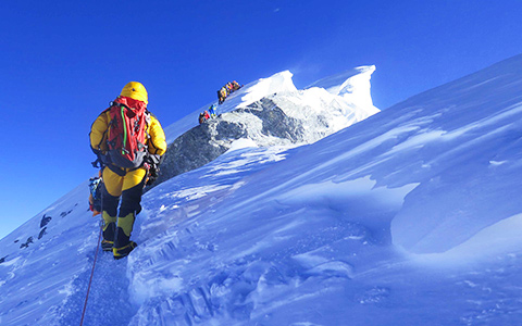 Mount Everest Climbing Expedition in Nepal
Tour Route:Kathmandu - Lukla - Phakding - Namche Bazaar - Tengboche - Dingboche - Duglha - Lobuche - Everest Base Camp - Mount Everest - Lukla - Kathmandu
-
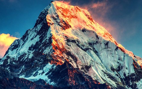 10 Days Everest Panorama View Trek Tour
Tour Route:Kathmandu - Lukla- Phakding- Namche Bazaar- Khumjung- Tengboche- Monjo- Kathmandu
-
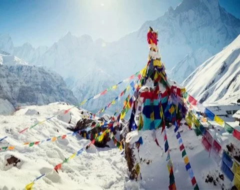 17 Days Nepal Everest Base Camp Trek Tour
Tour Route:Kathmandu - Phakding-Namche Bazaar-Tengboche- Dingboche- Lobuche-Gorakshep- Everest base camp-Kathmandu
-
 26 Days Everest Panoramic Trek in both Nepal and Tibet
Tour Route:Lhasa - Gyantse - Everest Base Camp - Gyirong Border - Rasuwagadhi - Kathmandu - Lukla - Phakding - Namche Bazaar - Everest Base Camp - Lukla - Kathmandu

.jpg)


0 Comment ON "Everest Base Camp Trekking Maps in Nepal"