12 Days Jomolhari Trek
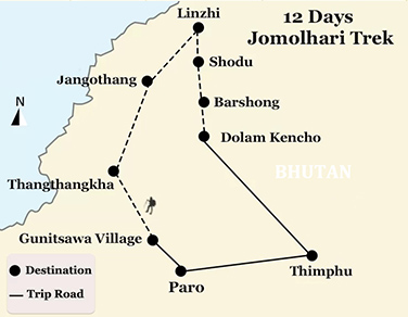
(BTT006) Paro - Gunitsawa Village - Thangthangkha - Jangothang - Linzhi - Shodu - Barshong - Dolam Kencho - Thimphu - Paro
-
Tour Type:
Escorted by private guide and vehicle; leave 365 days a year!
-
Trip Level:
Moderate - suitable for ones with average level fitness, family with kids bigger than 12 yrs.
-
Trip Level Guide:
- Easy - suitable for all level of fitness, family with kids and senior groups.
- Moderate - suitable for ones with average level fitness, family with kids bigger than 12 yrs.
- Moderate to Strenous - suitable for ones physically fit; have experiences of high altitude trek.
- Strenuous: suitable for adventures and individual with physically fit and healthy.
-
Season:春
Spring夏
Summer秋
Autumn冬
Winter
Overview
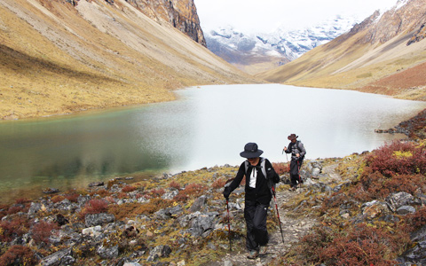
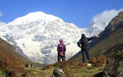
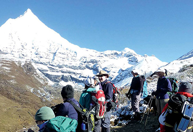
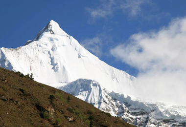
As an extension of the Jomolhari Loop Trek, the Jomolhari Trek enjoys great popularity all over the world with its wide range of landscapes, fauna and flora. Besides, it takes you to Jomolhari Basecamp the best basecamp in the Himalaya region and offers you a fantastic panoramic view of Mount Jomolhari and other Himalaya Mountains.
Max Elevation: 5,000 m
Min Elevation: 2,500 m
Difficulty: Medium
Best Season: April, May, June, September, October, November
Duration: 12 Days
At a Glance
Day 1Paro Arrival (2,200 m)
Day 2Paro (2,200 m) - Gunitsawa Village (2,930 m)
Day 3Gunitsawa (2,930 m) - Thangthangkha (3,575 m)
Day 4Thangthangkha (3,575 m) - Jangothang (4,044 m)
Day 5Jangothang Halt (4,044 m)
Day 6Jangothang (4,044 m) - Linzhi (3,880 m)
Day 7Linzhi (3,880 m) - Shodu (4,080 m)
Day 8Shodu (4,080 m) - Barshong (3,720 m)
Day 9Barshong (3,720 m) - Dolam Kencho (3,290 m) - Thimphu (2,334 m)
Day 10Thimphu (2,334 m)
Day 11Thimphu (2,334 m) - Paro (2,200 m)
Day 12Paro (2,200 m), Departure
Day to Day Itinerary
Day 1: Paro Arrival (2,200 m)
Arrival by plane or driving to Paro from Phuntsholing after crossing the India-Bhutan Border. Sighting according to the arrival time.
Stay overnight in Paro hotels
Day 2: Paro (2,200 m) - Gunitsawa Village (2,930 m)
Distance: 16 km
Ascent: Ascent 630 m
Camp Altitude: 2,890 m
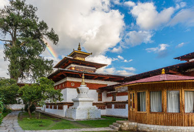
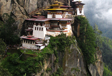
Drive to Gunitsawa village from Paro. Tourist bus stops temporarily at the intermediate stations where the scenery sites locate. Morning visit of Kyichu Lhakhang, the temple built in 8th century by Tibetan king Songtsen Gampo. Climb to Taktsang Gompa known as Tiger's Nest, the most venerated and holy place in Bhutan and take an overlook of the valley from a steep cliff.
After lunch the bus will drive you to Drukyel Dzong, the place used to be the starting point of this trek. Visit the ruins of the old dzong and further ascend to military camp of Gunitsawa on the newly built road. Camp the first night just above military camp.
Camping at Gunitsawa
Day 3: Gunitsawa (2,930 m) - Thangthangkha (3,575 m)
Distance: 19 km
Time: 5-6 hours
Ascent: Ascent 480 m
Camp Altitude: 4,080 m
Leaving Gunitsawa village, you start today’s trek early in the morning. Flanked by lush conifers and rhododendrons, the river Paro Chuu points you the way you are about to explore. Heading northwardly, you arrive at Shing Karap, a characteristic stone house at the elevation of 3,110 m after you passing through Jigme Dorji National Park, which is symbolized by a remnants of an old bridge with a house and a chorten.
Then continue to follow the trail to reach Tremo La (4,380 m), where the trail bifurcates. Don’t choose the left one, since it is an ancient trail leading to Tremo La, the old trade route from Phari Dzong in Tibet.
The stone-paved trail stretches with moderate ups and downs through dense forests of birch and fir flowed by blue pines, and eventually arrives at a meadow where our campsite is set up. Standing on the campsite, you can have a fantastic panoramic view of Jomolhari Mountain looming in front of your eyes.
Camping at Thangthangkha
Day 4: Thangthangkha (3,575 m) - Jangothang (4,044 m)
Distance: 19 km
Time: 5-6 hours
Ascent: Ascent 480 m
Camp Altitude: 4,080 m
If you miss the sunset of Mt. Jomolhari, then don’t let slip the spectacular sunrise of the mountain in the early morning. Get fully packed and continue to follow the trail along the Paro Chhu to get today’s trekking started. You will cross an army checkpoint where rough stone barracks are set up. Today, you still have the chance to enjoy a spectacular view of mountain ridges and snow-capped peaks.
The ascending trail brings you to the village of Soe after passing through the larch covered hillside. Then the view has suddenly changed, and the scenery of locals herding yaks pops into your eyes. If you are worried about having not met any highland hamlet along the route, then a cluster of stone houses on a plateau at 3,940 m will soon bump into your eyes after a one-hour trek to Takethang.
Dangochang is another village you are bound to cross before your final arrival at Janothang Base Camp. Villagers here are lived by yaks and sheep they raise and vegetables like potato, turnip, and radish they grow. Don’t miss the chance to experience the primitive life with the locals here.
The Trail goes upwardly to reach Jangothang at the altitude of 4,080 m, where a fantastic campsite can be found and a view of majestic Jomolhari is near at hand.
Camping at Jangothang Base Camp
Insider tips:
As the elevation of the trekking trail goes higher in this day, you need to slow down your hiking steps accordingly, since today’s trek will ascend to the places that can cause altitude sickness.
Day 5: Jangothang Halt (4,044 m)
The rest day or we call it the exploration day in Jangothang provides all possibilities for visitors to arrange a day hike to a nearby campsite. It is also regarded as the best day for acclimation if you plan an ascent to a higher place in Lingzhi.
There are four major trails you are recommended to take for further exploration from Jangothang. The first and the best route comes to a four-hour excursion up to the north of the camp, where after one hour’s walk you can get a splendid view of Jichu Drakye. The second option is to choose Mount Jomolhari which lies directly to the west. Or you can also ascend the numerous unclimbed mountains to the east.
Besides the listed excursion trails, here has another option waiting to be picked up. You can take an expedition to Tshophu, an eminent trout-filled lake located along the route of Jomolhari Loop Itinerary. It only takes one and a half hours to reach there.
Camping at Jangothang Base Camp
Day 6: Jangothang (4,044 m) - Linzhi (3,880 m)
Distance: 18 km
Time: 6-7 hours
Ascent: Ascent 840 m, descent 870 m
Camp Altitude: 4,010 m
This is one of the longest days of the trek. A short distance from the camp the trail begins climbing rapidly for about half an hour and then becomes a gradual ascent to the Nyilila pass at 4,870m. While on the climb enjoy the surroundings. You might see herds of blue sheep grazing on the slopes of the mountains. From the pass you will have spectacular views of Mt. Jomolhari, Jichu Drake and Tsherimgang, all of them rising above 7,000m.
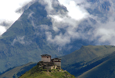
It's a gradual descent to the camp where you will pass by some of the yak herder’s tents, made from yak wool. The herders use these tents while traveling to various pastures for their yaks. As you come down into the Lingshi basin, a beautiful U-shaped valley, you get a wonderful view of Lingshi Dzong on clear days. Tserimgang and its glaciers rise up at the north end of the valley. The campsite is next to a stone hut you reach just before Lingshi Dzong.
Day 7: Linzhi (3,880 m) - Shodu (4,080 m)
Distance: 18 km
Time: 6-7 hours
Ascent: Ascent 840 m, descent 870 m
Camp Altitude: 4,010 m
With a fatiguing walk ahead of you for today’s trek, you need to start the trek early in the morning. Crossing Yale-la pass in the elevation of 4,930 m after an impressive climb up a headwall and descending to the large lake of Khedo Tsho at 4,720 m. Keep your eyes trained on some grazing blue sheep nearby.
The well-marked trail begins to descend along the valley and eventually reaches Shodu after some ups and downs in between. Set your campsite at the camping spot in Shodu when you have crossed the sandy slop.
Insider tips:
When Passing Yeli La, be sure enough not to walk with the pack animal since the trail here is narrow and sided with a rock cliff.
Day 8: Shodu (4,080 m) - Barshong (3,720 m)
Distance: 14 km
Time: 4 -5 hours
Ascent: Ascent 130 m, descent 360 m
Camp Altitude: 3,720 m
Descending trail with moderate climb is along the route. Passing the abandoned army camp, you are guided by the trail crossing the river several times. Along the route, a limestone valley with meditation caves is out there waiting for you to explore.
After crossing the muddy cypress forest followed by some wide-side rivers, you are approaching the obsolescent community wall and the ruins of Barshong Dzong. Climb up to set the camp just below the ruins.
Insider tips:
The camp site is in a swampy meadow which sometimes is inappropriate to pitch a tent, so most groups find another place about one and half hours ahead by the river to set the camp.
Day 9: Barshong (3,720 m) - Dolam Kencho (3,290 m) - Thimphu (2,334 m)
Distance: 15 km
Time: 4 hours
Ascent: Ascent 290 m, descent 430 m
The last day trip begins with a moderate descent through a forest with clusters of beautiful rhododendrons. Follow the trail you will soon reach Ta Gume Thang (Waiting for Horses), a clearing at 3,370 m for camping.
After going through the river valley with several ups and downs, you eventually arrive at the unpaved road leading to Dolam Kencho, an ideal camp in a large meadow at 3,290 m where your driver will be waiting for you and take you back to Thimphu.
Stay overnight in hotel at Thimphu
Day 10: Thimphu (2,334 m)
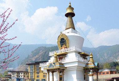
Take a fantastic city tour in Thimphu. Visit the Memorial Chorten, which was built to commemorate 3rd king of Bhutan. Then drive to the gigantic statue of Buddha from which you can overlook the valley.
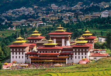
Enjoy the sightseeing in town including the Post Office with the collector’s stamps corner and other places. If you’re keen to do hiking, you might consider climbing up to the Phajoding Monastery to overlook the entire Thimphu valley, some 4-5 hours round trip. In the evening, you can pay a visit to Tashichho Dzong, where the seat of the king and the government locate or you can also choose to walk on the street for sightseeing.
Stay overnight in hotel at Thimphu
Day 11: Thimphu (2,334 m) - Paro (2,200 m)
Leaving Thimphu in the early morning and driving direct to Dochu-la, an eminent pass with 108 stupas and Royal Chapel dedicated to Bhutan’s fourth king. From the pass, you start a 4-5 hours round hike to the Lungchusey Gompa where a mountain-surrounded panorama viewpoint can be found.
After descending to Tashigang Gompa, you begin your reaching back to the road in Hontsho and drive to Paro.
Stay overnight in hotel at Paro
Day 12: Paro (2,200 m), Departure
Depart from Paro Airport
Service Guide
Service Included:
- A minimum of 3 star accommodation (4 & 5 star may require an premium payment);
- All meals specified in the itinerary;
- Airport transfer, private transport for sightseeing in Bhutan;
- Experienced driver;
- An English-speaking and licensed Bhutanese tour guide for the extent of your stay;
- Entry fee and road permits;
- Government fee, royalty, taxes;
- Bottled mineral water throughout the journey.
Service Excluded:
- Bhutan Visa Fee;
- International flight to and out of Bhutan;
- Personal expenses such as drinks, postage, and laundry, etc.;
- Travel insurance in Bhutan;
- Emergency evacuation;
- Tips and gratuities;
- Costs arising from unforeseen events;
- Extra activities like cultural show, kayaking, etc.
Contact us for your dream trip now !
Enquire NowYou May Also Like
-
 3 Days Classic Bumthang Culture Trek
Toktu Zampa - Ngang Lhakhang - Tahung - Mesithang
-
 3 Days Bumthang Owl Trek
Menchugang - Dhur Village - Drangela Pass - Tharpaling Goemba
-
 6 Days Dagala Thousand Lakes Small Group Trek
Geynizampa - Gur - Labatamba - Panka - Talakha - Chamgang
-
 6 Days Most Popular Druk Path Trek in Bhutan
Paro - Jili Dzong - Jangchhu Lakha - Jimilang Tsho - Simkotra Tsho - Phajoding - Motithang

The route along the Jomolhari Trek is dominated by changing sceneries and paralleling with the majestic Himalaya Range. This fantastic trek never disappoints you but do watch your moving steps, for some stretches are narrow with unpaved trail.
Tibetan Travel Guru,Lobsang Tsering
Get A Quotation of this Tour
Get Started - 12 Days Jomolhari Trek
You’re getting closer to your dream Tibet vacation! Fill out this form so our travel designers can start helping you plan a trip.
Privacy Policy: Your information is kept strictly confidential. Tibet Vista will never sell, trade, or give away your contact information to a third party.

.jpg)


.jpg)
