6 Days Most Popular Druk Path Trek in Bhutan
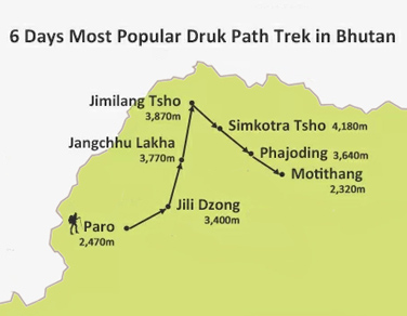
(BTT001) Paro - Jili Dzong - Jangchhu Lakha - Jimilang Tsho - Simkotra Tsho - Phajoding - Motithang
-
Tour Type:
Escorted by private guide and vehicle; leave 365 days a year!
-
Trip Level:
Moderate - suitable for ones with average level fitness, family with kids bigger than 12 yrs.
-
Trip Level Guide:
- Easy - suitable for all level of fitness, family with kids and senior groups.
- Moderate - suitable for ones with average level fitness, family with kids bigger than 12 yrs.
- Moderate to Strenous - suitable for ones physically fit; have experiences of high altitude trek.
- Strenuous: suitable for adventures and individual with physically fit and healthy.
-
Season:春
Spring夏
Summer秋
Autumn冬
Winter
Overview
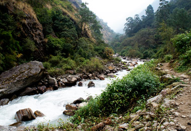
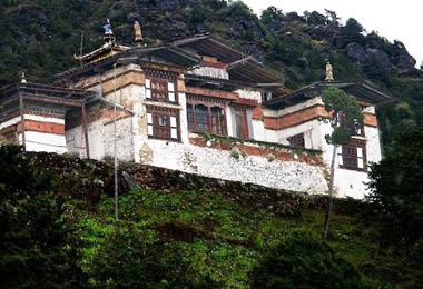
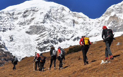
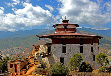
As the most popular trek in the country, Druk Path Trek connects both the Paro and Thimpu valleys. It embarks from the Ta Dzong (National Museum, 2470 m) in Paro and passes through a wonderland of amazing pine forests, high ridges and pristine lakes. Ancient mysterious Ihkhangs, Dzongs, and villages are dotting along the entire route and close at hand. The final trial through Phadjoding Monastery leads the way downwards to Thimpu, the capital city of Bhutan.
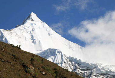
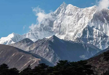
The highest unclimbed Gangkar Puensum Mountain with its name meaning “White Peak of the Three Spiritual Brothers” stays solemn in distance and is observable all along the route. If you want the trek to be in all of its prosperity and flourishment, then pay the visit at the best time from Mar. to Jun. and Sep. to Nov.
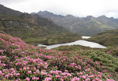
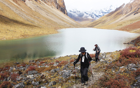
The short distance between campsites is fir forest covered trail with blue pines and dwarf rhododendron clusters at the altitude ranging from 2,400 m to 4,200 m. The alpine Jimiling Lake you reach shows you the paradise of gigantic trout.
Difficulty: Medium
Max Elevation: 4,235 m
Min Elevation: 2,400 m
Best Season: March, April, May, June, September, October, November
Duration: 6 days
At a Glance
Day 1Paro (2,470 m) - Jili Dzong (3,400 m)
Day 2Jili Dzong (3,400 m) - Jangchhu Lakha (3,770 m)
Day 3Jangchhu Lakha (3,770 m) - Jimilang Tsho (3,870 m)
Day 4Jimilang Tsho (3,870 m) - Simkotra Tsho (4,180 m)
Day 5Simkotra Tsho (4,180 m) - Phajoding (3,640 m)
Day 6Phajoding (3,640 m) - Motithang (2,320 m)
Day to Day Itinerary
Day 1: Paro (2,470 m) - Jili Dzong (3,400 m)
Distance: 7 km
Time: 4-5 hours
Ascent: Ascent 1,090 m, descent 40 m
Camp Altitude: 3,480 m
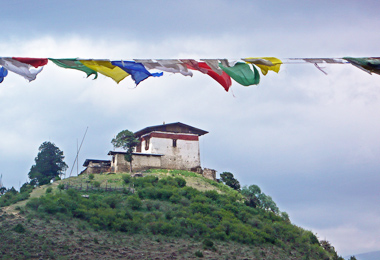
The first-day trek, short as it could be, is more arduous than any of the following ones, for you have to climb more than 1,000 m elevation. The trek embarks from Ta Dzong (National Museum, 2470 m) in Paro and follows a gravel road which pasts a few croplands for about 30 minutes. Then the trail ascends abruptly, leading us to a steep ridge before going through the blue pine and fir forests to Damche Gom. Once you reach the ridge below Jili Dzong you descend about 100m to the campsite below the Dzong.
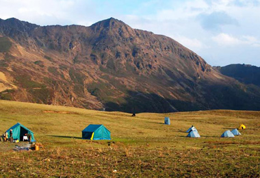
Camping at Jili Dzong
Day 2: Jili Dzong (3,400 m) - Jangchhu Lakha (3,770 m)
Distance: 10 km
Time: 4-5 hours
Ascent: Ascent 310 m, descent 50 m
Camp Altitude: 3,770 m
With constant ascents and descents at the ridge of the mountain, today’s walk is full of excitement and pleasure. The route begins with a steep climb for about one and a half hours, and then evens a bit with much more gradual slopes.
The trail takes you through dense alpine forests and dwarf rhododendron trees to see a greater view of Paro and Bemang Rong Valley. Cease your moving steps and grasp the chance to find a panorama view of Jhomolhari and other snow-caped mountains far from you can see.
Around your campsite, you can find local herders grazing their yaks on Jangchhu Lakha, a highland yak pasture at the elevation of 3760 m.
Camping at Jangchhu Lakha
Day 3: Jangchhu Lakha (3,770 m) - Jimilang Tsho (3,870 m)
Distance: 11 km
Time: 4 hours
Ascent: Ascent 330 m
Camp Altitude: 3,870 m
Most groups choose the higher trail rather than the lower one since views it offers is much more stunning. In fine weather, Jhomolhari and the Jichu Drakye (6,989 m), representing the protective deity of Paro are observable.
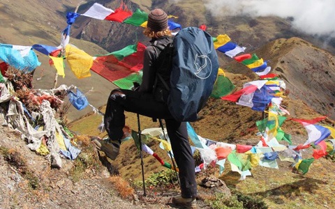
The prayer flag festooned scenic passes add more pilgrimage atmosphere to the journey. Rhododendron flourishes along the road and green grass meadows can be seen. When you reach the minor Langye Ja La (Ox Hump Pass), you have already ascended a high place with the elevation of 4,070 m and approximately 50 m away from the crest. Top the peak and enjoy a barrier-free distant mountain views. The campsite is built nearby the Jimilang Tsho Lake.
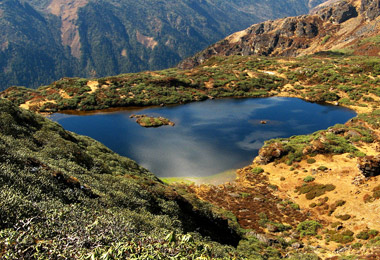
"Jimilang Tsho" means "Sand Ox Lake" and was named for the bull emerged from the Lake. Meanwhile, this lake is also known for its giant-sized trout.
Camping at Jimilang Tsho
Day 4: Jimilang Tsho (3,870 m) - Simkotra Tsho (4,180 m)
Distance: 11 km
Time: 4 hours
Ascent: Ascent 820 m, descent 400 m
Camp Altitude: 4,110 m
The trail takes you through dwarf rhododendron trees and directly to Janye Tsho Lake. You may come across some yak herder camps (3,880 m) along the road and have the opportunity to get a glimpse of or experience a nomad’s life.
A slight descent from the lake there appears some stone ruins. The campsite is close to Simkotra Tsho Lake at the elevation of 4,110.
Camping at Simkotra Tsho
Day 5: Simkotra Tsho (4,180 m) - Phajoding (3,640 m)
Distance: 10 km
Time: 3-4 hours
Ascent: Ascent 130 m, descent 680 m
Camp Altitude: 3,750 m
Today’s route begins with a gradual climb, and it takes a long time to arrive at the cairns (4,235 m) on the top of Labana La, a hill above the trail and taken as a seldom-used sky burial site.
If the weather permits, you will have a spectacular view of the highest mountain - Mount Gangkar Puensum in Bhutan and several other Himalayan Mountain pinnacles. Before the trek takes you downhill to Phajoding, it’s firmly recommended to take a southeast downward trek to Thujidrak Goemba, a remote meditation place which is attached to the side of a precipitation rock face at 3,950 m.
The entire hillside is dotted with meditation centers and lhakhangs of Phajoding Goemba (Residences used for extended meditation retreats). When the evening lights are lit far below you, you may possibly be astonished and surprisingly impressed by the feeling of standing on world’s other side.
Stay overnight in guest house or dorm bed in Phajoding Monastery
Day 6: Phajoding (3,640 m) - Motithang (2,320 m)
Distance: 4-5 km
Time: 3 hours
Ascent: Descent 1,130 m
After passing Phadjoding Monastery, the trek to Thimphu (Motithang) is mainly downhill through a forested area of mostly blue pines. Slow down your forwarding steps and choose one downhill road at the tail junction.
The normal route branches right is steeper with numerous short cuts all leading to the destination while the other route branches left is through Chhokhortse Goemba to BBS broadcasting tower at Sangaygang, providing an interesting alternative to the downhill trekking.
Service Guide
Service Included:
- A minimum of 3 star accommodation (4 & 5 star may require an premium payment);
- All meals specified in the itinerary;
- Airport transfer, private transport for sightseeing in Bhutan;
- Experienced driver;
- An English-speaking and licensed Bhutanese tour guide for the extent of your stay;
- Entry fee and road permits;
- Government fee, royalty, taxes;
- Bottled mineral water throughout the journey.
Service Excluded:
- Bhutan Visa Fee;
- International flight to and out of Bhutan;
- Personal expenses such as drinks, postage, and laundry, etc.;
- Travel insurance in Bhutan;
- Emergency evacuation;
- Tips and gratuities;
- Costs arising from unforeseen events;
- Extra activities like cultural show, kayaking, etc.
Contact us for your dream trip now !
Enquire NowYou May Also Like
-
 3 Days Classic Bumthang Culture Trek
Toktu Zampa - Ngang Lhakhang - Tahung - Mesithang
-
 3 Days Bumthang Owl Trek
Menchugang - Dhur Village - Drangela Pass - Tharpaling Goemba
-
 6 Days Dagala Thousand Lakes Small Group Trek
Geynizampa - Gur - Labatamba - Panka - Talakha - Chamgang
-
 10 Days Jomolhari Loop (Soi Yaksa) Trek
Paro - Gunitsawa Village - Sharna Zampa - Thangthangkha - Jangothang - Soi Yaktsa - Thombu Shong - Gunitsawa Village - Paro

The Druk Path Trek is not that hard to undertake, for the distance between the campsites are fairly short and with spectacular views. The best months to take the Druk Path Trek fall in Mar., Apr., May, Jun., Sep. Oct. and Nov.
Tibetan Travel Guru,Master Kungga Dundruk
Get A Quotation of this Tour
Get Started - 6 Days Most Popular Druk Path Trek in Bhutan
You’re getting closer to your dream Tibet vacation! Fill out this form so our travel designers can start helping you plan a trip.
Privacy Policy: Your information is kept strictly confidential. Tibet Vista will never sell, trade, or give away your contact information to a third party.

.jpg)


.jpg)
