 Search
 Pioneer of Tibet Tourism for Overseas Travelers since 1984!

Where is Bhutan in India Map? / Bhutan India Map
Have you been to Bhutan before? Or say have you ever noticed this country when you spot the large India on a map? If you have not paid any attention, it may be a little bit hard to find it on an India map. It is just borders to the north of India.
India Bhutan Border Map
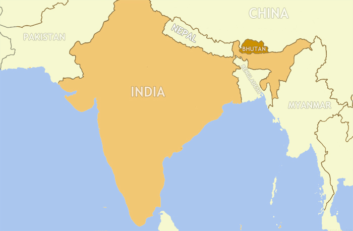 Bhutan and India Located on Map
Bhutan - India Border is the international boundary between the Kingdom of Bhutan and the Republic of India. It lies windingly in the southwest, south and southeast of Bhutan.
The border is 699 km long and adjoins the Indian states of Sikkim (32 km), West Bengal (183 km), Assam (267 km), and Arunachal Pradesh (217 km) in an anti-clockwise direction.
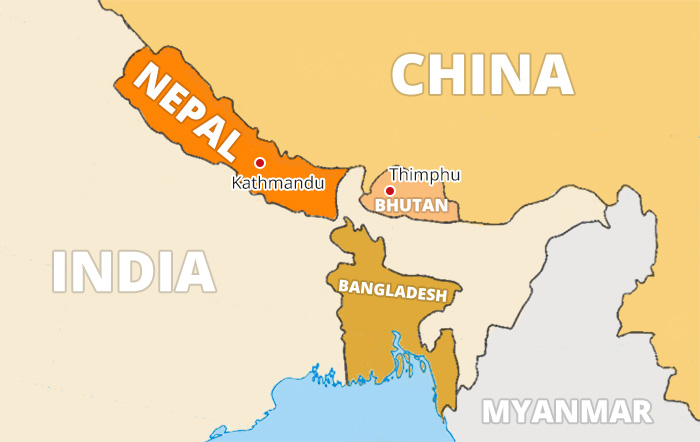 Bhutan Borders India in Its West, South and East
>> Know more about Bhutan Border Map/Bhutan Map with Surrounding Countries
India Bhutan Road Map
The land border areas for tourists to enter Bhutan are all opened on the borderline between Bhutan and India, for the border neighboring China is completely closed.
The single entry point for foreign travelers is between the towns of Jaigaon in the Indian state of West Bengal and Phuntsholing in southwest Bhutan.
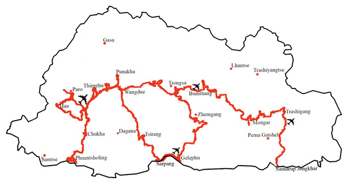 Three entries to get into Bhutan by overland: Phuentsholing, Gelephu, and Samdrup Jongkhar on Map
There are three points where you can cross over the Indian border and get into Bhutan. They are Phuentshing adjoining to the town of Jaigaon and with its next-door neighboring the Indian state of West Bengal, Gelephu neighboring the Indian state of Assam, and Samdrup Jongkhar, bordering the Indian state of Assam respectively.
>> How to Prepare a Bhutan Trip from Delhi
>> How to Get to Bhutan from India
 Email me about your travel idea