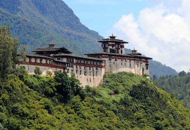
31 Days Snowman Trek
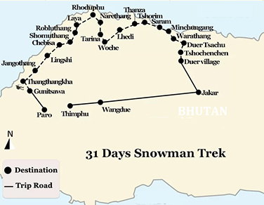
(STN1) Paro - Gunitsawa - Thangthangkha - Jangothang - Lingshi - Chebisa - Shomuthang - Robluthang - Limithang - Laya - Rhoduphu - Narethang - Tarina - Woche - Lhedi - Thanza - Tshorim - Saram - Minchungang - Warathang - Duer Tsachu Tshochenchen - Duer village - Jakar - Wangdue - Thimphu
-
Tour Type:
Escorted by private guide and vehicle; leave 365 days a year!
-
Trip Level:
Strenuous - suitable for adventures and individual with physically fit and healthy.
-
Trip Level Guide:
- Easy - suitable for all level of fitness, family with kids and senior groups.
- Moderate - suitable for ones with average level fitness, family with kids bigger than 12 yrs.
- Moderate to Strenous - suitable for ones physically fit; have experiences of high altitude trek.
- Strenuous: suitable for adventures and individual with physically fit and healthy.
-
Season:春
Spring夏
Summer秋
Autumn冬
Winter
Overview
The snowman trek travels to the far isolated Lunana district and is widely believed to be one of the most difficult treks in the world. Despite of all difficulties including the changing weather, endless distance, high altitude and unwonted remoteness, the snowman trek with its eternal charm still attracts a great number of worldwide tourists to conquer.
The trek starts from Sharna Zampa, and follows the classic Joholhari Trek and Laya-Gasa Trek to the area of Laya village, one of the most isolated and highest areas in northern Bhutan. Trials further ascend you up to Gangkhar Puensum and Bumthang for much more magnificent Himalaya Range spectacular snowcapped mountains or down to Sephu in Trongsa district depending on your choice.
Camping at the altitude of 5,000 m are normal and sometimes on the snow depending on the weather.
Difficulty: Hard
Max Elevation: 5,320 m
Min Elevation: 1,273 m
Best season: June, July, August, September, October
Duration: 31 days
At a Glance
Day 1Paro Arrival (2,200 m)
Day 2Paro Tour
Day 3Paro (2,200) - Gunitsawa (2,930 m) (Drive); Gunitsawa - Thangthangkha (3,575 m) (Trek)
Day 4Thangthangkha (3,575 m) - Jangothang (4,044 m)
Day 5Jangothang Halt (4,044 m)
Day 6Jangothang (4,044 m) - Lingshi (3,880 m)
Day 7Lingshi (3,880 m) - Chebisa (4,220 m)
Day 8Chebisa (4,220 m ) - Shomuthang (4,160 m)
Day 9Shomuthang (4,160 m) - Robluthang (4,140 m)
Day 10Robluthang (4,140 m) - Limithang (4,140 m)
Day 11Limithang (4,140 m) - Laya (3,840 m)
Day 12Rest / Acclimatization day in Laya (3,840 m)
Day 13Laya (3,840 m) - Rhoduphu (4,900 m)
Day 14Rhodophu (4,900 m) - Narethang (3,970 m)
Day 15Narethang (3,970 m) - Tarina (3,910 m)
Day 16Tarina (3,910 m) - Woche (3,940 m)
Day 17Woche (3,940 m) - Lhedi (4,150 m)
Day 18Lhedi (4,150 m) - Thanza (5,120 m)
Day 19Rest Day at Thanza (5,120 m)
Day 20Thanza (5,120 m) - Tshorim (4,970 m)
Day 21Tshorim (4,970 m) - Saram (4,900 m)
Day 22Saram (4,900 m) - Minchungang (4,200 m)
Day 23Minchungang (4,200 m) - Warathang (4,000 m)
Day 24Warathang (4,000 m) - Duer Tsachu (3,850 m)
Day 25Halt in Duer Tsachu (3,850 m)
Day 26Duer Tsachu (3,850 m) - Tshochenchen (3,920 m)
Day 27Tshochenchen (3,920 m) - Duer village (2870 m), drive to Jakar
Day 28Rest in Jakar (2,587 m)
Day 29Jakar (2,587 m) - Wangdue (1,273 m)
Day 30Wangdue (1,273 m) - Thimphu (2,334 m)
Day 31Departure from Thimphu (2,334 m)
Day to Day Itinerary
Day 1: Paro Arrival (2,200 m)
Arrival by plane or driving to Paro from Phuntsholing after crossing the India-Bhutan Border. Sighting according to the arrival time.
Stay overnight in Paro hotels
Day 2: Paro Tour
Drive to Gunitsawa village from Paro. Tourist bus stops temporarily at the intermediate stations where the scenery sites locate. Morning visit of Kyichu lhakhang, the temple built in 8th century by Tibetan king Songtsen Gampo. Climb to Taktsang gompa known as Tiger's Nest, the most venerated and holy place in Bhutan and take an overlook of the valley from a steep cliff.
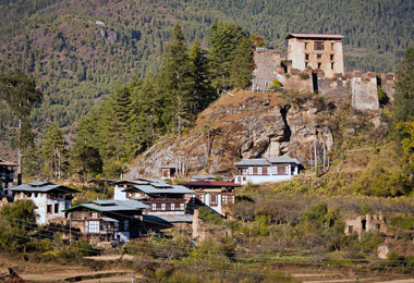
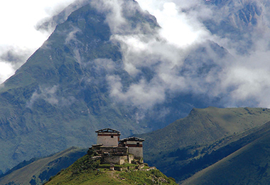
After lunch the bus will drive you to Drukyel dzong, the place used to be the starting point of this trek. Visit the castle-ruins of the Drukyel dzong, from where the panoramic view of holy Jomolhari Mountain can be sighted.
Stay overnight in Paro
Day 3: Paro (2,200) - Gunitsawa (2,930 m) (Drive); Gunitsawa - Thangthangkha (3,575 m) (Trek)
Distance: 16 km
Time: 7-8 hours
Ascent: Ascent 770 m, descent 10 m
Camp Altitude: 3,610 m
Leaving Paro for Gunitsawa military camp in early morning to pass through the army post and embark on the trekking. At the army post, your trekking permit is due to be checked. So get this permit prepared (Our tour operator will help you get it ready in advance).
Flanked by lush conifers and rhododendrons, the river Paro Chuu points you the way you are about to explore. Heading northwardly, you arrive at Shing Karap, a characteristic stone house at the elevation of 3,110 m after you passing through Jigme Dorji National Park, which is symbolized by a remnants of an old bridge with a house and a chorten.
Then continue to follow the trail to reach Tremo La (4,380 m), where the trail bifurcates. Don’t choose the left one, since it is an ancient trail leading to Tremo La, the old trade route from Phari Dzong in Tibet.
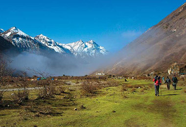
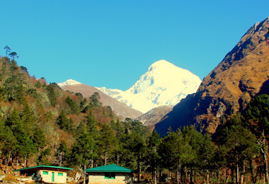
The stone-paved trail stretches with moderate ups and downs through dense forests of birch and fir flowed by blue pines, and eventually arrives at a meadow where our campsite is set up. Standing on the campsite, you can have a fantastic panoramic view of Jomolhari Mountain looming in front of your eyes.
Camping at Thangthangkha
Day 4: Thangthangkha (3,575 m) - Jangothang (4,044 m)
Distance: 19 km
Time: 5-6 hours
Ascent: Ascent 480 m
Camp Altitude: 4,080 m
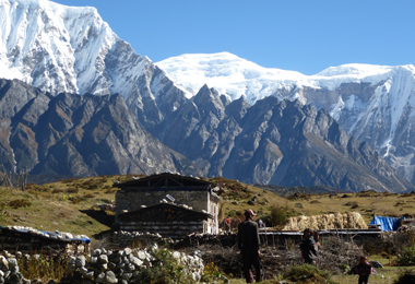
If you miss the sunset of Mt. Jomolhari, then don’t let slip the spectacular sunrise of the mountain in early morning. Get fully packed and continue to follow the trail along the Paro Chhu to get today’s trekking started. You will cross an army checkpoint where rough stone barracks are set up. Today, you still have the chance to enjoy a spectacular view of mountain ridges and snow-capped peaks.
The ascending trail brings you to the village of Soe after passing through the larch covered hillside. Then the view has suddenly changed, and the scenery of locals herding yaks pops into your eyes. If you are worry about having not met any highland hamlet along the route, then a cluster of stone houses on a plateau at 3,940 m will soon bump into your eyes after one-hour trek to Takethang.
Dangochang is another village you are bound to cross before your final arrival at Janothang Base Camp. Villagers here are lived by yaks and sheep they raise and vegetables like potato, turnip and radish they grow. Don’t miss the chance to experience the primitive life with the locals here.
The Trail goes upwardly to reach Jangothang at the altitude of 4,080 m, where a fantastic camp site can be found and a view of majestic Jomolhari is near at hand.
Insider tips:
As the elevation of the trekking trail goes higher in this day, you need to slow down your hiking steps accordingly, since today’s trek will ascend to the places that can cause altitude sickness.
Camping at Jangothang Base Camp
Day 5: Jangothang Halt (4,044 m)
The rest day or we call it the exploration day in Jangothang provides all possibilities for visitors to arrange a day hike to nearby campsite. It is also regarded as the best day for acclimation if you plan an ascent to a higher place in Lingzhi.
There are four major trails you are recommended to take for further exploration from Jangothang. The first and the best route comes to a four-hour excursion up to the north of the camp, where after one hour’s walk you can get a splendid view of Jichu Drakye. The second option is to choose Mount Jomolhari which lies directly to the west. Or you can also ascend the numerous unclimbed mountains to the east.
Besides the listed excursion trails, here has another option waiting to be picked up. You can take an expedition to Tshophu, an eminent trout-filled lake located along the route of Jomolhari Loop Itinerary. It only takes one and a half hours to reach there.
Camping at Jangothang Base Camp
Day 6: Jangothang (4,044 m) - Lingshi (3,880 m)
Distance: 18 km
Time: 6-7 hours
Ascent: Ascent 840 m, descent 870 m
Camp Altitude: 4,010 m
This is one of the longest days of the trek. A short distance from the camp the trail begins climbing rapidly for about half an hour and then becomes a gradual ascent to the Nyilila pass at 4,870m. While on the climb enjoy the surroundings. You might see herds of blue sheep grazing on the slopes of the mountains. From the pass you will have spectacular views of Mt. Jomolhari, Jichu Drake and Tsherimgang, all of them rising above 7,000m.
It's a gradual descent to the camp where you will pass by some of the yak herder’s tents, made from yak wool. The herders use these tents while travelling to various pastures for their yaks. As you come down into the Lingshi basin, a beautiful U-shaped valley, you get a wonderful view of Lingshi Dzong on clear days. Tserimgang and its glaciers rise up at the north end of the valley. The campsite is next to a stone hut you reach just before Lingshi Dzong.
Day 7: Lingshi (3,880 m) - Chebisa (4,220 m)
Distance: 10 km
Time: 5-6 hours
Ascent: Ascent 280 m, descent 410 m
Camp Altitude: 3,880 m
10 km stretch from Lingshi to Chebisa must be the shortest trek along the entire route, and you can take it easy. Leaving Lingshi in the morning, you will soon find a chorten below Lingshi Dzong, where appears an alternative route. You can choose to stay at the uphill main route or just take a descent tour by following this route to overlap the Jomolhari Trek which has been totally deviated from the set direction of this trek.
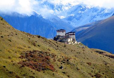
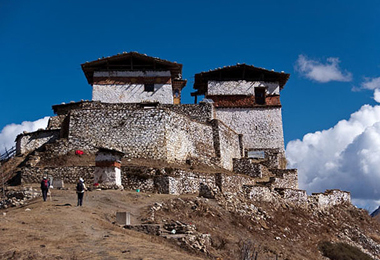
Make an ascent to reach Lingshi Dzong (4,220 m). This Dzong was once reconstructed after the earthquake happened in 2011 and damaged its central building. In addition to a very special atmosphere of mystic tranquility, Lingshi Dzong provides a great view over the valley.
In Goyul, stone houses can be found clustering together, forming a small village unlike any other in the outbound near Bhutan cities and towns. Leaving Goyul, you soon reach the campsite at Chebisa, the valley with some houses scattering around. You can have an early rest, or you can choose to pay a visit to these primitive house you like. Besides, don’t miss the fascinating waterfall behind the village.
Day 8: Chebisa (4,220 m ) - Shomuthang (4,160 m)
Distance: 17 km
Time: 6-7 hours
Ascent: Ascent 890 m, descent 540 m
Camp Altitude: 4,220 m
Leaving Chebisa in early morning, the trail tends to become steep. You can surprisingly find flocks of blue sheep inhabiting above the slope after you have successfully ascended up to it.
Then, when you finally reach the Gobu La Pass at 4,440 m, take a look around and you may be astonished by the sceneries as well as a few of highland shepherds herding their sheep on some lower green grass paved meadows.
After Gobu La (4,410 m), you come across some ups and downs to reach Shakshepasa (3,980 m), a large U-shaped valley with a helipad site marked by a big “H”. Follow the uphill trail stretching from here to arrive at the campsite at Shomuthang.
Insider tips:
Keep your eyes trained on wildness since animals like blue sheep, bearded vultures and Himalaya griffons appear along this route.
Day 9: Shomuthang (4,160 m) - Robluthang (4,140 m)
Distance: 18 km
Time: 6-7 hours
Ascent: Ascent 700 m, descent 760 m
Camp Altitude: 4,160 m
You begin by climbing up the valley to view Kang Bum (6,526 m), the snow peak visible along the route. Then the trail keep rising, leading you to reach Jhari La, the pass at 4,750 m and two hours trek from the campsite. The snowcapped Gangchhenta (6,840 m), better known as the Great Tiger Mountain, is visible in the north.
Tsheri Jathang, the camp by the river, has become a habitat for a large number of migrated takin, the Bhutanese national animal, from summer to late autumn. The valley has been declared a takin sanctuary, so with the agreement of the herders not grazing their animals while takin inhabit here, this easily disturbed animal can find enough good in this fertile grassland.
The trail makes a steep climb upwardly and traverses into a side valley named Robluthang, where you can set your camp here.
Day 10: Robluthang (4,140 m) - Limithang (4,140 m)
Distance: 19 km
Time: 6-7 hours
Ascent: Ascent 850 descent 870 m
Camp Altitude: 4,140 m
Today’s trek tends to be a little strenuous with an initial ascent to a large glacial side valley. Then you reach Sinche La (5,005 m), the final and highest pass on the trek, before passing a moraine and a great number of marmot holes.
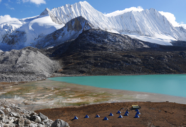
As you take a downhill trail, you will then meet an impressive and stunning terminal moraine and a glacial lake at the foot of the valley. You can see the classic lateral moraines where the glacier has pushed rocks up on both sides of the valley.
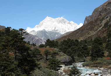
Below the moraine, you will cross the Kango Chhu and pass through a cedar forest interspersed with meadows to Limithang (4,140 m). Camp at this fantastic site by the river and with the snowcapped peak of Gangchhenta towering over it.
Day 11: Limithang (4,140 m) - Laya (3,840 m)
Distance: 10 km
Time: 4-5 hours
Ascent: Ascent 60 m, descent 340 m
Camp Altitude: 3,840 m
Today, you walk downhill all the way along a narrow, winding river valley. After a long time, the trail takes you through a densely forested region. The trail leads you to the west side of Laya village. From the west of the village you will have spectacular views of Mt. Gangchhenta and Mt. Masagang. In the village centre is a community school and a basic health unit with a telephone connection.
Today’s trek starts with a 20 mins downhill walk along a narrow and winding river valley to a deep cedar forests. Passing the densely forested region along the route, you reach at the Laya (3,840 m) after you passing a ridge and some stone houses.
Masang Gang (7,165 m) stands solemnly to the west far from Gangchhenta valley and you can just cease your trekking steps and camp here for a good rest and the stunning views.
Insider tips:
Along this route, you will experience a long walk through the heavily wooded and uninhabited valley. When you reach the campsite in Laya, a community school and an archery field can be found. A basic health unit centers in the village and the telephone communication is available.
Day 12: Rest / Acclimatization day in Laya (3,840 m)
The day you spend at Laya is not just taken as a recovery from the strenuous trekking far from Paro Valley, moreover, it serves as an ideal place for altitude acclimatization. Just relax and enjoy the beautiful views as far as eye can see and the remarkable inhabitants living here.
If you embark on the trek from Gasa (Punakha), you should also trek up to Laya to acclimatize and get prepared for the rest of the challenge.
Day 13: Laya (3,840 m) - Rhoduphu (4,900 m)
Distance: 19 km
Time: 6-8 hours
Ascent: Ascent 1,030 m, descent 750 m
Camp Altitude: 4,160 m
Leaving Laya, we begin with a downhill trail to an army camp and continue following the river till the turn off point to Rhoduphu. After lunch the climb continues through rhododendron bushes till you crest a large rock slide, from which a distant view of the glacial valley and a massive glacier on Tsenda Kang (7,100 m) can be sighted.
Insider tips:
It’s an ascending day today and you can have a fantastic view over Mo Chhu and Rhodo Chhu valleys.
Day 14: Rhodophu (4,900 m) - Narethang (3,970 m)
Distance: 17 km
Time: 5-6 hours
Ascent: Ascent 720 m
Camp Altitude: 4,900 m
The trek begins with an approximately 20 mins walk along the river and transverse to a steady uphill climb to a high open valley at 4,600 m. Then you are approaching Tsomo La (4,900 m), a high altitude mountain pass from which a spectacular views of the Tibet border and Mt. Jomolhari are clearly sighted if the weather is fine.
The route continues to ascend to a higher flat and barren plateau with yak trails everywhere and one route will lead you to the campsite which is at Narethang and towered by the peak of Gangla Karchung (6,395 m).
Day 15: Narethang (3,970 m) - Tarina (3,910 m)
Distance: 18 km
Time: 7-8 hours
Ascent: Ascent 270 m, descent 1,200 m
Camp Altitude: 3,970 m
Depart from the camp you will spend about an hour to reach Gangla Karchung La (5,120 m), another high altitude pass from which you can get an fantastic view of Kang Bum (6,526 m) to the west and Tsenda Kang, Teri Gang (7,300 m) as well as Jejekangphu Gang (7,100 m) to the north.
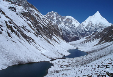
The pass then goes downhill along a large moraine with breathtaking on-the-way sights. A massive glacier descends from Teri Kang to a deep turquoise lake at its foot. Up here a glacial lake burst through its dam in the early 1960s, causing widespread damage and partially destroying Punakha Dzong.
Then you take a long nasty descending route to Tarina after passing the rhododendron laden U-shaped valley. In Tarina, you can spot several ideal campsite along the Tang Chhu River.
Day 16: Tarina (3,910 m) - Woche (3,940 m)
Distance: 17 km
Time: 6-7 hours
Ascent: Ascent 275 m, descent 330 m
Camp Altitude: 3,910 m
The route leads you downward along the river to several impressive waterfalls after passing through the conifer forests. Then the trail gain a steep climb over a ridge and terminates in Woche (3,940 m), a small settlement of a few houses. Take an early rest for the following challenge.
Day 17: Woche (3,940 m) - Lhedi (4,150 m)
Distance: 17 km
Time: 6 -7 hours
Ascent: Ascent 980 m, descent 950 m
Camp Altitude: 3,700 m
Crossing the Wochen Chhu, the trail climbs upwardly to Keche La Pass (4,650 m), from which excellent views of surrounding mountains including Jejekangphu Gang’s triple peak (Known as the source of the Woche Chhu) can be sighted.
After Keche La pass, the trail descends into the Pho Chhu valley and further reaches the Thaga village (4,050 m). Follow the river till you eventually arrive at Lhedi village. Keep your eyes focused on the distant sceneries since views along this route is stunning.
Insider tips:
Lhedi serves as a district headquarter with a basic health unit, a school and a wireless telephone connection. Trekkers can get a temporary recover at this site and prepare for the following trekking.
Day 18: Lhedi (4,150 m) - Thanza (5,120 m)
Distance: 17 km
Time: 4 - 5 hours
Ascent: Ascent 400 m
Camp Altitude: 4,150 m
High-altitude farms begin to catch your eyes during today’s trek. If the weather is fine, you can get a clear panoramic sight of Table Mountain (7,100 m). Continue following the trail to the small village of Chozo (4,090 m) with a dzong still in use around noon.
Follow the guide to keep ascending till you reach Thanza, where again you can get a much more stunning view of Zongophu Gang (Table Mountain). The Mountain forms a 3,000 m high wall of snow and ice behind the village. Although the scenery is breathtaking at Thanza, most of the groups prefer to camp in Toencha.
Day 19: Rest Day at Thanza (5,120 m)
Rest day is scheduled at Thanza for rounding up yaks and get recovery from the fatigue during the past trekking days. Experience some village life or climb up the ridge for fascinating views of lakes and mountains.
Day 20: Thanza (5,120 m) - Tshorim (4,970 m)
Time: 8 to 9 hours
Camp Altitude: 5,120 m
Today’s walk is carried out mainly on high altitude mountains with the camp site at about 5,120 m. The trek starts by ascending up to a ridge with the great distant view of Table Mountain and Thanza valley underneath. The ridge, with its altitude of 4,500 m, rises gradually up to 4,650 m. You finally reach your campsite after a continuous uphill trek and more ridges after lunch. The majestic snow-capped mountains can be sighted every now and then along the route.
Insider tips:
In Thanza, the main trekking route bifurcates. One is leading further up to Gangkhar Puensum (7,239 m), the highest maintain in Bhutan and also known as the highest unclimbed mountain in the world, and eventually end up at Bumthang valley. The other route is guiding you down to Sephu in Trongsa district.
Day 21: Tshorim (4,970 m) - Saram (4,900 m)
Time: 6 to 7 hours
Camp Altitude: 4,970 m
The view you will be sighting today is definitely the highlight that you take all the way here to find out. Spectacular Gophu La Ranges with its main Table Mountain peak, line up in front of your eyes. The atmosphere of solemnness and majesty of these Range Mountains makes each of the group members stand in awe.
When you are enjoying the panoramic view of the mountains, don’t forget to get your camera ready. After the last short climb of the Gophu La Pass (5,230 m), the route takes you to a ridge from which a great view of Gangkhar Puensum can be sighted.
A small pyramid-shaped peak near the ridge is recommended to ascend for a clearer and better view of the magnificent mountains. However, you can also choose to take the trail downward to reach your campsite nearby Sha Chhu.
Day 22: Saram (4,900 m) - Minchungang (4,200 m)
Time: 6 to 7 hours
Camp Altitude: 4,200 m
The trail further follows the Sha Chhu and descends gradually to Minchungang.
Day 23: Minchungang (4,200 m) - Warathang (4,000 m)
Time: 8 to 9 hours
Camp Altitude: 4,000 m
The first two and a half hours are spent in following the Sha Chhu till the stiff climb to Saka La begins. Visibility along the Saka La trail is poor so one must see top of the ridge for guidance. After having lunch nearby a yak herders’ camp you climb up to Saka La (4,800m). The path goes downward to a couple of lakes and another short ascent is stunning. Scenery once again is beautiful with small lakes and the mountain peaks.
Day 24: Warathang (4,000 m) - Duer Tsachu (3,850 m)
Time: 5 to 6 hours
Camp Altitude: 3,590 m
It’s one-hour climb to 4,700 m Juli La, a rocky saddle with a few prayer flags and a good view of the surrounding mountains. After the pass, you take the descending pass to the riverside through dense rhododendron, juniper and conifer forests. Then you will find a short climb leading you eventually to Duer Tsachu.
The path will guide you to the steaming hot springs which are believed to be the exact place where Guru Padmasambhava have once taken baths. You may find these remote pure hot springs might possibly be the most beautiful hot springs in Himalaya regions.
Day 25: Halt in Duer Tsachu (3,850 m)
Camp Altitude: 3,590 m
To recover from the fatigueless of the previous trekking, you can indulge yourself to rest in these holy hot springs. Meanwhile, you can also pack your things and have a good rest for the last arduous section of the trek.
Day 26: Duer Tsachu (3,850 m) - Tshochenchen (3,920 m)
Time: 8 to 9 hours
Camp Altitude: 3,850 m
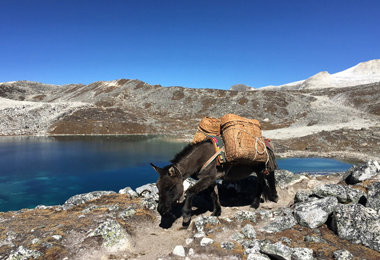
From the hot springs it is a long and steady climb again with great views of mountains in Lunana. You will also come across blue lakes and yak herder huts.
Day 27: Tshochenchen (3,920 m) - Duer village (2870 m), drive to Jakar
The last day of the trek tends to be much easier since the trail is mainly descending one with a few climbs in between. Your porters change from yaks to horses, and your trek comes to the end when you arrive at Duer village.
The driver awaits you at Duer village and drive you to Jakar to have an accommodation in the hotel.
Day 28: Rest in Jakar (2,587 m)
Enjoying the end of trek in beautiful valley of Bumthang. Easy sightseeing around and visiting temples like Jambey, Lhakhang, Kurjey and Tamshing. Visit to Red Panda brewery with beer tasting. Explore lively little town of Jakar.
The comfortable one day stay in Jakar leaves you more time for easy sightseeing and some temple visiting. You can pay a visit to one or two temples you favor most among Jambey, Lhakhang, Kurjey and Tamshing, or you can choose to explore the lively town of Jakar which bustles with commerce. The Red Panda brewery is another interesting place worth visiting.
Day 29: Jakar (2,587 m) - Wangdue (1,273 m)
After about 40 minutes’ drive from Jakar, you first reach Chunney, an eminent place for Bhutan traditional textile. You can shop around to find the uniqueness in these handcraft textiles. Then you will arrive at Trongsa after crossing Yotung-la pass (3,400 m).
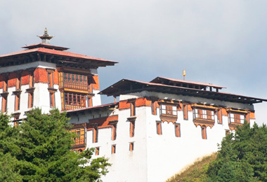
Trongsa, the capital of Trongsa District, means “new village” in Dzoingkha, and the first temple was built here by Ngagi Wangchunk, the unifier of Bhutan in 1543. Here, you will visit this large castle in Bhutan and experience the glorious past when the royal family had risen and here had been taken as the busiest east-west trade center in the past.
You continue to have a long drive on the windy road to Wangdue with temporary stop at Chenebji stupa, which is designed after Bouddhanath stupa of Kathmandu. Then after passing through the Pele-la pass (3450 m) which is the border of central and western Bhutan, you will finally descend to the subtropical Wangdue valley by the evening.
Day 30: Wangdue (1,273 m) - Thimphu (2,334 m)
With spectacular view of the valley and its terraced paddy fields below, the morning climb to Khamsum Monastery tends to be interesting and exciting. Then you will see the longest suspension bridge with the total length of 350 m over Pho Chhu River in Bhutan. After scenery sightseeing, you can pay a visit to the most intricately decorated castle Punakha dzong in Bhutan.
You also have the chance to visit Chhimmy Ihakhang temple, in which devotes the 15th century saint Drukpa Kunley who taught Buddhism by singing, drinking and rampant sexual behavior. If time permits, you are recommended to visit Sangchhen Dorji Lhuendrup Lhakhang nunnery with Bhutanese and Nepali style stupa and overlook the valley from the high hill. Afternoon drive to Thimphu. Walk around or shop in town to enjoy the last day in Bhutan.
Day 31: Departure from Thimphu (2,334 m)
Service Guide
Service Included:
- A minimum of 3 star accommodation (4 & 5 star may require an premium payment);
- All meals specified in the itinerary;
- Airport transfer, private transport for sightseeing in Bhutan;
- Experienced driver;
- An English-speaking and licensed Bhutanese tour guide for the extent of your stay;
- Entry fee and road permits;
- Government fee, royalty, taxes;
- Bottled mineral water throughout the journey.
Service Excluded:
- Bhutan Visa Fee;
- International flight to and out of Bhutan;
- Personal expenses such as drinks, postage, and laundry, etc.;
- Travel insurance in Bhutan;
- Emergency evacuation;
- Tips and gratuities;
- Costs arising from unforeseen events;
- Extra activities like cultural show, kayaking, etc.
Contact us for your dream trip now !
Enquire NowYou May Also Like
-
 3 Days Classic Bumthang Culture Trek
Toktu Zampa - Ngang Lhakhang - Tahung - Mesithang
-
 6 Days Dagala Thousand Lakes Small Group Trek
Geynizampa - Gur - Labatamba - Panka - Talakha - Chamgang
-
 6 Days Most Popular Druk Path Trek in Bhutan
Paro - Jili Dzong - Jangchhu Lakha - Jimilang Tsho - Simkotra Tsho - Phajoding - Motithang
-
 12 Days Jomolhari Trek
Paro - Gunitsawa Village - Thangthangkha - Jangothang - Linzhi - Shodu - Barshong - Dolam Kencho - Thimphu - Paro

The strenuous snowman trek lasts for almost one month time and you may encounter many unexpected things during this challenge. Find a reliable travel agency and a trustworthy guide to ensure an enjoyable trekking.
Tibetan Travel Guru,Sonam Tenphel
Get A Quotation of this Tour
Get Started - 31 Days Snowman Trek
You’re getting closer to your dream Tibet vacation! Fill out this form so our travel designers can start helping you plan a trip.
Privacy Policy: Your information is kept strictly confidential. Tibet Vista will never sell, trade, or give away your contact information to a third party.

.jpg)


.jpg)
