.jpg "Tibet Travel Information and Individualized Tibet Tours")


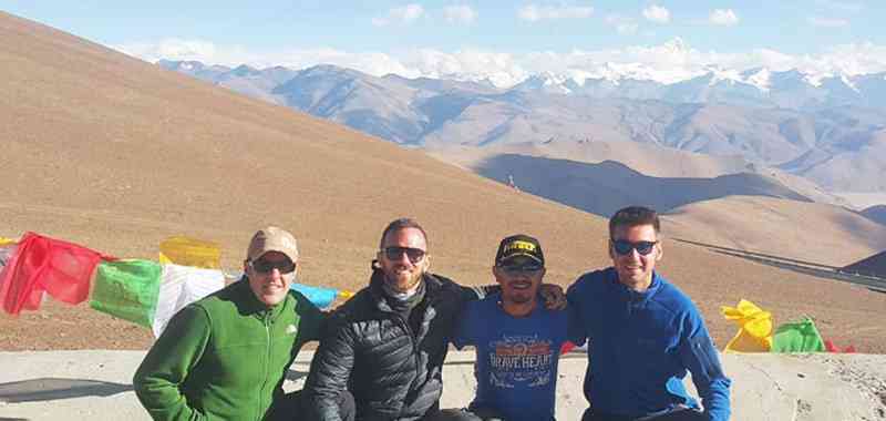
Mt.Kailash kora tour has always been a hottest tourist attraction in Tibetan tourism. It is a once-in-a-lifetime experience that you will never forget once you have went through it. It gives you a chance to experience trekking at one of the highest mountain routes within a relatively harsh natural environment. It attracts so many people to join the trekking tour despite all the tiredness might be involved during the process.
In order to give you an all-around explanation of the Mt.Kailash trek route, we provide you relevant route maps for your reference; and you will not miss them during your yatra in Mt.Kailash.
Geographic Location of Tibet in China
Capital City: Lhasa (3658m), with a population of around 560 thousand
Prefectures: Shigatse, Ngari, Shannan, Nagqu, Nyingchi, Chamdo
Total Area: 1,228,400 square km, the second largest region in China
Religious Belief: Tibetan Buddhism (practiced by 99% of Tibetans)
Average Altitude: above 4000m,
Language: both Tibetan and Mandarin Chinese
Bordering Countries: India, Nepal, Bhutan, Myanmar
Economy: predominantly in agriculture and animal husbandry
Demographics: 90% Tibetans, 8% Han, 2%others
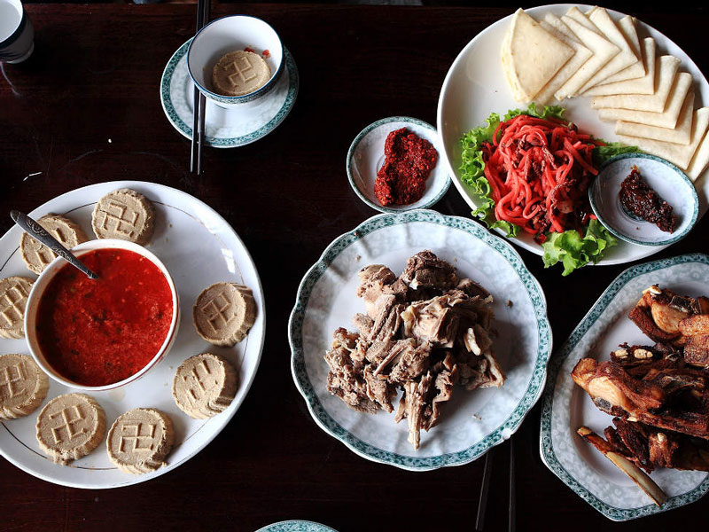
Staple Food: Tsampa (roasted barley flour), butter tea, yak meat, Tibetan momo, etc
Wildlife: wild yak, Tibetan antelope, Tibetan gazelle, black-necked crane, wild ass, wolf, snow leopard, marmot, vulture, etc.
Mineral Deposits: Borax, uranium, iron, chromite, etc.
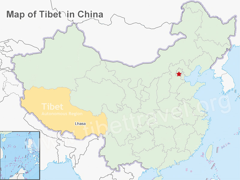
The geographic location of Tibet in China
Geographic Location of Mt.Kailash in Tibet
As one of the loftiest mountains in the world and center of the world by Hinduism, Tibetan Buddhism, Bon-native religion in Tibet and Jainism, Mt. Kailash is located at the regions between the north of Kunlun Mountains and south of the Himalayas. At 6656 meters above sea level, Mt. Kailash is the main peak of Gangdise Range, lying like a dragon in the plateau of the Ngari Prefecture with its highly symmetrical sides and pyramid shapes.
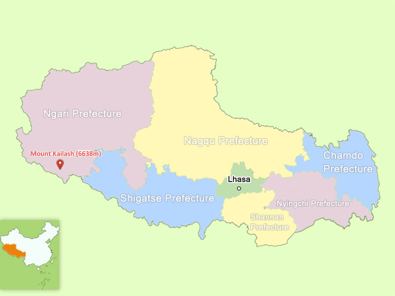
The geographic location of Mt.Kailash in Tibet
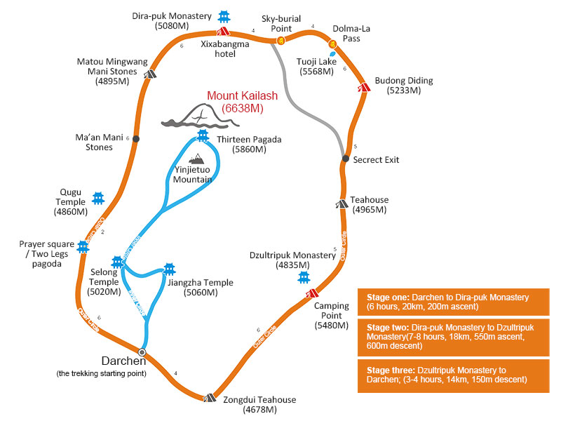
Mount Kailash Yatra Map
What below are the general yatra map of Mt Kailash and its specifics. The whole route lasts about 49 kilometers and the circuit is mainly like this: Darchen – 7km – Prayer Flag Piles – 2.6km – Qugu monastery bridge -4.5km – Ma’an Mani stones – 2.3km – Matou Mingwang Stones – 4.2km -Drirapuk Monastery or Xiaxibangma hotel(the 1st day stop) – 5.8km – Dolma-la pass – 2.6km -Budong Didin – 2.4km – Secrect Exit – 3km – Teahouse – 4.5km – Dzultripuk monastery(the 2nd day stop) – 6.2km – Zongdui Teahouse – 4km – Darchen

The general Mt Kailash yatra map
Geographic Location of Darchen, the starting point of the Mt.Kailash Yatra
The starting point of the Mt.Kailash kora is at Darchen (4574m), a small town at the south foot of the holly mountain. It is also the ending point of the kora. This small town is a stop where kora performers get their supplies and also a place for having a rest after the kora. You could buy everything from vegetables to oxygen cylinder here.
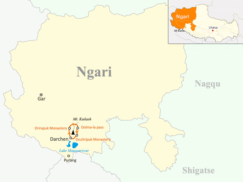
Darchen, the starting point and ending point of the Mt.Kailash kora
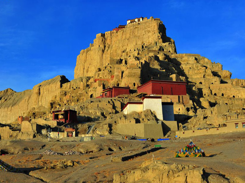
Geographic Location of Drirapuk Monastery, the first day stop of yatra
Typically we divide the Mt.Kailash kora trekking tour into three days; the first day we would stop at Drirapuk Monastery. The yatra in the first day lasts for about 7 hours with a distance of 20 kilometers. During the process you would see a grassy plain populated by nomads and pass some small valleys. You will spend the night in the guest house of the monastery and replenish you energy.
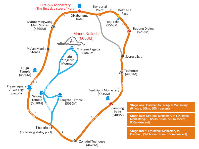
Drira-puk Monastery, the first day stop of the Kora
Geographic location of Dolma-la pass, the highest point of second day yatra
The second day of the yatra starts from Drirapuk to Dzultripuk monastery. The route has a distance of 18km about 7 to 8 hours’ duration. The route is hard and tough. You will pass the highest point of the whole yatra Dolma-la pass, which is about 5630m above sea level, 6.4km ahead and 762m above Drirapuk. You could take a rest here in the pass to restore your energy.

Dolma-la pass, the highest point of second day yatra
Geographic location of Dzultripuk monastery, the stop of second day yatra
After taking a rest at the peak of Dolma-la pass, you will descend to Lhachu valley floor, about one hour’s trekking distance from the pass. From here there is still four hours trekking to the second day yatra destination Dzultripuk monastery. The rooms for accommodation here in the temple are limited so it’s better to get there prior to other yatra performers.

Dolma-la pass, the highest point of second day yatra
The Third Day Yatra – from Dzultripuk to Darchen
The third day yatra route is relatively easy. The whole yatra lasts for 3 to 4 hours with a distance of 14 kilometers, and the exit from the valley can be reached within three hours. At the ending point of the valley, a driver will come to pick you up and take you back to Darchen.
Most of the maps are the landmarks of the traditional two or three-day kora route around Mt. Kailash. They are stops where kora performers get their supplies and accommodations in Ngari. Follow this route you will enjoy the whole process and achieve an unforgettable experience in Mt.Kailash yatra.


0 Comment ON "Mt Kailash Yatra Route Map – A Detailed Route Map for Your Kora around Mt. Kailash"